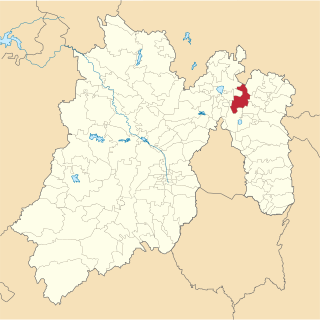
The State of Mexico, officially only Mexico, is one of the 32 federal entities of the United Mexican States. Commonly known as Edomex to distinguish it from the name of the whole country, it is the most populous, as well as the most densely populated, state in the country.
Xico is a city in the State of Mexico, Mexico. It serves as the municipal seat of Valle de Chalco municipality, with which it is, for all practical purposes, coterminous. The municipality lies adjacent to the east side of the Federal District and is part of the Mexico City metropolitan area. The city and municipality lie on the old lakebed of Lake Chalco, which was drained like much of the Basin of Mexico. The city name comes from the nearby Xico hill and the name of the municipality comes from the old lake plus a reference to the "Programa Nacional de Solidaridad" which was initiated here. The municipality's glyph and shield make reference to both names. It is a distinct entity from the city and municipality of Chalco, which is nearby. "Chalco" in both names refers to the Chalca tribe that were one of the original inhabitants of the area.

Atlatlahucan is a city in the Mexican state of Morelos. The name means Place of red or brown water, and today the water is stored in a type of cistern called a jagüey. To the north is the State of Mexico, south is Cuautla, east is Yecapixtla, and west are Tlayacapan and Yautepec. It stands at 18°56′N98°54′W, at a mean height of 1,656 metres above sea level. The municipality covers 71 km2.

Tuxpan is both a municipality and city located in the Mexican state of Veracruz. The population of the city was 78,523 and of the municipality was 134,394 inhabitants, according to the INEGI census of 2005, residing in a total area of 1,051.89 km2 (406.14 sq mi). The municipality includes many smaller outlying communities, the largest of which are Alto Lucero and Santiago de la Peña. A local beachside community is also nearby.

Cuautitlán municipality in the State of Mexico, just north of the northern tip of the Federal District within the Greater Mexico City urban area. The city of Cuautitlán is the municipal seat and makes up most of the municipality. The name comes from Nahuatl and means 'between the trees.'

Tlalnepantla de Baz is one of 125 municipalities of the state of Mexico, north of Mexico City. The municipal seat and largest city in the municipality is the city of Tlalnepantla. Tlalnepantla comes from the Náhuatl words tlalli (land) and nepantla (middle) to mean the middle land. The city was known in prior times as Tlalnepantla de Galeana and Tlalnepantla de Comonfort, to honor Hermenegildo Galeana and Ignacio Comonfort, respectively. The current addition of Baz comes from the last name of Gustavo Baz Prada, an important politician and soldier of Emiliano Zapata's army during the Mexican Revolution. After the Revolution, Baz Prada became Governor of the State of Mexico and President of the National Autonomous University of Mexico (UNAM). It is located in the northeastern part of the state of Mexico, in the Valley of Mexico north of Mexico City proper. Together with Atizapán, it comprises the dense Region XII of Mexico State.

Chimalhuacán is a city and municipality located in the eastern part of State of Mexico, Mexico. It lies just outside the northeast border of Mexico City and is part of the Greater Mexico City urban area.

Victoria is a Mexican city located in the Northeast region of the state of Guanajuato, within the Sierra Gorda range. The municipality has an area of 1009.437 square kilometres and is bordered to the north by the state of San Luis Potosí, to the east by Xichú, to the south by Santa Catarina and Doctor Mora, and to the west by San Luis de la Paz. The municipality had a population of 17,764 inhabitants according to the 2005 census.
San José Iturbide is a Mexican city located in the Northeast region of the state of Guanajuato, within the Sierra Gorda range. The municipality has an area of 534.11 square kilometres and is bordered to the north by San Luis de la Paz and Doctor Mora, to the east by Tierra Blanca, to the south by the state of Querétaro, and to the west by San Miguel de Allende. The municipality had a population of 54,661 inhabitants according to the 2005 census.
San Diego de la Unión is a Mexican city located in the Northwest region of the state of Guanajuato. The municipality has an area of 990.17 square kilometres and is bordered to the north by San Luis Potosí, to the east by San Luis de la Paz, to the south by Dolores Hidalgo, and to the west by San Felipe. The municipality had 34,088 inhabitants according to the 2005 census.

Acuitzio Municipality is a municipality located in the central region of the Mexican state of Michoacán.
Los Reyes is a municipality in the western part of the Mexican state of Michoacán. The municipality has an area of 480.09 square kilometres and is bordered to the north by the municipality of Tangancícuaro, to the east by Charapan, to the southeast by Uruapan, to the south by Peribán, to the southwest by Tocumbo, and to the northwest by Tingüindín. The municipality had a population of 77,000 inhabitants according to the 2009 census. Its municipal seat is the city of Los Reyes de Salgado.The city is also known for exporting avocados and blackberries. Both of these orchids surround the area between Los Reyes and Periban, it is also home of the Lobos Grises de los Reyes a professional soccer team currently playing in the Tercera Division Mexicana at Group IX.

Armería is a municipality in the south-central part of the Mexican state of Colima. Ciudad de Armería is a city and the seat of Armería municipality. The municipality reported 29,599 inhabitants in the 2015 census and has an area of 341.60 km². Its municipal seat is Ciudad de Armería.

Cuauhtémoc is a municipality in the Mexican state of Colima. Its municipal seat is the city of Cuauhtémoc, Colima.
Tecámac is a municipality in State of Mexico in Mexico. The municipality covers an area of 157.34 km². The municipal seat lies in the town (locality) of Tecámac de Felipe Villanueva. Its largest town, Ojo de Agua, with a population of 242,283 inhabitants, is the largest locality in Mexico that is not a municipal seat.

San Salvador Huixcolotla is a town and municipality in Puebla in southeastern Mexico that may be best known as the birthplace of papel picado. San Salvador is Spanish for "Holy Savior" and Huixcolotla is Nahuatl for "place of the curved spines".

Cucurpe Municipality is a municipality in Sonora in north-western Mexico.

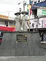
La Paz is a Mexico City Metro station that serves Line A. It is currently the terminal station. It opened, along with the other stations along Line A, on 12 August 1991. It is located in Los Reyes Acaquilpan, State of Mexico – a city that is the municipal seat of the La Paz municipio.
Los Reyes is a municipality in the Mexican state of Veracruz, located about 100 kilometres (62 mi) south of the state capital Xalapa.

Citlaltépetl is a municipality in the Mexican state of Veracruz, located 223 kilometres (139 mi) northwest of the state capital of Xalapa and 99 kilometres (62 mi) south of the city of Tampico, Tamaulipas.