Lake Casitas

Last updated

Lake Casitas
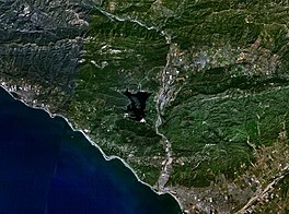
Wfm lake casitas landsat.jpg
Relief map of California.png
Red pog.svg
Lake Casitas
Usa edcp relief location map.png
Red pog.svg
Lake Casitas
Location Ventura County, California, U.S.
Coordinates 34°23′33″N119°20′05″W / 34.3924°N 119.3346°W / 34.3924; -119.3346
Lake type Reservoir
Primary inflows Coyote Creek; Santa Ana Creek
Primary outflows Coyote Creek
Catchment area 39 sq mi (100 km2)
Basin  countries United States
Managing agencyCasitas Municipal Water District
Max. length3.3 mi (5.3 km)
Max. width1.9 mi (3 km)
Surface area 1,100 acres (450 ha)
Max. depth240 feet (73 m) [1]
Water volume 254,000 acre⋅ft (313,000,000 m3)
Shore length132.4 miles (52.1 km) [1]
Surface elevation338 ft (103 m)
Settlements Oak View, Ojai
References U.S. Geological Survey Geographic Names Information System: Lake Casitas
1 Shore length is not a well-defined measure.

Lake Casitas is a reservoir in Ventura County, California, built by the United States Bureau of Reclamation and completed in 1959. [2] The project provides drinking water and water for irrigation. [3] [4] A secondary benefit is flood control. It was the venue for canoeing and rowing at the 1984 Summer Olympics.

Contents

Casitas Dam was constructed on Coyote Creek, two miles (3 km) before it joins the Ventura River. Santa Ana Creek and North Fork Coyote Creek also flow into the lake. The system was designed for water from the Ventura River to be diverted into a canal under specific conditions since the impounded watershed is not sufficient to fill the lake. [5] The dam is 279 ft (85 m) creating a lake capacity of 254,000 acre⋅ft (313,000,000 m3). [6] The dam was built as part of the Ventura River Project.

History

The lake filled for the first time around the 1970s. [7] The spillway was first used in 1978. As of 2024, it has operated eight times. [8]

During the 1984 Summer Olympics in Los Angeles, Lake Casitas hosted the canoeing and rowing events. [9]

The Thomas Fire at the end of 2017 had a significant impact on operations since the wildfire burned a large area within the watershed of the Ventura River. [10] Rainstorms brought a lot of ash, sandy silt, gravel, and debris into the Robles diversion facility that had collected over several years since the fire resulting in some temporary shutdowns of water from the Ventura River. [11] [12]

Operations

The Casitas Municipal Water District provides drinking water to the Ojai Valley, parts of Ventura, and the Rincon coast north of Ventura. [13] [14] They took over management of the Ojai water system by purchase of the franchise from Golden State Water Company in April 2017 after an overwhelming vote in favor. [15]

The Robles Diversion Dam was constructed on the Ventura River in 1958 to divert up to 107,800-acre-foot of water (133,000,000-cubic-metre) per year through a four-and-a-half mile canal (7.2 kilometres) to the reservoir. [16] About 30 to 40% of the total water in Lake Casitas is supplied from high winter flows in the Ventura River. [17]

Regulations

Human contact with the water is prohibited by the Board of Directors at the Casitas Municipal Water District. The board states that since the Lake is used for drinking water, body contact with water is not allowed, but fishing, boating, rowing and camping are permitted. [18]

The "no body contact with water" lake policy was established by The Casitas Municipal Water District in the 1950s and 1960s because the lake did not have a filtration system in place. In the 1990s a multimillion-dollar filtration system upgrade was made to the Lake Casitas facility. The US Department of the Interior conducted a 10-year study on the lake where allowing body contact with water was explored. The study reported, "The capabilities of the current water filtration system to handle the additional burden of body contact were called into question. The system was shown to exceed current regulatory standards, and would “probably” be sufficient to mitigate body contact pollution as well". [19] The Casitas Municipal Water District has not significantly changed the "no body contact with water" regulations in response to the facilities upgrade.

Lake Casitas as seen looking eastward from California State Route 150 CaliforniaLakeCasitas.png
Lake Casitas as seen looking eastward from California State Route 150

Fauna

What is believed to be the only nesting pair of bald eagles on the mainland of Ventura County uses a large nest in a eucalyptus tree at the lake. [20] Two baby birds were born in the spring of 2022 and 2023. [21] [22]

See also

Related Research Articles

<span class="mw-page-title-main">Ojai, California</span> City in California, United States

Ojai is a city in Ventura County, California. Located in the Ojai Valley, it is northwest of Los Angeles and east of Santa Barbara. The valley is part of the east–west trending Western Transverse Ranges and is about 10 miles (16 km) long by 3 miles (5 km) wide and divided into a lower and an upper valley, each of similar size, surrounded by hills and mountains. The population was 7,637 at the 2020 census, up from 7,461 at the 2010 census.
<span class="mw-page-title-main">Lake Powell</span> Reservoir in Utah and Arizona, United States

Lake Powell is a reservoir on the Colorado River in Utah and Arizona, United States. It is a major vacation destination visited by approximately two million people every year. It holds 24,322,000 acre-feet (3.0001×10¹⁰ m3) of water when full, second in the United States to only Lake Mead - though Lake Mead has fallen below Lake Powell in size several times during the 21st century in terms of volume of water, depth and surface area.

<span class="mw-page-title-main">Santa Clara River (California)</span> River in Ventura and Los Angeles counties, California

The Santa Clara River is an 83 mi (134 km) long river in Ventura and Los Angeles counties in Southern California. It drains parts of four ranges in the Transverse Ranges System north and northwest of Los Angeles, then flows west onto the Oxnard Plain and into the Santa Barbara Channel of the Pacific Ocean.
<span class="mw-page-title-main">Cachuma Lake</span> Reservoir in Santa Barbara County, California

Cachuma Lake is a reservoir in the Santa Ynez Valley of central Santa Barbara County, California on the Santa Ynez River adjoining the north side of California State Route 154. The artificial lake was created by the construction of Bradbury Dam, a 201 ft (61 m) earth-fill structure built by the U.S. Bureau of Reclamation in 1953. Its surface area covers 3,100 acres (1,300 ha), with a maximum design capacity of 205,000 acre⋅ft (253,000,000 m3), but it is currently limited to 188,000 acre⋅ft (232,000,000 m3) due to sediment accumulation. The late-December 2022 and early-January 2023 storms dramatically raised the water level in the lake, from an average of 33% full to 100% full for the first time in 12 years.

<span class="mw-page-title-main">Colorado–Big Thompson Project</span> Federal water diversion project

The Colorado–Big Thompson Project is a federal water diversion project in Colorado designed to collect West Slope mountain water from the headwaters of the Colorado River and divert it to Colorado's Front Range and plains. In Colorado, approximately 80% of the state's precipitation falls on the West Slope, in the Rocky Mountains, while around 80% of the state's growing population lives along the eastern slope, between the cities of Fort Collins and Pueblo.
<span class="mw-page-title-main">California State Route 150</span> Highway in California

State Route 150 is a state highway in the U.S. state of California. It runs from U.S. Route 101 near the Ventura/Santa Barbara County line to State Route 126 in Santa Paula, providing a connection to Lake Casitas and Ojai. It is a two-lane road. There were some one-lane bridges near the western end of the route, but these were rebuilt to be two-lane bridges after flooding in 2005.
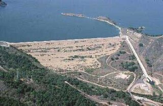
<span class="mw-page-title-main">Casitas Dam</span> Dam in Ventura County, California

Casitas Dam is an earthfill dam across Coyote Creek that forms Lake Casitas in Ventura County, California near Oak View, California. The dam is located two miles (3 km) above the junction of Coyote Creek and the Ventura River. Water from the Ventura River is diverted to Lake Casitas as well. The 334 ft (102 m) structure was built by the U.S. Bureau of Reclamation. It is a key part of the Ventura River Project. Construction was completed in 1959 and was strengthened in June–December 2000 as a seismic improvement to help withstand earthquakes greater than 6.5. Lake Casitas has a 254,000 acre⋅ft (313,000,000 m3) storage capacity and provides irrigation and municipal uses for the Casitas Municipal Water District.
<span class="mw-page-title-main">Ventura River</span> River in western Ventura County in southern California, United States

The Ventura River, in western Ventura County in southern California, United States, flows 16.2 miles (26.1 km) from its headwaters to the Pacific Ocean. The smallest of the three major rivers in Ventura County, it flows through the steeply sloped, narrow Ventura Valley, with its final 0.7 miles (1.1 km) through the broader Ventura River estuary, which extends from where it crosses under a 101 Freeway bridge through to the Pacific Ocean.

<span class="mw-page-title-main">Lake Piru</span> Reservoir in Ventura County, California

Lake Piru is a reservoir located in Los Padres National Forest and Topatopa Mountains of Ventura County, California, created by the construction in 1955 of the Santa Felicia Dam on Piru Creek, which is a tributary of the Santa Clara River.

The Central Utah Project is a US federal water project that was authorized for construction under the Colorado River Storage Project Act of April 11, 1956, as a participating project. In general, the Central Utah Project develops a portion of Utah's share of the yield of the Colorado River, as set out in the Colorado River Compact of 1922.

Casitas may refer to:

<span class="mw-page-title-main">Matilija Creek</span> River in California, United States of America

Matilija Creek is a major stream in Ventura County in the U.S. state of California. It joins with North Fork Matilija Creek to form the Ventura River. Many tributaries feed the mostly free flowing, 17.3-mile (27.8 km) creek, which is largely contained in the Matilija Wilderness. Matilija was one of the Chumash rancherias under the jurisdiction of Mission San Buenaventura. The meaning of the Chumash name is unknown.

<span class="mw-page-title-main">Dam removal</span>

Dam removal is the process of demolishing a dam, returning water flow to the river. Arguments for dam removal consider whether their negative effects outweigh their benefits. The benefits of dams include hydropower production, flood control, irrigation, and navigation. Negative effects of dams include environmental degradation, such as reduced primary productivity, loss of biodiversity, and declines in native species; some negative effects worsen as dams age, like structural weakness, reduced safety, sediment accumulation, and high maintenance expense. The rate of dam removals in the United States has increased over time, in part driven by dam age. As of 1996, 5,000 large dams around the world were more than 50 years old. In 2020, 85% percent of dams in the United States are more than 50 years old. In the United States roughly 900 dams were removed between 1990 and 2015, and by 2015, the rate was 50 to 60 per year. France and Canada have also completed significant removal projects. Japan's first removal, of the Arase Dam on the Kuma River, began in 2012 and was completed in 2017. A number of major dam removal projects have been motivated by environmental goals, particularly restoration of river habitat, native fish, and unique geomorphological features. For example, fish restoration motivated the Elwha Ecosystem Restoration and the dam removal on the river Allier, while recovery of both native fish and of travertine deposition motivated the restoration of Fossil Creek.

<span class="mw-page-title-main">Waconda Lake</span> Reservoir in Kansas, United States

Waconda Lake, also known as Glen Elder Reservoir, is a reservoir in Mitchell County and Osborne County, Kansas, United States. Built and managed by the U.S. Bureau of Reclamation for flood control and irrigation, it is also used for recreation. Glen Elder State Park is located on its north shore.

<span class="mw-page-title-main">Cedar Bluff Reservoir</span> Reservoir in Kansas, United States

Cedar Bluff Reservoir is a reservoir in Trego County, Kansas, United States. Built and managed by the U.S. Bureau of Reclamation for irrigation and area water supply, it is also used for flood control and recreation. Cedar Bluff State Park is located on its shore.

<span class="mw-page-title-main">Cheney Reservoir</span> Reservoir in Sedgwick / Kingman /, Reno counties in Kansas

Cheney Reservoir is a reservoir on the North Fork Ninnescah River in Reno, Kingman, and Sedgwick counties of Kansas in the United States. Built and managed by the U.S. Bureau of Reclamation for local water supply, it is also used for flood control and recreation. Cheney State Park is located on its shore.

<span class="mw-page-title-main">Matilija Dam</span> Arch dam in Ventura County, California

Matilija Dam is a concrete arch dam in Ventura County, California, completed in 1947. Designed for water storage and flood control, it impounds Matilija Creek to create the Matilija Reservoir in the Los Padres National Forest, south of the Matilija Wilderness and north of Ojai.

The Matilija Wilderness is a 29,207-acre (11,820 ha) wilderness area in Ventura and Santa Barbara Counties, Southern California. It is managed by the U.S. Forest Service, being situated within the Ojai Ranger District of the Los Padres National Forest. It is located adjacent to the Dick Smith Wilderness to the northwest and the Sespe Wilderness to the northeast, although it is much smaller than either one. The Matilija Wilderness was established in 1992 in part to protect California condor habitat.

<span class="mw-page-title-main">Ventura River Parkway Trail</span> Rail trail in Ventura County, California, U.S.

The Ventura River Parkway Trail is a southern California rail trail along the Ventura River in Ventura County. Roughly paralleling California State Route 33 for 16.5 mi (26.6 km) from Ventura to Ojai, it follows the route of the former Ventura and Ojai Valley Railroad that was abandoned between 1969 and 1995.
References

  1. 1 2 "Lake Casitas, CA: Lake Improvements" (PDF). Navionics. Archived from the original (PDF) on October 20, 2013.
  2. Carlson, Cheri (April 4, 2016). "Drought uncovers family history buried under Lake Casitas". Ventura County Star . Archived from the original on March 30, 2019. Retrieved April 5, 2016.
  3. Boyd-Barrett, Claudia (September 8, 2014). "Ventura leans on lake for water for eastern half of city". Ventura County Star .
  4. Staff (April 17, 2015). "Lake Casitas just 50 percent full". Ventura County Star .
  5. Carlson, Cheri (March 12, 2019). "Lake Casitas gets OK to divert more water just as it passes the mark to do so". Ventura County Star . Archived from the original on March 29, 2019. Retrieved March 16, 2019.
  6. Carlson, Cheri (April 18, 2016). "No rain could mean Lake Casitas runs dry in four years". Ventura County Star . Retrieved August 22, 2016.
  7. Crawford Coates; Kit Stolz (April 20, 2017). "All That The Rain Promises | Questions remain as western Ventura moves toward a state water connection". VC Reporter | Southland Publishing. Retrieved May 24, 2019.
  8. Carlson, Cheri (April 23, 2024). "'At the tippy top:' Ventura County's Lake Casitas hits capacity, highest level since 1998". Ventura County Star. Retrieved April 23, 2024.
  9. 1984 Summer Olympics official report. Archived 2010-11-02 at the Wayback Machine Volume 1. Part 1. pp. 108–12.
  10. Carlson, Cheri (March 28, 2019). "Thomas Fire fallout blamed for second 'critical shutdown' at Lake Casitas facility". Ventura County Star . Retrieved March 29, 2019.
  11. Carlson, Cheri (August 3, 2020). "Longtime incumbent on Ojai Valley water board announces he will not seek re-election". Ventura County Star . Retrieved August 4, 2020.
  12. Carlson, Cheri (December 16, 2021). "Storm delivers small boost to drought-stressed Lake Casitas". Ventura County Star. Retrieved December 17, 2021.
  13. Carlson, Cheri (August 29, 2018). "Drought-stricken western Ventura County may need more than planned $45M pipeline as a fix". Ventura County Star . Archived from the original on March 30, 2019. Retrieved August 30, 2018.
  14. Stantec Consulting Services Inc. (June 8, 2020). Draft Casitas Municipal Water District Comprehensive Water Resources Plan (Report). Casitas Municipal Water District.
  15. Boyd-Barrett, Claudia (May 13, 2016). "Casitas moves to take over Ojai water system". Ventura County Star . Retrieved May 13, 2016.
  16. "Robles Dam". U.S. Department of Interior Bureau of Reclamation. June 4, 2009. Archived from the original on September 28, 2016. Retrieved March 16, 2013.
  17. Carlson, Cheri (April 2, 2024). "Lake Casitas edges closer to spilling for the first time in 25 years". Ventura County Star. Retrieved April 3, 2024.
  18. Carlson, Cheri (September 23, 2021). "Review finds rust, safety issues at Lake Casitas water park". Ventura County Star. Retrieved September 27, 2021.
  19. Bureau of Reclamation (February 2010) "Lake Casitas Resource Management Plan/Environmental Impact Statement" United States Department of the Interior
  20. Kisken, Tom (January 27, 2022). "Updated: Ojai Valley's walking, talking eagle cam awaits babies in the nest" . Ventura County Star. Retrieved March 29, 2022.
  21. Kisken, Tom (July 5, 2023). "Baby eagles at Lake Casitas near Ojai learn landing is harder than flying". Ventura County Star. Retrieved July 9, 2023.
  22. Kisken, Tom (March 29, 2024). "Forget the cigars, these birds need trout: Eagle chick hatches at Lake Casitas". Ventura County Star. Retrieved March 30, 2024.

Further reading