Lakeside, Colorado

Last updated

Town of Lakeside, Colorado
LakesideTownHall.JPG
The municipal offices of the Town of Lakeside.
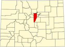
Jefferson County Colorado Incorporated and Unincorporated areas Lakeside Highlighted 0842495.svg
Location of Lakeside in Jefferson County, Colorado.
Coordinates: 39°47′00″N105°03′25″W / 39.78333°N 105.05694°W / 39.78333; -105.05694
Country Flag of the United States (23px).png  United States
State Flag of Colorado.svg  State of Colorado
County Jefferson County [1]
Incorporated November 25, 1907 [2]
Government
  Type Statutory Town [1]
Area
[3]
  Total0.25 sq mi (0.64 km2)
  Land0.19 sq mi (0.49 km2)
  Water0.06 sq mi (0.16 km2)
Elevation
[4]
5,364 ft (1,635 m)
Population
 (2020) [5]
  Total16
  Density64/sq mi (25/km2)
Time zone UTC-7 (MST)
  Summer (DST) UTC-6 (MDT)
ZIP code [6]
Denver CO 80212
Area code(s) Both 303 and 720
FIPS code 08-42495
GNIS feature ID 1669462
The least populous Colorado municipality

The Town of Lakeside is a Statutory Town in Jefferson County, Colorado, United States. The town population was 16 at the 2020 United States Census, making Lakeside the least populous municipality in the State of Colorado. [5] Lakeside is immediately west of the City and County of Denver, the most populous municipality in the state. The Denver Post Office (ZIP Code 80212) serves Lakeside. [6]

Contents

The town's namesake lake is Lake Rhoda, which covers 20% of its total area. A year after its incorporation on November 12, 1907, the Lakeside Amusement Park, nicknamed "White City", opened on the eastern shores. Both town and park were founded by a syndicate led by prominent Denver brewer Adolph Zang, who endeavored to build the resort just across the county line from Denver, and incorporated to move beyond the reach of Denver liquor laws. A shopping mall, Lakeside Center, was built in 1956 on the southern shore, but fell into financial troubles due to lack of business around the turn of the century [7] and was converted into a Walmart and strip mall circa 2010. The amusement park, shopping area, and lake occupy almost all of the tiny municipality. Residences are limited to a handful of houses in the southeast corner of the town occupied by employees of the amusement park.
Geography

Lakeside is located at 39°47′0″N105°3′25″W / 39.78333°N 105.05694°W / 39.78333; -105.05694 . According to the United States Census Bureau, the town has a total area of 0.2 square miles (0.52 km2), of which, 0.2 square miles (0.52 km2) of it is land and 0.1 square miles (0.26 km2) of it (20.83%) is water.

Demographics

Historical population
CensusPop.Note
1910 103
1920 36−65.0%
1930 4936.1%
1940 39−20.4%
1950 4617.9%
1960 28−39.1%
1970 17−39.3%
1980 1911.8%
1990 11−42.1%
2000 2081.8%
2010 8−60.0%
2020 16100.0%

See also

Related Research Articles

<span class="mw-page-title-main">Thornton, Colorado</span> City in Colorado, United States

Thornton is a home rule municipality located in Adams and Weld counties, Colorado, United States. The city population was 141,867, all in Adams County, at the 2020 United States Census, an increase of +19.44% since the 2010 United States Census. Thornton is the sixth most populous city in Colorado and the 191st most populous city in the United States. Thornton is 10 miles (16 km) north of the Colorado State Capitol in Denver and is a part of the Denver–Aurora–Lakewood, CO Metropolitan Statistical Area.

<span class="mw-page-title-main">Bow Mar, Colorado</span> Town in Colorado, United States

Bow Mar is a Statutory Town located in Arapahoe and Jefferson counties, Colorado, United States. The town population was 853 at the 2020 United States Census with 587 residing in Arapahoe County and 266 residing in Jefferson County. Bow Mar is part of the Front Range Urban Corridor. The current mayor of Bow Mar is Bryan Sperry.

<span class="mw-page-title-main">Columbine Valley, Colorado</span> Town in Colorado, United States

The Town of Columbine Valley is a Statutory Town located in western Arapahoe County, Colorado, United States. The town population was 1,502 at the 2020 United States Census, a +19.59% increase since the 2010 United States Census. Columbine Valley is a part of the Denver-Aurora-Lakewood, CO Metropolitan Statistical Area and the Front Range Urban Corridor.

<span class="mw-page-title-main">Englewood, Colorado</span> City in Colorado, United States

The City of Englewood is a home rule municipality located in Arapahoe County, Colorado, United States. The town population was 33,659 at the 2020 United States Census. Englewood is a part of the Denver–Aurora–Lakewood, CO Metropolitan Statistical Area and the Front Range Urban Corridor. Englewood is located immediately south of Denver in the South Platte River Valley.

<span class="mw-page-title-main">Sheridan, Colorado</span> City in Colorado, United States

The City of Sheridan is a home rule municipality located in Arapahoe County, Colorado, United States. Sheridan is a part of the Denver–Aurora–Lakewood, CO Metropolitan Statistical Area. The population was 6,105 at the 2020 census.

<span class="mw-page-title-main">Downieville-Lawson-Dumont, Colorado</span> Census Designated Place in Colorado, United States

Downieville-Lawson-Dumont is a census-designated place (CDP) comprising the unincorporated communities of Downieville, Lawson, and Dumont located in and governed by Clear Creek County, Colorado, United States. The CDP is a part of the Denver–Aurora–Lakewood, CO Metropolitan Statistical Area. The Dumont post office ZIP code 80436 serves the area. At the United States Census 2020, the population of the Downieville-Lawson-Dumont CDP was 527.

<span class="mw-page-title-main">Empire, Colorado</span> Town in Colorado, United States

The historic Town of Empire is a Statutory Town located in Clear Creek County, Colorado, United States. The town population was 345 at the 2020 United States Census, a +22.34% increase since the 2010 United States Census. The town is a former mining settlement that flourished during the Colorado Silver Boom in the late 19th century. Empire is now a part of the Denver–Aurora–Lakewood, CO Metropolitan Statistical Area and the Front Range Urban Corridor.

<span class="mw-page-title-main">Lone Tree, Colorado</span> City in Colorado, United States

The City of Lone Tree is a home rule municipality located in northern Douglas County, Colorado, United States. Lone Tree is a part of the Denver–Aurora–Lakewood, CO Metropolitan Statistical Area. The city population was 14,253 at the 2020 United States Census.

<span class="mw-page-title-main">Applewood, Colorado</span> Census Designated Place in Colorado, United States

Applewood is an unincorporated community and a census-designated place (CDP) located in and governed by Jefferson County, Colorado, United States. The CDP is a part of the Denver–Aurora–Lakewood, CO Metropolitan Statistical Area. The population of the Applewood CDP was 7,833 at the 2020 United States Census. The Golden post office serves the area.

<span class="mw-page-title-main">Aspen Park, Colorado</span> Census Designated Place in Colorado, United States

Aspen Park is an unincorporated community and a census-designated place (CDP) located in Jefferson County, Colorado, United States. The CDP is a part of the Denver–Aurora–Lakewood, CO Metropolitan Statistical Area. The population of the Aspen Park CDP was 810 at the United States Census 2020. The Aspen Park Metropolitan District provides services. The Conifer post office serves the area.

<span class="mw-page-title-main">Genesee, Colorado</span> Census Designated Place in Colorado, United States

Genesee is an unincorporated community and a census-designated place (CDP) located in and governed by Jefferson County, Colorado, United States. The CDP is a part of the Denver–Aurora–Lakewood, CO Metropolitan Statistical Area. The population of the Genesee CDP was 3,610 at the United States Census 2020. The Golden post office serves the area.

<span class="mw-page-title-main">Indian Hills, Colorado</span> Census Designated Place in Colorado, United States

Indian Hills is an unincorporated town, a post office, and a census-designated place (CDP) located in and governed by Jefferson County, Colorado, United States. The CDP is a part of the Denver–Aurora–Lakewood, CO Metropolitan Statistical Area. The Indian Hills post office has the ZIP code 80454. At the United States Census 2020, the population of the Indian Hills CDP was 1,474.

<span class="mw-page-title-main">Kittredge, Colorado</span> Census Designated Place in Colorado, United States

Kittredge is an unincorporated town, a post office, and a census-designated place (CDP) located in and governed by Jefferson County, Colorado, United States. The CDP is a part of the Denver–Aurora–Lakewood, CO Metropolitan Statistical Area. The Kittredge post office has the ZIP code 80457. At the United States Census 2020, the population of the Kittredge CDP was 1,308.

<span class="mw-page-title-main">Mountain View, Colorado</span> Town in Colorado, United States

The Town of Mountain View is a home rule municipality located in Jefferson County, Colorado, United States. Mountain View is situated west of, and adjacent to, the city and county of Denver. As of the 2020 census, the population of Mountain View was 541. The Denver Post Office serves Mountain View.

<span class="mw-page-title-main">Denver–Aurora combined statistical area</span> Combined Statistical Area in Colorado, United States

The United States Office of Management and Budget has defined the 12-county Denver–Aurora, CO Combined Statistical Area comprising the Denver–Aurora–Lakewood, CO Metropolitan Statistical Area, the Boulder, CO Metropolitan Statistical Area, and the Greeley, CO Metropolitan Statistical Area. The United States Census Bureau estimates that the population was 3,214,218 as of July 1, 2012, an increase of +3.99% since the 2010 United States Census, and ranking as the 16th most populous metropolitan combined statistical area and the 17th most populous primary statistical area of the United States. The population estimate for 2020 was 3,652,385.

<span class="mw-page-title-main">North Central Colorado Urban Area</span> Metropolitan area of Colorado

The North Central Colorado Urban Area comprises the four contiguous metropolitan statistical areas in the north central region of the State of Colorado: the Denver–Aurora Metropolitan Statistical Area, the Boulder Metropolitan Statistical Area, the Fort Collins-Loveland Metropolitan Statistical Area, and the Greeley Metropolitan Statistical Area. With the exception of southeastern Elbert County, southeastern Park County, and tiny portions of southern Douglas County, the entire North Central Colorado Urban Area is drained by the South Platte River and its tributaries. The North Central Colorado Urban Area is the central, and the most populous, of the three primary subregions of the Front Range Urban Corridor.

<span class="mw-page-title-main">Lakewood, Colorado</span> City in Colorado, United States

Lakewood is the home rule municipality that is the most populous municipality in Jefferson County, Colorado, United States. The city population was 155,984 at the 2020 U.S. Census, making Lakewood the fifth most populous city in Colorado and the 167th most populous city in the United States. Lakewood is a suburb of Denver and is a principal city of the Denver–Aurora–Lakewood, CO Metropolitan Statistical Area and a major city of the Front Range Urban Corridor.

<span class="mw-page-title-main">Brick Center, Colorado</span> Census Designated Place in Colorado, United States

Brick Center is an unincorporated community and a census-designated place (CDP) located in and governed by Arapahoe County, Colorado, United States. The CDP is a part of the Denver–Aurora–Lakewood, CO Metropolitan Statistical Area. The population of the Brick Center CDP was 105 at the United States Census 2020. The Bennett post office serves the area.

<span class="mw-page-title-main">Fairmount, Colorado</span> Census Designated Place in Colorado, United States

Fairmount is an unincorporated community and a census-designated place (CDP) in Jefferson County, Colorado, United States. The CDP is a part of the Denver–Aurora–Lakewood, CO Metropolitan Statistical Area. The population of the Fairmount CDP was 9,324 at the United States Census 2010. ZIP code 80403 applies to addresses in Fairmount.

References

  1. 1 2 "Active Colorado Municipalities". State of Colorado, Department of Local Affairs. Archived from the original on December 12, 2009. Retrieved November 30, 2007.
  2. "Colorado Municipal Incorporations". State of Colorado, Department of Personnel & Administration, Colorado State Archives. December 1, 2004. Retrieved November 30, 2007.
  3. "2019 U.S. Gazetteer Files". United States Census Bureau. Retrieved July 1, 2020.
  4. "US Board on Geographic Names". United States Geological Survey. October 25, 2007. Retrieved January 31, 2008.
  5. 1 2 United States Census Bureau. "Lakeside town, Colorado" . Retrieved April 10, 2023.
  6. 1 2 "ZIP Code Lookup". United States Postal Service. December 14, 2006. Archived from the original (JavaScript/HTML) on November 4, 2010. Retrieved December 14, 2006.
  7. Arellano, Kristi (January 24, 2006). "Developer buys Lakeside mall". The Denver Post. Denver. Retrieved September 4, 2020.