
Etobicoke is an administrative district and former city within Toronto, Ontario, Canada. Comprising the city's west-end, Etobicoke is bordered on the south by Lake Ontario, on the east by the Humber River, on the west by Etobicoke Creek, the cities of Brampton, and Mississauga, the Toronto Pearson International Airport, and on the north by the city of Vaughan at Steeles Avenue West.

The Humber River is a river in Southern Ontario, Canada. It is in the Great Lakes Basin, is a tributary of Lake Ontario and is one of two major rivers on either side of the city of Toronto, the other being the Don River to the east. It was designated a Canadian Heritage River on September 24, 1999.

The Kingsway is a residential neighbourhood in Toronto, Ontario, Canada. It is bounded by Bloor Street to the south, Dundas Street to the north, the Mimico Creek to the west and the Humber River to the east. The neighbourhood was officially known as Kingsway Park, which later became replaced by its nickname the Kingsway. In this neighbourhood, the Kingsway specifically refers to a two-lane road beginning in the south-east corner of the neighbourhood extending northerly in a north-west direction past Dundas Street.
Mimico is a neighbourhood in Toronto, Ontario, Canada, being located in the south-west area of Toronto on Lake Ontario. It is in the south-east corner of the former Township of Etobicoke, and was an independent municipality from 1911 to 1967.
The Toronto Suburban Railway was a Canadian electric railway operator with local routes in west Toronto, and a radial (interurban) route to Guelph.

The Queensway is a major street in the municipalities of Toronto and Mississauga, Ontario, Canada. It is a western continuation of Queen Street, after it crosses Roncesvalles Avenue and King Street in Toronto. The Queensway is a divided roadway from Roncevalles westerly until 600 metres of the South Kingsway with its centre median dedicated to streetcar service. The road continues undivided west from there to Etobicoke Creek as a four- or six-lane thoroughfare.
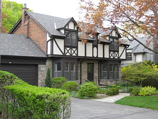
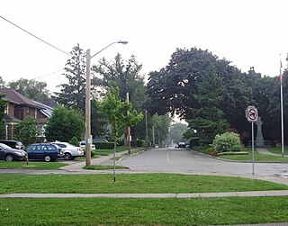
Humber Valley Village is a neighbourhood located in Toronto, Ontario, Canada. It is within the former suburb of Etobicoke and includes some of the most expensive real estate in the metropolitan west end. The boundaries are from Dundas Street on the south to Islington Avenue to the west, Eglinton Avenue to the north, and the Humber River in the east. The neighbourhood is in the political riding of Etobicoke Centre.

Humber Heights-Westmount, also known as Humbervale, is a neighbourhood in Toronto, Ontario, Canada. The neighbourhood is bounded by the west bank of the Humber River, west to Royal York Road and south to Eglinton Avenue West. The Humber Creek divides the area into the northern 'Humber Heights' and the southern 'Westmount' centred along Scarlett Road and La Rose Avenue.

Islington-City Centre West is a commercial and residential neighbourhood in Toronto, Ontario, Canada. One of four central business districts outside Downtown Toronto, it is bounded by Rathburn Road to the north, Islington Avenue to the east, Bloor Street to the south, Mimico Creek to the west.

Old Mill is a neighbourhood of Toronto, Ontario, Canada on the banks of the Humber River. It is located north and west of the intersection of Bloor Street and Jane Street. The area takes its name from the old grist mill ruins on the west bank of the river, now converted into a hotel. The City of Toronto includes this neighbourhood in the official "Lambton Baby Point" neighbourhood which includes the Baby Point enclave and former Lambton village areas to the north.

Rockcliffe–Smythe is a neighbourhood in Toronto, Ontario, Canada. It was developed after World War II as part of the urbanization of the former suburb of York Township. It is in Ward 5 in the City of Toronto.

The Queensway–Humber Bay, known officially as Stonegate–Queensway, is a neighbourhood in the southwest of Toronto, Ontario, Canada. It is located in the southeast area of the former City of Etobicoke.

Lambton is a neighbourhood in the city of Toronto, Ontario, Canada. It is situated on the east bank of the Humber River north and south of Dundas Street West. It is bounded on the north by Black Creek, on the east by Jane Street and on the south by St. Mark's Road. The area west of Gooch Avenue and south of Dundas Street West is also known as "Warren Park", the name of the housing sub-division built in the 1950s. The portion south of Dundas Street West is within the 'Lambton Baby Point' neighbourhood as defined by the City of Toronto.

Etobicoke Centre is a provincial electoral district in Toronto, Ontario, Canada. It elects one member to the Legislative Assembly of Ontario.
Royal York Road, historically known as Church Street or New Church Street, is a north-south arterial road in Toronto, Ontario, Canada. It is a concession road, 5 concessions (10 km) west of Yonge Street, and runs through many residential neighbourhoods, most notably Mimico and the Kingsway. It is classified as a "minor arterial" road by the city of Toronto.

Lambton House is a historic former inn in Toronto, Ontario, Canada. It is the last remaining building from the former village of Lambton Mills along the Humber River. The inn was established in 1847, with its present building erected in 1860.

John Scarlett (1777–1865) was a merchant-miller who played a significant role in the development of the part of the historic York Township that later became the Junction neighbourhood of Toronto, Ontario.

Dundas Street is a major historic arterial road in Ontario, Canada. The road connects the city of Toronto with its western suburbs and several cities in southwestern Ontario. Three provincial highways—2, 5, and 99—followed long sections of its course, although these highway segments have since been downloaded to the municipalities they passed through. Originally intended as a military route to connect the shipping port of York to the envisioned future capital of London, Ontario, the street today connects Toronto landmarks such as Yonge–Dundas Square and the city's principal Chinatown to rural villages and the regional centres of Hamilton and London.


