| Leogang Mountains | |
|---|---|
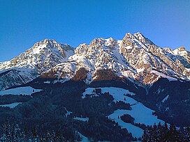 | |
| Highest point | |
| Peak | Birnhorn |
| Elevation | 2,634 m (8,642 ft) |
| Geography | |
 | |
| Country | Austria |
| States | Salzburg and Tyrol |
| Range coordinates | 47°28′29″N12°44′1″E / 47.47472°N 12.73361°E |
| Parent range | Northern Limestone Alps |
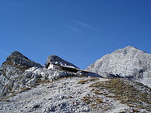
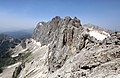
The Leogang Mountains [1] (German : Leoganger Steinberge, lit. "Leogang Rock Mountains") are a mountain range in Austria in the state of Salzburg and form part of the Northern Limestone Alps within the Eastern Alps. They are located between the Lofer valley, Saalfelden and Leogang and, together with the Lofer Mountains to the northwest, form two mountain massifs that are separated by the saddle of the Römersattel (1,202 m), but which the Alpine categorisation of the Eastern Alps defines as a single sub-group (the Lofer and Leogang Mountains). The Leogang Mountains are separated from the Kitzbühel Alps to the south and the Steinernes Meer to the east by deeply incised valleys. Typical of the Steinberge are high plateaux with steep sides and sharply undulating high cirques.
Contents
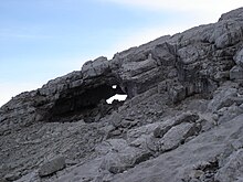
As typical karst mountains the Leogang Mountains are also pierced by numerous caves. The most famous of these is the Lamprechtsofen, over 50 km long, located immediately next to the federal road between Lofer and Saalfelden. A prominent rock formation is the Melkerloch in the southeastern face of the Birnhorn mountain.
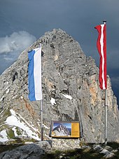
At 2,634 metres (8,642 ft) the Birnhorn is the highest peak in the range. The Hochfilzen Military Training Area used by the Austrian Army lies in the west of the Leoganger Steinberge.