Wetterstein | |
---|---|
Highest point | |
Peak | Zugspitze [1] |
Elevation | 2,962 [1] m (9,718 ft) |
Coordinates | 47°25′0″N10°59′42″E / 47.41667°N 10.99500°E |
Geography | |
Groups of the Northern Limestone Alps (purple lines showing international borders and the borders of Austrian states) | |
Countries | Austria and Germany |
States | Tyrol and Bavaria |
Range coordinates | 47°25′N11°8′E / 47.417°N 11.133°E Coordinates: 47°25′N11°8′E / 47.417°N 11.133°E |
Parent range | Northern Limestone Alps |
Geology | |
Type of rock | Limestone |
The Wetterstein mountains (German : Wettersteingebirge), colloquially called Wetterstein, [1] is a mountain group in the Northern Limestone Alps within the Eastern Alps. It is a comparatively compact range located between Garmisch-Partenkirchen, Mittenwald, Seefeld in Tirol and Ehrwald along the border between Germany (Bavaria) and Austria (Tyrol). Zugspitze, the highest peak is at the same time the highest mountain in Germany. [1]
The Wetterstein mountains are an ideal region for mountaineers and climbers. Mountain walkers sometimes need to allow for significant differences in elevation. The proximity of the range to the south German centres of population, the scenic landscape and its good network of cable cars and lifts mean that the mountains are heavily frequented by tourists for most of the year. There are, however, places in the Wetterstein that are rarely or never visited by people.
The Wetterstein borders on the following other mountain ranges of the Alps:
In the AVE, the Alpine Club classification of the Eastern Alps, the Wetterstein and the Mieming range are classed as a single group.
The River Loisach forms the boundary of the range to the west and north, from the Ehrwald Basin to Garmisch-Partenkirchen. To the northeast the boundary runs from Garmisch-Partenkirchen to Mittenwald along the Kankerbach and Kranzbach streams and the Isar river. To the east the Isar forms the boundary from Mittenwald to Scharnitz. South of Scharnitz it continues along the Drahnbach stream to Seestadeln. To the south the boundary extends from Ehrwald along the Gaisbach stream and over the Ehrwalder Alm to the Gaistal valley (Leutascher Ache) and continues via Leutasch-Oberweidach and past the Simmelberg to the north to the Drahnbach.
The saddle between the Kankerbach and the Kranzbach (the Loisach – Isar watershed) links the Wetterstein with the Bavarian Prealps. The saddle near the Ehrwalder Alm is the link between the Wetterstein and Mieming Chain.
SOIUSA officially divides the Wettersteingebirge into two groups and eight subgroups:
The Alpine Club Guide divides the range based on access:
The 10 highest summits of the Wetterstein are:
1 | Zugspitze | 2,962 m | 6 | Hochwanner | 2,744 m | |
2 | Schneefernerkopf | 2,875 m | 7 | Mittlere Höllentalspitze | 2,743 m | |
3. | Zugspitzeck | 2,820 m | 8. | Innere Höllentalspitze | 2,741 m | |
4 | Mittlere Wetterspitze | 2,750 m | 9 | Äußere Höllentalspitze | 2,720 m | |
5 | Nördliche Wetterspitze | 2,746 m | 10 | Hochblassen | 2,706 m |
There are over 150 named summits in the Wetterstein with spot heights. Amongst the best known are (in order of height):
|
|
The Zugspitze is very frequently climbed using various routes and the Alpspitze summit, too, is a popular destination that can be reached on several different routes. The ridge of Jubiläumsgrat is a high alpine climbing route that links these two summits. The climbing along the Blassenkamm ridge over the tops of the Innere, Mittlere and Äußere Höllentalspitze has sections that are classified as UIAA grade III-.
The region around the Oberreintal Hut and the south side of the Schüsselkarspitze and Scharnitzspitze are well known for alpine climbing routes of all levels up the solid, limestone slabs. The south side above the Gaistal is markedly quieter than the north side.
For climbers, the mountains north of Leutasch are very interesting, especially the Oberreintal-Schrofen, the Scharnitzspitze and the Schüsselkarspitze. On the south faces of these three border mountains are alpine climbing routes aplenty. In recent years several alpine classics were renovated by Heinz Zak. This has attracted ever more climbers to the region.
The combination of alms and rugged rocky terrain is not only unique in the German Alpine region, but also offers habitats for several species of animal, such as chamois, Alpine marmots, Alpine choughs, Alpine salamanders, adders, golden eagles and many species of marten.
The German Alpine Club maintains six managed Alpine Club huts in the Wetterstein mountains with overnight accommodation: the Münchner Haus (2,962 m), the Meiler Hut (2,366 m), the Knorr Hut (2,052 m), the Kreuzeckhaus (also: Adolf Zoeppritz Haus, 1,652 m), the Höllentalanger Hut (1,379 m) and the Reintalanger Hut (1,366 m). In addition, are the privately run Schachenhaus (1,866 m) and the Wiener Neustädter Hut (2,209 m, maintained by the Austrian Tourist Club) offer food, refuge and accommodation for mountaineers and hikers. The Munich Branch of the German Alpine Club has rented the Waxenstein Hut (also Alpl Hut or Aiple Hut) since 1920 and operates it as self-catered accommodation. In the Oberreintalkar lies the Oberreintal Hut, which is the meeting point for Wetterstein climbers (a self-catering hut although drinks are sold by the proprietor). In winter the Stuiben Hut is used as a self-catering hut for ski tourers and snowshoe trekkers. In addition there are several privately owned huts in the Wetterstein mountains. Of these, the Kreuzjochhaus stands out because of its idyllic setting, which offers one of the best panoramas in the Bavarian Alps in the summer and is located in the middle of the Garmisch-Partenkirchen ski region in the winter.
The Via Alpina, a cross-border long-distance path with five stages through the whole of the Alps, also runs through the Wetterstein. The Red Way of the Via Alpina (Rote Weg der Via Alpina) runs through the Wetterstein in three stages:
Stage 15 of the North Alpine long-distance path 01 (Limestone Alp Way) runs through the Wetterstein in two route variations.
From Scharnitz over the Hoher Saddle to Leutasch-Ahrn both variations are combined. In Ahrn the long-distance path forks into a high alpine and an easier variant. The high alpine variant runs via the Meiler Hut into the Reintal valley and continues to the summit of the Zugspitze. From there it descends to Ehrwald. The easier variant runs through the Leutascher Achental valley via the Ehrwalder Alm and also ends at Ehrwald.
There are the following Klettersteigs (sometimes abbreviated Steig) in the Wetterstein:
Several large cable cars and lifts link to the summit regions and high skiing areas: The Bavarian Zugspitze Railway (a metre gauge rack railway from Garmisch to the Zugspitzplatt), the Eibsee Cable Car (from the Eibsee to the Zugspitzplatt), the Tyrolean Zugspitze Cable Car (from Ehrwald to the Zugspitzplatt) and the Ehrwalder Almbahn.
Those not interested in a climbing tour or multi-day summit tour, can hike the Partnach Gorge, the Leutasch Gorge or the Höllental Gorge in a day.
For many years there were discussions about a project to build a railway tunnel between the Tyrolean village of Telfs and the Bavarian town of Garmisch-Partenkirchen. The tunnel would have had a total length of 22 kilometres and would have enabled the journey time of trunk services between Munich Central Station and Innsbruck Central Station to be cut to 90 minutes. The project was assessed in 2013 to cost €2.2 billion to build. A tunnel through the Wetterstein would save trains one hour in travelling between Munich and Landeck or Vorarlberg and relieve both the line from Munich via Rosenheim to Innsbruck and the route from Munich to Lindau. [2] By bypassing Garmisch and moving the south portal of the tunnel east of Telfs-Sagl, the tunnel would be just under 25 kilometres in length.
The Zugspitze, at 2,962 m (9,718 ft) above sea level, is the highest peak of the Wetterstein Mountains as well as the highest mountain in Germany. It lies south of the town of Garmisch-Partenkirchen, and the Austria–Germany border runs over its western summit. South of the mountain is the Zugspitzplatt, a high karst plateau with numerous caves. On the flanks of the Zugspitze are three glaciers, including the two largest in Germany: the Northern Schneeferner with an area of 30.7 hectares and the Höllentalferner with an area of 24.7 hectares. The third is the Southern Schneeferner which covers 8.4 hectares.
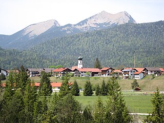
Krün is a municipality in the Upper Bavarian district of Garmisch-Partenkirchen. It belongs with Garmisch-Partenkirchen as district capital and cultural center as well as other municipalities to the region Werdenfelser Land. A few kilometers south runs the German-Austrian border.
The Krottenkopf, 2,086 metres/6,844 ft, is a peak in the Ester Mountains and the highest mountain in the Bavarian Prealps. It lies within the Bavarian district of Garmisch-Partenkirchen.
Leutasch is a municipality in the northern part of the district Innsbruck-Land in the Austrian state of Tyrol about 30 km northwest of Innsbruck and 10 km northwest of Seefeld in Tirol
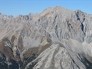
At 2,744 metres (9,003 ft), the Hochwanner is the second highest mountain in Germany after the Zugspitze. In addition the Hochwanner is the highest peak on the main ridge of the Wetterstein (Wettersteinhauptkamm) running from Gatterl to the Upper Wettersteinspitze above Mittenwald in an east–west direction. From the Hochwanner massif there is an all-round view of the Rein valley (Reintal), the Leutasch valley in Austria, the Gais valley, the Zugspitze, the Mieming Chain, the Jubiläumsgrat, the Karwendel mountains and far into the central Alps.
Dreitorspitze is a large and very prominent, multi-peak mountain massif in the eastern part of the Wetterstein Mountains in southern Germany. It is divided into Partenkirchen Dreitorspitze at 2,633 metres (8,638 ft) and Leutasch Dreitorspitze at 2,682 metres (8,799 ft); each of which has several peaks. The main peak of the fourth highest mountain massif in Germany is the Leutasch Dreitorspitze, which is also known as the Karlspitze. The Dreitorspitze marks the spot where the main chain of the Wetterstein mountains changes direction from its primary east-west orientation to run northwards for a short distance, before turning back again onto its main axis. East of the Dreitorspitze lies the karst plateau of the Leutasch Platt, comparable to the Zugspitzplatt at the foot of the Zugspitze.
The Ammergau Alps are a mountain range in the Northern Limestone Alps in the states of Bavaria (Germany) and Tyrol (Austria). They cover an area of about 30 x 30 km and begin at the outer edge of the Alps. The highest summit is the Daniel which has a height of 2,340 metres (7,680 ft).
The Alpspitze is a mountain, 2628 m, in Bavaria, Germany. Its pyramidal peak is the symbol of Garmisch-Partenkirchen and is one of the best known and most attractive mountains of the Northern Limestone Alps. It is made predominantly of Wetterstein limestone from the Upper Triassic.
The Arnspitze Group is a free-standing mountain chain in Austrian and Germany, in the states of Tyrol and Bavaria, between Seefeld in Tirol and Mittenwald, and between the Leutasch valley in the west and the Isar valley near Scharnitz in the east. In the literature, the Arnspitze Group is classed as part of the Wettersteingebirge. The majority of the group belongs to Tyrol, a northeastern part of the chain lies in Bavaria. The border between Bavaria and Tyrol runs over the summit of the Große Arnspitze.
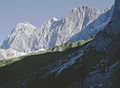
The Reintal is the name given to the upper and lower valleys of the River Partnach between the Zugspitzplatt plateau and the Partnachklamm gorge. A hiking route to Germany's highest mountain, the Zugspitze runs through the valley.
The Seebensee is a natural high mountain lake at a height of 1,657 metres, south of Ehrwald in the Mieming Range. It is surrounded by the Vorderer Tajakopf in the east, the Vorderer Drachenkopf in the south and the Ehrwalder Sonnenspitze in the west.
The Ausserfern Railway is a cross-border railway line in the German state of Bavaria and the Austrian state of Tyrol. The single-tracked branch line starts from Kempten in Germany, before crossing into Austria just after passing through Pfronten. It then transits the Außerfern area around Reutte, before passing back into Germany in order to terminate at Garmisch-Partenkirchen.
The Münchner Haus on Germany's highest mountain, the Zugspitze, is an Alpine Club hut belonging to the Munich Section of the German Alpine Club (DAV).
The Mieming(er) Range, Mieminger Chain or Mieminger Mountains, is a mountain range of the Northern Limestone Alps in the Eastern Alps. It is located entirely in Austria within the state of Tyrol. This sub-group is somewhat in the shadows of its more famous neighbour, the Wetterstein to the north. Whilst the region around the Coburger Hut and the lakes of Seebensee and Drachensee in the west and the Hohe Munde in the extreme east receive large numbers of visitors, the less developed central area remains very quiet. The Hohe Munde is also a popular and challenging ski touring destination.
The Werdenfelser Land is a region of Upper Bavaria that extends from Mittenwald in the south to Farchant. It includes parts of the Bavarian Alps. From the Middle Ages until the Thirty Years' War, the Werdenfelser Land was subject to the Prince-Bishop of Freising, not the Duke of Bavaria.
The Reintalanger Hut (1,366 m) is an Alpine Club hut in the Wetterstein Mountains at the head of the Reintal valley. The River Partnach has its source in the vicinity. West of the hut the valley floor climbs steeply up to the plateau of the Zugspitzplatt below Germany's highest mountain.
The Knorr Hut is a mountain hut belonging to the German Alpine Club and located in the Wetterstein Mountains at a height of 2,052 m. Its lies right on the edge of the Zugspitzplatt where it drops into the Reintalanger in a location with scenic views and is an important base for hikers who can climb up to it on the normal route from the town of Garmisch-Partenkirchen through the Reintal valley to Germany's highest mountain, the Zugspitze.
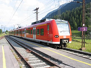
The Mittenwald Railway, popularly known as the Karwendelbahn, is a railway line in the Alps in Austria and Germany. It connects Innsbruck via Seefeld and Mittenwald to Garmisch-Partenkirchen.
The Scharnitz Pass is a narrow section of the upper Isar valley in the Northern Limestone Alps. It lies at a height of about 955 m on the Austro-German border between the states of Bavaria and Tyrol. Its name derives from the village of Scharnitz immediately to the south.
The Nördlinger Hut is an Alpine Club hut belonging to the German Alpine Club that is situated at a height of 2,238 m (AA) south of the summit of the Reither Spitze in the Austrian state of Tyrol. It is thus the highest refuge hut in the entire Karwendel range. It is located in the westernmost part of the Karwendel Alps, the Erlspitze Group, above the village and ski resort of Seefeld. From the hut there are expansive views over the Stubai Alps, the Inn valley and the Wetterstein Mountains.
Wikimedia Commons has media related to Wetterstein . |