Lewiston, Wisconsin

Last updated

Lewiston, Wisconsin
WIMap-doton-Lewiston.png
Location of Lewiston, Wisconsin
Coordinates: 43°35′20″N89°33′33″W / 43.58889°N 89.55917°W / 43.58889; -89.55917
Country Flag of the United States.svg  United States
State Flag of Wisconsin.svg  Wisconsin
County Columbia
Area
  Total54.9 sq mi (142.2 km2)
  Land54.0 sq mi (139.8 km2)
  Water1.0 sq mi (2.5 km2)
Elevation
[1]
804 ft (245 m)
Population
 (2000)
  Total1,187
  Density22.0/sq mi (8.5/km2)
Time zone UTC-6 (Central (CST))
  Summer (DST) UTC-5 (CDT)
FIPS code 55-43775 [2]
GNIS feature ID1583549 [1]

Lewiston is a town in Columbia County, Wisconsin, United States. The population was 1,187 at the 2000 census.

Contents

Geography

According to the United States Census Bureau, the town has a total area of 54.9 square miles (142.2 km2), of which, 54.0 square miles (139.8 km2) of it is land and 1.0 square miles (2.5 km2) of it (1.75%) is water.

Demographics

As of the census [2] of 2000, there were 1,187 people, 473 households, and 347 families residing in the town. The population density was 22.0 people per square mile (8.5/km2). There were 573 housing units at an average density of 10.6 per square mile (4.1/km2). The racial makeup of the town was 97.89% White, 0.51% Native American, 0.25% Asian, 0.17% from other races, and 1.18% from two or more races. Hispanic or Latino of any race were 1.01% of the population.

There were 473 households, out of which 30.4% had children under the age of 18 living with them, 63.6% were married couples living together, 4.2% had a female householder with no husband present, and 26.6% were non-families. 20.1% of all households were made up of individuals, and 7.4% had someone living alone who was 65 years of age or older. The average household size was 2.51 and the average family size was 2.88.

In the town, the population was spread out, with 23.3% under the age of 18, 5.8% from 18 to 24, 28.7% from 25 to 44, 29.5% from 45 to 64, and 12.7% who were 65 years of age or older. The median age was 41 years. For every 100 females, there were 109.7 males. For every 100 females age 18 and over, there were 111.9 males.

The median income for a household in the town was $45,962, and the median income for a family was $51,125. Males had a median income of $36,810 versus $23,214 for females. The per capita income for the town was $19,644. About 3.3% of families and 5.3% of the population were below the poverty line, including 6.6% of those under age 18 and 12.2% of those age 65 or over.

Historic sites

The Aldo Leopold Shack and Farm is located 6 miles south, in the town of Fairfield, in Sauk County, Wisconsin.

Related Research Articles

<span class="mw-page-title-main">Blades, Delaware</span> Town in Delaware, United States

Blades is a town in Sussex County, Delaware, United States. As of the 2010 census, the town population was 1,241, a 29.8% increase over the previous decade. It is part of the Salisbury, Maryland-Delaware Metropolitan Statistical Area.

<span class="mw-page-title-main">Hollister, Idaho</span> City in Idaho, United States


Hollister is a city in Twin Falls County, Idaho, United States. The population was 272 at the 2020 census. It is part of the Twin Falls, Idaho Micropolitan Statistical Area.

<span class="mw-page-title-main">Windsor, Maine</span> Town in the state of Maine, United States

Windsor is a town in Kennebec County, Maine, United States. The population was 2,632 at the 2020 census. Windsor is included in the Augusta, Maine micropolitan New England City and Town Area.

<span class="mw-page-title-main">Chase Township, Michigan</span> Civil township in Michigan, United States

Chase Township is a civil township of Lake County in the U.S. state of Michigan. The population was 1,153 at the 2020 census.

Palmville Township is a township in Roseau County, Minnesota, United States. The population was 55 at the 2000 census. The town was named for Louis Palm, a Swedish settler.

<span class="mw-page-title-main">Warsaw, North Carolina</span> Town in North Carolina, United States

Warsaw is a town in Duplin County, North Carolina, United States. The population was 3,054 at the 2010 census.

<span class="mw-page-title-main">Redfield, South Dakota</span> City in South Dakota, United States

Redfield is a city in and the county seat of Spink County, South Dakota, United States. The population was 2,214 at the 2020 census. The city was named for J. B. Redfield, a railroad official.
<span class="mw-page-title-main">Melvin, Texas</span> Town in Texas, United States

Melvin is a town in McCulloch County, Texas, United States. Its population was 179 at the 2010 census.

<span class="mw-page-title-main">Marcellon, Wisconsin</span> Town in Wisconsin, United States

Marcellon is a town in Columbia County, Wisconsin, United States. The population was 1,024 at the 2000 census. The unincorporated community of Belle Fountain is located in the town.

Friendship is a town in Fond du Lac County, Wisconsin, United States. The population was 2,406 at the 2000 census. The unincorporated communities of Dexter and Van Dyne are located within the town.
<span class="mw-page-title-main">Ringle, Wisconsin</span> Town in Wisconsin, United States

Ringle is a town in Marathon County, Wisconsin, United States. It is part of the Wausau (WI) Metropolitan Statistical Area. The population was 1,711 at the 2010 census. The unincorporated community of Ringle is located in the town.
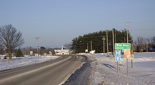
<span class="mw-page-title-main">Wild Rose, Wisconsin</span> Village in Wisconsin, United States

Wild Rose is a village in Waushara County, Wisconsin, United States. The population was 725 at the 2010 census.

<span class="mw-page-title-main">Prairie Farm, Wisconsin</span> Village in Wisconsin, United States

Prairie Farm is a village in Barron County in the U.S. state of Wisconsin. The population was 473 at the 2010 census. The village is located within the Town of Prairie Farm, on eastern shore of the Prairie Farm Flowage, a reservoir on the Hay River.

<span class="mw-page-title-main">Wyocena (town), Wisconsin</span>

Wyocena is a town in Columbia County, Wisconsin, United States. The population was 619 at the 2000 Census. The Village of Wyocena is located within the town.

<span class="mw-page-title-main">Cross Plains (town), Wisconsin</span> Town in Dane County, Wisconsin

Cross Plains is a town in Dane County, Wisconsin, United States. The population was 1,419 at the 2000 census. The Village of Cross Plains is located partially within the town. The unincorporated community of Pine Bluff is located in the town.

<span class="mw-page-title-main">Dane (town), Wisconsin</span>

Dane is a town in Dane County, Wisconsin, United States. The population was 968 at the 2000 census. The unincorporated community of Lutheran Hill is located partially in the town.

<span class="mw-page-title-main">Mazomanie (town), Wisconsin</span>

Mazomanie is a town in Dane County, Wisconsin. The population was 1,185 at the time of the 2000 census. The Village of Mazomanie is located within the town.

Woodman is a town in Grant County in the U.S. state of Wisconsin. The population was 195 at the 2000 census. The Village of Woodman is located within the town.

The Town of Prairie du Sac is located in southwestern Sauk County, Wisconsin, United States. The population was 1,138 at the 2000 census. The Village of Prairie du Sac is located within the town. The unincorporated community of Loddes Mill is also located in the town.

Williamson is a hamlet located in the Town of Williamson, Wayne County, New York, United States. The population was 2,495 at the 2010 census. Government offices for the Town of Williamson are located in the hamlet.

References

  1. 1 2 "US Board on Geographic Names". United States Geological Survey. October 25, 2007. Retrieved January 31, 2008.
  2. 1 2 "U.S. Census website". United States Census Bureau . Retrieved January 31, 2008.

43°34′50″N89°38′08″W / 43.58056°N 89.63556°W / 43.58056; -89.63556