Likely, British Columbia

Last updated

Likely
Downtownlikely.jpg
Downtown Likely
Canada British Columbia location map 2.svg
Red pog.svg
Likely
Location of Likely
Canada location map 2.svg
Red pog.svg
Likely
Likely (Canada)
North America laea location map.svg
Red pog.svg
Likely
Likely (North America)
Coordinates: 52°37′00″N121°33′49″W / 52.61667°N 121.56361°W / 52.61667; -121.56361
CountryCanada
Province British Columbia
Region North Cariboo
Regional district Cariboo Regional District
Founded1923
Government
  Governing bodyCariboo Regional District
   MP Todd Doherty (Conservative)
   MLA Coralee Oakes (Liberal)
Elevation
871 m (2,858 ft)
Population
  Total350
Time zone UTC−08:00 (PST)
Waterways Quesnel River

Likely is an unincorporated community in British Columbia, Canada. It is located in the Cariboo region of the province, and is situated where the west arm of Quesnel Lake empties into the Quesnel River. Roads from Likely lead southwest to Williams Lake, northwest to Quesnel, south to Horsefly, and north to Barkerville. Likely is in the Quesnel Highland, a transition zone between the Cariboo Plateau and the Cariboo Mountains.

Contents

History

Likely is one of the few remaining Cariboo Gold Rush settlements. Likely was originally called Quesnel Dam. The name was changed to honour prospector John A. Likely (1842-1929) of the Bullion Pit Mine, who was affectionately called "Plato" for his tendency to philosophize. [1] He lies in an unmarked grave in Kamloops Cemetery. [2] :153

The Quesnel River was dammed near Likely in 1898 to enable downriver areas to be explored for gold. One such site became the Bullion Pit mine, which operated from 1892 to 1942. In 1935, this mine became the site of the largest hydraulic monitors ever installed in North America. (Hydraulic monitors are high-pressure and high-volume water nozzles used to wash down large volumes of gold bearing gravel in placer mining. Over 64 kilometres of canals drew water from nearby creeks and lakes to feed the hydraulic nozzles, which used more water each day than the entire city of Vancouver did at the time. Today, the Bullion Pit stands as an astonishing man-made canyon measuring 3 kilometres long by 400 feet (120 m) deep. It displaced 12,000,000 cubic yards (9,200,000 m3) of gravel.

Bactrian camels were used as pack animals during the Cariboo Gold Rush. One was shot at Beaver Valley, near Likely, by a prospector named Morris, when he mistook it for a giant grizzly bear.

Environmental issues

On 4 August 2014, the tailings pond of the Mount Polley mine was breached, spilling water and tailing sediment and silt into Polley Lake and Quesnel Lake. Subsequent water quality analysis showed no changes to water quality. A drinking water ban was lifted for all areas except a small area adjacent to the tailing pond at Polley Lake. [3]

Recreation

Quesnel Lake is the largest lake in the Cariboo, with the North Arm extending 77 kilometres and the East Arm reaching out 100 kilometres. Ten to 16 pound rainbow trout, lake trout up to 30 or 40 pounds, as well as kokanee can all be caught by fishers. Tree species in the area include black cottonwood, western hemlock, western red cedar, Engelmann spruce, and subalpine fir. [4]

A highlight of a visit to Likely in late summer includes watching thousands of salmon migrate up the Quesnel River to their spawning grounds in the Horsefly and Mitchell Rivers. Visitors can also explore the historic ghost town of Quesnel Forks, only 11 km to the northwest.

Cedar Point Park, an impressive stand of western red cedar on the shores of Quesnel Lake, is a nice spot to visit, now a park and campground. One of the Twin Giants (huge Vulcan steam shovels purchased in 1906 to dig a canal from Spanish Lake to the Bullion Mines) lies there. The shovels weighed approximately 22,000 pounds each, and were shipped in pieces from Toledo, Ohigho. Transported first by rail then by wagon to a site below the dam on Spanish Lake, they were assembled and placed on railway tracks to begin digging the ditch. It was reported that $20,000 were spent before the operations were suspended, leaving the shovels where they stopped work in the year 1907. (The other Twin Giant is now in Quesnel).

Climate

Likely has a humid continental climate (Köppen Dfb) with mild summers with quite high diurnal temperature variations along with cold winters with high snowfall.

Climate data for Likely, BC (1971–2000 normals)
MonthJanFebMarAprMayJunJulAugSepOctNovDecYear
Record high °C (°F)11.5
(52.7)
14.5
(58.1)
16
(61)
29.4
(84.9)
35
(95)
33
(91)
34
(93)
34
(93)
34.5
(94.1)
23.5
(74.3)
16.7
(62.1)
11
(52)
35
(95)
Mean daily maximum °C (°F)−2.9
(26.8)
0.6
(33.1)
5.8
(42.4)
11.3
(52.3)
16.3
(61.3)
19.8
(67.6)
22.7
(72.9)
22.3
(72.1)
17.3
(63.1)
10.6
(51.1)
2.5
(36.5)
−2.1
(28.2)
11.2
(52.2)
Daily mean °C (°F)−7.0
(19.4)
−4.4
(24.1)
−0.1
(31.8)
4.6
(40.3)
9.3
(48.7)
12.9
(55.2)
15.4
(59.7)
15.1
(59.2)
10.7
(51.3)
5.4
(41.7)
−1.2
(29.8)
−5.7
(21.7)
4.6
(40.3)
Mean daily minimum °C (°F)−11.1
(12.0)
−9.4
(15.1)
−6.1
(21.0)
−2.1
(28.2)
2.3
(36.1)
6
(43)
8.1
(46.6)
7.8
(46.0)
4
(39)
0.1
(32.2)
−4.8
(23.4)
−9.2
(15.4)
−1.2
(29.8)
Record low °C (°F)−37.5
(−35.5)
−34.5
(−30.1)
−31.1
(−24.0)
−13.9
(7.0)
−6
(21)
−3
(27)
2.5
(36.5)
−2.5
(27.5)
−5.5
(22.1)
−25
(−13)
−35.5
(−31.9)
−38.5
(−37.3)
−38.5
(−37.3)
Average precipitation mm (inches)60.9
(2.40)
41.7
(1.64)
35.5
(1.40)
41.8
(1.65)
55
(2.2)
81.8
(3.22)
59.7
(2.35)
67.2
(2.65)
51.6
(2.03)
59.4
(2.34)
60.6
(2.39)
77.4
(3.05)
692.4
(27.26)
Average snowfall cm (inches)49.7
(19.6)
33.4
(13.1)
22.1
(8.7)
8.6
(3.4)
0.4
(0.2)
0.0
(0.0)
0.0
(0.0)
0.0
(0.0)
0.0
(0.0)
5.7
(2.2)
29.7
(11.7)
65.5
(25.8)
215.2
(84.7)
Source: Environment Canada [5]

Related Research Articles

<span class="mw-page-title-main">Fraser River</span> River in British Columbia, Canada

The Fraser River is the longest river within British Columbia, Canada, rising at Fraser Pass near Blackrock Mountain in the Rocky Mountains and flowing for 1,375 kilometres (854 mi), into the Strait of Georgia just south of the City of Vancouver. The river's annual discharge at its mouth is 112 cubic kilometres (27 cu mi) or 3,550 cubic metres per second (125,000 cu ft/s), and each year it discharges about 20 million tons of sediment into the ocean.

<span class="mw-page-title-main">Cariboo</span> Region of British Columbia, Canada

The Cariboo is an intermontane region of British Columbia, Canada, centered on a plateau stretching from Fraser Canyon to the Cariboo Mountains. The name is a reference to the caribou that were once abundant in the region.

British Columbia gold rushes were important episodes in the history and settlement of European, Canadian and Chinese peoples in western Canada.

<span class="mw-page-title-main">Cariboo Gold Rush</span> 19th-century gold rush in British Columbia, Canada

The Cariboo Gold Rush was a gold rush in the Colony of British Columbia, which later became the Canadian province of British Columbia. The first gold discovery was made at Hills Bar in 1858, followed by more strikes in 1859 on the Horsefly River, and on Keithley Creek and Antler Creek in 1860. The actual rush did not begin until 1861, when these discoveries were widely publicized. By 1865, following the strikes along Williams Creek, the rush was in full swing.

<span class="mw-page-title-main">Fraser Canyon Gold Rush</span> First main gold rush in British Columbia

The Fraser Canyon Gold Rush, began in 1858 after gold was discovered on the Thompson River in British Columbia at its confluence with the Nicoamen River a few miles upstream from the Thompson's confluence with the Fraser River at present-day Lytton. The rush overtook the region around the discovery and was centered on the Fraser Canyon from around Hope and Yale to Pavilion and Fountain, just north of Lillooet.

<span class="mw-page-title-main">Quesnel River</span> River in Canada

The Quesnel River is a major tributary of the Fraser River in the Cariboo District of central British Columbia. It begins at the outflow of Quesnel Lake, at the town of Likely and flows for about 100 kilometres (60 mi) northwest to its confluence with the Fraser at the city of Quesnel.

Wells is a small mining and tourist town in the Cariboo District of central British Columbia, located on BC Highway 26, 74 km (46 mi) from Quesnel and 8 km (5 mi) before the highway's terminus at Barkerville. It gains much of its revenue and jobs from tourists who pass through on their way to the Bowron Lake Provincial Park and to the historic museum town of Barkerville.

<span class="mw-page-title-main">Strathcona Provincial Park</span> Provincial park in British Columbia, Canada

Strathcona Provincial Park is the oldest provincial park in British Columbia, Canada, and the largest on Vancouver Island. Founded in 1911, the park was named for Donald Alexander Smith, 1st Baron Strathcona and Mount Royal, a wealthy philanthropist and railway pioneer. It lies within the Strathcona Regional District. The Clayoquot Sound Biosphere Reserve, established in 2000, includes three watersheds in the western area of the park.

The Big Bend Gold Rush was a gold rush in the Big Bend Country of the Colony of British Columbia in the mid-1860s.

<span class="mw-page-title-main">Quesnel Highland</span>

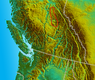
The Quesnel Highland is a geographic area in the Central Interior of the Canadian province of British Columbia. As defined by BC government geographer in Landforms of British Columbia, an account and analysis of British Columbia geography that is often cited as authoritative, the Highland is a complex of upland hill and plateau areas forming and defined as being the buffer between the Cariboo Plateau and the Cariboo Mountains, as a sort of highland foothills along the eastern edge of the Interior Plateau running southeast from a certain point southeast of the city of Prince George to the Mahood Lake area at the southeast corner of the Cariboo. Beyond Mahood Lake lies another separately classified area dubbed by Holland the Shuswap Highland which spans similar terrain across the North Thompson and Shuswap Lake-Adams River drainage basins, forming a similar upland-area buffer between the Thompson Plateau and the Monashee Mountains. A third area, the Okanagan Highland, extends from the southern end of the Shuswap Highland in the area of Vernon and Enderby in the northern Okanagan region into Washington State, and also abuts the Monashee Mountains.

The Old Cariboo Road is a reference to the original wagon road to the Cariboo gold fields in what is now the Canadian province of British Columbia. It should not be confused with the Cariboo Road, which was built slightly later and used a different route.

<span class="mw-page-title-main">Quesnel Lake</span> Glacial lake in British Columbia, Canada

Quesnel Lake is a glacial lake or fjord in British Columbia, Canada, and is the major tributary of the Fraser River. With a maximum depth of 631 m (2,070 ft), it is claimed to be the deepest fjord lake in the world, the deepest lake in BC, and the third-deepest lake in North America, after Great Slave Lake and Crater Lake.

The Omineca Gold Rush was a gold rush in British Columbia, Canada in the Omineca region of the Northern Interior of the province. Gold was first discovered there in 1861, but the rush didn't begin until late in 1869 with the discovery at Vital Creek. There were several routes to the goldfields: two were from Fort St. James, one of which was a water route through the Stuart and Tachie Rivers to Trembleur Lake to Takla Lake and the other was overland, called the Baldy Mountain route. A third route came in overland from Hazelton on the Skeena River and a fourth route used the Fraser River and crossed over the Giscome Portage to Summit Lake, through McLeod Lake, and up the Finlay River to the Omineca River.

Horsefly is an unincorporated community on the northwest shore of the Horsefly River, in the Cariboo region of central British Columbia. The location, via BC Highway 97, Likely Rd, and Horsefly Rd, is about 67 kilometres (42 mi) northeast of Williams Lake, and by road 22 kilometres (14 mi) south of Quesnel Lake.

<span class="mw-page-title-main">Quesnel Forks</span> Place in British Columbia, Canada

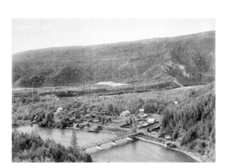
Quesnel Forks, historically Quesnelle Forks, also simply known as "The Forks" or grandly known as "Quesnel City" is a ghost town in the Cariboo region of British Columbia, Canada. It is located the junction of the Quesnel and Cariboo Rivers and is 60 km southeast of Quesnel and only 11 km northwest of Likely.

Hobson Lake is the uppermost lake on the Clearwater River in east-central British Columbia, Canada. Hobson Lake is one of the six major lakes in Wells Gray Provincial Park.

Gold Trails and Ghost Towns is a Canadian historical documentary show, created and produced by television station CHBC-TV in Kelowna, British Columbia for Canadian syndication and hosted by Mike Roberts with historian/storyteller Bill Barlee. The show was filmed in a studio which resembled an old trapper's cabin. Mike and Bill discussed prospectors and the history of British Columbia around 1900.

<span class="mw-page-title-main">Highland Valley Copper mine</span>

The Highland Valley Copper mine is the largest open-pit copper mine in Canada, located near Logan Lake, British Columbia. It is an amalgamation of three historic mining operations: Bethlehem, Lornex and Highmont.

<span class="mw-page-title-main">Mount Polley mine</span> Gold and copper mine in British Columbia, Canada

Mount Polley mine is a Canadian gold and copper mine located in British Columbia near the towns of Williams Lake and Likely. It consists of two open-pit sites with an underground mining component and is owned and operated by the Mount Polley Mining Corporation, a wholly owned subsidiary of Imperial Metals. In 2013, the mine produced an output of 38,501,165 pounds (17,463,835 kg) of copper, 45,823 ounces of gold, and 123,999 of silver. The mill commenced operations in 1997 and was closed and placed on care and maintenance in 2019. The company owns 20,113 hectares (201.13 km2) of property near Quesnel Lake and Polley Lake where it has mining leases and operations on 2,007 hectares (20.07 km2) and mineral claims on 18,106 hectares (181.06 km2). Mineral concentrate is delivered by truck to the Port of Vancouver.

Mount Polley, originally Polley Mountain, elevation 1255 m, prominence 271 m, is a low mountain in the Cariboo region of the Central Interior of British Columbia, Canada. It is located just west of the foot of Quesnel Lake between Bootjack and Polley Lakes. The site experienced a dam breach in 2014 at the Mount Polley mine which caused a spill of mine tailings into the nearby lake and creek.

References

  1. Akrigg, G.P. (Philip) V.; Akrigg, Helen (1 November 2011). British Columbia Place Names (3rd ed.). University of British Columbia Press. p. 153. ISBN   9780774841702 . Retrieved 8 March 2015.
  2. Akrigg, G.P.V.; Akrigg, Helen B. (1986), British Columbia Place Names (3rd, 1997 ed.), Vancouver: UBC Press, ISBN   0-7748-0636-2
  3. Gordon Hoekstra (12 August 2014). "Most water-use bans from Mount Polley tailings dam collapse lifted (updated)". Vancouver Sun.
  4. "CCCS: Forests and Waterways". Cariboo Chilcotin Conservation Society. Retrieved 6 July 2021.
  5. Environment CanadaCanadian Climate Normals 1971–2000, accessed 24 March 2010

Further reading