List of Brooklyn thoroughfares

Last updated

This article provides a listing (with simple descriptions, where possible) of the streets in the New York City borough of Brooklyn, including Fort Hamilton, the last active-duty military post in New York City.

Contents

State-named roadways

NameFromToDistance# of lanesTraffic directionAdditional notes
Alabama Avenue Fulton Street Flatlands Avenue 1.9 mi1SouthExists in 3 segments.
Arkansas DriveIndiana PlaceBassett Avenue0.23 mi2Southwest-Northeast Mill Basin
Georgia Avenue Fulton Street Flatlands Avenue 1.9 mi1North
Indiana PlaceNational DriveMayfair Drive South0.15 mi2North-South Mill Basin
Kansas PlaceNational DriveArkansas Drive0.06 mi2North-South Mill Basin
Louisiana AvenueWilliams AvenueSeaview Avenue1.5 mi1-2VariesSplit into 2 segments by Linden Boulevard.
Montana PlaceNational DriveArkansas Drive0.07 mi2North-South Mill Basin
New Jersey Avenue Jamaica Avenue Flatlands Avenue 1.9 mi1VariesExists in 3 vehicular segments (two pedestrian segments).
New York Avenue Fulton Street Kings Highway 4.4 mi2-3VariesExists in 2 segments.
Pennsylvania Avenue Jackie Robinson Parkway/Jamaica-East New York-Bushwick Avenues triangle Belt Parkway 2.8 mi4-7North-south
Vermont PlaceCypress AvenueHighland Boulevard0.5 mi2North-south
Vermont Street Jamaica Avenue Flatlands Avenue 2.3 mi1South
Washington Avenue Flushing Avenue Flatbush Avenue 2.6 mi2-4North-south
Washington StreetDead-endProspect Street0.25 mile1SouthContinues as Cadman Plaza East.

Avenues

NameFromToDistance# of lanesTraffic directionAdditional notes
Albany AvenueDecatur StreetAvenue K3.5 miles2South
Allen AvenueKnapp StreetGerritsen Avenue0.23 miles1East Gerritsen Beach
Arlington Avenue
Atkins Avenue
Atlantic Avenue Brooklyn-Queens Expressway Van Wyck Expressway in Queens 10.3 miles [1] 6Bidirectional
Autumn Avenue
Banner Avenue Brighton Beach
Bassett Avenue
Bath Avenue14th AvenueStillwell Avenue2.11 miles2Bidirectional Bath Beach
Battery AvenueFort Hamilton Army Base86th Street1 mile1North Dyker Heights
Bay Avenue
Bay Ridge AvenueShore RoadBay Pkwy3.1 miles1-2East/West Bay Ridge
Bayview Avenue Coney Island/Seagate
Bedford Avenue Manhattan Avenue Emmons Avenue10.2 miles [2] 2North/South Sheepshead Bay
Belmont Avenue
Benson Avenue
Bergen Avenue
Bijou AvenueEbony CourtGerritsen Avenue0.152Southwest/Northeast Gerritsen Beach
Blake Avenue
Brighton Beach Avenue Brighton Beach
Brooklyn Avenue
Buffalo Avenue
Bushwick Avenue
Canal Avenue Coney Island
Canda Avenue Sheepshead Bay
Carlton Avenue
Caton Avenue
Central Avenue
Channel AvenueEbony CourtGerritsen Avenue0.15 miles2Southwest/Northeast
Chauncey Avenue
Chestnut Avenue
Christopher Avenue
Church Avenue
Clarkson Avenue
Classon Avenue
Clermont Avenue
Clinton Avenue
Coney Island Avenue Machate Circle Riegelmann Boardwalk
Conklin Avenue
Crawford Avenue
Crescent Avenue
Crooke Avenue
Cropsey Avenue
Crosby Avenue
Cypress Avenue
Cyrus Avenue Gerritsen Beach
Debevoise Avenue
DeKalb Avenue Runs briefly into Ridgewood, New York in Queens County. Ridgewood was once part of Bushwick, Brooklyn, but seceded and became part of Queens, adjacent to the existing area of Glendale, Queens. Ridgewood and Glendale have the same zip code (11385).
Devon AvenueJoval CourtGerritsen Avenue0.26 miles2Southwest/Northeast
Dewitt Avenue
Ditmas Avenue
Division Avenue
Dock Avenue Brooklyn Navy Yard
Driggs Avenue
Dumont Avenue
East New York Avenue
Elm Avenue
Elmwood Avenue
Emmons Avenue Sheepshead Bay
Engert Avenue
Everett Avenue
Evergreen Avenue
Fillmore Avenue
Flatbush Avenue Manhattan Bridge Marine Parkway/Gil Hodges Memorial Bridge 9.9 miles [3] 4Bidirectional
Flatlands Avenue
Florence Avenue Gerritsen Beach
Flushing AvenueNavy StreetQueens line
Foster Avenue
Fountain Avenue
Front Avenue
Gates Avenue
Gee Avenue
Gelston Avenue86th Street94th Street.4 mile1South
Gerritsen Avenue Nostrand Avenue Lois Avenue2.05 miles2Northwest/Southeast
Glenmore Avenue
Gotham AvenueFane CourtGerritsen Avenue0.31 miles2Southwest/Northeast
Graham AvenuePart of which is known as the "Avenue of Puerto Rico"
Grand Avenue
Grant Avenue
Greene Avenue
Greenpoint AvenueDead-end (Brooklyn) Roosevelt Avenue and Queens Boulevard (Queens)2.5 miles2-4BidirectionalRuns from Greenpoint, Brooklyn to Sunnyside, Queens and crosses Newtown Creek over the J.J. Byrne Bridge. Continues as Roosevelt Avenue past Queens Boulevard.
Greenwood AvenueProspect Park SouthwestMcDonald Avenue0.4 mile2BidirectionalThis avenue exists in two segments. They are separated by the open-cut Prospect Expressway. In theory, the avenue is connected, but this is achieved by a pedestrian overpass.
Guider AvenueSometimes misspelled as "Guilder Avenue"
Hale Avenue
Hamilton Avenue
Hampton Avenue Manhattan Beach
Harkness Avenue
Harrison Avenue
Harway Avenue
Hegeman Avenue
Highland Avenue
Highlawn Avenue
Hitchings Avenue Sheepshead Bay
Homecrest Avenue
Howard Avenue
Hudson Avenue DUMBO
Hunter Avenue
Independence Avenue
Irving Avenue
Jamaica Avenue
Jefferson Avenue
Jerome Avenue
Johnson Avenue
Kay Avenue Williamsburg
Kent Avenue
Kingsland Avenue
Knickerbocker Avenue
Lafayette Avenue
Lake Avenue
Lancaster Avenue
Laurel Avenue Sea Gate
Lawrence Avenue
Lee Avenue
Lefferts Avenue
Lewis Avenue
Lexington Avenue
Liberty Avenue
Lincoln Avenue
Linden Avenue
Livonia Avenue
Lois AvenueHyman CourtGerritsen Avenue0.2 miles2Southwest/Northeast Gerritsen Beach
Loring Avenue
Lott Avenue
Madoc AvenueCyrus AvenuePost Court0.15 miles2Northwest/Southeast Gerritsen Beach
Manhattan Avenue Former Vernon Avenue BridgeBroadway3.4 miles1-2North/South Greenpoint & Williamsburg
Maple Avenue Sea Gate
Marcy Avenue Metropolitan Avenue Fulton Street 2.6 miles2South Frontage road for Brooklyn-Queens Expressway for its northernmost 0.6 miles.
Marine Avenue92nd StreetFort Hamilton Parkway0.66 mile2BidirectionalContinuation of Colonial Road. Carries a northbound on-street bike lane running from 92nd Street to Oliver Street.
Maspeth Avenue
McDonald Avenue
McDonough Avenue Brooklyn Navy Yard
Meeker AvenueGardner Avenue Metropolitan Avenue 1.5 mile2-4BidirectionalIs a frontage road for the Brooklyn-Queens Expressway for most of its length.
Mermaid AvenueSurf AvenueStillwell Avenue1.25 miles2BidirectionalSite of the Mermaid Parade in Coney Island.
Metropolitan Avenue East RiverQueens line Williamsburg
Miller Avenue
Morris Avenue
Montauk Avenue
Montrose Avenue
Myrtle Avenue
Narrows Avenue68th StreetShore Road1.10 miles2BidirectionalPath impeded between 83rd and 85th streets by Fort Hamilton High School.
Nassau Avenue
Nautilus Avenue
Neptune AvenueSurf AvenueShore Boulevard & Emmons Avenue2.96 miles2-4Bidirectional; bike lanes run along most of its length. Coney Island and Sheepshead Bay
Newkirk Avenue
New Lots Avenue
New Utrecht Avenue
New York Avenue
Noel AvenueBartlett PlaceLois Avenue0.34 miles1-2Southeast/Northwest Gerritsen Beach
Norman Avenue
North Conduit Avenue
North Portland Avenue
Norwood Avenue
Nostrand Avenue
Ocean Avenue
Oceanic Ave Sea Gate
Oceanview (or Ocean View) Avenue
Onderdonk Avenue
Ordnance Avenue Brooklyn Navy Yard
Ovington Avenue
Paidge Avenue
Park Avenue
Parkside Avenue
Parkville Avenue
Pennsylvania Avenue
Perry Avenue Kingsborough Community College
Pitkin Avenue
Poplar Avenue Sea Gate
Prospect Avenue Ocean Parkway 4th Avenue 1.59 miles2VariesTwo-way from Ocean Parkway to 6th Avenue and one-way westbound to its terminus at 4th Avenue.
Putnam Avenue
Railroad Avenue
Ralph Avenue
Remsen Avenue
Ridgewood Avenue
Riverdale Avenue
Roder Avenue
Rogers Avenue
Ryder Avenue
Saratoga Avenue
Sea Breeze AvenueWest 5th StreetBeach Walk0.3 mile2Bidirectional
Sea Gate Avenue Sea Gate
Seaview Avenue
Seawall Avenue Kingsborough Community College
Seba AvenueMadoc AvenueGerritsen Avenue0.31 miles2Southwest/Northeast Gerritsen Beach
Schenectady Avenue
Schenk Avenue
Schroeders Avenue Starrett City
Scott Avenue
Seneca Avenue
Sheffield Avenue
Sheridan Avenue
Ship Ways Avenue Brooklyn Navy Yard
Skillman Avenue
Snediker Avenue
Snyder Avenue
South Portland Avenue
St Felix Avenue
St Marks Avenue
St Nicholas Avenue
Starr Avenue
Stewart Avenue
Stillwell Avenue Bay ParkwayRiegelmann Boardwalk
Strickland Avenue
Stuyvesant Avenue
Sunnyside Avenue
Surf AvenuePoplar Avenue & Highland Avenue (Sea Gate) Ocean Parkway & Sea Breeze Avenue2.61 miles2-6BidirectionalContinuation of Poplar Avenue and Ocean Parkway.
Sutter Avenue
Thatford Avenue
Throop Avenue
Tilden Avenue
Tompkins Avenue
Troy Avenue
Underhill Avenue
Union Avenue
Utica Avenue
Van Sinderen Avenue
Vandalia Avenue Starrett City
Vanderbilt Avenue
Vandervoort Avenue
Varick AvenueSometimes misidentified as Varick Street Bushwick
Vernon Avenue
Voorhies Avenue
Warrington Avenue Brooklyn Navy Yard
Washington Avenue Prospect Heights and Clinton Hill
Waverly Avenue
Webster Avenue
West Brighton Avenue
Westshore (or West Shore) Avenue
Willoughby Avenue
Wilson Avenue
Woodruff Avenue
Woodside Avenue
Wyckoff Avenue
Wythe Avenue

Numbered Avenues

Apart from the portion of 3rd through 7th Avenues beyond 86th Street, the numbered avenues run approximately 40 degrees west of south, but by local custom are called North–south.

AvenueNorth-endSouth-endLength# of lanesTraffic directionAdditional notesImage
First Avenue 39th Street 58th Street2North–southRail tracks are embedded along the center of the avenue for most of its length. Renamed "Colonial Road" in Bay Ridge.
Second AvenueDead-end north of 5th Street64th Street2North–southExists in two sections; Fifth Street to Hamilton Avenue, and 28th to 64th streets. Renamed "Ridge Boulevard" in Bay Ridge. 2nd Av 34st Brooklyn jeh.JPG
Third Avenue Flatbush Avenue Shore Road2–10North–southServes as service road for Gowanus Expressway between Prospect Avenue and 65th Street. Served by the B37 bus along the entire avenue and northbound B103 bus north of the Prospect Expressway (but only has one stop at State Street)
Fourth Avenue Flatbush AvenueShore Road4–6North–southThe BMT Fourth Avenue Line runs underneath.
Fifth AvenueFlatbush Avenue4th Avenue2North–south B63 runs the entire length of the avenue. Amer Legion Post -1833 at 389 5 Av Bk jeh.jpg
Sixth Avenue Atlantic Avenue Fort Hamilton Parkway 1–2VariesExists in three segments, separated by 36th–38th Street Yard and Sunset Park. OLPH Elem Sch jeh.JPG
Seventh AvenueFlatbush Avenue Cropsey Avenue 2–5North–southExists in three segments. Serves as service road for Gowanus Expressway from 65th to 79th Streets. Has subway stations on the IND Culver Line and BMT Brighton Line. The B67 and B69 buses run on it between 20th Street and Flatbush Avenue.
The avenue widens south of 65th Street.
All Saints CoE 7&7 PS jeh.jpg
Eighth Avenue Flatbush Avenue73rd Street2VariesExists in two segments. B70 runs along the avenue from Bay Ridge Avenue to 39th Street. Has a station on the BMT Sea Beach Line 61st St & 8th Ave (Brooklyn, New York City - 19 January 2006).jpg
Ninth AvenueFlatbush AvenueBay Ridge Parkway2–3North–southExists in four segments. Has one station on the BMT West End Line
10th AvenueProspect Park SW86th Street2North–southExists in three segments.
11th AvenueProspect Park SW86th Street2North–southExists in two segments, separated by Green-Wood Cemetery and Fort Hamilton Parkway. Has an entrance to Fort Hamilton Parkway on the BMT Sea Beach Line
12th AvenueDahill Road86th Street2VariesExists in two segments.
13th Avenue 36th Street86th Street2North–southB64 bus runs along the avenue from 86th Street to Bay Ridge Avenue. Bay Ridge-bound B16 buses run along the avenue from 37th Street to 57th Street. BoroughPark-13thAvenue.jpg
14th AvenueMcDonald AvenueCropsey Avenue2North–southProspect Park-bound B16 bus runs on the avenue from 56th to 36th Streets
15th AvenueMcDonald AvenueShore Parkway2North–south
16th Avenue38th StreetShore Parkway2North–south
17th AvenueDahill Road17th Court2North–southHas an entrance to 18th Avenue on the BMT Sea Beach Line
18th Avenue Coney Island Avenue Shore Parkway3North–southThe B8 runs along the entire Avenue; has subway stations on the BMT West End Line, BMT Sea Beach Line, and IND Culver Line; merges with Ditmas Avenue east of Coney island Avenue
19th Avenue51st StreetShore Parkway2North–south
20th AvenueMcDonald AvenueShore Parkway2North–southHas subway stations on the BMT West End Line and BMT Sea Beach Line
21st AvenueDahill RoadShore Parkway2North–south
Bay Parkway (formerly 22nd Avenue)Ocean ParkwayCaesar's Shopping Plaza4North–southThe B6 bus runs along most of the street, until Ave J. The B82 runs south of Kings Highway. Three subway stations on the BMT West End Line, BMT Sea Beach Line, and IND Culver Line. [4]
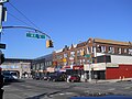
 BaypkwyBhurst.jpg
23rd AvenueStillwell AvenueCropsey Avenue2North–south
23rd Avenue65th StreetDahill Road2North–south
24th AvenueStillwell AvenueGravesend Bay2North–southSplit into two sections by the Belt Parkway
24th Avenue65th StreetMcDonald Ave2North–south
25th AvenueStillwell AvenueGravesend Bay2North–southHas a station on the BMT West End Line and served by the B3 bus; Split into two sections by the Belt Parkway
26th AvenueStillwell AvenueShore Parkway2North–south
27th AvenueStillwell AvenueShore Parkway2North–south
28th AvenueStillwell AvenueCropsey Avenue2North–south
95th AvenueElderts LaneDrew Street (continues into Queens)1East-westThis two-block long Queens-numbered avenue is divided by the border of Brooklyn and Queens, with the Brooklyn half on the southern side, but having Queens-style (73-xx and 74-xx) addresses.
101st AvenueLiberty Avenue/Forbell StreetDrew Street (continues into Queens)2West–eastThis Queens-numbered avenue runs one block entirely in Brooklyn, with Brooklyn addresses.

Boulevards

NameFromToDistance# of lanesTraffic directionAdditional notesPhoto
Brooklyn Bridge Boulevard Brooklyn Bridge Fulton Street 0.84 mile8North to southCo-named Adams Street AdamsStreetRU.jpg
Conduit Boulevard
Empire BoulevardFormerly called Malbone Street, renamed after the Malbone Street wreck.
Highland Boulevard East New York
John Berry Boulevard Kingsborough Community College Manhattan Beach
Linden Boulevard
Malcolm X BoulevardFormerly known as Reid Avenue
Marcus Garvey BoulevardFormerly known as Sumner Avenue
McGuinness Boulevard Pulaski Bridge/Dead-endHumboldt Street1.34 miles4North to southContinues north as 11th Street in Queens after crossing the Pulaski Bridge; continues south as Humboldt Street.
Mother Gaston BoulevardFormerly known as Stone Avenue
Oriental Boulevard Manhattan Beach
Ridge Boulevard65th StreetShore Road1.8 Miles2BidirectionalContinuation of Second Avenue, above.
Shore Boulevard

Courts

NameFromToDistance# of lanesTraffic directionAdditional notes
1st Court Coney Island Avenue East 9th Street0.091West
Abbey Court Gerritsen Beach
Agate Court
Alice Court
Applegate Court
Aster Court Gerritsen Beach
Atwater Court
Barberry Court
Beacon Court Gerritsen Beach
Bennett Court (sometimes misspelled as Bennet Court)
Bergen CourtEast 72nd StreetBergen Avenue1Northeast-Southwest (2 way) Bergen Beach [5]
Bevy Court Gerritsen Beach
Blake Court
Bokee Court Gravesend
Bridge Plaza CourtNassau StreetConcord Street0.051South
Brighton Court
Brightwater Court Brighton Beach
Cameron Court66th Street67th Street0.07 mile1North to south
Canton Court Gerritsen Beach
Cary CourtDead ended private street along Coney Island Avenue
Celeste Court
Chester Court
Cobek Court
Colby Court Gravesend
Corso Court
Cypress Court
Dahl Court
Dank Court Gravesend
Dare Court Gerritsen Beach
Dekoven Court
Desmond Court
Dictum Court Gerritsen Beach
Doone Court
Dunne Court
Duryea Court66th Street67th Street0.07 mile1
Eaton Court Gerritsen Beach
Ebony Court Gerritsen Beach
Fane Court
Frank Court Gerritsen Beach
Gain Court Gerritsen Beach
Garland CourtAllen Avenue (1st segment) Devon Avenue (2nd segment)dead-end (1st segment), Florence Avenue (2nd segment)0.26 miles (1st segment 0.04 miles, 2nd segment 0.22 miles)1-2Southeast
Gerald CourtConey Island AvenueEast 7th Street Sheepshead Bay
Glendale Court
Grace CourtDead-endHicks Street0.11 mile1West to east
Gunnison Court Sheepshead Bay
Hattie Jones Court
Hazel Court
Horace Court
Hyman Court Gerritsen Beach
Ira Court Gerritsen Beach
Ivan Court Gerritsen Beach
Jackson Court
Jodie Court
Joval Court Gerritsen Beach
Just Court
Kathleen Court (formerly Kathleen Place)Coney Island AvenueEast 7th Street Sheepshead Bay
Kay Court Gerritsen Beach
Keen Court Gerritsen Beach
Knight Court
Lacon Court
Lama Court
Lamont Court
Landis Court Gerritsen Beach
Lawn Court
Lester Court Gerritsen Beach
Lloyd Court
Manhattan Court
Manor Court
Matthews Court
Melba Court Gerritsen Beach
Merit Court Gerritsen Beach
McKibbin Court Williamsburg
Mesereau Court
Montauk Court
Murdock Court Gravesend
Nixon Court
Nova Court Gerritsen Beach
Ocean Court
Ovington Court66th Street67th Street0.07 mile1North to south
Parkway Court
Preston Court
Ridge Court
Schenck Court
Seaview CourtEast 96 StreetCanarsie Road1East to west
Spencer Court
Southgate Court
Stephens Court
Stryker Court
Sunset Court
Temple Court
Tennis Court
Village Court
Wallaston Court66th Street67th Street0.07 mile1North to south
Waldorf Court
Walsh Court
Wellington Court
Westbury Court

Lanes

NameFromToDistance# of lanesTraffic direction
19th Lane
20th Lane
Ames LaneNo longer extant Canarsie
Bedell Lane
Canarsie Lane Canarsie
Church Lane Canarsie
Doubleday Lane
Eldert (also called Elderts) Lane
Harbor LaneHarbor View TerraceDead-end0.05 mile1West to east
Holmes Lane No longer extant Canarsie
Hoyt's Lane No longer extant Canarsie
Hunts LaneHenry StreetDead-end0.08 mile1West to east
Love LaneHicks StreetDead-end east of Henry Street0.11 mile1East
Meadow Lane No longer extant (also formerly known as Road To Lott's House) Canarsie
Nolans Lane (or Nolan's Lane)
Poole LaneNo longer extant Sheepshead Bay
Red Hook LaneFulton StreetBoerum Place0.08 mile1North
Savage Lane No longer extant Canarsie
School Lane Franklin K. Lane High School
Shore Road LaneShore RoadCul-de-Sac0.05 mile1West to east
Skidmore Lane Canarsie
Smiths (or Smith's) Lane Canarsie

Tiemans (or Tieman's) Lane

Canarsie
Westerly LaneColonial CourtDead-end0.03 mile1West to east
Whitty Lane East Flatbush

Loops

NameFromToDistance# of lanesTraffic direction
Ardsley LoopContained within Starrett City
Bethel LoopContained within Starrett City
Croton LoopContained within Starrett City
Delmar LoopContained within Starrett City
Elmira LoopContained within Starrett City
Geneva LoopContained within Starrett City
Hornell LoopContained within Starrett City

Parkways

NameFromToDistance# of lanesTraffic directionAdditional notesPhoto
Bay Ridge ParkwayShore RoadBay Parkway3.1 miles4Bidirectional East/West
Eastern Parkway Prospect Park at Grand Army Plaza Bushwick Avenue3.9 miles6-8North to southContinues as a dead-end street east of Bushwick Avenue. Known as "Eastern Parkway Extension" east of Broadway. Eastern Pkwy west of New York Ave.JPG
Fort Hamilton Parkway Ocean Parkway 101st Street4.15 miles2-4North to southKnown as Fort Hamilton Avenue prior to 1892
Marine ParkwayNostrand AvenueFillmore Avenue.6 miles4Northwest to Southeast
Ocean Parkway Prospect Park at Park CircleSurf Avenue and Sea Breeze Avenue5.37 miles2-8North to southContinues as Surf Avenue once it reaches Coney Island. OceanParkway.JPG
Rockaway Parkway
Shore ParkwayService road for Belt Parkway between exits 4 and 9B

Places

NameFromToDistance# of lanesTraffic directionAdditional notes
1st Place Carroll Gardens
2nd Place Carroll Gardens
3rd Place Carroll Gardens
4th Place Carroll Gardens
Aitken PlaceSidney PlaceClinton Street0.061East
Amersfort Place
Anchorage Place
Arion Place
Ashland Place
Auburn Place
Balfour Place
Bancroft Place
Bay Ridge Place69th Street/Bay Ridge AvenueOvington Avenue0.08 mile1South
Bayview Place
Beach Place Pedestrian-only alley on East 88th Street and Stillwells Place, south of Avenue K and Canarsie Cemetery
Bergen PlaceWakeman Place67th Street0.07 mile1South
Berkeley Place
Billings Place
Boerum Place
Borinquen Place
Boynton Place
Bulwer Place
Bushwick Place
Cass Place
Cathedral PlaceJay Street Flatbush Avenue Extension 0.11 mile1East
Caton Place
Cheever Place
Claver Place
Clifford Place
Clifton Place
Colin Place
College PlaceDead-endLove Lane0.071North to south
Columbia PlaceJoralemon StreetState Street0.11 mile1South
Columbus Place
Corbin Place Brighton Beach
Dahlgren PlaceFort Hill Place86th Street.4 mile2North
Delmonico Place
Dennet Place
Denton Place
Dewey Place
Dinsmore Place
Division Place
Dunham Place
Durland Place
Elizabeth PlaceOld Fulton StreetDoughty Street0.04 mile1South
Elm PlaceFulton StreetLivingston Street0.07 mile1North
Emerson Place
Fairview Place
Fanchon Place
Farragut Place
Fiske PlaceGarfield PlaceCarroll Street0.08 mile1North-South (2 way)
Fleet Place
Friel Place
Fort Greene Place
Fort Hill PlaceBattery AveDahlgren Place.05 mile1West
Fuller Place
Gallatin PlaceFulton StreetLivingston Street0.07 mile1North
Garden PlaceJoralemon StreetState Street0.12 mile1South
Garfield PlaceProspect Park WestFourth Avenue0.71 mile1West
Gatling Place86th Street92nd Street.3 mile2South
Grove PlaceHanover PlaceDead-end0.051West to east
Gunther Place
Hampton Place
Hanover Place Fulton Street Livingston Street0.07 mile1North
Hanson Place
Harrison Place
Hart Place
Havens Place
Hillel Place
Hinckley Place
Howard Place
Irvington Place
Jackson Place
Jardine Place
Juliana Place
Kane Place
Kenilworth PlaceFarragut RoadHillel Place
Kermit Place
Kossuth Place
Lake Place
Lefferts Place
Lewis Place
Lincoln Place
Lott Place
Louis Place
Ludlam Place
MacKay Place Bay Ridge
Madison Place
Martin Luther King Jr. Place
McKeever Place
Micieli Place
Miller Place
Monaco Place
Montgomery Place
North Elliott Place
O'Brien PlaceSometimes transcribed as O Brien Place or Obrien Place
Overbaugh Place
Park Place
Parrott Place
Pierrepont PlacePierrepont StreetMontague Street0.05 mile1North 2 & 3 Pierrepont Place from south.jpg
Pleasant Place
Polhemus PlaceGarfield PlaceCarroll Street0.07 mile1North-South (2 way)
Poly Place Dyker Heights (street address of the elite Poly Prep Country Day School)
Prescott Place
Prospect Place
Radde Place
Raleigh Place
Red Cross PlaceCadman Plaza EastAdams Street0.051East
Reeve Place
Revere Place
Ridgewood Place
Robert Place
Rockwell Place
Roosevelt Place
Royce PlaceEast 72nd StreetBergen Avenue1Northeast-Southwest (2 way) Bergen Beach [6]
Rutherford Place
Sedgwick PlaceWakeman Place67th Street0.07 mile1North
Sherlock Place
Sidney PlaceJoralemon StreetState Street0.13 mile1North
Sloan Place
South Elliott Place
Spencer Place
St Andrews Place
St Charles Place
St Francis Place
St James Place
St Johns Place
St Marks Place
St Pauls Place
Sterling Place
Stillwell (or Stillwells) Place Canarsie
Stoddard Place
Strong Place
Sullivan Place
Sumner Place
Taaffe Place
Tech PlaceAdams StreetJay Street0.081EastRenamed portion of Johnson Street
Terrace Place
Tiffany Place
Tompkins Place
Turner Place
Veronica Place
Visitation Place
Wakeman PlaceColonial Road3rd Avenue0.3 mile1East
Warren Place
Warsoff Place
Webster Place
Whitney Place
Whitwell Place
Williams Place
Willow PlaceJoralemon StreetState Street0.11 mile1South
Windsor Place
Wolf Place
Wythe Place

Roads

NameFromToDistance# of lanesTraffic directionAdditional notesPhoto
Albemarle Roadnorthsouth
Argyle Roadone-way
Assembly Roadidek Brooklyn Navy Yard
Beverley Roadnorth-south
Brooklyn Avenorth-south
Buckingham Roadone-way
Campus Roadone-way Brooklyn College
Clarendon Roadnorth-south
Colonial RoadWakeman Place92nd Street1.48 miles2North to southContinuation of First Avenue, above.
Cortelyou RoadConey island ave and Flatbush Avenue.north-south
Coventry Road
Cripplebush RoadNo longer extant (now part of Wythe Avenue)
Dahill Road (in four segments)Caton AvenueKings Highway4.8 miles (discounting interruptions)2 for most of its lengthNorth/SouthDahill Road was formerly called West Street, and still continues as West Street south of Avenue T (this continuation was not counting in the termini and length shown here). It serves as the dividing line between the East-numbered streets and West-numbered streets of southern Brooklyn, and forms the western border of the old town of Flatbush (which can be seen in its division of several street grids, especially along its northern portion).
Dorchester Road
Farragut Road
Glenwood Road
Gravesend Neck RoadAlso known as just "Neck Road"
Grimes Road
Ivy Hill Road
Lenox Road
Lincoln Road
Marlborough Road
Old Mill Road
Old New Utrecht Road
Quentin Road
Rugby Road
Rutland Road
Sheepshead Bay Road
Shell Road
Shore Road68th StreetFourth Avenue2North to south VerrazanoNIteLITES.jpg
Stanton Road
Stratford Road
Varkens Hook Road (formerly Varkens Hook Lane)No longer extant Canarsie
Village Road East/North/South
Wallabout Road
Welding Road Steiner Studios
Westminster Road
Woodpoint Road


Streets

Named streets

NameFromToDistance# of lanesTraffic directionAdditional notesPhoto
Adams StreetJohn Street Fulton Street 0.84 mile1-6VariesCut-off at two points. One-lane one-way street in Dumbo; six-lane boulevard south of Brooklyn Bridge AdamsStreetRU.jpg
Adelphi Street
Ainslie Street
Amboy Street Brownsville
Amherst Street Manhattan Beach
Amity StreetHicks StreetCourt Street0.3 mile1East
Anthony Street
Apollo Street
Ashford Street
Bainbridge Street
Baltic Street
Banker StreetFranklin StreetNassau Avenue0.36 mile1North
Barbey Street
Barnell Street
Bartlett Street
Batchelder Street
Bayard Street
Beadel Street
Beard Street
Beaumont Street Manhattan Beach
Beaver Street
Berry Street
Bogart Street
Bond Street
Bowne Street
Bradford Street
Bragg Street
Branton Street
Bridge Street
Bridgewater Street
Brigham Street
Bristol Street
Brown Street
Bryant Street
Burnett Street
Bush Street
Butler Street
Carroll Street
Cedar Street
Centre Street
Chapel StreetJay StreetFlatbush Avenue Extension0.1 mile1East
Chauncey Street
Cherry Street
Chester Street
Chestnut Street
Clara Street
Cleveland Street
Clinton Street
Clymer Street
Coffey Street
Coleman Street
Coleridge Street Manhattan Beach
Columbia Street Atlantic Avenue Dead-end at Columbia Street pier 1.88 miles2SouthCut-off by Brooklyn-Battery Tunnel
Concord Street
Conover Street
Conselyea Street
Conway Street
Cook Street
Cooper Street
Cornelia Street
Court StreetMontague StreetDead-end1.84 miles1-4Varies Dime Savings Bank, Court and Remsen Streets, Brooklyn, ca. 1896-1950. (5832948605).jpg
Covert Street
Coyle Street
Cranberry StreetColumbia HeightsHenry Street0.18 mile1East
Crescent Street
Cross Street
Crown Street
Crystal Street
Cumberland Street
Cypress Hills Street
Danforth Street
Dean Street
Debevoise Street
Decatur Street
Degraw Street
Delavan Street
Devoe Street
Dikeman Street
Ditmars Street Bushwick [7]
Dobbin Street
Dock StreetWater StreetFront Street0.05 mile1NorthContinues as Old Dock Street.
Dodworth Street
Dooley Street Sheepshead Bay
Dorset Street
Doughty StreetFurman StreetVine Street0.13 mile1Varies
Douglass Street
Dover Street Manhattan Beach
Downing Street
Duffield Street
Eckford Street
Egan Street
Eldert Street
Ellery Street
Elton Street
Erasmus Street
Erskine Street Starrett City
Essex Street
Etna Street
Everit StreetColumbia Heights & Doughty StreetOld Fulton Street0.03 mile1NorthContinuation of Columbia Heights
Exeter Street Manhattan Beach
Falmouth Street Manhattan Beach
Fayette Street
Fenimore Street
Ferris Street
Fleet Street
Floyd Street
Ford Street
Forrest Street
Franklin StreetCommercial StreetKent Avenue and North 14th Street0.83 mile2SouthContinues as Kent Avenue
Front StreetOld Fulton StreetHudson Avenue0.64 mile1-2Varies
Frost Street
Furman StreetOld Fulton StreetColumbia Street0.86 mile1South
Fulton Street Adams StreetEldert Lane6.72 miles2Varies Fulton Mile jeh.JPG
Garden Street
Garnet Street
Gem Street
George Street
Gerry Street
Girard Street Manhattan Beach
Gold Street
Grand Street
Grattan Street
Green Street
Guernsey Street
Hall Street
Halleck Street
Halsey Street
Hancock Street
Harden Street
Haring Street
Harman Street
Hart Street
Hastings Street Manhattan Beach
Havemeyer Street
Hawthorne Street
Hemlock Street
Hendrickson Street
Hendrix Street
Henry Street
Herbert Street
Herkimer Street
Herzl StreetNamed for Theodor Herzl
Heyward Street
Hewes Street
Hicks StreetFulton StreetBay Street2.04 miles1-4VariesCut-off at several points; Brooklyn-Queens Expressway and at the Red Hook Houses. Hicks Street serves as the service road for BQE between Congress Street and Hamilton Avenue.
High Street
Himrod Street
Hinsdale Street
Hooper Street
Hope Street
Hopkins Street
Hoyt Street
Hubbard Street
Hull Street
Humboldt Street
Huntington Street
Imlay Street
Ingraham Street
Irwin Street Manhattan Beach
Jackson Street
Jaffrey Street Manhattan Beach
Jay Street
Jefferson Street
Jerome Street
Jewel Street
John StreetAdams StreetLittle Street0.46 mile1WestCut-off between Bridge and Gold streets.
Johnson Street
Joralemon Street
Judge Street
Junius Street Brownsville
Kane Street
Keap Street
Kensington Street Manhattan Beach
Kimball Street
King Street
Knapp Street
Kosciuszko Street
Lake Street
Langham Street Manhattan Beach
Lawrence Street
Lawton Street
Leonard Street
Linwood Street
Little Nassau Street
Livingston Street
Locust Street
Logan Street
Lombardy Street
Lorimer Street
Lorraine Street
Lott Street
Louisa Street
Luquer Street
Lynch Street
MacDonough Street
Mackenzie Street Manhattan Beach
Macon Street
Madison Street
Main StreetPlymouth StreetFront Street0.09 mile1North
Maple Street
Marginal Street East/West
Marion Street
Center, North and South Market Street
Marshall StreetGold StreetPlymouth and Little streets.0.25 mile1VariesContinues as Little Street.
Martense Street
Maujer Street
McKibbin Street
Meadow Street
Melrose Street
Meserole Street
Middagh Street
Middleton Street
Midwood Street
Milton Street
Minna Street
Moffat Street
Monitor StreetNamed after the USS Monitor built in Greenpoint.
Monroe Street
Montague Street
Montgomery Street
Montieth Street
Moore Street
Morton Street
Nassau Street
Navy Street Brooklyn Navy Yard
Nelson Street
Nevins Street
New Dock StreetFerry LandingWater Street0.09 mile1North to south
Newel (or Newell) Street
Newport Street
Newton Street
Noble Street
Noll Street
Norfolk Street Manhattan Beach
Norman Street
North Henry Street
North Oxford Street
Old Dock StreetDead-endWater Street0.04 mile1VariesContinues as Dock Street.
Old Fulton Street
Olive Street
Oliver StreetShore RoadMarine Avenue0.13 mile1East
Orange StreetColumbia HeightsHenry Street0.18 mile1West
Osborn Street
Otsego Street
Oxford Street Manhattan Beach
Pacific Street
Palmetto Street
Park Street
Paulding Street
Pearl StreetDead-endFulton Street0.5 mile1VariesCut-off by MetroTech Center.
Pembroke Street Manhattan Beach
Pence Street
Penn Street
Pierrepont Street
Pine Street
Pineapple StreetDead-endHenry Street0.21 mile1East
Pioneer Street
Plymouth StreetMain StreetLittle Street0.56 mile1East Plymouth Street 2008 jeh.jpg
Polar Street Seagate
Poplar StreetWillow StreetHenry Street0.13 mile1EastContinuation of Willow Street.
Powell Street Brownsville
Powers Street
President Street
Prince Street
Provost Street
Pulaski Street
Quincy Street
Randolph Street
Rapelye StreetThis street is split up into two parts.
Reed Street
Rewe Street Williamsburg
Richardson Street
Rodney Street Metropolitan Avenue Kent Avenue0.8 mile1NorthThe street is split up into three parts. Williamsburg
Roebling Street
Rose Street
Ross Street
Russell Street
Rutledge Street
Ryder Street
Ryerson Street
Sackett Street
Sackman Street
Sandford Street
Sands Street
Schaefer Street
Schermerhorn Street
Scholes Street
Seabring Street
Schenck Street
Seeley Street
Seigel Street
Senator StreetColonial Road6th Avenue0.75 mile1EastThe street is not aligned, continues to 6th Avenue south of where it first reaches 5th Avenue.
Sharon Street
Sherman Street
Skillman Street
Smith Street
Somers Street
South Oxford Street
Spencer Street
St Edwards Street
St Felix Street
Stagg Street
Stanhope Street
Stanwix Street
Starr Street
State Street
Sterling Street
Steuben Street
Stockholm Street
Stockton Street
Story StreetFormerly called Story Court
Strauss Street
Stryker Street
Stuart Street
Sullivan Street
Sumpter Street
Sutton Street
Suydam Street
Tapscott Street
Taylor Street
Tehama Street
Ten Eyck Street
Thames Street
Thomas Street
Thomas S. Boyland Street
Thornton Street
Tillary Street
Townsend Street
Troutman Street
Truxton Street
Union Street
Van Brunt Street
Van Buren Street
Van Dam Street
Vanderbilt Street
Van Dyke Street
Van Sicklen Street
Varet Street
Verona Street
Wallabout Street
Walton Street
Walworth Street
Warren Street
Warwick Street
Water StreetOld Fulton StreetHudson Avenue0.68 mile1WestCut-off by Manhattan Bridge.
Waterbury Street
Watkins Street
Weirfield Street
West Street (Gravesend)Avenue TShore Parkway North1.08 miles1-2Varies
West Street (Greenpoint)Eagle StreetQuay Street0.59 mile1Varies
Whipple Street
Willmohr Street
Willoughby Street
Wilson Street
Winthrop Street
Withers Street
Wolcott Street
Wyckoff Street
Wyona Street
York StreetFront StreetNavy Street and Hudson Avenue0.6 mile1West

Named streets in Greenpoint

The east–west streets in Greenpoint are in mostly alphabetical order from north to south. Originally, these streets were simply given lettered names such as "A Street" and "B Street", but in the mid-19th century, the streets were given longer names. [8] [9] This system persists today with a few exceptions: Ash, Box, Clay, Dupont, Eagle, Freeman, Greene, Huron, India, Java, Kent, Greenpoint Avenue (formerly Lincoln Street), Milton, Noble, Oak, and Quay streets. [10] Greenpoint Avenue was formerly named Lincoln Street. There would have been a street starting with the letter "P" between Oak and Quay Streets, but it was named Calyer Street early in Greenpoint's history, after the patriarch of a nearby family. [8] [9]

NameFromToDistance# of lanesTraffic directionAdditional notesPhoto
Ash StreetCommercial Street/Manhattan AvenueMcGuinness Boulevard0.13 mile1WestContinued as Commercial Street
Box StreetCommercial StreetPaidge Avenue/McGuinness Boulevard0.21 mile1-2VariesContinued as Paidge Avenue
Calyer Street
Clay StreetCommercial StreetPaidge Avenue0.38 mile1East
Dupont StreetCommercial StreetProvost Street0.48 mile1-2VariesCut-off by McGuinness Boulevard
Eagle StreetWest StreetProvost Street0.5 mile1EastCut-off by McGuinness Boulevard
Freeman StreetWest StreetProvost Street0.6 mile1WestCut-off by McGuinness Boulevard
Green StreetWest StreetProvost Street0.6 mile1EastCut-off by McGuinness Boulevard
Huron StreetWest StreetProvost Street0.6 mile1West
India StreetWest StreetProvost Street0.6 mile1East
Java StreetWest StreetProvost Street0.6 mile1West
Kent StreetWest StreetProvost Street0.6 mile1East
Milton Street
Noble Street
Oak Street
Quay StreetDead-endFranklin Street0.13 mile1West

Directionally numbered streets

North Streets

The following chart lists and describes the numbered streets directionally labeled 'North', delineated by Grand Street in Williamsburg.

NameFromToDistance# of lanesTraffic directionAdditional notes
North 1st StreetDead-endDriggs Avenue0.43 mile1West
North 3rd StreetDead-endMetropolitan Avenue0.41 mile1East
North 4th StreetKent AvenueMetropolitan Avenue0.49 mile1West
North 5th StreetDead-endMetropolitan Avenue0.64 mile1Varies
North 6th StreetDead-endMeeker Avenue0.69 mile1West
North 7th StreetDead-endMeeker Avenue0.71 mile1East
North 8th StreetDead-endMeeker Avenue0.63 mile1West
North 9th StreetKent AvenueHavenmeyer Street0.53 mile1East
North 10th StreetDead-endUnion Avenue0.68 mile1West
North 11th StreetDead-endUnion Avenue0.65 mile1East
North 12th StreetDead-endUnion Avenue0.61 mile1West
North 13th StreetKent AvenueBerry Street0.18 mile1Two-way
North 14th StreetKent AvenueBerry Street0.2 mile1Two-way
North 15th StreetFranklin StreetNassau Avenue0.25 mile1West

South Streets

The following chart lists and describes the numbered streets directionally labeled "South", delineated by Grand Street in Williamsburg.

NameFromToDistance# of lanesTraffic directionAdditional notes
South 1st StreetKent AvenueUnion Avenue0.82 mile1EastCut-off by the Brooklyn-Queens Expressway (BQE).
South 2nd StreetDead-endUnion Avenue0.87 mile1WestCut-off by the BQE.
South 3rd StreetDead-endUnion Avenue1 mile1East
South 4th StreetKent AvenueUnion Avenue0.92 mile1-2VariesCut-off by the Williamsburg Bridge.
South 5th StreetDead-endUnion Avenue1.02 miles1EastCut-off by the Williamsburg Bridge.
South 6th StreetDead-end Broadway/Bedford Avenue 0.27 mile1West
South 8th StreetKent AvenueBroadway0.45 mile1Varies
South 9th StreetKent AvenueBroadway0.51 mile1EastClosed-off between Kent and Wythe avenues.
South 10th StreetWythe AvenueBedford Avenue0.15 mile1West
South 11th StreetKent AvenueBerry Street0.13 mile1Varies

West Streets

There are streets which are designated as "West #" Street. These streets are oriented north-south and lie west of Dahill Road/West Street (Gravesend). There are two streets named West 9th Street: one in Carroll Gardens and Red Hook west of 9th Street, and the other in Gravesend and Coney Island between West 8th and West 10th Streets. Only the West 9th Street in Coney Island is part of the overall "West Street" numbering system.

StreetNorth-endSouth-endLength# of lanesTraffic directionAdditional notes
West StreetAvenue T Belt Parkway 1SouthWest Street is interrupted at the north end by the McDonald playground at Avenue T, as well as the bend in McDonald Avenue starting one block further north at Kings Highway. North of Kings Highway, the street was renamed Dahill Road in the 1920s, and is also interrupted at many points. Together, West and Dahill form boundaries for the old town of Flatbush, the East and West numbered streets, and the East numbered streets to the old Brooklyn street grid. While McDonald Avenue is usually recognized as the East/West border, it can be seen that West 1st Street is to the east of McDonald Avenue, and West 2 and West 3 are also east of the Shore Road continuation of McDonald.
West 1st Street65th StreetSea Breeze Avenue1NorthExists in three segments.
West 2nd Street65th StreetSea Breeze Avenue1SouthExists in three segments.
West 3rd Street65th StreetWest Brighton Avenue1NorthExists in three segments.
West 4th Street65th StreetAvenue U1South
West 5th Street65th StreetSurf Avenue1-2VariesExists in two segments.
West 6th Street65th StreetSheepshead Bay Road1-4North-SouthExists in two segments.
West 7th StreetBay ParkwayBoynton Place1Varies
West 8th StreetBay Parkway Coney Island Boardwalk 1-4VariesExists in three segments.
West 9th Street (Gravesend/Coney Island)Bay Parkway86th Street1North
West 9th Street (Carroll Gardens/Red Hook)Columbia StreetSmith Street/Gowanus Canal 1WestIs a continuation of 9th Street beyond the Gowanus Canal.
West 10th StreetBay ParkwayConey Island Boardwalk1-2VariesExists in two segments.
West 11th StreetBay ParkwayAvenue X1-2Varies
West 12th StreetBay ParkwayConey Island Boardwalk1-2VariesExists in three segments.
West 13th StreetAvenue PDead-end1-2VariesExists in three segments.
West 15th StreetWest 15th PlaceConey Island Boardwalk1-2VariesCut-off by Coney Island Creek.
West 16th StreetBay 50th StreetConey Island Boardwalk1-2VariesCut-off by Coney Island Creek.
West 17th StreetBay 50th StreetConey Island Boardwalk2-3North-SouthExists in three segments, becoming the continuation of Cropsey Avenue in Coney Island.
West 19th StreetBay 53rd StreetDead-end1-2VariesCut-off by Coney Island Creek.
West 20th StreetNeptune AvenueSurf Avenue1North
West 21st StreetNeptune AvenueConey Island Boardwalk1South
West 22nd StreetShore ParkwayConey Island Boardwalk1-2VariesCut-off by Coney Island Creek.
West 23rd StreetDead-end north of Neptune AvenueConey Island Boardwalk1South
West 24th StreetNeptune AvenueConey Island Boardwalk1North
West 25th StreetNeptune AvenueConey Island Boardwalk1South
West 27th StreetNeptune AvenueConey Island Boardwalk1NorthExists in two segments.
West 28th StreetNeptune AvenueConey Island Boardwalk1South
West 29th StreetNeptune AvenueConey Island Boardwalk1North
West 30th StreetNeptune AvenueSurf Avenue1South
West 31st StreetNeptune AvenueSurf Avenue1North
West 32nd StreetNeptune AvenueConey Island Boardwalk1SouthExists in two segments.
West 33rd StreetBayview AvenueConey Island Boardwalk1South
West 35th StreetBayview AvenueConey Island Boardwalk1NorthExists in two segments.
West 36th StreetBayview AvenueConey Island Boardwalk1-2Varies
West 37th StreetBayview AvenueConey Island Boardwalk1-2Varies

East Streets

There are also streets which are designated as 'East X' Street. They run from East 1st Street to East 108th Street. These streets are oriented north-south and generally lie east of Dahill Road/West Street (Gravesend) which forms the western edge of the old town of Flatbush. Many of the "east" streets extend into Prospect Lefferts Gardens.[ citation needed ]

Brooklyn has no "East" streets with the following numbers:

  • East 20th Street (replaced by Ocean Avenue)
  • East 25th Street (replaced by Bedford Avenue)
  • East 30th Street (replaced by Nostrand Avenue)
    • Note: In Marine Park, Marine Parkway diverges from Nostrand Avenue. East 31st Street is located east of Marine Parkway, but East 29th Street is located west of Nostrand Avenue. As a result, several named streets separate Nostrand Avenue and Marine Parkway.
  • East 33rd Street (replaced by New York Avenue except below Flatlands Avenue in Marine Park where East 33rd Street exists.
  • East 41st Street in Flatlands (mostly replaced by Albany Avenue)
  • East 44th Street (replaced by Troy Avenue)
  • East 47th Street (replaced by Schenectady Avenue)
  • East 50th Street (replaced by Utica Avenue)
  • East 62nd Street (replaced by Mill Avenue)
  • East 75th Street (does not exist in the grid)
  • East 90th Street (replaced by Remsen Avenue)
  • East 97th Street (replaced by Rockaway Parkway)

Some of the "East Streets" do nominally exist, but for the most part, are replaced by named roads. These include:

  • East 1st Street in Brighton Beach (mostly replaced by McDonald Avenue)
  • East 6th Street in Brighton Beach (mostly replaced by Ocean Parkway)
  • East 11th Street in Brighton Beach (mostly replaced by Coney Island Avenue)
  • East 60th Street in Mill Basin (mostly replaced by Ralph Avenue)

Other numbered streets

Bay Streets

There are 28 "Bay Streets" in Bath Beach numbered Bay 7th Street through Bay 50th Street. Every third street (Bay 9th Street, Bay 12th Street, etc.) does not exist, and a numbered avenue takes its place. Most of them run between 86th Street and Belt Parkway.

Brighton Streets

There are 16 "Brighton Streets" in Brighton Beach, although Brighton 1st and Brighton 9th Street do not exist, while Brighton 1st Road, Brighton 1st Place, and Brighton 8th Court do.

West Brighton Avenue leads to Brighton Beach Avenue at the intersection of Ocean Parkway. After, the streets begin numerically, beginning at Brighton 1st Road, Brighton 1st Place, Brighton 2nd Street, Brighton 3rd Street, Brighton 4th Street, Brighton 5th Street, Brighton 6th Street, Brighton 7th Street before hitting Coney Island Avenue, which runs perpendicular. Then, Brighton 8th Street, Brighton 8th Court, Brighton 10th Street (which has a small cul-de-sac of small side streets named Brighton 10th Court, Brighton 10th Path, Brighton Terrace, and Brighton 10th Lane), Brighton 11th Street, Brighton 12th Street, Brighton 13th Street, Brighton 14th Street, Brighton 15th Street, ending at Corbin Place, where Manhattan Beach begins.

Flatlands Streets

There are 10 "Flatlands Streets" in eastern Canarsie. Unlike the Bay Streets, they alternate with the lettered Avenues. (e.g. Flatlands 3rd Street is not replaced by Avenue K, etc.) Each street is one block long.

Paerdegat Streets

There are 15 streets, numbered Paerdegat 1st Street through Paerdegat 15th Street, in Paerdegat, Brooklyn. They each run one block between Paerdegat Avenue North (East 76th Street) and East 80th Street. [11]

Plumb Streets

There are three streets, Plumb 1st Street and Plumb 2nd Street, in the Plumb Beach section of Brooklyn. These streets are both very short, with Plumb 1st Street being 3 blocks long and Plumb 2nd and 3rd Street being 2 blocks long.

Terraces

NameFromToDistance# of lanesTraffic directionAdditional notes
Albemarle Terrace
Bay Cliff Terrace68th StreetDead-end0.04 mile1South
Bliss Terrace68th Street69th Street/Bay Ridge Avenue0.07 mile1South
Harbor View Terrace80th Street82nd Street0.13 mile1South
Kenmore Terrace
Louise Terrace Bay Ridge
Oceana Terrace Brighton Beach
Perry Terrace
Ridge Crest Terrace
Tudor Terrace
Wogan Terrace

Other

NameFromToDistance# of lanesTraffic directionAdditional notes
20th Drive
21st Drive
56th DriveOld Mill Basin
Admiral's Row Brooklyn Navy Yard (no longer extant)
Albee Square/Albee Square West
Angela Drive
Boardwalk (also known as Riegelmann Boardwalk)2.7 miles, from West 37th Street in Coney Island to Brighton 15th Street in Brighton Beach
Bowery (aka Bowery Street) Coney Island
Broadway
Brookdale PlazaBrookdale University Hospital Medical Center
Brownsville/East New York
Barlow Drive North/South
Beach WalkDead-endSmall side street between Brighton Beach Avenue and the Riegelmann Boardwalk Brighton Beach
Cadman Plaza East/West
Clinton Wharf Brooklyn Cruise Terminal
East Drive/West Drive Prospect Park
East Way/West Way
Gateway Drive
Grace Court AlleyHicks StreetDead-end0.06 mile1West to east
Grand Army Plaza Prospect Park
Jones Walk Coney Island
Kings HighwayEast 98th StreetBay Parkway
Leif Ericson Drive
Liberty Way
Marshall Drive
Mayfair Drive North/South
National Drive
Navy Walk Brooklyn Navy Yard
North Oxford Walk
Ocean Drive Coney Island
Oceana Drive East/West Brighton Beach
One Blue Slip Greenpoint
Park Circlea.k.a. Machate Circle Prospect Park
Pineapple Walk
Prospect Park West
Schweikerts Walk Coney Island
Stagg Walk
Ten Eyck Walk
Twin Pines Drive and/or Twin Pines Drive East
Vince Lombardi Square Sheepshead Bay
Whitman Drive

Fort Hamilton

The following thoroughfares are located inside Fort Hamilton, the last active-duty military post in New York City, and are under federal jurisdiction: Roosevelt Avenue, Schum Avenue, Walke Avenue, Warren Avenue (formerly General Lee Avenue), White Avenue (also N. White Avenue), Marshall Drive, Sterling Drive, Stonewall Jackson Drive, Wainwright Drive, Washington Drive, Pershing Loop North/South, Sheridan Loop, Grimes Road, MacArthur (or Macarthur) Road, Schum Road, Washington Road, Pence Street (partially), and 101st Street (partially). [12]

Related Research Articles

<span class="mw-page-title-main">Brooklyn</span> Borough of New York City

Brooklyn is a borough of New York City. Located on the westernmost end of Long Island, it is coextensive with Kings County in the U.S. state of New York. With 2,736,074 residents as of the 2020 United States census, Kings County is the most populous of the five boroughs of New York City and the most populous county in the State of New York. The population density of Brooklyn was 37,339.9 inhabitants per square mile (14,417.0/km2) in 2022, making it the second-most-densely-populated county in the United States, behind Manhattan, and it had the ninth-highest population of any county nationwide. Were Brooklyn still an independent city, it would be the fourth most populous in the U.S. after the rest of New York City, Los Angeles, and Chicago.

The BMT Brighton Line, also known as the Brighton Beach Line, is a rapid transit line in the B Division of the New York City Subway in Brooklyn, New York City, United States. Local service is provided at all times by the Q train, but is joined by the B express train on weekdays. The Q train runs the length of the entire line from Coney Island–Stillwell Avenue to the Manhattan Bridge south tracks. The B begins at Brighton Beach and runs via the bridge's north tracks.

<span class="mw-page-title-main">Gravesend, Brooklyn</span> Neighborhood of Brooklyn in New York City

Gravesend is a neighborhood in the south-central section of the New York City borough of Brooklyn, on the southwestern edge of Long Island in the U.S. state of New York. It is bounded by the Belt Parkway to the south, Bay Parkway to the west, Avenue P to the north, and Ocean Parkway to the east.

<span class="mw-page-title-main">Belt Parkway</span> Highway in New York

The Belt Parkway is the name given to a series of controlled-access parkways that form a belt-like circle around the New York City boroughs of Brooklyn and Queens. The Belt Parkway comprises three of the four parkways in what is known as the Belt System: the Shore Parkway, the Southern Parkway, and the Laurelton Parkway. The three parkways in the Belt Parkway are a combined 25.29 miles (40.70 km) in length. The Cross Island Parkway makes up the fourth parkway in the system, but is signed separately.

<span class="mw-page-title-main">Brighton Beach station (BMT Brighton Line)</span> New York City Subway station in Brooklyn

The Brighton Beach station is an elevated express and terminal station on the BMT Brighton Line of the New York City Subway. It is located over Brighton Beach Avenue between Brighton 5th Street and Brighton 7th Street in Brighton Beach, Brooklyn. The station is served by the Q train at all times and is the southern terminal for the B train on weekdays only.

<span class="mw-page-title-main">Community boards of Brooklyn</span>

Community boards of Brooklyn are New York City community boards in the borough of Brooklyn, which are the appointed advisory groups of the community districts that advise on land use and zoning, participate in the city budget process, and address service delivery in their district.

<span class="mw-page-title-main">Coney Island Avenue</span> Avenue in Brooklyn, New York

Coney Island Avenue is a road in the New York City borough of Brooklyn that runs north-south for a distance of roughly five miles, almost parallel to Ocean Parkway and Ocean Avenue. It begins at Brighton Beach Avenue in Coney Island and goes north to Park Circle at the southwest corner of Prospect Park, where it becomes Prospect Park Southwest. Near-parallel Ocean Parkway terminates five blocks south and three blocks west of that intersection, becoming the Prospect Expressway. Ocean Parkway originally extended north to Park Circle, where Coney Island Avenue meets Prospect Park, until construction of the Prospect Expressway replaced the northern half-mile of Ocean Parkway but included ramps to the edge of Prospect Park.

The Culver Line, Gravesend Avenue Line, or McDonald Avenue Line was a surface public transit line in Brooklyn, New York City, United States, running along McDonald Avenue and built by the Prospect Park and Coney Island Railroad. Most of its main line has been essentially replaced by the IND Culver Line of the New York City Subway.

<span class="mw-page-title-main">Brooklyn Heights Railroad</span>

The Brooklyn Heights Railroad was a street railway company in the U.S. state of New York. It leased and operated the streetcar lines of the Brooklyn Rapid Transit Company, but started out with the Montague Street Line, a short cable car line connecting the Wall Street Ferry with downtown Brooklyn along Montague Street. Eliphalet Williams Bliss owned the railroad.

<span class="mw-page-title-main">B6 (New York City bus)</span> Bus route in Brooklyn, New York

The B6 constitutes a bus route between Bath Beach and East New York in Brooklyn, New York City. Originally operated by Brooklyn-Manhattan Transit, the route is operated by the MTA Regional Bus Operations under the New York City Transit Authority brand.

<span class="mw-page-title-main">B82 (New York City bus)</span> Bus route in Brooklyn, New York

The B82 bus route constitutes a public transit line in central Brooklyn, New York City. It connects Starrett City in southeast Brooklyn with Coney Island on Brooklyn's southwestern coast. The B82 operates primarily via Kings Highway and Flatlands Avenue in southern Brooklyn. The route is operated by MTA Regional Bus Operations, under the New York City Bus and Select Bus Service brands.

<span class="mw-page-title-main">Bergen Beach, Brooklyn</span> Neighborhood of Brooklyn in New York City

Bergen Beach is a residential neighborhood in the borough of Brooklyn, New York City. It is located on a peninsula abutting Jamaica Bay in the southeastern portion of the borough, and is bordered by Mill Basin and the neighborhood of the same name to the south and west; the neighborhood of Flatlands to the northwest; Paerdegat Basin and the neighborhood of Canarsie to the northeast; and Jamaica Bay and the Belt Parkway to the east. Bergen Beach contains a sub-neighborhood named Georgetown. The vast majority of residents are white, and the neighborhood generally has a suburban quality.

<span class="mw-page-title-main">B48 (New York City bus)</span> Bus route in Brooklyn, New York

The B48 bus route constitutes a public transit line in Brooklyn, New York City, running along Lorimer Street, Franklin Avenue, and Classon Avenue between Flatbush and Greenpoint. Originally the Lorimer Street streetcar line, it is now a bus route operated by MTA New York City Bus.

Mapleton is a neighborhood in southern Brooklyn, New York City, bounded by 16th Avenue on the west, Dahill Road on the east, 57th Street on the north, and 65th Street on the south. It borders Bensonhurst and Borough Park to the west, and Midwood to the east.

Flatlands Avenue is a major street in the New York City borough of Brooklyn. It runs approximately 5 miles (8.0 km) east-west, from Avenue N and East 35th Street in Flatlands in the west to Forbell Street, east of Fountain Avenue in East New York, near the Brooklyn-Queens border. The right-of-way continues in Lindenwood and Howard Beach, Queens as 156th Avenue, separated by the remnants of Spring Creek. The portion of Flatlands Avenue east of Louisiana Avenue in East New York was previously mapped as Fairfield Avenue.

McDonald Avenue is a north-south street in Brooklyn, New York City. The avenue runs about 4.5 miles (7.2 km) between the intersection of 86th Street and Shell Road in Gravesend, north to 20th Street and 10th Avenue in Windsor Terrace. It runs underneath the New York City Subway's IND Culver Line for most of its length.

References

  1. "Brooklyn-Queens Expressway to Van Wyck Expressway". Google Maps. Retrieved 2020-06-21.
  2. "Emmons Avenue to Manhattan Avenue". Google Maps. Retrieved 2020-06-21.
  3. "Marine Parkway Toll Booth to Bridge Plaza". Google Maps. Retrieved 2020-06-21.
  4. "Brooklyn Bus Map" (PDF). Metropolitan Transportation Authority. October 2020. Retrieved December 1, 2020.
  5. "About This Location". Walk Score. Retrieved February 10, 2022.
  6. "About This Location". Walk Score. Retrieved February 10, 2022.
  7. Description of Ditmars Street, forgotten-ny.com. Accessed April 14, 2022.
  8. 1 2 "Lost Streets of Greenpoint". Forgotten New York. 2012-12-17. Retrieved 2018-04-16.
  9. 1 2 "Greenpoint Playground Highlights : NYC Parks". New York City Department of Parks & Recreation. Retrieved 2018-04-16.
  10. Jackson, Kenneth T.; Manbeck, John B., eds. (2004). The Neighborhoods of Brooklyn (2nd ed.). New Haven, Connecticut: Citizens for NYC and Yale University Press. p. 144. ISBN   0-300-10310-7. (map)
  11. Paerdegat Basin Park Highlights, nycgovparks.org; accessed February 13, 2015.
  12. Google (August 3, 2018). "United States Army Garrison Fort Hamilton" (Map). Google Maps . Google. Retrieved August 3, 2018.