This article has no lead section .(June 2023) |
This article has no lead section .(June 2023) |
This is a list of Ecuadorian regions by Human Development Index as of 2023, using the 2021 data.
| Rank | Region | HDI (2021) [1] |
|---|---|---|
| High human development | ||
| 1 | Sierra | 0.753 |
| - | 0.740 | |
| 2 | Costa | 0.738 |
| 3 | Oriente | 0.704 |
This section needs to be updated.(June 2023) |

0,800–0,849 0,750–0,799 0,700–0,749 0,650–0,699 |
This is a list of Ecuadorian provinces by Human Development Index as of 2019, using the 2018 data. [2] The following report is not official, but it is calculated with the official data of the indicators of the index, given by the National Institute of Statistics and Censuses (INEC), [3] [4] and the Central Bank of Ecuador (BCE). [5]
| Rank | Province | 2018 HDI [6] |
|---|---|---|
| Very high human development | ||
| 1 | 0.827 | |
| 2 | 0.806 | |
| High human development | ||
| 3 | 0.792 | |
| 4 | 0.771 | |
| 5 | 0.766 | |
| - | 0.758 | |
| 6 | 0.758 | |
| 7 | 0.749 | |
| 8 | 0.742 | |
| 9 | 0.735 | |
| 10 | 0.733 | |
| 10 | 0.733 | |
| 12 | 0.731 | |
| 13 | 0.728 | |
| 14 | 0.726 | |
| 14 | 0.726 | |
| 16 | 0.723 | |
| 17 | 0.711 | |
| 18 | 0.709 | |
| 19 | 0.708 | |
| 20 | 0.705 | |
| 21 | 0.704 | |
| 22 | 0.702 | |
| Medium human development | ||
| 23 | 0.698 | |
| 24 | 0.695 | |

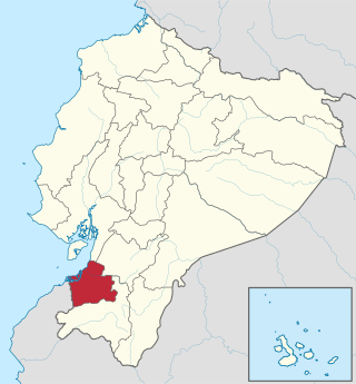
Guayas is a coastal province in Ecuador. It is bordered to the west by Manabí, Santa Elena, and the Pacific Ocean ; to the east by Los Ríos, Bolívar, Chimborazo, Cañar, and Azuay; to the north by Los Ríos and Bolívar; and to the south by El Oro and the Pacific Ocean.

Azuay, Province of Azuay is a province of Ecuador, created on 25 June 1824. It encompasses an area of 8,309.58 square kilometres (3,208.35 sq mi). Its capital is Cuenca. It is located in the south center of Ecuador in the highlands. Its mountains reach 4,500 m (14,800 ft) above sea level in the national park of El Cajas.

El Oro is the southernmost of Ecuador's coastal provinces. It was named for its historically important gold production. Today it is one of the world's major exporters of bananas. The capital is Machala.

Bolívar is a province in Ecuador. The capital is Guaranda. Much of the province has a cool, 'sierra' climate, as it is located in the Andes Mountains. The area in the lower foothills has a cold, tundra-like climate.

Cañar is a province in Ecuador. The capital is Azogues. At the time of census 2010 the province had a population of 225,184. It contains the 16th-century ruins of Ingapirca, the best-known Inca settlement in Ecuador and a product of their conquest of the indigenous Cañari.

Carchi is a province in Ecuador. The capital is Tulcán. The Carchi River rises on the slopes of Chiles volcano and forms the boundary between Colombia and Ecuador near Tulcan. Rumichaca Bridge is the most important land route between Colombia and Ecuador.

Chimborazo is a province in the central Ecuadorian Andes. It is a home to a section of Sangay National Park. The capital is Riobamba. The province contains Chimborazo, Ecuador's highest mountain.

Cotopaxi is one of the provinces of Ecuador. The capital is Latacunga. The province contains the Cotopaxi Volcano, an intermittent volcano with a height of 19,347 feet (5,897 m).

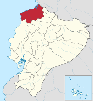
Esmeraldas is a province in northwestern Ecuador. The capital is Esmeraldas.

Galápagos is a province of Ecuador in the country's Insular region, located approximately 1,000 km (620 mi) off the western coast of the mainland. The capital is Puerto Baquerizo Moreno.

Imbabura is a province located in the Andes of northern Ecuador. The capital is Ibarra. The people of the province speak Spanish, and a large portion of the population also speaks the Imbaburan Kichwa variety of the Quechua language.

Los Ríos is a province in Ecuador. The capital is Babahoyo. The province was founded on October 6, 1860. Under legislative decree. Babahoyo was made its capital on September 30, 1948.

Manabí is a province in Ecuador. Its capital is Portoviejo. The province is named after the Manabí people.

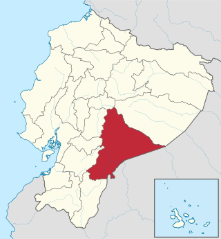
Morona Santiago is a province in Ecuador. The province was established on February 24, 1954. The capital is Macas.

Napo is a province in Ecuador. Its capital is Tena. The province contains the Napo River. The province is low developed without much industrial presence. The thick rainforest is home to many natives that remain isolated by preference, descendants of those who fled the Spanish invasion in the Andes, and the Incas years before. In 2000, the province was the sole remaining majority-indigenous province of Ecuador, with 56.3% of the province either claiming indigenous identity or speaking an indigenous language.

Orellana is an inland province of Ecuador. The capital is Puerto Francisco de Orellana. It was created on July 30, 1998, from part of Napo Province.

Pichincha is a province of Ecuador located in the northern Sierra region; its capital and largest city is Quito. It is bordered by Imbabura and Esmeraldas to the north, Cotopaxi and Santo Domingo de los Tsáchilas to the south, Napo and Sucumbíos to the east, and Esmeraldas and Santo Domingo de los Tsáchilas to the west.

Zamora Chinchipe, Province of Zamora Chinchipe is a province of the Republic of Ecuador, located at the southeastern end of the Amazon Basin, which shares borders with the Ecuadorian provinces of Azuay and Morona Santiago to the north, Loja and Azuay to the west, and with Peru to the east and south. The province comprises an area of approximately 10,456 km² and is covered with a uniquely mountainous topography which markedly distinguishes it from the surrounding Amazonian provinces. Zamora-Chinchipe is characterized and largely identified by its mining industry; indigenous ethnic groups with a rich archaeological legacy; its biodiversity; and its niche and tourist attractions, which include a number of waterfalls well-noted for their beauty. The province takes its name from the bureaucratic fusion of the Zamora and Chinchipe cantons. The provincial capital is the city of Zamora.

Santo Domingo de los Tsáchilas is a province in the Republic of Ecuador, created in October 2007 from territory previously in the province of Pichincha.

The Province of Santa Elena is a province of Ecuador in the coastal region. Created in 2007 from territory that belonged to the Guayas Province, it is one of the two newest provinces of Ecuador, along with Santo Domingo de Los Tsáchilas. Its capital city is Santa Elena, from which the province derives its name.