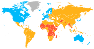
A developed country, or advanced country, is a sovereign state that has a high quality of life, developed economy, and advanced technological infrastructure relative to other less industrialized nations. Most commonly, the criteria for evaluating the degree of economic development are the gross domestic product (GDP), gross national product (GNP), the per capita income, level of industrialization, amount of widespread infrastructure and general standard of living. Which criteria are to be used and which countries can be classified as being developed are subjects of debate. Different definitions of developed countries are provided by the International Monetary Fund and the World Bank; moreover, HDI ranking is used to reflect the composite index of life expectancy, education, and income per capita. Another commonly used measure of a developed country is the threshold of GDP (PPP) per capita of at least US$22,000. In 2023, 40 countries fit all four criteria, while an additional 15 countries fit three out of four.

The Human Development Index (HDI) is a statistical composite index of life expectancy, education, and per capita income indicators, which is used to rank countries into four tiers of human development. A country scores a higher level of HDI when the lifespan is higher, the education level is higher, and the gross national income GNI (PPP) per capita is higher. It was developed by Pakistani economist Mahbub ul-Haq and was further used to measure a country's development by the United Nations Development Programme (UNDP)'s Human Development Report Office.

Hulu Langat District is a district of Malaysia located in the southeastern corner of Selangor, between Kuala Lumpur and Negeri Sembilan. It is bordered by the state of Pahang to the east and north, Gombak district to the north-west, Federal Territory of Kuala Lumpur and Petaling district to the west, Sepang district to the south-west, and state of Negeri Sembilan to the south.

Angelândia is a municipality in the northeast of the Brazilian state of Minas Gerais. As of 2020 the population was 8,557 in a total area of 185 km². The elevation is 891 meters. It is part of the IBGE statistical meso-region of Jequitinhonha and the micro-region of Capelinha. It became a municipality in 1995.

Marzagão is a municipality in south Goiás state, Brazil.
The fundaments of the Brazilian Unified Health System (SUS) were established in the Brazilian Constitution of 1988, under the principles of universality, integrality and equity. It has a decentralized operational and management system, and social participation is present in all administrative levels. The Brazilian health system is a complex composition of public sector (SUS), private health institutions and private insurances. Since the creation of SUS, Brazil has significantly improved in many health indicators, but a lot needs to be done in order to achieve Universal Health Coverage (UHC).
Aricanduva is a municipality in the northeast of the Brazilian state of Minas Gerais. As of 2020 the population was 5,269 in a total area of 243 km². The elevation is 682 meters. It is part of the IBGE statistical meso-region of Jequitinhonha and the micro-region of Capelinha. It became a municipality in 1995.
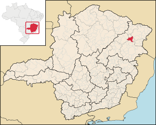
Ponto dos Volantes is a Brazilian municipality located in the northeast of the state of Minas Gerais. The city belongs to the mesoregion of Jequitinhonha and to the microregion of Araçuaí. As of 2020 the population was 12,179 in an area of 1,215 km². The elevation is 400 meters. It became a municipality in 1997. The postal code (CEP) is 39615-000.

Malaysia is classified by The World Bank as upper middle income country and is attempting to achieve high-income status by 2020 and to move further up the value-added production chain by attracting investments in high technology, knowledge-based industries and services. Malaysia's HDI value for 2015 was recorded at 0.789 and HDI rank no 59 out of 188 countries and territories on the United Nations Development Programme's Human Development Index. In 2016, the population of Malaysia is 31 million; Total expenditure on health per capita is 1040; Total expenditure on health as % of GDP (2014) was 4.2 Gross national income (GNI) per capita was recorded at 24,620
Human development involves studies of the human condition with its core being the capability approach. The inequality adjusted Human Development Index is used as a way of measuring actual progress in human development by the United Nations. It is an alternative approach to a single focus on economic growth, and focused more on social justice, as a way of understanding progress

Indaiabira is a municipality in the northeast of the Brazilian state of Minas Gerais. As of 2020 the population was 7,339 in a total area of 1,008 km². The elevation is 857 meters. It became a municipality in 1997.

Montezuma is a municipality in the northeast of the Brazilian state of Minas Gerais. It is isolated, and the inhabitants are poor, mainly engaged in cattle raising and small-scale farming. It became a municipality in 1993.

São João das Missões is a municipality in the north of the Brazilian state of Minas Gerais. As of 2020 the population was 13,125 in a total area of 675 km². The elevation is 501 meters. It became a municipality in 1997.
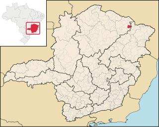
Curral de Dentro is a municipality in the northeast of the Brazilian state of Minas Gerais. As of 2020 the population was 7,799 in a total area of 571 km2. The elevation is 890 meters. It became a municipality in 1997.

Vargem Grande do Rio Pardo is a municipality in the northeast of the Brazilian state of Minas Gerais.