List of Great North of Scotland Railway stations

Last updated

The communities that were served by the Great North of Scotland Railway GNoSR Area.svg
The communities that were served by the Great North of Scotland Railway

When, on 1 January 1923, the Great North of Scotland Railway (GNoSR) merged with other railways to become the London and North Eastern Railway, it owned 333+13 miles (536.4 km) of line. [1] Its main line, from Aberdeen in Scotland to Elgin via Keith, served branches to Fraserburgh and Peterhead, Alford, Oldmeldrum, Macduff, Banff, Boat of Garten and Lossiemouth. The GNoSR operated two routes to Elgin, one via Moray Firth, known as the Coast line, and another via Keith and Craigelliache; these connected with the Highland Railway at Keith and Elgin for services to Inverness. Another line, used by the reigning monarch when they travelled to Balmoral Castle, connected Aberdeen with Ballater.

Contents

Main line

The first section of Great North of Scotland's main line opened in 1854 from Kittybrewster to Huntly [2] and was extended two years later to Keith. [3] A through route to Inverness was formed in 1858 when was to become the Highland Railway reached the station and a junction was formed. [4] Services ran to a terminus in Aberdeen at Waterloo from 1856 [5] before Aberdeen joint station opened in 1867. [6] The line was extended at the country end to Dufftown in 1862. [7] Meanwhile, the Morayshire Railway had built a line from Rothes to Craigellachie, [8] and subsequently linked this line to its Elgin station in 1862. [9] This was connected to the GNoSR when the Strathspey Railway opened in 1863. [10]

The GNoSR ran suburban services between Aberdeen and Dyce from 1887 and 1937. [11] The old GNoSR main line west of Keith and the Coast line closed on 6 May 1968; [12] on the same day services were withdrawn from minor intermediate stations. Currently the Aberdeen to Inverness Line uses the former Great North of Scotland Railway line as far Keith, with intermediate stations at Dyce, Inverurie, Insch, Huntly and Keith, before continuing over the former Highland Railway route to Inverness.

StationDistance [13] OpenedClosedNotes
Aberdeen 0 miles (0 km)4 November 1867 [6]
Schoolhill 38 mile (0.60 km)1887 [14] 5 April 1937 [15]
Hutcheon Street 78 mile (1.4 km)1 July 1887 [16] 5 April 1937 [15]
Waterloo
1 April 1856 [5] 4 November 1867 [6] Original station in the city, 1+34 miles (2.8 km) from Kittybrewster. [17]
Kittybrewster 1+38 miles (2.2 km)20 September 1854 [18] 6 May 1968 [19] Branch from Waterloo joins main line. Opened as Aberdeen Kittybrewster, moved and name changed to Kittybrewster in 1856, moved again in 1867. [20]
Don Street 2+14 miles (3.6 km)1 July 1887 [21] 5 April 1937 [15]
Woodside 2+58 miles (4.2 km)1858 [22] 5 April 1937 [15]
Persley 3+14 miles (5.2 km)1903 [23] 5 April 1937 [15] Renamed Persley Halt in 1926 [23]
Bucksburn 4+18 miles (6.6 km)20 September 1854 [18] 5 March 1957 [24] Spelt Buxburn until 1897 [25]
Bankhead 4+58 miles (7.4 km)1 July 1887 [26] 5 April 1937 [15]
Stoneywood 5+18 miles (8.2 km)1 July 1887 [27] 5 April 1937 [15]
Dyce 6+14 miles (10.1 km)20 September 1854 [18] 6 May 1968 [28] Junction for the Buchan section from 1861, moved 200 metres (660 ft) when the branch opened. Reopened 15 September 1984 on site of first station. [28]
Pitmedden 8+14 miles (13.3 km)1874 [29] 7 December 1964 [30]
Kinaldie 10+12 miles (16.9 km)1 December 1854 [18] [lower-alpha 1] 7 December 1964 [30]
Kintore 13+14 miles (21.3 km)20 September 1854 [18] 7 December 1964 [30] Junction for the Alford branch
Inverurie 16 miles (26 km)20 September 1854 [18]
Junction for the Oldmeldrum branch. Opened as Inverury, renamed in 1866, moved 805 metres (2,641 ft) south in 1902. [31]
Inveramsay 20+12 miles (33.0 km)5 September 1857 [32] 1 October 1951 [32] Junction for the Macduff branch
Pitcaple 20+14 miles (32.6 km)20 September 1854 [18] 6 May 1968 [29]
Oyne 24+12 miles (39.4 km)20 September 1854 [18] 6 May 1968 [33]
Buchanstone 25+34 miles (41.4 km)1 December 1854 [18] September 1866 [24]
Insch 27+12 miles (44.3 km)20 September 1854 [18]
Wardhouse 31 miles (50 km)1 December 1854 [18] 5 June 1961 [34]
Kennethmont 32+34 miles (52.7 km)20 September 1854 [18] 6 May 1968 [35]
Gartly 35+34 miles (57.5 km)20 September 1854 [18] 6 May 1968 [36] Sometimes described as Gartly for Lumsden and Strathdon. [36]
Huntly 40+34 miles (65.6 km)20 September 1854 [18]
Rothiemay 45+14 miles (72.8 km)10 October 1856 [3] 6 May 1968 [37]
Cairnie Junction 48+14 miles (77.7 km)May 1897 [38] 6 May 1968 [38] Named Cairnie Platform before June 1919. [38]
Grange 48+34 miles (78.5 km)10 October 1856 [3] 6 May 1968 [38] Interchange for Portsoy and Banff until the Coast line opened in 1886 with through services from Aberdeen. [39]
Keith Junction 53+14 miles (85.7 km)10 October 1856 [3]
Junction with the Highland Railway to Inverness from 18 August 1858. [4]
Keith Town 54 miles (87 km)21 February 1862 [40] 6 May 1968 [41] Earlsmill until 1897 [40]
Auchindachy 56+34 miles (91.3 km)21 February 1862 [40] 6 May 1968 [41] Botriphnie until 1862 [40]
Drummuir 59+12 miles (95.8 km)21 February 1862 [40] 6 May 1968 [41]
Dufftown 64 miles (103 km)21 February 1862 [40] 6 May 1968 [41]
Craigellachie 68 miles (109 km)1 July 1863 [42] 6 May 1968 [41] Junction for the Strathspey branch. Opened as Strathspey Junction, renamed in 1864. [43]
Dandaleith 68+34 miles (110.6 km)23 December 1858 [44] 6 May 1968 [41] Named Craigellachie until 1864. [43]
Rothes 71 miles (114 km)23 August 1858 [44] 6 May 1968 [41] Served by a link to Orton until 31 July 1866 [45]
Birchfield 74 miles (119 km)c.1871 [46] 7 May 1956 [46]
Coleburn 75+12 miles (121.5 km)5 June 1863 [47] After July 1926 [47] Use restricted and renamed Coleburn April 1867 [47]
Longmorn 77+34 miles (125.1 km)1 January 1862 [48] 6 May 1968 [48]
Elgin 80+34 miles (130.0 km)10 August 1852 [49]
Coast line and Lossiemouth branch, and a through line to the Highland Railway

Buchan section

The Formartine and Buchan Railway built the 29 miles (47 km) from Dyce to Old Deer (renamed Mintlaw in 1867) via Maud, which opened on 18 July 1861, Maud becoming a junction when the 16-mile (26 km) line to Fraserburgh opened on 24 April 1865. [50] The line was worked by the GNoSR from opening, who absorbed the original railway company on 1 August 1866. [51] A branch from Ellon to Cruden Bay and Boddam opened in 1897. [52] The line was closed to passengers on 4 October 1965 and completely 8 October 1979. [12]

StationDistance [13] OpenedClosedNotes
Dyce 0 miles (0 km)
6+14 miles (10.1 km) from Aberdeen on the main line
Parkhill 1+14 miles (2.0 km)18 July 1861 [53] 3 April 1950 [54]
Elrick SB3+34 miles (6.0 km)
Newmachar 5+14 miles (8.4 km)18 July 1861 [53] 4 October 1965 [55] Originally New Machar [53]
Udny 8+14 miles (13.3 km)18 July 1861 [53] 4 October 1965 [56]
Logierieve 10 miles (16 km)18 July 1861 [53] 4 October 1965 [57] Briefly Newburgh Road on opening. [53]
Esslemont 11+12 miles (18.5 km)18 July 1861 [53] 15 September 1951 [58]
Ellon 13+14 miles (21.3 km)18 July 1861 [53] 4 October 1965 [59] Junction with Cruden section. Known as Ellon for Cruden until 1897. [59]
Arnage 16+34 miles (27.0 km)18 July 1861 [53] 4 October 1965 [60]
Auchnagatt 20+34 miles (33.4 km)18 July 1861 [53] 4 October 1965 [61]
Maud 25 miles (40 km)18 July 1861 [53] 4 October 1965 [62] Junction with Peterhead branch. Opened as Brucklay, [53] renamed New Maud Junction on 24 April 1865, Maud Junction in April 1866, [55] and Maud 21 September 1925. [62]
Strichen 30+34 miles (49.5 km)24 April 1865 [63] 4 October 1965 [59]
Mormond 33+14 miles (53.5 km)24 April 1865 [63] [lower-alpha 2] 4 October 1965 [64]
Lonmay 35+34 miles (57.5 km)24 April 1865 [63] 4 October 1965 [48]
Rathen 38+14 miles (61.6 km)24 April 1865 [63] 4 October 1965 [65]
Philorth 39+12 miles (63.6 km)24 April 1865 [63] 4 October 1965 [66] Private station, not in public timetable until 1926. [63]
Fraserburgh 41 miles (66 km)24 April 1865 [63] 4 October 1965 [67]

Cruden section

The GNoSR opened a branch from Ellon to Boddam on 2 August 1897 to serve a hotel and golf complex it was building at Cruden Bay. [52] The line closed to passengers on 31 October 1932 and completely on 7 November 1945. [12]

StationDistance [13] OpenedClosedNotes
Ellon 0 miles (0 km)
13+14 miles (21.3 km) from Dyce on the Buchan section
Auchmacoy 3+12 miles (5.6 km)2 August 1897 [61] 31 October 1932 [61]
Pitlurg 5+12 miles (8.9 km)2 August 1897 [29] 31 October 1932 [29]
Hatton 8+14 miles (13.3 km)2 August 1897 [68] 31 October 1932 [68]
Cruden Bay 10+14 miles (16.5 km)2 August 1897 [69] 31 October 1932 [69]
Bullers O'Buchan 12 miles (19 km)1900 [70] 31 October 1932 [70]
Longhaven 13+12 miles (21.7 km)2 August 1897 [48] 31 October 1932 [48]
Boddam 15+12 miles (24.9 km)2 August 1897 [71] 31 October 1932 [71]

Peterhead branch

The line from Dyce to Old Deer (renamed Mintlaw in 1867) was opened on 18 July 1861 by the Formartine and Buchan Railway, and extended the 9 miles (14 km) to Peterhead the following year. [50] The railway was worked by the GNoSR from opening, who absorbed the Formartine and Buchan on 1 August 1866. [51] The branch closed to passengers on 3 May 1965 and completely in 1970. [13]

StationDistance [13] OpenedClosedNotes
Maud 0 miles (0 km)
25 miles (40 km) from Dyce on the Buchan section
Mintlaw 4 miles (6.4 km)18 July 1861 [53] 3 May 1965 [72] Opened as Old Deer
Longside 7+14 miles (11.7 km)3 July 1862 [53] 3 May 1965 [48]
Newseat 9+12 miles (15.3 km)3 July 1862 [53] 3 May 1965 [73] Variously New Seat and Newseat Halt [73]
Inverugie 11 miles (18 km)3 July 1862 [53] 3 May 1965 [32]
Peterhead 13 miles (21 km)3 July 1862 [53] 3 May 1965 [66]

St Combs Light Railway

The GNoSR opened the St Combs Light Railway from Fraserburgh to St Combs on 1 July 1903, [74] and it closed on 3 May 1965. [12]

StationDistance [13] OpenedClosedNotes
Fraserburgh 0 miles (0 km)
Terminus of the Buchan section
Kirkton Bridge 1 mile (1.6 km)c.July 1904 [19] 3 May 1965 [19] Opened as Kirton Bridge Halt, renamed June 1908 [19]
Philorth Bridge Halt 2+14 miles (3.6 km)1 July 1903 [74] 3 May 1965 [66]
Cairnbulg 3+58 miles (5.8 km)1 July 1903 [74] 3 May 1965 [38] Known as Inverallochy until 1 September 1903. [38]
St Combs 5+18 miles (8.2 km)1 July 1903 [74] 3 May 1965 [75]

Alford branch

The Alford Valley Railway from Kintore to Alford opened on 21 March 1859, [76] worked by the GNoSR, with whom it merged on 1 August 1866. [51] The line closed to passengers on 2 January 1950 and to goods in 1966. [12]

StationDistance [13] OpenedClosedNotes
Kintore 0 miles (0 km)
On main line, 13+14 miles (21.3 km) from Aberdeen
Paradise Sidings 3+34 miles (6.0 km)Private
Kemnay 4+12 miles (7.2 km)21 March 1859 [76] 2 January 1950 [35]
Monymusk 7+12 miles (12.1 km)21 March 1859 [76] 2 January 1950 [77]
Tillyfourie 10+34 miles (17.3 km)1860 [76] 2 January 1950 [78]
Whitehouse 13 miles (21 km)21 March 1859 [76] 2 January 1950 [79]
Alford 16 miles (26 km)21 March 1859 [76] 2 January 1950 [80]

Oldmeldrum branch

The Inverury and Old Meldrum Junction Railway from Inverurie to Old Meldrum opened on 26 June 1856, [81] worked by the GNoSR, with whom it merged on 1 August 1866. [51] The line closed to passengers on 2 November 1931 and to goods on 3 January 1966. [12]

StationDistance [13] OpenedClosedNotes
Inverurie 0 miles (0 km)
On main line, 16 miles (26 km) from Aberdeen
Lethenty 2+14 miles (3.6 km)1 July 1856 [82] 2 November 1931 [82]
Fingask Platform 3+12 miles (5.6 km)1866 [83] 2 November 1931 [83] In some timetable as Fingask. [83]
Old Meldrum 5+14 miles (8.4 km)1 July 1856 [84] 2 November 1931 [84] Opened as Oldmeldrum, name changed about 1902. [84]

Macduff branch

Authorised in 1855 and sponsored by the Great North, the Banff, Macduff and Turriff Junction Railway opened a line from Inveramsay to Turriff in 1857, and another company, the Banff, Macduff and Turriff Extension built and opened an extension to Banff & Macduff nearly two years later. The railways were worked by the GNoSR from opening, and merged with it on 1 August 1866. The short extension to Macduff was opened by the GNoSR in 1872, the original terminal closed and demolished. [85] The branch closed to passengers on 1 October 1951, the section north of Turriff completely on 1 August 1961 and completely on 3 January 1966. [13]

StationDistance [13] OpenedClosedNotes
Inveramsay 0 miles (0 km)
On main line, 20+12 miles (33.0 km) from Aberdeen
Wartle 3+34 miles (6.0 km)5 September 1857 [86] [lower-alpha 3] 1 October 1951 [34]
Rothie-Norman 7+12 miles (12.1 km)5 September 1857 [86] 1 October 1951 [37] Opened as Rothie, renamed Rothie-Norman 1 March 1870 [37]
Fyvie 10+34 miles (17.3 km)5 September 1857 [86] 1 October 1951 [87]
Auchterless 14 miles (23 km)5 September 1857 [86] 1 October 1951 [61]
Turriff 18 miles (29 km)5 September 1857 [86] 1 October 1951 [88]
Plaidy 22+12 miles (36.2 km)4 June 1860 [86] 22 May 1944 [29]
King Edward 24+34 miles (39.8 km)4 June 1860 [86] 1 October 1951 [89]
Banff & Macduff 4 June 1860 [86] 1 July 1872 [90]
Banff Bridge 29+12 miles (47.5 km)1 July 1872 [90] 1 October 1951 [26]
Macduff 29+34 miles (47.9 km)1 July 1872 [90] 1 October 1951 [91]

Coast line

The railway from Grange to Portsoy via Tillynaught was opened by the Banff, Portsoy and Strathisla Railway on 30 July 1859, with full services from 2 August following a derailment on the opening day. The GNoSR operated services from 1863; these ran from Grange to Banff with a connection at Tillynaught. [92] This became an alternate route from Aberdeen to Elgin when the coast line had fully opened in 1886, a new curve allowing direct access from Aberdeen. Cairnie Platform (later Cairnie Junction) was built to allow trains to divide, with portions for Elgin via Craigellachie and the Coast Line. [93] Direct access to Grange from the line was withdrawn after the curve closed on 7 March 1960 and the line closed completely on 6 May 1968. [13]

StationDistance [13] OpenedClosedNotes
Cairnie Junction 0 miles (0 km)
On main line, 48+14 miles (77.7 km) from Aberdeen
Knock [lower-alpha 4] 3+14 miles (5.2 km)30 July 1859 [94] 6 May 1968 [94]
Glenbarry 4+12 miles (7.2 km)30 July 1859 [95] 6 May 1968 [96] Opened as Barry, closed in 1863. Reopened as Glenbarry in 1872. [97]
Cornhill 7+34 miles (12.5 km)30 July 1859 [98] 6 May 1968 [98]
Tillynaught 10 miles (16 km)30 July 1859 [78] 6 May 1968 [78]
Portsoy 12+34 miles (20.5 km)30 July 1859 [99] 6 May 1963 [99] Station moved in 1884. [100]
Glassaugh 14+34 miles (23.7 km)1 April 1884 [100] 21 September 1953 [101]
Tochieneal 17 miles (27 km)1 April 1884 [100] 1 October 1951 [102]
Cullen 18+14 miles (29.4 km)1 May 1886 [100] 6 May 1968 [103]
Portknockie 20+14 miles (32.6 km)1 May 1886 [100] 6 May 1968 [104]
Findochty 21+12 miles (34.6 km)1 May 1886 [100] 6 May 1968 [105]
Portessie 23 miles (37 km)1 August 1884 [106] 6 May 1968 [104] Also used by Highland Railway services from Keith before 1915. [106] [104]
Buckie 24+14 miles (39.0 km)1 May 1886 [100] 6 May 1968 [24]
Buckpool 25+14 miles (40.6 km)1 May 1886 [100] 7 March 1960 [24] Known as Nether Buckie before 1 January 1887. [24]
Portgordon 26+34 miles (43.0 km)1 May 1886 [100] 6 May 1968 [104] Known as Port Gordon before 1938. [104]
Spey Bay 29 miles (47 km)1 May 1886 [100] 6 May 1968 [107] Known as Fochabers and Spey Bay before 1 January 1918. [107]
Garmouth 30+14 miles (48.7 km)12 August 1884 [100] 6 May 1968 [36]
Urquhart 33+12 miles (53.9 km)12 August 1884 [100] 6 May 1968 [108]
Calcots 36 miles (58 km)12 August 1884 [100] 6 May 1968 [38]
Lossie Junction SB36 miles (58 km)12 August 1884 [100] Junction with the Lossiemouth branch
Elgin 39 miles (63 km)10 August 1852 [49]
Main line via Craigellachie, Lossiemouth branch and a connection with the Highland Railway

Banff branch

This was served from Grange until the Coast line opened in 1886, when services connected at Tillynaught. [92] The branch closed to passengers on 6 July 1964 and completely on 6 May 1968. [13]

StationDistance [13] OpenedClosedNotes
Tillynaught 0 miles (0 km)
On Coast Line 10 miles (16 km) from Cairnie Junction
Ordens 1+14 miles (2.0 km)30 July 1859 [109] 6 July 1964 [109] Opened as Ordens. Service restricted after October 1863, renamed Ordens Platform by 1911 and service restored and renamed Ordens Halt on 14 July 1924 [109]
Ladysbridge 3+12 miles (5.6 km)30 July 1859 [94] 6 July 1964 [94] Opened as Lady's Bridge, renamed June 1886 [94]
Bridgefoot Halt 4+34 miles (7.6 km)1914 [110] 6 July 1964 [110]
Golf Club House 5+14 miles (8.4 km)1914 [111] 6 July 1964 [111] Also known as Banff Golf Club House [111]
Banff 6 miles (9.7 km)30 July 1859 [26] 6 July 1964 [26] Known as Banff Harbour until June 1926. [26]

Speyside section

The Strathspey Railway opened on 1 July 1863 between Dufftown and Abernethy (later called Nethy Bridge), via Strathspey Junction (later called Craigellachie) where it joined an extension of the Morayshire Railway. The line from Dufftown north through Craigellachie became the main line, and the railway south to Nethy Bridge, (later extended to Boat of Garten) the branch line. [112] The Strathspey was absorbed by the Great North of Scotland Railway in 1866. [51] The line closed to passengers on 18 October 1965, the section south of Aberlour completely on 4 November 1968 and the remaining section completely 15 November 1971. [12]

StationDistance [13] OpenedClosedNotes
Craigellachie 0 miles (0 km)
On main line, 68 miles (109 km) from Aberdeen
Aberlour 2+14 miles (3.6 km)1 July 1863 [113] 18 October 1965 [114]
Dailuaine Halt [lower-alpha 5] 4+34 miles (7.6 km)1934 [115] 18 October 1965 [115]
Carron 5+12 miles (8.9 km)1 July 1863 [113] 18 October 1965 [116]
Imperial Cottages [lower-alpha 5] 6 miles (9.7 km)15 June 1959 [32] 18 October 1965 [32]
Knockando House 6+34 miles (10.9 km)1 September 1869 [94] 18 October 1965 [94] Private platform, known as Knockando until 1905. [117]
Gilbey's Cottages [lower-alpha 5] 7+34 miles (12.5 km)Summer 1959 [118] 18 October 1965 [119]
Knockando 8 miles (13 km)1899 [117] 18 October 1965 [94] Known as Dalbeallie until 1905. [117]
Blacksboat 10+14 miles (16.5 km)1 July 1863 [113] 18 October 1965 [120]
Ballindalloch 12 miles (19 km)1 July 1863 [113] 18 October 1965 [121]
Advie 15+14 miles (24.5 km)1 July 1863 [113] 18 October 1965 [122] Moved 1868. [43]
Dalvey Farm [lower-alpha 5] 17+34 miles (28.6 km)15 June 1959 [123] 18 October 1965 [123]
Dalvey 1 July 1863 [113] 1 September 1868 [123] Originally spelt Dalvie. [43]
Cromdale 21 miles (34 km)1 July 1863 [113] 18 October 1965 [124]
Grantown-on-Spey 24 miles (39 km)1 July 1863 [113] 18 October 1965 [125] Opened as Grantown, renamed Grantown-on-Spey 1 June 1912 and Grantown-on-Spey East 5 June 1950 [125]
Ballifurth Farm [lower-alpha 5] 26+12 miles (42.6 km)15 June 1959 [121] 18 October 1965 [121]
Nethy Bridge 28+12 miles (45.9 km)1 July 1863 [42] 18 October 1965 [126] Opened as Abernethy, renamed in 1867. [42]
Broomhill Junction30+14 miles (48.7 km)
Boat of Garten 33+14 miles (53.5 km)3 August 1863 [71] 18 October 1965 [71] The Strathspey Railway reached here on 1 August 1866. [42] Joint station with Highland Railway.

Lossiemouth branch

The Lossiemouth branch was built by the Morayshire Railway from its Elgin station on 10 August 1852. [49] Worked by the GNoSR since 1863, the Morayshire Railway was absorbed by the GNoSR in August 1881. [51] The line was closed to passengers on 6 April 1964 and completely two years later. [12]

StationDistance [13] OpenedClosedNotes
Lossie Junction
Signal Box
0 miles (0 km)
On Coast Line 1 mile (1.6 km) from Elgin
Linksfield12 mile (0.80 km)10 August 1852 [49] 1859 [49] Request stop, did not appear in timetables after 1859. [49]
Greens of Draine2+12 miles (4.0 km)10 August 1852 [49] 1859 [49] Request stop, did not appear in timetables after 1859. [49]
Lossiemouth 4+12 miles (7.2 km)10 August 1852 [49] 6 April 1964 [12]

Deeside section

The Deeside Railway opened from Ferryhill to Banchory on 8 September 1853 and services were extended to Guild Street when this opened the following year. [127] A new company, the Aboyne Extension opened the line to Aboyne in 1859, and the Aboyne & Braemar Railway extended the line to Ballater in 1866. [128] The Aberdeen joint station became the terminus when this opened in 1867. [6] The Deeside Railway was leased by the GNoSR from 1866 who absorbed the Deeside Railway on 1 August 1875 and the Aboyne & Braemar Railway on 31 January 1876. [129] The line closed to passengers on 28 February 1966, the section west of Culter completely on 18 July 1966 and the remaining section completely 2 January 1967. [12]

StationDistance [13] OpenedClosedNotes
Aberdeen (Joint) 0 miles (0 km)4 November 1867 [6]
Ferryhill Junction
signal box
58 mile (1.0 km)
Holburn Street 1+38 miles (2.2 km)2 July 1894 [130] 5 April 1937 [15]
Ruthrieston 1+34 miles (2.8 km)January 1856 [131] 5 April 1937 [15] Closed 1876–1885 [131]
Pitfodels 3 miles (4.8 km)2 July 1894 [29] 5 April 1937 [15]
Cults 3+58 miles (5.8 km)8 September 1853 [132] 28 February 1966 [103] Station moved 1855. [103]
West Cults 4+18 miles (6.6 km)1 August 1894 [133] 5 April 1937 [15]
Bieldside 4+34 miles (7.6 km)1 June 1897 [46] 5 April 1937 [15]
Murtle 5+38 miles (8.7 km)8 September 1853 [132] 5 April 1937 [15]
Milltimber 6+14 miles (10.1 km)1854 [132] 5 April 1937 [15]
Culter 7+38 miles (11.9 km)8 September 1853 [132] 28 February 1966 [103]
Drum 9+34 miles (15.7 km)January 1854 [134] 10 September 1951 [134]
Park 10+34 miles (17.3 km)8 September 1853 [132] 28 February 1966 [54]
Mills of Drum 13 miles (21 km)8 September 1853 [132] 1 January 1863 [135]
Crathes 14+14 miles (22.9 km)8 September 1853 [132] 28 February 1966 [136] Private platform, replaced Mills of Drum as public station from 1863 [132]
Banchory 16+34 miles (27.0 km)8 September 1853 [132] 28 February 1966 [26] Station moved in 1859 and 1902 [26]
Dee Street Halt [lower-alpha 5] 17+12 miles (28.2 km)6 February 1961 [137] 28 February 1966 [137]
Glassel 21+38 miles (34.4 km)2 December 1859 [138] 28 February 1966 [101]
Torphins 23+34 miles (38.2 km)2 December 1859 [138] 28 February 1966 [102]
Lumphanan 26+78 miles (43.3 km)2 December 1859 [138] 28 February 1966 [139]
Dess 29+12 miles (47.5 km)2 December 1859 [138] 28 February 1966 [140]
Aboyne 32+14 miles (51.9 km)2 December 1859 [138] 28 February 1966 [122]
Dinnet 36+34 miles (59.1 km)17 October 1866 [138] 28 February 1966 [140]
Cambus O'May 39+38 miles (63.4 km)1876 [138] 28 February 1966 [141]
Ballater 43+14 miles (69.6 km)17 October 1866 [138] 28 February 1966 [121]

Notes and references

Notes

  1. Butt (1995, p. 133) lists opening date as November 1854.
  2. Butt (1995, p. 163) has opening date in 1870.
  3. Butt (1995, p. 241) lists the opening date as 5 August 1857
  4. Millegan railway station is listed in Vallance (1991, Appendix 4), 1+14 miles (2.0 km) from Cairne Junction, but not listed on Butt (1995, p. 160) or Jowett (1989, map 15)
  5. 1 2 3 4 5 6 Opened after the GNoSR had become part of the LNER.

Related Research Articles

<span class="mw-page-title-main">Highland Railway</span> Former British railway company

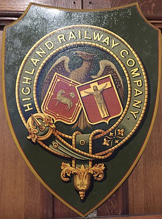
The Highland Railway (HR) was one of the smaller British railways before the Railways Act 1921, operating north of Perth railway station in Scotland and serving the farthest north of Britain. Based in Inverness, the company was formed by merger in 1865, absorbing over 249 miles (401 km) of line. It continued to expand, reaching Wick and Thurso in the north and Kyle of Lochalsh in the west, eventually serving the counties of Caithness, Sutherland, Ross & Cromarty, Inverness, Perth, Nairn, Moray and Banff. Southward it connected with the Caledonian Railway at Stanley Junction, north of Perth, and eastward with the Great North of Scotland Railway at Boat of Garten, Elgin, Keith and Portessie.

<span class="mw-page-title-main">Great North of Scotland Railway</span> Former Scottish railway company

The Great North of Scotland Railway (GNSR) was one of the two smallest of the five major Scottish railway companies prior to the 1923 Grouping, operating in the north-east of the country. Formed in 1845, it carried its first passengers the 39 miles (63 km) from Kittybrewster, in Aberdeen, to Huntly on 20 September 1854. By 1867 it owned 226+14 route miles (364.1 km) of line and operated over a further 61 miles (98 km).

<span class="mw-page-title-main">Morayshire Railway</span> Former railway in Scotland

The Morayshire Railway was the first railway to be built north of Aberdeen, Scotland. It received royal assent in 1846 but construction was delayed until 1851 because of the adverse economic conditions existing in the United Kingdom. The railway was built in two phases with the section from Elgin to Lossiemouth completed in 1852. When the Inverness and Aberdeen Junction Railway (I&AJR) reached Keith via Elgin, the Morayshire was able to complete the Speyside second phase by connecting the Craigellachie line at Orton. Initially, the Morayshire ran its own locomotives on the I&AJR track between Elgin and Orton but this was short-lived and the Morayshire carriages were then hauled to Orton by the I&AJR. Disagreements with the I&AJR eventually forced the Morayshire into constructing a new section of track between its stations at Elgin and Rothes; this was completed in 1862. The Morayshire accomplished its final enlargement by connecting to the new Great North of Scotland Railway (GNoSR) Craigellachie station in 1863. Crippling debt forced the company into an arrangement with the GNoSR for it to assume operation of the track in 1866. By 1881, the Morayshire had greatly reduced its liabilities and its long-sought-after amalgamation with the GNoSR finally took place.

The Strathspey Railway was a railway company in Scotland that ran from Dufftown to Boat of Garten. It was proposed locally but supported by the larger Great North of Scotland Railway (GNoSR), which wanted to use it as an outlet towards Perth. The GNoSR had to provide much of the funding, and the value of traffic proved to be illusory. The line opened in 1863 to Abernethy, but for the time being was unable to make the desired connection to the southward main line. Although later some through goods traffic developed, the route never achieved its intended purpose.

The Keith and Dufftown Railway was a railway company in Scotland. Its line ran between Dufftown and Keith on the main line between Inverness and Aberdeen. The company was formed in 1857, but it struggled to attract investors and for some years was unable to proceed with construction.

<span class="mw-page-title-main">Banff, Macduff and Turriff Junction Railway</span> Former railway line in Scotland

The Banff, Macduff and Turriff Junction Railway was a railway company that connected the Aberdeenshire town of Turriff with the main line of the Great North of Scotland Railway (GNoSR) at Inveramsay. It had earlier been intended to reach Macduff, but shortage of finance forced curtailment. It opened its line in 1857.

The Banff, Portsoy and Strathisla Railway was a Scottish railway company that connected the Aberdeenshire ports of Banff and Portsoy with the main line of the Great North of Scotland Railway (GNoSR) main line at Grange, a place some distance east of Keith. The railway opened in 1859, and was renamed the Banffshire Railway in 1863 when the GNoSR began running services.

<span class="mw-page-title-main">Portsoy railway station</span> Former railway station in Scotland

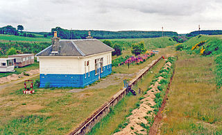
Portsoy railway station was a railway station in Portsoy, in current day Aberdeenshire. Opened in 1859 by the Banff, Portsoy and Strathisla Railway, it was absorbed by the Great North of Scotland Railway in 1867. The original terminus closed in 1884 and a new station opened nearby on a through route and two years later, after the Moray Firth coast line opened, the station was served by Aberdeen to Elgin trains.

<span class="mw-page-title-main">Grange railway station (Scotland)</span> Former railway station in Scotland

Grange railway station was a railway station in the parish of Grange, historically in Banffshire. Opened in 1856 by the Great North of Scotland Railway, three years later it became a junction station after the Banff, Portsoy and Strathisla Railway built a branch to Banff and Portsoy.

<span class="mw-page-title-main">Kittybrewster railway station</span> Former railway station in Scotland

There have been three Kittybrewster railway stations at Kittybrewster, Aberdeen. The first opened in 1854 as a terminus of the Great North of Scotland Railway's (GNoSR) first line to Huntly. This was replaced two years later by a station on a new line to a city terminus at Waterloo. It was replaced again when the Denburn Valley Line to Aberdeen Joint opened in 1867.

<span class="mw-page-title-main">Buckie railway station</span> Disused railway station in Scotland

Buckie railway station was a railway station in Buckie, in current day Moray. The station was opened by the Great North of Scotland Railway (GNoSR) on its Moray Firth coast line in 1886, served by Aberdeen to Elgin trains.

<span class="mw-page-title-main">Spey Bay railway station</span> Former railway station in Scotland

Spey Bay railway station was a railway station in Spey Bay, Moray. The railway station was opened by the Great North of Scotland Railway (GNoSR) on its Moray Firth coast line in 1886, served by Aberdeen to Elgin trains. The station was originally named Fochabers-on-Spey railway station on 1 May 1886. In November 1893 it became Fochabers railway station, Fochabers and Spey Bay railway station on 1 January 1916 before finally becoming on 1 January 1918 Spey Bay railway station. It closed to regular passenger traffic on 6 May 1968 on the same date as the line itself.

<span class="mw-page-title-main">Garmouth railway station</span>

Garmouth railway station was a railway station in Garmouth, parish of Urquhart, Moray. The railway station was opened by the Great North of Scotland Railway (GNoSR) on its Moray Firth coast line in 1884, served by Aberdeen to Elgin trains. It served the villages of Kingston-on-Spey and Garmouth and closed to regular passenger traffic on 6 May 1968 on the same date as the line itself.

<span class="mw-page-title-main">Urquhart railway station</span> Former railway station in Scotland

Urquhart railway station was a railway station serving the village of Urquhart, parish of Urquhart, Moray. The railway station was opened by the Great North of Scotland Railway (GNoSR) on its Moray Firth coast line in 1884, served by Aberdeen to Elgin trains.

Calcots railway station was a railway station in the parish of St Andrews-Lhanbryd, Moray. The railway station was opened by the Great North of Scotland Railway (GNoSR) on its Moray Firth coast line in 1884, served by Aberdeen to Elgin trains. It served a rural area rather than a discrete settlement and closed to regular passenger traffic on 6 May 1968 on the same date as the line itself.

Findochty railway station was a railway station in the small fishing village of Findochty, Moray about 3 miles to the east of Buckie. The railway station was opened by the Great North of Scotland Railway (GNoSR) on its Moray Firth coast line in 1886, served by Aberdeen to Elgin trains.

Portknockie railway station was a railway station that served the small fishing village of Portknockie, close to Cullen in Moray. The railway station was opened by the Great North of Scotland Railway (GNoSR) on its Moray Firth coast line in 1886, served by Aberdeen to Elgin trains.

Tochieneal railway station was a railway station that served the small industrial village of Tochieneal, close to Cullen in Moray. The railway station was opened by the Great North of Scotland Railway (GNoSR) on its Moray Firth coast line in 1884. The station closed to regular passenger traffic on 1 October 1951, more than a decade before the total closure of the line itself in 1968.

<span class="mw-page-title-main">Glassaugh railway station</span> Former railway station in Scotland

Glassaugh railway station was a railway station that served the rural area of Glassaugh and the nearby Glenglassaugh distillery close to Portsoy in Moray. The railway station was opened by the Great North of Scotland Railway (GNoSR) on its Moray Firth coast line in 1884, served by Aberdeen to Elgin trains. The station closed to regular passenger traffic on 21 September 1953, more than a decade before the total closure of the line itself in 1968.

<span class="mw-page-title-main">Tillynaught railway station</span> Former railway station in Aberdeenshire, Scotland

Tillynaught railway station or Tillynaught Junction was a junction railway station in what is now Aberdeenshire, Parish of Fordyce, 6 miles south-west of Banff. Tillynaught was opened in 1859 by the Banff, Portsoy and Strathisla Railway, and in 1867 was absorbed by the Great North of Scotland Railway(GNSR). This junction station was served by Aberdeen to Elgin trains as well as trains running to the branch terminus at Banff.

References

  1. Vallance 1991, p. 143.
  2. Vallance 1991, p. 24.
  3. 1 2 3 4 Vallance 1991, p. 30.
  4. 1 2 Vallance 1991, p. 31.
  5. 1 2 Vallance 1991, p. 28.
  6. 1 2 3 4 5 Vallance 1991, p. 71.
  7. Vallance 1991, pp. 53–54.
  8. Vallance 1991, pp. 39–40.
  9. Vallance 1991, p. 43.
  10. Vallance 1991, p. 45.
  11. Vallance 1991, pp. 100, 181.
  12. 1 2 3 4 5 6 7 8 9 10 Vallance 1991, Appendix 3.
  13. 1 2 3 4 5 6 7 8 9 10 11 12 13 14 15 16 17 Vallance 1991, Appendix 4.
  14. Butt 1995, p. 206.
  15. 1 2 3 4 5 6 7 8 9 10 11 12 13 14 Vallance 1991, p. 181.
  16. Butt 1995, p. 125.
  17. Vallance 1991, p. 27.
  18. 1 2 3 4 5 6 7 8 9 10 11 12 13 14 Vallance 1991, pp. 23–25.
  19. 1 2 3 4 Butt 1995, p. 136.
  20. Butt 1995, pp. 12, 136.
  21. Butt 1995, p. 81.
  22. Butt 1995, p. 254.
  23. 1 2 Butt 1995, p. 184.
  24. 1 2 3 4 5 Butt 1995, p. 47.
  25. Vallance 1991, p. 25.
  26. 1 2 3 4 5 6 7 Butt 1995, p. 26.
  27. Butt 1995, p. 221.
  28. 1 2 Butt 1995, p. 86.
  29. 1 2 3 4 5 6 Butt 1995, p. 186.
  30. 1 2 3 Vallance 1991, p. 187.
  31. Butt 1995, p. 128.
  32. 1 2 3 4 5 Butt 1995, p. 127.
  33. Butt 1995, p. 180.
  34. 1 2 Butt 1995, p. 241.
  35. 1 2 Butt 1995, p. 130.
  36. 1 2 3 Butt 1995, p. 101.
  37. 1 2 3 Butt 1995, p. 200.
  38. 1 2 3 4 5 6 7 Butt 1995, p. 51.
  39. Vallance 1991, p. 94.
  40. 1 2 3 4 5 6 Vallance 1991, p. 54.
  41. 1 2 3 4 5 6 7 Vallance 1991, p. 188.
  42. 1 2 3 4 Vallance 1991, p. 55.
  43. 1 2 3 4 Vallance 1991, p. 56.
  44. 1 2 Vallance 1991, p. 40.
  45. Vallance 1991, p. 46.
  46. 1 2 3 Butt 1995, p. 34.
  47. 1 2 3 Butt 1995, p. 66.
  48. 1 2 3 4 5 6 Butt 1995, p. 149.
  49. 1 2 3 4 5 6 7 8 9 10 Vallance 1991, p. 38.
  50. 1 2 Vallance 1991, pp. 62–64.
  51. 1 2 3 4 5 6 Vallance 1991, Appendix 5.
  52. 1 2 Vallance 1991, pp. 95–97.
  53. 1 2 3 4 5 6 7 8 9 10 11 12 13 14 15 16 17 Vallance 1991, p. 63.
  54. 1 2 Butt 1995, p. 181.
  55. 1 2 Butt 1995, p. 170.
  56. Butt 1995, p. 237.
  57. Butt 1995, p. 148.
  58. Butt 1995, p. 92.
  59. 1 2 3 Butt 1995, p. 90.
  60. Butt 1995, p. 19.
  61. 1 2 3 4 Butt 1995, p. 21.
  62. 1 2 Butt 1995, p. 156.
  63. 1 2 3 4 5 6 7 Vallance 1991, p. 64.
  64. Butt 1995, p. 163.
  65. Butt 1995, p. 194.
  66. 1 2 3 Butt 1995, p. 185.
  67. Butt 1995, p. 99.
  68. 1 2 Butt 1995, p. 115.
  69. 1 2 Butt 1995, p. 73.
  70. 1 2 Butt 1995, p. 48.
  71. 1 2 3 4 Butt 1995, p. 38.
  72. Butt 1995, p. 161.
  73. 1 2 Butt 1995, p. 171.
  74. 1 2 3 4 Vallance 1991, p. 119.
  75. Butt 1995, p. 203.
  76. 1 2 3 4 5 6 Vallance 1991, p. 61.
  77. Butt 1995, p. 162.
  78. 1 2 3 Butt 1995, p. 230.
  79. Butt 1995, p. 248.
  80. Butt 1995, p. 15.
  81. Vallance 1991, p. 60.
  82. 1 2 Butt 1995, p. 142.
  83. 1 2 3 Butt 1995, p. 96.
  84. 1 2 3 Butt 1995, p. 177.
  85. Vallance 1991, pp. 57–59.
  86. 1 2 3 4 5 6 7 8 Vallance 1991, p. 58.
  87. Butt 1995, p. 100.
  88. Butt 1995, p. 236.
  89. Butt 1995, p. 113.
  90. 1 2 3 Vallance 1991, p. 59.
  91. Butt 1995, p. 152.
  92. 1 2 Vallance 1991, pp. 49–51.
  93. Vallance 1991, p. 116.
  94. 1 2 3 4 5 6 7 8 Butt 1995, p. 137.
  95. Butt 1995, p. 28.
  96. Butt 1995, p. 104.
  97. Butt 1995, pp. 28, 104.
  98. 1 2 Butt 1995, p. 69.
  99. 1 2 Butt 1995, p. 190.
  100. 1 2 3 4 5 6 7 8 9 10 11 12 13 14 Vallance 1991, p. 93.
  101. 1 2 Butt 1995, p. 103.
  102. 1 2 Butt 1995, p. 231.
  103. 1 2 3 4 Butt 1995, p. 74.
  104. 1 2 3 4 5 Butt 1995, p. 189.
  105. Butt 1995, p. 97.
  106. 1 2 Vallance 1991, p. 95.
  107. 1 2 Butt 1995, p. 217.
  108. Butt 1995, p. 238.
  109. 1 2 3 Butt 1995, p. 178.
  110. 1 2 Butt 1995, p. 43.
  111. 1 2 3 Butt 1995, p. 106.
  112. Vallance 1991, pp. 55–57.
  113. 1 2 3 4 5 6 7 8 Vallance 1991, pp. 55–56.
  114. Butt 1995, p. 12.
  115. 1 2 Butt 1995, p. 75.
  116. Butt 1995, p. 54.
  117. 1 2 3 Vallance 1991, pp. 56–57.
  118. Vallance 1991, p. 102.
  119. Butt 1995, p. 102.
  120. Butt 1995, p. 36.
  121. 1 2 3 4 Butt 1995, p. 24.
  122. 1 2 Butt 1995, p. 13.
  123. 1 2 3 Butt 1995, p. 76.
  124. Butt 1995, p. 72.
  125. 1 2 Butt 1995, p. 108.
  126. Butt 1995, p. 168.
  127. Vallance 1991, pp. 75–77.
  128. Vallance 1991, pp. 77–78.
  129. Vallance 1991, pp. 78, 81.
  130. Butt 1995, p. 121.
  131. 1 2 Butt 1995, p. 202.
  132. 1 2 3 4 5 6 7 8 9 Vallance 1991, p. 76.
  133. Butt 1995, p. 245.
  134. 1 2 Butt 1995, p. 83.
  135. Butt 1995, p. 160.
  136. Butt 1995, p. 71.
  137. 1 2 Butt 1995, p. 77.
  138. 1 2 3 4 5 6 7 8 Vallance 1991, p. 78.
  139. Butt 1995, p. 151.
  140. 1 2 Butt 1995, p. 79.
  141. Butt 1995, p. 52.

Books