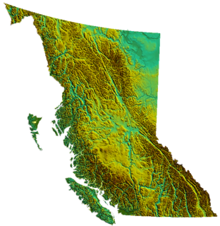
This is a list of Ministry of Environment Regions of British Columbia, Canada. The provincial Ministry of Environment administers environmental policy and has under its wing the provincial Fish and Wildlife Branch, the Water Rights Branch, the Pesticide Control Branch, and other similar offices as well as the provincial parks system. The Ministry of Environment's administration system divides the province into nine areas:

Canada is a country in the northern part of North America. Its ten provinces and three territories extend from the Atlantic to the Pacific and northward into the Arctic Ocean, covering 9.98 million square kilometres, making it the world's second-largest country by total area. Its southern border with the United States, stretching some 8,891 kilometres (5,525 mi), is the world's longest bi-national land border. Canada's capital is Ottawa, and its three largest metropolitan areas are Toronto, Montreal, and Vancouver.
- Vancouver Island Environment Region
- Headquartered in Nanaimo, this region includes all of Vancouver Island and adjoining islands, plus the mainland coast in the area of Queen Charlotte Strait
- Lower Mainland Environment Region
- Headquartered in Surrey, this region includes all of the Lower Mainland, all of the Sunshine Coast and adjoining areas of the mainland, and also the Sea to Sky Corridor (Squamish-Whistler-Pemberton) and the lower Fraser Canyon and adjoining parts of the Cascade Mountains.

Surrey is a city in the province of British Columbia, Canada, located south of the Fraser River and north of the Canada–United States border. It is a member municipality of the Metro Vancouver regional district and metropolitan area. Mainly a suburban city, Surrey is the province's second-largest by population after Vancouver and the third largest by area after Abbotsford and Prince George.

The Lower Mainland is a name commonly applied to the region surrounding and including Vancouver, British Columbia, Canada. As of 2016, 2,759,365 people, lived in the region; sixteen of the province's thirty most populous municipalities are located there. Islands contained within rivers in the region are considered to be part of the Lower Mainland.
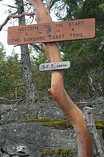
The Sunshine Coast is a region of the southern mainland coast of British Columbia, Canada, on the eastern shore of the Strait of Georgia, just northwest of Greater Vancouver. It includes the coastal areas of the regional district of Sunshine Coast, where the name originated, and the regional district of Powell River up to and including the village of Lund and into Desolation Sound, much farther to the north.
- Thompson Environment Region, also known as the Thompson-Nicola Environment Region
- Headquartered in Kamloops, this region includes all of the Thompson Country, Nicola Country and the upper half of the Lillooet Country, including the Bridge River Country, as well as the basin of Adams Lake (but not the rest of the Shuswap Country) and some of the South Cariboo.

Kamloops is a city in south-central British Columbia, Canada, at the confluence of the two branches of the Thompson River and east of Kamloops Lake.
The Thompson Country, also referred to as The Thompson and in some ways as the Thompson Valley and historically known as the Couteau Country or Couteau District, is a historic geographic region of the Southern Interior of British Columbia, more or less defined by the basin of the Thompson River, a tributary of the Fraser and focused on the city of Kamloops.
The Nicola Country, also known as the Nicola Valley and often referred to simply as The Nicola, and originally Nicolas' Country or Nicholas' Country, adapted to Nicola's Country and simplified since, is a region in the Southern Interior of British Columbia, Canada. It is the main subregion of the larger Thompson Country and is often referred to separately, or in combination forms, notably the Thompson-Nicola Regional District. The combination Nicola-Similkameen is also common.
- Kootenay Environment Region
- This region has two headquarters offices, one in Nelson, the other in Cranbrook. It comprises all of the West and East Kootenay, including the Columbia Country and Big Bend.

Nelson is a city located in the Selkirk Mountains on the extreme West Arm of Kootenay Lake in the Southern Interior of British Columbia, Canada. Known as "The Queen City", and acknowledged for its impressive collection of restored heritage buildings from its glory days in a regional silver rush, Nelson is one of the three cities forming the commercial and population core of the West Kootenay region, the others being Castlegar and Trail. The city is the seat of the Regional District of Central Kootenay. It is represented in the provincial legislature by the riding of Nelson-Creston, and in the Parliament of Canada by the riding of Kootenay—Columbia.

Cranbrook is a city in southeast British Columbia, Canada, located on the west side of the Kootenay River at its confluence with the St. Mary's River, It is the largest urban centre in the region known as the East Kootenay. As of 2016, Cranbrook's population is 19,259 with a census agglomeration population of 26,083. It is the location of the headquarters of the Regional District of East Kootenay and also the location of the regional headquarters of various provincial ministries and agencies, notably the Rocky Mountain Forest District.
The Kootenays or Kootenay is a region of southeastern British Columbia. It takes its name from the Kootenay River, which in turn was named for the Kutenai First Nations people.
- Cariboo Environment Region
- Headquartered in Williams Lake, this region includes all of the Central and North Cariboo plus the Chilcotin District and the Central Coast including the towns of Bella Coola and Bella Bella.
- Skeena Environment Region
- Headquartered in Smithers, this region includes the North Coast from the Hartley Bay area northwards, Haida Gwaii, and all of the Skeena, Nass, Stikine and Taku basins plus the Atlin District and portions of the Cassiar District and also western portions of the Nechako and Omineca Countries.
- Omineca Environment Region
- Headquartered in Prince George, this region includes the eastern portion of the Omineca Country, the eastern Omineca Mountains, and the Rocky Mountain Trench from Sifton Pass to the vicinity of Valemount, and adjoining regions of the Rocky Mountains west of that range's main spine.
- Okanagan Environment Region
- Headquartered in Penticton, this region includes all of the Okanagan plus the Similkameen and Boundary Countries, plus the main part of the Shuswap Country (excluding the basin of Adams Lake).
- Peace Region
- Headquartered in Fort St. John, this region comprises all of the northeastern part of the province beyond the Rocky Mountains, plus the Rocky Mountain Trench north of Sifton Pass and the basins of the Liard and Dease Rivers, excluding that portion of the Dease basin which is in the Skeena Region (namely Dease Lake).

Nanaimo is a city on the east coast of Vancouver Island in British Columbia, Canada. It is known as "The Harbour City". The city was previously known as the "Hub City", which has been attributed to its original layout design where the streets radiated out from the shoreline like the spokes of a wagon wheel, as well as its generally centralized location on Vancouver Island. Nanaimo is also the headquarters of the Regional District of Nanaimo.

Vancouver Island is in the northeastern Pacific Ocean. It is part of the Canadian province of British Columbia. The island is 460 kilometres (290 mi) in length, 100 kilometres (62 mi) in width at its widest point, and 32,134 km2 (12,407 sq mi) in area. It is the largest island on the West Coast of the Americas.

Queen Charlotte Strait is a strait between Vancouver Island and the Mainland of British Columbia, Canada. It connects Queen Charlotte Sound with Johnstone Strait and Discovery Passage and via them to the Strait of Georgia and Puget Sound. It forms part of the Inside Passage from Washington to Alaska. The term Queen Charlotte Strait is also used to refer to the general region and its many communities, notably of the Kwakwaka'wakw peoples. Despite its name, Queen Charlotte Strait does not lie between Haida Gwaii and the mainland; that body of water is named Hecate Strait.