List of areas in Wolverhampton

Last updated

This is a list of areas in the City of Wolverhampton local authority district in the West Midlands, England.

Related Research Articles

Tettenhall is an historic village within the City of Wolverhampton, England. Tettenhall became part of Wolverhampton in 1966, along with Bilston, Wednesfield and parts of Willenhall, Coseley and Sedgley.

<span class="mw-page-title-main">Blakenhall</span> Suburb of Wolverhampton, England

Blakenhall is a suburb and ward in Wolverhampton, England. The population was 12,614 at the 2021 census.

<span class="mw-page-title-main">Heath Town</span> Human settlement in England

Heath Town is a district of the City of Wolverhampton, West Midlands, England, located east of the city centre. It is also a ward of City of Wolverhampton Council. The ward forms part of the Wolverhampton North East constituency.
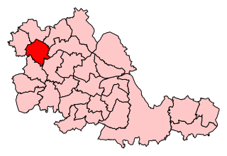
<span class="mw-page-title-main">Wolverhampton South East (UK Parliament constituency)</span> Parliamentary constituency in the United Kingdom, 1974 onwards

Wolverhampton South East is a borough constituency represented in the House of Commons of the Parliament of the United Kingdom. It elects one Member of Parliament (MP) by the first past the post system of election.
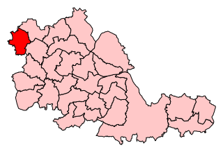
<span class="mw-page-title-main">Wolverhampton South West (UK Parliament constituency)</span> Parliamentary constituency in the United Kingdom

Wolverhampton South West is a constituency created in 1950 represented in the House of Commons of the UK Parliament since 2019 by Stuart Anderson of the Conservative Party.

Goldthorn Park is a suburb of Wolverhampton, West Midlands. It is situated 1½ miles south of the city centre within the Blakenhall ward. It mostly consists of private houses built from the 1930s onwards.

St Peter's is a ward of Wolverhampton City Council, West Midlands. It has two parts: the city centre, and the inner-city areas immediately to the north and north-west, including Dunstall Hill and part of Whitmore Reans.

<span class="mw-page-title-main">City of Wolverhampton Council</span> Local government body in England

City of Wolverhampton Council is the governing body of the city of Wolverhampton, England. It was previously known as Wolverhampton Metropolitan Borough Council (WMBC) prior to the award of city status in 2000, and also as Wolverhampton City Council before adopting the "City of Wolverhampton" branding in 2015.

<span class="mw-page-title-main">A459 road</span> Road in the West Midlands

The A459 is a main road in the West Midlands of England, which runs from Halesowen to Wolverhampton City Centre. Is also a primary route connecting Wolverhampton and Dudley.

Woodcross is a residential area of Coseley, West Midlands, England. It is set within the City of Wolverhampton, though the area traditionally existed within the boundaries of Sedgley and later Coseley until 1966.

<span class="mw-page-title-main">Wolverhampton</span> City in the West Midlands, England

Wolverhampton is a city and metropolitan borough in the West Midlands, England. The population was 263,700 in 2021. People from the city are called "Wulfrunians". The city is located 12 miles (19 km) north-west of Birmingham.
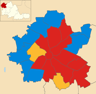
<span class="mw-page-title-main">2007 Wolverhampton City Council election</span>

Elections to Wolverhampton City Council were held on 3 May 2007 in Wolverhampton, England. One third of the council was up for election and the Labour Party kept overall control of the council.

Colton Hills Community School is a mixed secondary school and sixth form situated in the Goldthorn Park area of Wolverhampton, West Midlands, England.

References

  1. "Batmans Hill, City of Wolverhampton - area information, map". OS GetOutside. Ordnance Survey. Retrieved 4 December 2023.
  2. "Blakeley Green, City of Wolverhampton - area information, map". OS GetOutside. Ordnance Survey. Retrieved 4 December 2023.
  3. "Bushbury Hill, City of Wolverhampton - area information, map". OS GetOutside. Ordnance Survey. Retrieved 4 December 2023.
  4. "Cinder Hill, City of Wolverhampton - area information, map". OS GetOutside. Ordnance Survey. Retrieved 4 December 2023.
  5. "Elston Hall, City of Wolverhampton - area information, map". OS GetOutside. Ordnance Survey. Retrieved 4 December 2023.
  6. "Freezeland, City of Wolverhampton - area information, map". OS GetOutside. Ordnance Survey. Retrieved 4 December 2023.
  7. "Ladymoor, City of Wolverhampton - area information, map". OS GetOutside. Ordnance Survey. Retrieved 4 December 2023.
  8. "Loxdale, City of Wolverhampton - area information, map". OS GetOutside. Ordnance Survey. Retrieved 4 December 2023.
  9. "March End, City of Wolverhampton - area information, map". OS GetOutside. Ordnance Survey. Retrieved 4 December 2023.
  10. "Millfields, City of Wolverhampton - area information, map". OS GetOutside. Ordnance Survey. Retrieved 4 December 2023.
  11. "Moseley, City of Wolverhampton - area information, map". OS GetOutside. Ordnance Survey. Retrieved 4 December 2023.
  12. "Moseley Village, City of Wolverhampton - area information, map". OS GetOutside. Ordnance Survey. Retrieved 4 December 2023.
  13. "Neachells, City of Wolverhampton - area information, map". OS GetOutside. Ordnance Survey. Retrieved 4 December 2023.
  14. "Nordley Hill, City of Wolverhampton - area information, map". OS GetOutside. Ordnance Survey. Retrieved 4 December 2023.
  15. "Oxbarn, City of Wolverhampton - area information, map". OS GetOutside. Ordnance Survey. Retrieved 4 December 2023.
  16. "Parkfield, City of Wolverhampton - area information, map". OS GetOutside. Ordnance Survey. Retrieved 4 December 2023.
  17. "Rough Hills, City of Wolverhampton - area information, map". OS GetOutside. Ordnance Survey. Retrieved 4 December 2023.
  18. "St Chads, City of Wolverhampton - area information, map". OS GetOutside. Ordnance Survey. Retrieved 4 December 2023.
  19. "Underhill, City of Wolverhampton - area information, map". OS GetOutside. Ordnance Survey. Retrieved 5 December 2023.
  20. "Wergs, City of Wolverhampton - area information, map". OS GetOutside. Ordnance Survey. Retrieved 4 December 2023.