List of bays of the Orkney Islands

Last updated

This List of bays of the Orkney Islands summarises the bays that are located in the islands of the Orkney in Scotland

Contents

Auskerry

The small island of Auskerry has no bays.

Brough of Birsay

The tidal island of Brough of Birsay has no bays.

Burray

NameCountyNearest TownCoordinatesNotes
Echnaloch Bay Orkney 58°51′39″N2°55′30″W / 58.8608°N 2.9251°W / 58.8608; -2.9251 (Echnaloch Bay) Echnaloch Bay and Echnaloch Loch - geograph.org.uk - 4055251.jpg

Eday

NameCountyNearest TownCoordinatesNotes
Bay of Backaland Orkney Calfsound 59°09′31″N2°45′00″W / 59.1587°N 2.750°W / 59.1587; -2.750 (Bay of Backaland) Bay of Backaland - geograph.org.uk - 231824.jpg
Bay of Carrick Orkney Calfsound 59°13′51″N2°45′04″W / 59.2308°N 2.751°W / 59.2308; -2.751 (Bay of Carrick)
Bay of Doomy Orkney Calfsound 59°11′44″N2°46′48″W / 59.1955°N 2.780°W / 59.1955; -2.780 (Bay of Doomy)
Bay of Greentoft Orkney Calfsound 59°08′34″N2°46′17″W / 59.1427°N 2.7714°W / 59.1427; -2.7714 (Bay of Greentoft)
Bay of Icevay Orkney Calfsound 59°11′13″N2°45′31″W / 59.1870°N 2.7585°W / 59.1870; -2.7585 (Bay of Icevoy)
Bay of London Orkney Calfsound 59°11′30″N2°45′28″W / 59.1916°N 2.7577°W / 59.1916; -2.7577 (Bay of London)
Bay of Newark Orkney Calfsound 59°12′28″N2°46′48″W / 59.2078°N 2.780°W / 59.2078; -2.780 (Bay of Newark)
Bight of Milldale Orkney Calfsound 59°12′04″N2°45′00″W / 59.2010°N 2.7499°W / 59.2010; -2.7499 (Bight of Milldale)
Cusbay Orkney Calfsound 59°13′35″N2°47′10″W / 59.2265°N 2.786°W / 59.2265; -2.786 (Cusbay)
Fersness Bay Orkney Calfsound 59°11′48″N2°47′59″W / 59.1968°N 2.7998°W / 59.1968; -2.7998 (Fersness Bay)
Mill Bay Orkney Calfsound 59°12′27″N2°44′59″W / 59.2076°N 2.7496°W / 59.2076; -2.7496 (Mill Bay)
Sealskerry Bay Orkney Calfsound 59°10′09″N2°49′09″W / 59.1693°N 2.8191°W / 59.1693; -2.8191 (Sealskerry Bay)
Whitemaw Bay Orkney Calfsound 59°08′54″N2°47′39″W / 59.1482°N 2.7942°W / 59.1482; -2.7942 (Whitemaw Bay)

Hoy

NameCountyNearest TownCoordinatesNotes
Aith Hope Orkney Saltness 58°47′06″N3°13′56″W / 58.7849°N 3.2323°W / 58.7849; -3.2323 (Aith Hope)
Bay of Creekland Orkney Quoydale 58°55′17″N3°19′09″W / 58.9213°N 3.3191°W / 58.9213; -3.3191 (Bay of Creekland)
Bay of the Stairs Orkney Quoydale 58°55′20″N3°23′14″W / 58.9222°N 3.3873°W / 58.9222; -3.3873 (Bay of the Stairs)
Bay of the Tongue Orkney Quoydale 58°55′26″N3°22′57″W / 58.9238°N 3.3826°W / 58.9238; -3.3826 (Bay of the Tongue)
Bay of Quoys Orkney Quoydale 58°54′38″N3°18′44″W / 58.9105°N 3.3121°W / 58.9105; -3.3121 (Bay of Quoys)
Chalmers' Hope Orkney Quoyness 58°53′20″N3°14′23″W / 58.8889°N 3.2398°W / 58.8889; -3.2398 (Chalmers' Hope)
Ha Wick Orkney 58°46′57″N3°18′09″W / 58.7826°N 3.3026°W / 58.7826; -3.3026 (Ha Wick)
Little Rack Wick Orkney 58°49′00″N3°20′04″W / 58.8168°N 3.3344°W / 58.8168; -3.3344 (Little Rack Wick)
Lyrawa Bay Orkney Quoyness 58°52′16″N3°13′10″W / 58.8712°N 3.2194°W / 58.8712; -3.2194 (Lyrawa Bay)
Mill Bay Orkney Lyness 58°50′36″N3°12′19″W / 58.8432°N 3.2054°W / 58.8432; -3.2054 (Mill Bay)
North Bay Orkney Saltness 58°47′42″N3°13′58″W / 58.7951°N 3.2328°W / 58.7951; -3.2328 (North Bay)
Ore Bay Orkney Lyness 58°49′44″N3°11′49″W / 58.8288°N 3.1969°W / 58.8288; -3.1969 (Ore Bay)
Pegal Bay Orkney Lyness 58°51′41″N3°12′56″W / 58.8614°N 3.2155°W / 58.8614; -3.2155 (Pegal Bay)
Rackwick Bay Orkney 58°51′55″N3°23′14″W / 58.8654°N 3.3873°W / 58.8654; -3.3873 (Rackwick Bay)
Rysa Bay Orkney Lyness 58°51′01″N3°11′56″W / 58.8502°N 3.1989°W / 58.8502; -3.1989 (Rysa Bay)
The Pow Orkney Quoydale 58°55′55″N3°20′52″W / 58.932°N 3.3479°W / 58.932; -3.3479 (The Pow)

Orkney Mainland

NameCountyNearest TownCoordinatesNotes
Bay of Ayre Orkney Kirkwall 58°53′37″N2°54′54″W / 58.8936°N 2.9149°W / 58.8936; -2.9149 (Bay of Ayre)
Bay of Berstane Orkney Kirkwall 58°58′47″N2°55′00″W / 58.9798°N 2.9167°W / 58.9798; -2.9167 (Bay of Berstane)
Bay of Carness Orkney Kirkwall 59°00′36″N2°55′21″W / 59.0099°N 2.9226°W / 59.0099; -2.9226 (Bay of Carness)
Bay of Cornquoy Orkney St Mary's, Orkney 58°52′30″N2°50′16″W / 58.8751°N 2.8379°W / 58.8751; -2.8379 (Bay of Cornquoy)
Bay of Deepdale Orkney Kirkwall 58°55′22″N2°57′22″W / 58.9229°N 2.956°W / 58.9229; -2.956 (Bay of Deepdale)
Bay of Firth Orkney Kirkwall 59°00′32″N3°05′24″W / 59.0089°N 3.0901°W / 59.0089; -3.0901 (Bay of Firth) [1]
Bay of Ireland Orkney Stromness 58°58′06″N3°14′55″W / 58.9684°N 3.2486°W / 58.9684; -3.2486 (Bay of Ireland) [2]
Bay of Isbister Orkney Isbister 59°02′32″N3°02′36″W / 59.0421°N 3.0432°W / 59.0421; -3.0432 (Bay of Isbister) [1]
Bay of Kirkwall Orkney Tankerness 58°59′56″N2°57′59″W / 58.999°N 2.9663°W / 58.999; -2.9663 (Bay of Kirkwal)
Bay of Latherbare Orkney Tankerness 58°58′58″N2°47′42″W / 58.9827°N 2.7951°W / 58.9827; -2.7951 (Bay of Latherbare)
Bay of Lea Taing Orkney Tankerness 58°58′49″N2°47′31″W / 58.9803°N 2.7920°W / 58.9803; -2.7920 (Bay of Lea Taing)
Bay of Navershaw Orkney Stromness 58°57′45″N3°16′18″W / 58.9625°N 3.2717°W / 58.9625; -3.2717 (Bay of Navershaw) [2]
Bay of Hinderayre Orkney Gorseness 59°03′33″N3°00′13″W / 59.0591°N 3.0036°W / 59.0591; -3.0036 (Bay of Hinderayre)
Bay of Houton Orkney Houton 58°54′54″N3°11′13″W / 58.9151°N 3.187°W / 58.9151; -3.187 (Bay of Houton)
Bay of Meil Orkney Kirkwall 58°59′45″N2°54′12″W / 58.9957°N 2.9034°W / 58.9957; -2.9034 (Bay of Meil)
Bay of Myre Orkney Houton 58°55′03″N3°10′24″W / 58.9174°N 3.1732°W / 58.9174; -3.1732 (Bay of Myre)
Bay of Puldrite Orkney 59°03′00″N3°00′33″W / 59.0499°N 3.0092°W / 59.0499; -3.0092 (Bay of Puldrite)
Bay of Sandber Orkney St Mary's, Orkney 58°53′27″N2°55′25″W / 58.8908°N 2.9236°W / 58.8908; -2.9236 (Bay of Sandber)
Bay of Sandoyne Orkney St Mary's, Orkney 58°54′06″N2°56′10″W / 58.9017°N 2.9362°W / 58.9017; -2.9362 (Bay of Sandoyne)
Bay of Semolie Orkney St Mary's, Orkney 58°53′10″N2°49′02″W / 58.8861°N 2.8172°W / 58.8861; -2.8172 (Bay of Semolie)
Bay of Skaill Orkney Quoyloo 59°03′12″N3°20′37″W / 59.0533°N 3.3436°W / 59.0533; -3.3436 (Bay of Skaill)
Bay of Suckquoy Orkney Tankerness 58°55′15″N2°49′29″W / 58.9208°N 2.8246°W / 58.9208; -2.8246 (Bay of Suckquoy) [3]
Bay of Weyland Orkney Kirkwall 58°59′28″N2°57′03″W / 58.991°N 2.9508°W / 58.991; -2.9508 (Bay of Weyland)
Bay of Work Orkney Kirkwall 59°00′05″N2°54′30″W / 59.0013°N 2.9082°W / 59.0013; -2.9082 (Bay of Work)
Billia Croo Orkney Stromness 58°58′23″N3°21′17″W / 58.9731°N 3.3546°W / 58.9731; -3.3546 (Billia Croo)
Bight of Mousland Orkney Stromness 58°59′31″N3°21′47″W / 58.992°N 3.363°W / 58.992; -3.363 (Bight of Mousland)
Birsay Bay Orkney Birsay 59°07′35″N3°19′54″W / 59.1263°N 3.3316°W / 59.1263; -3.3316 (Birsay Bay)
Bor Wick Orkney Stromness 59°01′52″N3°21′18″W / 59.0312°N 3.3551°W / 59.0312; -3.3551 (Bor Wick)
Clivie Bay Orkney Upper Sanday 58°54′24″N2°47′38″W / 58.9068°N 2.7940°W / 58.9068; -2.7940 (Clivie Bay)
Cumminess Bay Orkney Stromness 58°58′17″N3°14′33″W / 58.9714°N 3.2425°W / 58.9714; -3.2425 (Cumminess Bay)
Den Wick Orkney Skaill 58°58′03″N2°43′58″W / 58.9676°N 2.7327°W / 58.9676; -2.7327 (Den Wick)
Dingyshowe Bay Orkney Upper Sanday 58°54′51″N2°47′05″W / 58.9141°N 2.7846°W / 58.9141; -2.7846 (Dingyshowe Bay)
Hangie Bay Orkney Tankerness 58°58′35″N2°47′36″W / 58.9763°N 2.7933°W / 58.9763; -2.7933 (Hangie Bay)
Hamnavoe Orkney Stromness 58°57′55″N3°17′32″W / 58.9654°N 3.2923°W / 58.9654; -3.2923 (Hamnavoe)
Howes Wick Orkney St Mary's, Orkney 58°53′17″N2°51′00″W / 58.8880°N 2.85°W / 58.8880; -2.85 (Howes Wick)
Inganess Bay Orkney Kirkwall 58°58′17″N2°52′24″W / 58.9715°N 2.8732°W / 58.9715; -2.8732 (Inganess Bay) [4]
Mar Wick Orkney Birsay 59°05′51″N3°21′02″W / 59.0976°N 3.3505°W / 59.0976; -3.3505 (Mar Wick)
Newark Bay Orkney Snippigar 58°55′16″N2°44′48″W / 58.9212°N 2.7467°W / 58.9212; -2.7467 (Newark Bay)
Orphir Bay Orkney Houton 58°55′09″N3°09′23″W / 58.9193°N 3.1565°W / 58.9193; -3.1565 (Orphir Bay)
Rack Wick Orkney Stromness 58°58′06″N3°21′21″W / 58.9682°N 3.3559°W / 58.9682; -3.3559 (Rack Wick)
Roanaby Orkney Stromness 58°56′15″N2°42′48″W / 58.9374°N 2.7133°W / 58.9374; -2.7133 (Roanaby)
Sailhouse Bay Orkney Stromness 58°56′43″N3°14′13″W / 58.9454°N 3.2369°W / 58.9454; -3.2369 (Sailhouse Bay)
Sandside Bay Orkney 58°56′38″N2°42′32″W / 58.9438°N 2.7090°W / 58.9438; -2.7090 (Sandside Bay)
Scapa Bay Orkney Kirkwall 58°56′55″N2°59′28″W / 58.9486°N 2.9912°W / 58.9486; -2.9912 (Scapa Bay)
St Mary's Bay Orkney St Mary's, Orkney 58°53′15″N2°54′48″W / 58.8875°N 2.9134°W / 58.8875; -2.9134 (St Mary's Bay)
St Peter's Bay Orkney Upper Sanday 58°55′28″N2°48′12″W / 58.9245°N 2.8032°W / 58.9245; -2.8032 (St Peter's Bay)
St Peter's Pool Orkney Upper Sanday 58°55′21″N2°47′30″W / 58.9225°N 2.7916°W / 58.9225; -2.7916 (St Peter's Pool)
Swanbister Bay Orkney Swanbister 58°55′36″N3°06′32″W / 58.9266°N 3.109°W / 58.9266; -3.109 (Swanbister Bay) [5]
Taracliff Bay Orkney Upper Sanday 58°54′55″N2°46′41″W / 58.9154°N 2.7780°W / 58.9154; -2.7780 (Taracliff Bay)
The Spord Orkney Quoyloo 59°04′40″N3°20′58″W / 59.0777°N 3.3495°W / 59.0777; -3.3495 (The Spord)
Waulkmill Bay Orkney Swanbister 58°56′11″N3°04′36″W / 58.9365°N 3.0767°W / 58.9365; -3.0767 (Waulkmill Bay) [5]
Warebeth Orkney Stromness 58°57′29″N3°20′01″W / 58.958°N 3.3335°W / 58.958; -3.3335 (Warebeth)
Wass Wick Orkney 59°04′54″N3°01′25″W / 59.08179°N 3.0237°W / 59.08179; -3.0237 (Wass Wick)
Wood Wick Orkney 59°05′53″N3°03′13″W / 59.0980°N 3.0535°W / 59.0980; -3.0535 (Wood Wick)

Papa Westray

NameCountyNearest TownCoordinatesNotes
Bay of Burland Orkney 59°20′14″N2°52′42″W / 59.3373°N 2.8782°W / 59.3373; -2.8782 (Bay Burland)
Bay of Hookin Orkney 59°20′47″N2°52′52″W / 59.3465°N 2.8811°W / 59.3465; -2.8811 (Bay of Hookin)
Bay of Moclett Orkney 59°19′36″N2°53′45″W / 59.3268°N 2.8957°W / 59.3268; -2.8957 (Bay of Moclett)
North Wick Orkney 59°21′43″N2°52′41″W / 59.3619°N 2.8780°W / 59.3619; -2.8780 (North Wick)
South Wick Orkney 59°21′29″N2°52′36″W / 59.3581°N 2.8768°W / 59.3581; -2.8768 (South Wick)

Rousay

NameCountyNearest TownCoordinatesNotes
Bay of Ham Orkney Sourin 59°10′20″N2°57′53″W / 59.1721°N 2.9647°W / 59.1721; -2.9647 (Bay of Ham)
Bay of Moaness Orkney Frotoft 59°08′40″N3°05′39″W / 59.1445°N 3.0941°W / 59.1445; -3.0941 (Bay of Moaness)
Bay of Swandro Orkney Frotoft 59°08′42″N3°05′42″W / 59.1451°N 3.0951°W / 59.1451; -3.0951 (Bay of Swandro)
Bay of Westness Orkney Frotoft 59°08′25″N3°05′03″W / 59.1403°N 3.0842°W / 59.1403; -3.0842 (Bay of Westness)
Saviskaill Bay Orkney Sourin 59°11′16″N3°00′46″W / 59.1879°N 3.0128°W / 59.1879; -3.0128 (Saviskaill Bay)

Sanday

NameCountyNearest TownCoordinatesNotes
Backaskail Bay Orkney Backaskail 59°13′56″N2°37′21″W / 59.2321°N 2.6226°W / 59.2321; -2.6226 (Backaskail Bay)
Bay of Brough Orkney Lady 59°15′44″N2°36′35″W / 59.2621°N 2.6096°W / 59.2621; -2.6096 (Bay of Brough)
Bay of Lopness Orkney Northwall 59°16′02″N2°28′59″W / 59.2673°N 2.483°W / 59.2673; -2.483 (Bay of Lopness)
Bay of Newark Orkney Lady 59°14′27″N2°30′24″W / 59.2407°N 2.5066°W / 59.2407; -2.5066 (Bay of Newark)
Bay of Sandquoy Orkney Northwall 59°17′39″N2°27′37″W / 59.2942°N 2.4603°W / 59.2942; -2.4603 (Bay of Sandquoy)
Bay of Sowerdie Orkney Northwall 59°18′03″N2°25′08″W / 59.3009°N 2.419°W / 59.3009; -2.419 (Bay of Sowerdie)
Bay of Stove Orkney Stove 59°11′30″N2°40′58″W / 59.1917°N 2.6829°W / 59.1917; -2.6829 (Bay of Stove)
Bay of Tresness Orkney Lady 59°14′08″N2°38′04″W / 59.2355°N 2.6345°W / 59.2355; -2.6345 (Bay of Tresness)
Bay of Wheevi Orkney Northwall 59°16′34″N2°24′46″W / 59.2761°N 2.4129°W / 59.2761; -2.4129 (Bay of Wheevi)
Bight of Lotheran Orkney Northwall 59°16′34″N2°23′24″W / 59.2762°N 2.39°W / 59.2762; -2.39 (Bight of Lotheran)
Braes Wick Orkney Lady 59°13′21″N2°41′37″W / 59.2224°N 2.6936°W / 59.2224; -2.6936 (Braes Wick)
Kettletoft Bay Orkney Lady 59°13′30″N2°34′58″W / 59.2249°N 2.5827°W / 59.2249; -2.5827 (Kettletoft Bay)
Otters Wick Orkney Lady 59°17′07″N2°31′25″W / 59.2853°N 2.5235°W / 59.2853; -2.5235 (Otters Wick)
Pool Bay Orkney Lady 59°13′39″N2°40′38″W / 59.2274°N 2.6771°W / 59.2274; -2.6771 (Pool Bay)
Roos Wick Orkney Burness 59°17′39″N2°36′23″W / 59.2943°N 2.6064°W / 59.2943; -2.6064 (Roos Wick)
Scuthvie Bay Orkney Northwall 59°17′08″N2°23′52″W / 59.2855°N 2.3979°W / 59.2855; -2.3979 (Scuthvie Bay)
Sty Wick Orkney Lady 59°13′58″N2°33′17″W / 59.2327°N 2.5546°W / 59.2327; -2.5546 (Sty Wick)
Whitemill Bay Orkney Burness 59°18′31″N2°32′32″W / 59.3086°N 2.5423°W / 59.3086; -2.5423 (Whitemill Bay)

South Ronaldsay

NameCountyNearest TownCoordinatesNotes
Barswick Orkney Mossetter 58°45′45″N2°59′01″W / 58.7625°N 2.9835°W / 58.7625; -2.9835 (Barswick)
Bur Wick Orkney Greamston 58°43′54″N2°57′53″W / 58.7318°N 2.9648°W / 58.7318; -2.9648 (Bur Wick)
Dam of Hoxa Orkney St Margaret's Hope 58°49′47″N2°59′30″W / 58.8297°N 2.9916°W / 58.8297; -2.9916 (Dam of Hoxa)
Gill Bay Orkney St Margaret's Hope 58°50′07″N2°58′17″W / 58.8352°N 2.9713°W / 58.8352; -2.9713 (Gill Bay)
Hoston Bay Orkney Lower Olad 58°46′10″N2°58′48″W / 58.7695°N 2.98°W / 58.7695; -2.98 (Hoston Bay)
Hune Bay Orkney Sandwick 58°46′26″N2°58′53″W / 58.7738°N 2.9813°W / 58.7738; -2.9813 (Hune Bay)
Manse Bay Orkney St Margaret's Hope 58°48′43″N2°54′24″W / 58.8119°N 2.9067°W / 58.8119; -2.9067 (Manse Bay)
Newark Bay Orkney Mossetter 58°47′56″N2°55′15″W / 58.7988°N 2.9207°W / 58.7988; -2.9207 (Newark Bay)
Oyce of Herston Orkney St Margaret's Hope 58°48′16″N2°59′24″W / 58.8045°N 2.99°W / 58.8045; -2.99 (Oyce of Herston)
Oyce of Quindry Orkney St Margaret's Hope 58°48′48″N2°59′17″W / 58.8134°N 2.9880°W / 58.8134; -2.9880 (Oyce of Quindry)
Pool of Cletts Orkney Cletts 58°48′00″N2°55′15″W / 58.8°N 2.9208°W / 58.8; -2.9208 (Pool of Cletts)
Sand Wick Orkney St Margaret's Hope 58°47′03″N2°59′10″W / 58.7841°N 2.9862°W / 58.7841; -2.9862 (Sand Wick)
St Margaret's Hope Orkney St Margaret's Hope 58°49′57″N2°57′12″W / 58.8326°N 2.9532°W / 58.8326; -2.9532 (St Margaret's Hope)
Widewall Bay Orkney St Margaret's Hope 58°49′08″N3°00′29″W / 58.8190°N 3.008°W / 58.8190; -3.008 (Widewall Bay) Seaside duck pond - geograph.org.uk - 178221.jpg
Wind Wick Orkney Mossetter 58°46′07″N2°56′05″W / 58.7686°N 2.9347°W / 58.7686; -2.9347 (Wind Wick)

South Walls

NameCountyNearest TownCoordinatesNotes
Kirk Hope Orkney Hackness 58°47′30″N3°08′34″W / 58.7918°N 3.1429°W / 58.7918; -3.1429 (Kirk Hope)
Myre Bay Orkney Hackness 58°48′10″N3°09′52″W / 58.8027°N 3.1645°W / 58.8027; -3.1645 (Myre Bay)
North Bay Orkney Wyng 58°47′42″N3°13′58″W / 58.7951°N 3.2328°W / 58.7951; -3.2328 (North Bay)

Shapinsay

NameCountyNearest TownCoordinatesNotes
Bay of Crook Orkney Balfour 59°02′47″N2°49′16″W / 59.0465°N 2.821°W / 59.0465; -2.821 (Bay of Crook)
Bay of Furrowend Orkney Balfour 59°03′17″N2°55′18″W / 59.05479°N 2.9217°W / 59.05479; -2.9217 (Bay of Furrowend)
Bay of Linton Orkney Balfour 59°03′00″N2°49′11″W / 59.05°N 2.8198°W / 59.05; -2.8198 (Bay of Linton)
Bay of Sandgarth Orkney Balfour 59°01′23″N2°50′25″W / 59.0231°N 2.8404°W / 59.0231; -2.8404 (Bay of Sandgarth)
Shapinsay Orkney Balfour 59°01′57″N2°54′08″W / 59.0326°N 2.9021°W / 59.0326; -2.9021 (Elwick)
Innsker Orkney Balfour 59°04′44″N2°50′06″W / 59.0789°N 2.8350°W / 59.0789; -2.8350 (Innsker)
Veantrow Bay Orkney Balfour 59°04′08″N2°52′07″W / 59.069°N 2.8687°W / 59.069; -2.8687 (Veantrow Bay)

Stronsay

NameCountyNearest TownCoordinatesNotes
Bay of Bomasty Orkney Whitehall 59°05′53″N2°40′26″W / 59.098°N 2.6738°W / 59.098; -2.6738 (Bay of Bomasty)
Bay of Franks Orkney Whitehall 59°08′49″N2°37′18″W / 59.1469°N 2.6217°W / 59.1469; -2.6217 (Bay of Franks)
Bight of Aith Orkney Whitehall 59°06′04″N2°37′13″W / 59.1012°N 2.6202°W / 59.1012; -2.6202 (Bay of Aith)
Bight of Baywest Orkney Whitehall 59°06′08″N2°40′18″W / 59.1021°N 2.6716°W / 59.1021; -2.6716 (Bight of Baywest)
Bight of Doonatown Orkney Whitehall 59°06′01″N2°39′16″W / 59.1002°N 2.6544°W / 59.1002; -2.6544 (Bay of Doonatown)
Bay of Holland Orkney Whitehall 59°05′34″N2°37′38″W / 59.0927°N 2.6271°W / 59.0927; -2.6271 (Bay of Holland)
Bay of Houseby Orkney Whitehall 59°04′44″N2°33′32″W / 59.0788°N 2.5588°W / 59.0788; -2.5588 (Bay of Houseby)
Bight of Matpow Orkney Whitehall 59°06′47″N2°37′50″W / 59.1131°N 2.6305°W / 59.1131; -2.6305 (Bight of Matpow)
Bight of Scarma Orkney Whitehall 59°04′40″N2°36′29″W / 59.0778°N 2.608°W / 59.0778; -2.608 (Bight of Scarma)
Mill Bay Orkney Whitehall 59°07′36″N2°35′05″W / 59.1266°N 2.5848°W / 59.1266; -2.5848 (Mill Bay)
Odin Bay Orkney Whitehall 59°06′26″N2°32′26″W / 59.1073°N 2.5406°W / 59.1073; -2.5406 (Odin Bay)
Oyce of Huip Orkney Whitehall 59°09′11″N2°37′34″W / 59.1531°N 2.6261°W / 59.1531; -2.6261 (Oyce of Huip)
Pow of the Sty Orkney Whitehall 59°07′15″N2°33′13″W / 59.1208°N 2.5536°W / 59.1208; -2.5536 (Pow of the Sty)
St Catherine's Bay Orkney Whitehall 59°07′30″N2°39′42″W / 59.125°N 2.6616°W / 59.125; -2.6616 (St Catherine's Bay)

Westray

NameCountyNearest TownCoordinatesNotes
Bay of Brough Orkney Pierowall 59°18′43″N2°57′17″W / 59.31197°N 2.9547°W / 59.31197; -2.9547 (Bay of Cleat)
Bay of Cubbigeo Orkney Skelwick 59°16′24″N2°54′38″W / 59.2732°N 2.9105°W / 59.2732; -2.9105 (Bay of Cubbigeo)
Bay of Cleat Orkney Pierowall 59°18′28″N2°55′50″W / 59.3077°N 2.9305°W / 59.3077; -2.9305 (Bay of Cleat)
Bay of Havey Orkney Sskelwick 59°17′58″N2°53′53″W / 59.2994°N 2.8981°W / 59.2994; -2.8981 (Bay of Havey)
Bay of Kirbist Orkney Pierowall 59°16′19″N3°00′35″W / 59.2719°N 3.0096°W / 59.2719; -3.0096 (Bay of Kirbist)
Bay of Noup Orkney Pierowall 59°19′49″N3°01′29″W / 59.3302°N 3.0246°W / 59.3302; -3.0246 (Bay of Noup)
Bay of Pierowall Orkney Pierowall 59°19′17″N2°58′11″W / 59.32136°N 2.9696°W / 59.32136; -2.9696 (Bay of Pierowall)
Bay of Skaill Orkney Pierowall 59°20′37″N2°57′07″W / 59.3436°N 2.952°W / 59.3436; -2.952 (Bay of Skaill)
Bay of Swartmill Orkney Skelwick 59°18′10″N2°54′52″W / 59.3028°N 2.9144°W / 59.3028; -2.9144 (Bay of Swartmill)
Bay of Tafts Orkney Skelwick 59°15′05″N2°52′58″W / 59.2513°N 2.8828°W / 59.2513; -2.8828 (Bay of Tafts)
Bay of Tuquoy Orkney Skelwick 59°16′44″N2°56′29″W / 59.27880°N 2.94129°W / 59.27880; -2.94129 (Bay of Tuquoy)
Bight of Stangerhead Orkney Rapness 59°16′09″N2°51′41″W / 59.2691°N 2.8614°W / 59.2691; -2.8614 (Bight of Stangerhead)
Hooro Nev Orkney Pierowall 59°17′10″N3°01′08″W / 59.2860°N 3.0189°W / 59.2860; -3.0189 (Hooro Nev)
Monivey Orkney Pierowall 59°19′04″N3°03′22″W / 59.31769°N 3.05603°W / 59.31769; -3.05603 (Monivey)
Rack Wick Orkney Pierowall 59°20′12″N2°59′12″W / 59.3367°N 2.9866°W / 59.3367; -2.9866 (Rack Wick)
Rack Wick Orkney Skelwick 59°16′08″N2°52′43″W / 59.2688°N 2.8785°W / 59.2688; -2.8785 (Rack Wick)
Skel Wick Orkney Skelwick 59°17′36″N2°53′19″W / 59.2933°N 2.8886°W / 59.2933; -2.8886 (Skel Wick)
The Vian Orkney Rackwick 59°21′21″N2°56′41″W / 59.3558°N 2.9446°W / 59.3558; -2.9446 (The Vianl)

See also

Related Research Articles

<span class="mw-page-title-main">Isbister Holm</span> Islet in the Shetland Islands

Isbister Holm is a small islet in the Shetland islands of Scotland, situated roughly 2 kilometres (1.2 mi) east off the coast of Isbister, Whalsay. The highest point of the islet is about 65 feet (20 m) and it measures roughly 500 metres (1,600 ft) by 250 metres (820 ft). To the north are the islets of Mooa and Nista. On 12 November 1778 Jufron Ingester was shipwrecked, probably on the holm, the precise location not being certain. It was carrying some 260 tons of skins, tallow and coarse hose from Ireland to Copenhagen. One crew member died and the cargo was not salvaged.
<span class="mw-page-title-main">Nista</span>

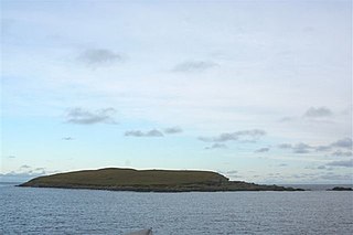
Nista is a small islet of the Shetland Islands of Scotland, situated roughly 2 kilometres (1.2 mi) east off the coast of Whalsay. It lies to the north of Mooa.

<span class="mw-page-title-main">Mooa</span> Small islet of the Shetland Islands of Scotland

Mooa is a small islet of the Shetland Islands of Scotland, situated roughly 2 kilometres (1.2 mi) east off the coast of Whalsay. It lies to the north of Isbister Holm and south of Nista. The highest point of the islet is 63 feet (19 m).

The Inner Holm of Skaw is a small, uninhabited islet off the northern tip of the island of Whalsay, in the Shetland Islands of Scotland, north of the village of Skaw.

The Outer Holm of Skaw is a small, uninhabited islet, a rock outlier off the northeast coast of the island of Whalsay, in the Shetland Islands of Scotland.

The Holm of Skaw is a small islet off the northeast coast of the island of Unst. It is just northeast of the settlement of Skaw. The island is 57 feet (17 m) in height. There is a lighthouse on the island. Tidal currents are slack between Holm of Skaw and Herma Ness at high water, and the passage may be made by small boats. The Skaw Röst, a dangerous tidal race, forms off the shore of the Holm of Skaw and Lamba Ness.

<span class="mw-page-title-main">Skate of Marrister</span>

The Skate of Marrister is a flat ledge that extends about 300 yards (270 m) from the western shore of Whalsay, in the Shetland islands of Scotland. It is slightly more than 1 mile (1.6 km) north-north-west from Symbister Ness off the village of Marrister, in Linga Sound. At low tide the ledge rises 5 feet (1.5 m) above the water. There is a risk that the strong tide in Whalsay Sound will carry a boat onto the Skate. There is a minor light on the Skate with a nominal range of four miles, flashing green every six seconds.
<span class="mw-page-title-main">Rumble, Shetland</span>

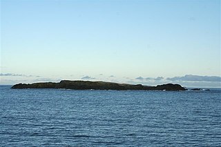
Rumble is a skerry in the Shetland islands of Scotland, situated roughly 4 kilometres (2.5 mi) east off the coast of Huxter, southeastern Whalsay. It lies 0.75 miles (1.21 km) to southwest of East Linga. The main island, also known as Rumble Holm, is 27 feet (8.2 m) high. Nearby and to the north are the Flaeshans of Rumble, a series of small islets and stacks and Burlastack of Rumble lies to the east. On the northern side of the main island is an inlet, known as the Voe of Rumble. Lobsters and prawns are said to shelter here. It is also mentioned that a ship named Griften of unknown nationality was shipwrecked either here or on the Holm of Sandwick in 1611.

<span class="mw-page-title-main">Gossabrough</span> Human settlement in Scotland

Gossabrough is a coastal hamlet, wick and ness on the southeast side of the island of Yell, Shetland, Scotland. The Wick of Gossabrough lies between the northern extremity of Gossabrough Ness and the Saddle of Swarister. The hamlet is accessed via the B9081 road. The Loch of Hudon lies just to the southwest.
<span class="mw-page-title-main">Linga Sound, Shetland</span>

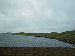
Linga Sound is the strait between the islands of Whalsay and West Linga in the Shetland islands of Scotland.

References

  1. 1 2 Center, United States Defense Mapping Agency Hydrographic (1976). Sailing Directions (enroute) for Scotland (1st ed.). Defense Mapping Agency, Hydrographic Center. p. 331.
  2. 1 2 Center, United States Defense Mapping Agency Hydrographic (1950). Sailing Directions for the North and East Coasts of Scotland: Cape Wrath to Fife Ness and Including the Orkney, Shetland and Faeroe Islands. Washington: U.S. Government Printing Office. p. 233.
  3. Center, United States Defense Mapping Agency Hydrographic (1950). Sailing Directions for the North and East Coasts of Scotland: Cape Wrath to Fife Ness and Including the Orkney, Shetland and Faeroe Islands (3rd ed.). Washington: U.S. Government Printing Office. p. 211.
  4. Office, United States Hydrographic (1915). British Islands Pilot: Faroes, Shetlands, and Orkney Islands and north and east coasts of Scotland. Washington: U.S. Government Printing Office. p. 246.
  5. 1 2 Office, United States Hydrographic (1950). Sailing Directions for the North and East Coasts of Scotland: Cape Wrath to Fife Ness and Including the Orkney, Shetland and Faeroe Islands (3rd ed.). Washington: U.S. Government Printing Office. p. 250.