List of bays of the Shetland Islands

Last updated

Detailed map of Shetland Shetland2022OSM.png
Detailed map of Shetland

This List of Bays of Shetland Islands summarises the bays that are located on the islands of the Shetland Islands in Scotland.

Contents

Balta

The small island of Balta has no bays.

Bigga

NameCountyNearest VillageCoordinatesNotes
Wester Hevda WickZetland 60°29′50″N1°11′58″W / 60.4972°N 1.1994°W / 60.4972; -1.1994 (Wester Hevda Wick)
Eastern Hevda WickZetland 60°29′56″N1°11′30″W / 60.4990°N 1.1918°W / 60.4990; -1.1918 (Eastern Hevda Wick)

Bressay

NameCountyNearest VillageCoordinatesNotes
Aith Voe ZetlandBressay 60°10′32″N1°05′17″W / 60.1755°N 1.0880°W / 60.1755; -1.0880 (Aith Voe)
Bay of Cuppa ZetlandHeogan 60°09′48″N1°03′29″W / 60.1632°N 1.058°W / 60.1632; -1.058 (Bay of Cuppa)
Bay of Heogan ZetlandHeogan 60°10′17″N1°08′42″W / 60.1715°N 1.1451°W / 60.1715; -1.1451 (Bay of Heogan)
Bight of Ham ZetlandBressay 60°08′29″N1°07′14″W / 60.1413°N 1.1205°W / 60.1413; -1.1205 (Bight of Ham)
Elvis Voe ZetlandBressay 60°11′06″N1°05′15″W / 60.1851°N 1.0875°W / 60.1851; -1.0875 (Elvis Voe)
Minni of Aith ZetlandBressay 60°10′35″N1°04′27″W / 60.1764°N 1.0742°W / 60.1764; -1.0742 (Minni of Aith)
Voe of Cullingsburgh ZetlandBressay 60°10′13″N1°02′56″W / 60.1703°N 1.049°W / 60.1703; -1.049 (Voe of Cullingsburgh)
Voe of Leiraness ZetlandBressay 60°09′11″N1°07′06″W / 60.1531°N 1.1182°W / 60.1531; -1.1182 (Voe of Leiraness)

Brother Isle

Brother Isle has no bays.

East Burra

NameCountyNearest VillageCoordinatesNotes
Clivland Bay ZetlandGrunasound 60°02′52″N1°20′25″W / 60.0477°N 1.3404°W / 60.0477; -1.3404 (Clivland Bay)
Houb ZetlandGrunasound 60°03′12″N1°19′57″W / 60.0534°N 1.3325°W / 60.0534; -1.3325 (Houb)
Millburn Bay ZetlandGrunasound 60°04′53″N1°18′12″W / 60.0815°N 1.3033°W / 60.0815; -1.3033 (Millburn Bay)
South Voe ZetlandGrunasound 60°04′21″N1°19′57″W / 60.0726°N 1.3326°W / 60.0726; -1.3326 (South Voe)
Voe of North House ZetlandGrunasound 60°03′57″N1°19′14″W / 60.0657°N 1.3205°W / 60.0657; -1.3205 (Voe of North House)
Wick of Blumbister ZetlandGrunasound 60°03′58″N1°19′42″W / 60.0662°N 1.3284°W / 60.0662; -1.3284 (Wick of Blumbister)

Fair Isle

NameCountyNearest VillageCoordinatesNotes
Bight of South Haven Zetland 59°32′00″N1°36′30″W / 59.5332°N 1.6082°W / 59.5332; -1.6082 (Bight of South Haven)
North Haven Zetland 59°32′23″N1°36′11″W / 59.5397°N 1.6031°W / 59.5397; -1.6031 (North Haven)
South Harbour Zetland 59°30′40″N1°38′41″W / 59.5112°N 1.6448°W / 59.5112; -1.6448 (South Harbour)
South Haven Zetland 59°32′06″N1°36′22″W / 59.5349°N 1.6061°W / 59.5349; -1.6061 (South Haven)
Wick of Furse Zetland 59°32′33″N1°36′32″W / 59.5424°N 1.6090°W / 59.5424; -1.6090 (Wick of Furse)
Wick of Hestigeo Zetland 59°30′53″N1°39′24″W / 59.5147°N 1.6568°W / 59.5147; -1.6568 (Wick of Hestigeo)

Fetlar

NameCountyNearest VillageCoordinatesNotes
Filla Wick Zetland 60°37′27″N0°49′42″W / 60.6242°N 0.8282°W / 60.6242; -0.8282 (Filla Wick)
Funzie Bay ZetlandHoubie 60°35′02″N0°47′23″W / 60.5838°N 0.7898°W / 60.5838; -0.7898 (Funzie Bay)
Wick of Aith ZetlandAith 60°35′13″N0°49′56″W / 60.5870°N 0.8322°W / 60.5870; -0.8322 (Wick of Aith)
Wick of Houbie Zetland Houbie 60°35′23″N0°51′43″W / 60.5896°N 0.8619°W / 60.5896; -0.8619 (Wick of Houbie)
Wick of Gruting ZetlandHoubie 60°36′28″N0°48′33″W / 60.6077°N 0.8092°W / 60.6077; -0.8092 (Wick of Gruting) [1]
Wick of Tresta ZetlandHoubie 60°34′41″N0°50′57″W / 60.5781°N 0.8493°W / 60.5781; -0.8493 (Wick of Tresta) [2]

Foula

NameCountyNearest VillageCoordinatesNotes
Da VoeZetland 60°08′05″N2°02′46″W / 60.1346°N 2.0462°W / 60.1346; -2.0462 (Da Voe)
Ham Little Zetland 60°07′48″N2°02′50″W / 60.1301°N 2.0471°W / 60.1301; -2.0471 (Ham Little)
Hellabrik's Wick Zetland 60°06′55″N2°04′30″W / 60.1152°N 2.0749°W / 60.1152; -2.0749 (Hellabrik's Wick)
Hiorawick Zetland 60°09′21″N2°04′11″W / 60.1559°N 2.0696°W / 60.1559; -2.0696 (Hiorawick)
Mucklebrik's Wick Zetland 60°07′41″N2°05′58″W / 60.1281°N 2.0994°W / 60.1281; -2.0994 (Mucklebrik's Wick)

Hascosay

NameCountyNearest VillageCoordinatesNotes
Djuba Wick Zetland 60°37′02″N0°59′02″W / 60.6171°N 0.9839°W / 60.6171; -0.9839 (Djuba Wick) [3]
Housa Wick Zetland 60°36′15″N0°59′51″W / 60.6043°N 0.9975°W / 60.6043; -0.9975 (Housa Wick) [3]
The Bow of Hascosay Zetland 60°36′36″N1°00′18″W / 60.6100°N 1.0049°W / 60.6100; -1.0049 (The Bow of Hascosay)

Hildasay

NameCountyHildasayNearest VillageCoordinatesNotes
Cusa Voe Zetland 60°08′29″N1°22′02″W / 60.1413°N 1.3673°W / 60.1413; -1.3673 (Cusa Voe) [4]
Djuba Voe Zetland 60°08′20″N1°21′39″W / 60.1388°N 1.3608°W / 60.1388; -1.3608 (Cusa Voe)
Tangi Voe Zetland 60°08′25″N1°21′47″W / 60.1403°N 1.3630°W / 60.1403; -1.3630 (Tangi Voe) [4]

Lamba

NameCountyHildasayNearest VillageCoordinatesNotes
Wick of Lamba Zetland 60°30′47″N1°17′28″W / 60.5131°N 1.291°W / 60.5131; -1.291 (Wick of Lamba)

Linga

The small island of Linga has no bays.

Mainland

NameCountyNearest VillageCoordinatesNotes
Aith Voe Zetland Aith 60°18′16″N1°22′24″W / 60.3044°N 1.3734°W / 60.3044; -1.3734 (Aith Voe) [5]
Aith Wick Zetland Brae 60°02′55″N1°11′52″W / 60.0486°N 1.1979°W / 60.0486; -1.1979 (Aith Wick)
Aith Wick Zetland Bremirehoull 60°02′14″N1°12′44″W / 60.0372°N 1.2121°W / 60.0372; -1.2121 (Aith Wick) On the east coast.
As WickZetlandGarth 60°15′31″N1°08′34″W / 60.2587°N 1.1427°W / 60.2587; -1.1427 (As Wick)
Ayre of Brae Zetland Brae 60°23′38″N1°21′19″W / 60.3939°N 1.3554°W / 60.3939; -1.3554 (Bay of Garth)
Bay of Brenwell Zetland Sandness 60°17′50″N1°35′28″W / 60.2972°N 1.5910°W / 60.2972; -1.5910 (Bay of Brenwell)
Bay of Deepdale Zetland Sandness 60°16′43″N1°41′17″W / 60.2787°N 1.6881°W / 60.2787; -1.6881 (Bay of Deepdale) [6]
Bay of Fladdabister Zetland Sandness 60°04′30″N1°12′41″W / 60.07490°N 1.2114°W / 60.07490; -1.2114 (Bay of Fladdabister) [7]
Bay of Garth Zetland Sandness 60°18′24″N1°36′49″W / 60.3068°N 1.6135°W / 60.3068; -1.6135 (Bay of Garth)
Bay of Okraquoy Zetland Bremirehoull 60°03′55″N1°12′37″W / 60.0653°N 1.2102°W / 60.0653; -1.2102 (Bay of Okraquoy)
Bay of Ollaberry Zetland Ollaberry 60°30′15″N1°20′13″W / 60.5041°N 1.3369°W / 60.5041; -1.3369 (Bay of Ollaberry) [8]
Bay of Quendale Zetland Boddam 59°53′35″N1°19′57″W / 59.8931°N 1.3325°W / 59.8931; -1.3325 (Bay of Quendale) [9]
Bay of Scousburgh Zetland Scousburgh 59°56′56″N1°20′10″W / 59.9488°N 1.3360°W / 59.9488; -1.3360 (Bay of Scousburgh) [10]
Bight of Bellister ZetlandBellister 60°19′32″N1°07′27″W / 60.3255°N 1.1242°W / 60.3255; -1.1242 (Bight of Bellister)
Bight of Boga Zetland North Roe 60°36′43″N1°20′39″W / 60.6120°N 1.3442°W / 60.6120; -1.3442 (Bight of Boga)
Bight of Brimness Zetland Gott 60°13′10″N1°10′06″W / 60.2195°N 1.1683°W / 60.2195; -1.1683 (Bight of Brimness)
Bight of Gremista Zetland Lerwick 60°10′12″N1°09′45″W / 60.1701°N 1.1624°W / 60.1701; -1.1624 (Bight of Gremista)
Bight of Haggrister Zetland Brae 60°24′37″N1°22′08″W / 60.4104°N 1.3689°W / 60.4104; -1.3689 (Bight of Haggrister) [11]
Bight of Niddister Zetland Hillswick 60°27′43″N1°29′09″W / 60.4620°N 1.4859°W / 60.4620; -1.4859 (Bight of Niddister)
Bight of Stavaness ZetlandBellister 60°19′29″N1°06′04″W / 60.3246°N 1.1011°W / 60.3246; -1.1011 (Bight of Stavaness)
Bight of Valayre Zetland Brae 60°24′30″N1°22′24″W / 60.4082°N 1.3732°W / 60.4082; -1.3732 (Bight of Valayre)
Bight of Vatsland Zetland Lerwick 60°11′37″N1°09′08″W / 60.1935°N 1.1523°W / 60.1935; -1.1523 (Bight of Vatsland)
Boatsroom Voe Zetland Vidlin 60°25′11″N1°06′22″W / 60.4197°N 1.1061°W / 60.4197; -1.1061 (Boatsroom Voe) [12]
Brae Wick Zetland Braehoulland 60°29′02″N1°33′11″W / 60.4840°N 1.5530°W / 60.4840; -1.5530 (Brae Wick)
Brei Wick Zetland Lerwick 60°08′42″N1°08′55″W / 60.1450°N 1.1487°W / 60.1450; -1.1487 (Brei Wick)
Brei Wick Zetland Gott 60°12′14″N1°11′06″W / 60.2040°N 1.1849°W / 60.2040; -1.1849 (Brei Wick) A bay on the north-west coast of Dales Voe.
Brindister Voe Zetland Braehoulland 60°17′58″N1°29′07″W / 60.2994°N 1.4853°W / 60.2994; -1.4853 (Brindister Voe)
Bur Wick Zetland Scalloway 60°08′47″N1°17′44″W / 60.1465°N 1.2956°W / 60.1465; -1.2956 (Bur Wick)
Burra Voe Zetland North Roe 60°34′59″N1°19′39″W / 60.5831°N 1.3275°W / 60.5831; -1.3275 (Burra Voe) On the north coast
Burrier Wick Zetland North Roe 60°36′41″N1°25′45″W / 60.6113°N 1.4291°W / 60.6113; -1.4291 (Burrier Wick)
Busta Voe Zetland Brae 60°23′38″N1°21′19″W / 60.3939°N 1.3554°W / 60.3939; -1.3554 (Busta Voe)
Cat Firth Zetland Nesting 60°14′45″N1°11′18″W / 60.2459°N 1.1884°W / 60.2459; -1.1884 (Cat Firth)
Channer Wick Zetland Hoswick 59°59′21″N1°16′17″W / 59.9893°N 1.2714°W / 59.9893; -1.2714 (Channer Wick)
Colla Firth ZetlandGrutin 60°24′39″N1°11′29″W / 60.4109°N 1.1915°W / 60.4109; -1.1915 (Colla Firth)
Colla Firth Zetland Ollaberry 60°32′03″N1°20′07″W / 60.5343°N 1.3352°W / 60.5343; -1.3352 (Colla Firth)
Coppa Wick Zetland Sandness 60°15′41″N1°41′38″W / 60.2613°N 1.6939°W / 60.2613; -1.6939 (Coppa Wick)
Dale Voe Zetland Brae 60°27′50″N1°19′41″W / 60.4639°N 1.3281°W / 60.4639; -1.3281 (Dale Voe) [13]
Dales Voe ZetlandGrutin 60°24′57″N1°13′14″W / 60.4159°N 1.2206°W / 60.4159; -1.2206 (Dales Voe) On the north of the island
Dales Voe Zetland Twatt 60°12′19″N1°10′55″W / 60.2052°N 1.1819°W / 60.2052; -1.1819 (Dales Voe)
Dock of Lingness Zetland Brough 60°16′24″N1°07′18″W / 60.2732°N 1.1218°W / 60.2732; -1.1218 (Dock of Lingness)
Dury Voe Zetland Laxo 60°20′19″N1°07′29″W / 60.3386°N 1.1246°W / 60.3386; -1.1246 (Dury Voe)
Effirth Voe Zetland Twatt 60°15′15″N1°25′27″W / 60.2541°N 1.4243°W / 60.2541; -1.4243 (Effirth Voe)
Easter Wick Zetland North Roe 60°37′45″N1°18′51″W / 60.6291°N 1.3143°W / 60.6291; -1.3143 (Easter Wick)
East Lunna Voe Zetland Vidlin 60°24′03″N1°07′03″W / 60.4007°N 1.1176°W / 60.4007; -1.1176 (East Lunna Voe)
East Voe of Quarff Zetland Quarff 60°05′57″N1°13′11″W / 60.099280°N 1.219744°W / 60.099280; -1.219744 (East Voe of Quarff) [7]
East Voe of Skellister Zetland Brough 60°16′30″N1°08′39″W / 60.2751°N 1.1441°W / 60.2751; -1.1441 (East Voe of Skellister)
Effirth Voe Zetland Twatt 60°15′15″N1°25′27″W / 60.2541°N 1.4243°W / 60.2541; -1.4243 (Effirth Voe)
Ell Wick Zetland Brae 60°24′35″N1°20′12″W / 60.4098°N 1.3366°W / 60.4098; -1.3366 (Ell Wick) [11]
Es Wick Zetland Brough 60°16′14″N1°06′22″W / 60.2706°N 1.1061°W / 60.2706; -1.1061 (Es Wick)
Feor Wick Zetland Vidlin 60°26′48″N1°04′06″W / 60.4467°N 1.0682°W / 60.4467; -1.0682 (Feor Wick)
Firths Voe Zetland Mossbank 60°26′57″N1°10′54″W / 60.4491°N 1.1817°W / 60.4491; -1.1817 (Firths Voe) [14]
Foraness Voe Zetland Gott 60°12′48″N1°10′28″W / 60.2134°N 1.1744°W / 60.2134; -1.1744 (Foraness Voe)
Garderhouse Voe ZetlandLeeans 60°12′31″N1°23′54″W / 60.2085°N 1.3984°W / 60.2085; -1.3984 (Garderhouse Voe)
Garths Voe Zetland Mossbank 60°26′48″N1°16′07″W / 60.4468°N 1.2687°W / 60.4468; -1.2687 (Garths Voe)
Gluss Voe Zetland Ollaberry 60°29′29″N1°20′09″W / 60.4914°N 1.3358°W / 60.4914; -1.3358 (Gluss Voe) [13]
Grunna Voe Zetland Vidlin 60°22′58″N1°08′19″W / 60.3829°N 1.1385°W / 60.3829; -1.1385 (Grunna Voe)
Gruting Voe Zetland Gruting 60°13′06″N1°30′58″W / 60.2184°N 1.5160°W / 60.2184; -1.5160 (Gruting Voe) [15]
Grutness Voe Zetland Sumburgh 60°07′26″N1°11′42″W / 60.1239°N 1.1950°W / 60.1239; -1.1950 (Grutness Voe)
Gulber Wick Zetland Gulberwick 59°52′32″N1°16′51″W / 59.8755°N 1.2808°W / 59.8755; -1.2808 (Gulber Wick)
Gunnister Voe Zetland Gunnister 60°26′56″N1°26′10″W / 60.4488°N 1.4362°W / 60.4488; -1.4362 (Gunnister Voe)
Hamar Voe ZetlandUrafirth 60°28′00″N1°26′50″W / 60.4668°N 1.4473°W / 60.4668; -1.4473 (Hamar Voe)
Hamna Voe Zetland Braehoulland 60°30′17″N1°34′15″W / 60.5046°N 1.5708°W / 60.5046; -1.5708 (Hamna Voe)
Hamna Voe Zetland Vidlin 60°25′30″N1°06′17″W / 60.4249°N 1.1046°W / 60.4249; -1.1046 (Hamna Voe) East side of the island. [16]
Hos Wick Zetland Hoswick 59°59′39″N1°15′17″W / 59.9943°N 1.2547°W / 59.9943; -1.2547 (Hos wick)
Houb of Burravoe Zetland Brae 60°23′01″N1°20′48″W / 60.3837°N 1.3466°W / 60.3837; -1.3466 (Houb of Burravoe)
Ireland Wick Zetland Bigton 59°58′36″N1°19′52″W / 59.9767°N 1.3310°W / 59.9767; -1.3310 (Ireland Wick)
Kaila Zetland Sandness 60°18′25″N1°39′07″W / 60.3070°N 1.6519°W / 60.3070; -1.6519 (Kaila)
Kels Wick Zetland Vidlin 60°24′17″N1°06′14″W / 60.4048°N 1.1039°W / 60.4048; -1.1039 (Kels Wick)
Lang Clodie Wick Zetland Ollaberry 60°34′44″N1°26′32″W / 60.5788°N 1.4422°W / 60.5788; -1.4422 (Lang Clodie Wick)
Laxo Voe Zetland Laxo 60°21′01″N1°10′34″W / 60.3503°N 1.1761°W / 60.3503; -1.1761 (Laxo Voe)
Lax Firth Zetland Gott 60°12′49″N1°12′11″W / 60.2136°N 1.20292°W / 60.2136; -1.20292 (Lax Firth)
Lera Voe Zetland Walls 60°13′03″N1°36′01″W / 60.2176°N 1.6002°W / 60.2176; -1.6002 (Lera Voe) [17]
Leven Wick Zetland Hoswick 59°58′34″N1°15′43″W / 59.9760°N 1.2619°W / 59.9760; -1.2619 (Leven Wick)
Longa Voe Zetland Aith 60°19′21″N1°25′24″W / 60.3226°N 1.4234°W / 60.3226; -1.4234 (Longa Voe)
Loura Voe ZetlandLaxfirth 60°15′33″N1°11′23″W / 60.2593°N 1.1898°W / 60.2593; -1.1898 (Loura Voe)
May Wick ZetlandMay Wick 60°00′24″N1°19′38″W / 60.0066°N 1.3273°W / 60.0066; -1.3273 (May Wick)
Nor Wick Zetland Ollaberry 60°30′57″N1°19′55″W / 60.5157°N 1.3320°W / 60.5157; -1.3320 (Nor Wick) [18]
North Bight of Rovahead Zetland Lerwick 60°11′28″N1°08′51″W / 60.1911°N 1.1475°W / 60.1911; -1.1475 (North Bight of Rovahead)
North Voe of Gletness ZetlandGletness 60°14′57″N1°08′52″W / 60.2492°N 1.1477°W / 60.2492; -1.1477 (North Voe of Gletness)
North Wick Zetland North Roe 60°37′00″N1°24′42″W / 60.6166°N 1.4118°W / 60.6166; -1.4118 (North Wick)
Olas Voe ZetlandSelivoe 60°12′23″N1°29′38″W / 60.2064°N 1.4938°W / 60.2064; -1.4938 (Olas Voe) [19]
Orka Voe Zetland Mossbank 60°28′51″N1°15′45″W / 60.4809°N 1.2625°W / 60.4809; -1.2625 (Orka Voe) [13]
Orr Wick Zetland Ollaberry 60°30′48″N1°23′52″W / 60.5133°N 1.3979°W / 60.5133; -1.3979 (Orr Wick)
Orra Wick Zetland Vidlin 60°23′18″N1°04′56″W / 60.3883°N 1.0821°W / 60.3883; -1.0821 (Orra Wick)
Pund Voe Zetland Scalloway 60°07′58″N1°18′06″W / 60.1329°N 1.3017°W / 60.1329; -1.3017 (Pund Voe)
Quey Firth Zetland Ollaberry 60°31′10″N1°20′11″W / 60.5195°N 1.3364°W / 60.5195; -1.3364 (Quey Firth) [20]
Raa Wick Zetland North Roe 60°28′51″N1°15′43″W / 60.4809°N 1.262°W / 60.4809; -1.262 (Raa Wick)
Rea Wick Zetland Skeld 60°11′07″N1°24′17″W / 60.1853°N 1.4048°W / 60.1853; -1.4048 (Rea Wick)
Riven Noust Zetland Vidlin 60°26′21″N1°04′53″W / 60.4392°N 1.0813°W / 60.4392; -1.0813 (Riven Noust)
Sand Voe ZetlandLeeans 60°36′04″N1°20′15″W / 60.6010°N 1.3374°W / 60.6010; -1.3374 (Sand Voe)
Sand Wick Zetland Sandwick 59°59′24″N1°13′28″W / 59.9899°N 1.2244°W / 59.9899; -1.2244 (Sand Wick)
Scutta Voe Zetland Gruting 60°13′49″N1°30′07″W / 60.2304°N 1.5019°W / 60.2304; -1.5019 (Scutta Voe) [21]
Seli Voe Zetland Gruting 60°12′59″N1°29′05″W / 60.2164°N 1.4847°W / 60.2164; -1.4847 (Seli Voe) [22]
Sil Wick Zetland Silwick 60°09′34″N1°28′20″W / 60.1595°N 1.4723°W / 60.1595; -1.4723 (Sil Wick)
Skelda Voe Zetland Skeld 60°10′30″N1°26′33″W / 60.1750°N 1.4424°W / 60.1750; -1.4424 (Skelda Voe) [23]
Skipadock Zetland Brae 60°24′09″N1°22′53″W / 60.4024°N 1.3815°W / 60.4024; -1.3815 (Skipadock)
Skletta Bay Zetland Vidlin 60°23′35″N1°06′13″W / 60.3931°N 1.1037°W / 60.3931; -1.1037 (Skletta Bay)
South Bay of Eswick ZetlandBenston 60°15′41″N1°07′21″W / 60.2613°N 1.1224°W / 60.2613; -1.1224 (South Bay of Eswick)
South Bight of Rovahead Zetland Lerwick 60°11′20″N1°08′44″W / 60.1888°N 1.1455°W / 60.1888; -1.1455 (South Bight of Rovahead)
South Nesting Bay ZetlandSkellister 60°17′14″N1°06′52″W / 60.2873°N 1.1145°W / 60.2873; -1.1145 (South Nesting Bay) [24]
South Voe of Gletness ZetlandGletness 60°14′28″N1°09′46″W / 60.2410°N 1.1629°W / 60.2410; -1.1629 (South Voe of Gletness) [25]
South Wick Zetland North Roe 60°36′01″N1°25′50″W / 60.6002°N 1.4306°W / 60.6002; -1.4306 (South Wick)
Stead of Aithsness Zetland Aith 60°19′06″N1°25′02″W / 60.3182°N 1.4173°W / 60.3182; -1.4173 (Stead of Aithsness)
Stead of Culswick ZetlandCulswick 60°19′06″N1°25′02″W / 60.3182°N 1.4173°W / 60.3182; -1.4173 (Stead of Culswick)
Swining Voe Zetland Vidlin 60°23′54″N1°09′37″W / 60.3983°N 1.1602°W / 60.3983; -1.1602 (Swining Voe)
Swinister Voe Zetland Mossbank 60°26′06″N1°10′35″W / 60.4351°N 1.1765°W / 60.4351; -1.1765 (Swinister Voe) [26]
St Ninian's Bay ZetlandCulswick 59°57′59″N1°20′12″W / 59.9663°N 1.3367°W / 59.9663; -1.3367 (St Ninian's Bay)
The Crook Zetland Aith 60°19′02″N1°05′15″W / 60.3172°N 1.0876°W / 60.3172; -1.0876 (The Crook)
The Groot Zetland Laxfirth 60°18′18″N1°38′57″W / 60.3051°N 1.6492°W / 60.3051; -1.6492 (The Groot)
The Vadills Zetland Vidlin 60°25′07″N1°06′05″W / 60.4187°N 1.1013°W / 60.4187; -1.1013 (The Vadills) [27]
Tang Wick Zetland Braehoulland 60°28′43″N1°34′56″W / 60.4785°N 1.5821°W / 60.4785; -1.5821 (Tang Wick)
The Houb Zetland Walls 60°13′16″N1°33′11″W / 60.2211°N 1.5530°W / 60.2211; -1.5530 (The Houb)
The Houb Zetland Walls 60°12′14″N1°12′24″W / 60.20402°N 1.20654°W / 60.20402; -1.20654 (The Houb) Bay in Lax Firth
Tofts Voe Zetland Mossbank 60°27′53″N1°11′56″W / 60.4646°N 1.1989°W / 60.4646; -1.1989 (Tofts Voe) [13]
Trea Wick Zetland Vidlin 60°24′24″N1°10′00″W / 60.4067°N 1.1667°W / 60.4067; -1.1667 (Trea Wick)
Tresta Voe ZetlandTresta 60°14′33″N1°21′36″W / 60.2425°N 1.3600°W / 60.2425; -1.3600 (Tresta Voe) [28]
Tros Wick Zetland Boddam 59°55′57″N1°16′06″W / 59.9325°N 1.2684°W / 59.9325; -1.2684 (Tros Wick)
Vassa Voe Zetland Nesting 60°15′23″N1°10′21″W / 60.2563°N 1.1724°W / 60.2563; -1.1724 (Vassa Voe)
Vidlin Voe Zetland Vidlin 60°23′02″N1°07′29″W / 60.3838°N 1.1248°W / 60.3838; -1.1248 (Vidlin Voe) [29]
VoeZetland Boddam 59°55′08″N1°17′03″W / 59.9189°N 1.2841°W / 59.9189; -1.2841 (Voe)
Voe of Browland Zetland Walls 60°14′12″N1°31′19″W / 60.2368°N 1.5219°W / 60.2368; -1.5219 (Voe of Browland) [30]
Voe of the Brig ZetlandHousetter 60°32′19″N1°20′58″W / 60.5387°N 1.3495°W / 60.5387; -1.3495 (Voe of the Brig)
Voe of Clousta Zetland Twatt 60°18′00″N1°27′17″W / 60.3000°N 1.4548°W / 60.3000; -1.4548 (Voe of Clousta) [31]
Voe of Dale Zetland Walls 60°15′05″N1°41′37″W / 60.2513°N 1.6937°W / 60.2513; -1.6937 (Voe of Dale)
Voe of Footabrough Zetland Walls 60°13′31″N1°38′53″W / 60.2253°N 1.6481°W / 60.2253; -1.6481 (Voe of Footabrough) [32]
Voe of Littlure Zetland Walls 60°12′45″N1°37′56″W / 60.2126°N 1.6323°W / 60.2126; -1.6323 (Voe of Littlure)
Voe of Scatsta Zetland Mossbank 60°26′35″N1°16′59″W / 60.4430°N 1.2830°W / 60.4430; -1.2830 (Voe of Scatsta)
Voe of Snarraness Zetland Mossbank 60°17′41″N1°34′41″W / 60.2948°N 1.5780°W / 60.2948; -1.5780 (Voe of Snarraness) [33]
Voe of Sound Zetland Lerwick 60°08′02″N1°10′05″W / 60.1338°N 1.1681°W / 60.1338; -1.1681 (Voe of Sound)
Voxter Voe Zetland Brae 60°24′35″N1°20′12″W / 60.4098°N 1.3366°W / 60.4098; -1.3366 (Voxter Voe) [11]
Wadbister Voe Zetlandgirlsta 60°14′10″N1°12′34″W / 60.2360°N 1.2095°W / 60.2360; -1.2095 (Wadbister Voe) [34]
Wick of Housabister Zetland Brettabister 60°18′09″N1°06′46″W / 60.3026°N 1.1128°W / 60.3026; -1.1128 (Wick of Housabister)
Weisdale Voe Zetland Hellister 60°12′58″N1°18′58″W / 60.2160°N 1.3161°W / 60.2160; -1.3161 (Weisdale Voe) [35]
West Lunna Voe Zetland Vidlin 60°24′19″N1°07′43″W / 60.4053°N 1.1287°W / 60.4053; -1.1287 (West Lunna Voe) [16]
Wester Wick Zetland Westerwick 60°37′52″N1°19′03″W / 60.6311°N 1.3175°W / 60.6311; -1.3175 (Wester Wick)
West Voe of Skellister ZetlandSkellister 60°16′55″N1°08′57″W / 60.2820°N 1.1492°W / 60.2820; -1.1492 (West Voe of Skellister)
West Voe of Sumburgh Zetland Sumburgh 59°51′43″N1°17′36″W / 59.8620°N 1.2932°W / 59.8620; -1.2932 (West Voe of Sumburgh) [36]
West Voe of Quarff Zetland Quarff 60°05′56″N1°16′34″W / 60.0988°N 1.2761°W / 60.0988; -1.2761 (West Voe of Quarff)
Whal Wick ZetlandBraehoulland 60°30′52″N1°34′09″W / 60.5144°N 1.5691°W / 60.5144; -1.5691 (Whal Wick)
Whiteness Voe Zetland Wadbister 60°11′27″N1°17′32″W / 60.1908°N 1.2923°W / 60.1908; -1.2923 (Whiteness Voe)
Wick of Breibister Zetland Gulberwick 60°37′33″N1°18′53″W / 60.6258°N 1.3148°W / 60.6258; -1.3148 (Wick of Breibister) [37]
Wick of Burland Zetland North Roe 60°06′24″N1°12′13″W / 60.1066°N 1.2036°W / 60.1066; -1.2036 (Wick of Burland)
Wick of Glachon Zetland Vidlin 60°26′40″N1°02′57″W / 60.4445°N 1.0492°W / 60.4445; -1.0492 (Wick of Glachon) [38]
Wick of Neap Zetland Neap 60°18′26″N1°05′17″W / 60.3072°N 1.0881°W / 60.3072; -1.0881 (Wick of Neap)
Wick of Sandsayre Zetland North Roe 60°00′32″N1°13′12″W / 60.0088°N 1.2199°W / 60.0088; -1.2199 (Wick of Sandsayre) [7]
Wick of Shunni Zetland Boddam 59°55′14″N1°22′17″W / 59.9206°N 1.3715°W / 59.9206; -1.3715 (Wick of Shunni)
Wick of Virdibreck Zetland North Roe 60°24′35″N1°20′12″W / 60.4098°N 1.3366°W / 60.4098; -1.3366 (Wick of Virdibreck)
Wick of Watsness ZetlandWatsness 60°14′06″N1°40′56″W / 60.2350°N 1.6822°W / 60.2350; -1.6822 (Wick of Watsness)
Yarfils Wick Zetland Brae 60°29′25″N1°18′44″W / 60.4903°N 1.3122°W / 60.4903; -1.3122 (Yarfils Wick)

Mousa

NameCountyHildasayNearest VillageCoordinatesNotes
East HamZetland 60°00′13″N1°10′36″W / 60.0037°N 1.1767°W / 60.0037; -1.1767 (East Ham)
West HamZetland 60°00′04″N1°11′13″W / 60.0010°N 1.1869°W / 60.0010; -1.1869 (West Ham)

Muckle Roe

NameCountyNearest VillageCoordinatesNotes
Mucke Ayre Zetland 60°20′51″N1°25′30″W / 60.3474°N 1.4250°W / 60.3474; -1.4250 (Mucke Ayre)
North Ham Zetland 60°22′47″N1°27′10″W / 60.3796°N 1.4527°W / 60.3796; -1.4527 (North Ham)
Otter Ayre Zetland 60°22′53″N1°24′49″W / 60.3815°N 1.4135°W / 60.3815; -1.4135 (Otter Ayre)
South Ham Zetland 60°22′28″N1°27′44″W / 60.3744°N 1.4622°W / 60.3744; -1.4622 (South Ham)

Isle of Noss

NameCountyNearest VillageCoordinatesNotes
Nesti Voe Zetland 60°08′54″N1°02′40″W / 60.1483°N 1.0444°W / 60.1483; -1.0444 (Nesti Voe)
Voe of the Mels Zetland 60°08′41″N1°02′16″W / 60.1447°N 1.0378°W / 60.1447; -1.0378 (Voe of the Mels)

Oxna Shetland

NameCountyNearest VillageCoordinatesNotes
Little Voe Zetland 60°07′02″N1°21′46″W / 60.1171°N 1.3628°W / 60.1171; -1.3628 (Little Voe)
Sandy Voe Zetland 60°07′13″N1°21′48″W / 60.1204°N 1.3633°W / 60.1204; -1.3633 (Sandy Voe)

Papa

NameCountyNearest VillageCoordinatesNotes
Caishie Voe Zetland 60°07′23″N1°21′28″W / 60.1231°N 1.3577°W / 60.1231; -1.3577 (Caishie Voe)
Croo Bight Zetland 60°07′26″N1°20′48″W / 60.1239°N 1.3466°W / 60.1239; -1.3466 (Croo Bight)
North Voe Zetland 60°07′24″N1°20′17″W / 60.1232°N 1.338°W / 60.1232; -1.338 (North Voe)
South Voe Zetland 60°07′10″N1°20′31″W / 60.1194°N 1.3419°W / 60.1194; -1.3419 (South Voe)
Tangi Voe Zetland 60°07′17″N1°21′06″W / 60.1214°N 1.3516°W / 60.1214; -1.3516 (Tangi Voe)

Papa Little

NameCountyNearest VillageCoordinatesNotes
Bight of Warwick Zetland Brae 60°20′05″N1°22′30″W / 60.33480072°N 1.37512652°W / 60.33480072; -1.37512652 (Bight of Warwick)

Papa Stour

NameCountyNearest VillageCoordinatesNotes
Culla Voe Zetland Biggings 60°20′20″N1°41′49″W / 60.3389°N 1.6969°W / 60.3389; -1.6969 (Culla Voe)
Hamna Voe Zetland Biggings 60°19′19″N1°42′29″W / 60.3219°N 1.7081°W / 60.3219; -1.7081 (Hamna Voe)
Housa Voe Zetland Biggings 60°19′43″N1°40′15″W / 60.3287°N 1.6709°W / 60.3287; -1.6709 (Housa Voe)
Scopa Wick Zetland Biggings 60°20′11″N1°39′50″W / 60.3363°N 1.6638°W / 60.3363; -1.6638 (Scopa Wick)
Sholma Wick Zetland Biggings 60°20′31″N1°42′27″W / 60.3419°N 1.7076°W / 60.3419; -1.7076 (Sholma Wick)
West Voe Zetland Biggings 60°20′12″N1°41′08″W / 60.3366°N 1.6856°W / 60.3366; -1.6856 (West Voe)

Samphrey

The small island of Samphrey has no bays.

South Havra

NameCountyNearest VillageCoordinatesNotes
The Harbour Zetland 60°01′14″N1°21′14″W / 60.0205°N 1.3540°W / 60.0205; -1.3540 (The Harbour)
West Ham Zetland 60°01′22″N1°21′21″W / 60.0227°N 1.3557°W / 60.0227; -1.3557 (West Ham)

Trondra

The tiny island of Trondra has no bays.

Unst

NameCountyNearest VillageCoordinatesNotes
Brei Wick Zetland 60°49′56″N0°49′33″W / 60.8321°N 0.8257°W / 60.8321; -0.8257 (Brei Wick)
Burga Wick Zetland Haroldswick 60°42′29″N0°51′46″W / 60.7081°N 0.8628°W / 60.7081; -0.8628 (Burga Wick) [39]
Burra Firth ZetlandValsgarth 60°49′37″N0°51′44″W / 60.8269°N 0.8623°W / 60.8269; -0.8623 (Burra Firth)
Fiska Wick ZetlandValsgarth 60°48′49″N0°52′23″W / 60.8135°N 0.8731°W / 60.8135; -0.8731 (Fiska Wick) [40]
Girr Wick ZetlandValsgarth 60°48′01″N0°46′54″W / 60.8003°N 0.7817°W / 60.8003; -0.7817 (Girr Wick)
Harold's Wick Zetland Haroldswick 60°46′56″N0°48′51″W / 60.7821°N 0.8141°W / 60.7821; -0.8141 (Harold's Wick) [41]
Looss Wick ZetlandBaltasound 60°50′36″N0°53′25″W / 60.8434°N 0.8902°W / 60.8434; -0.8902 (Looss Wick)
Lunda Wick ZetlandBaltasound 60°43′17″N0°58′04″W / 60.7215°N 0.9677°W / 60.7215; -0.9677 (Lunda Wick) [42]
Ham of Muness ZetlandBaltasound 60°41′45″N0°50′44″W / 60.6958°N 0.8456°W / 60.6958; -0.8456 (Ham of Muness)
Nor Wick Zetland Haroldswick 60°48′33″N0°47′24″W / 60.8091°N 0.7900°W / 60.8091; -0.7900 (Nor Wick)
Sand Wick ZetlandMuness 60°42′01″N0°51′41″W / 60.7004°N 0.8614°W / 60.7004; -0.8614 (Sand Wick) [39]
Scolla Wick Zetland Haroldswick 60°40′56″N0°50′33″W / 60.6823°N 0.8425°W / 60.6823; -0.8425 (Scolla Wick)
Snarra Voe ZetlandBaltasound 60°41′49″N0°58′11″W / 60.6969°N 0.9698°W / 60.6969; -0.9698 (Snarra Voe)
Wick of Belmont ZetlandBelmont 60°40′58″N0°58′17″W / 60.6827°N 0.9715°W / 60.6827; -0.9715 (Wick of Belmont) [43]
Wick of Collaster ZetlandBaltasound 60°44′43″N0°56′58″W / 60.7452°N 0.9494°W / 60.7452; -0.9494 (Wick of Collaster) [44]
Wick of Hagdale Zetland Baltasound 60°46′21″N0°49′02″W / 60.7724°N 0.8173°W / 60.7724; -0.8173 (Wick of Hagdale)
Wick of Smirgirt ZetlandMuness 60°42′21″N0°51′51″W / 60.7058°N 0.8643°W / 60.7058; -0.8643 (Wick of Smirgirt) [45]
Wick of Skaw ZetlandValsgarth 60°49′32″N0°47′07″W / 60.8256°N 0.7853°W / 60.8256; -0.7853 (Wick of Skaw) [46]
Wood Wick ZetlandValsgarth 60°46′57″N0°56′03″W / 60.7825°N 0.9343°W / 60.7825; -0.9343 (Wood Wick)

Uyea, Unst

NameCountyNearest VillageCoordinatesNotes
Brei Wick Zetland 60°40′00″N0°52′54″W / 60.6666°N 0.8818°W / 60.6666; -0.8818 (Brei Wick)
Staeta Wick Zetland 60°39′54″N0°53′08″W / 60.6651°N 0.8855°W / 60.6651; -0.8855 (Staeta Wick)

Vaila

NameCountyNearest VillageCoordinatesNotes
Muckle Bight Zetland 60°11′35″N1°34′44″W / 60.1931°N 1.5788°W / 60.1931; -1.5788 (Muckle Bight)
Voe of Vaila Zetland 60°12′26″N1°35′46″W / 60.2071°N 1.596°W / 60.2071; -1.596 (Voe of Vaila) [47]

Vementry

NameCountyNearest VillageCoordinatesNotes
Lamba Wick Zetland 60°19′50″N1°27′02″W / 60.3306°N 1.4505°W / 60.3306; -1.4505 (Lamba Wick)
North Voe Zetland 60°19′52″N1°26′42″W / 60.3310°N 1.4450°W / 60.3310; -1.4450 (North Voe)
Northra Voe Zetland 60°20′05″N1°28′22″W / 60.3347°N 1.4728°W / 60.3347; -1.4728 (Northra Voe)
Peerie Voe Zetland 60°19′27″N1°26′59″W / 60.3242°N 1.4498°W / 60.3242; -1.4498 (Peerie Voe)
Seggi Bight Zetland 60°19′06″N1°27′53″W / 60.3182°N 1.4647°W / 60.3182; -1.4647 (Seggi Bight)
South Voe Zetland 60°19′36″N1°26′46″W / 60.3266°N 1.4460°W / 60.3266; -1.4460 (South Voe)
Suthra Voe Zetland 60°19′32″N1°28′28″W / 60.3255°N 1.4744°W / 60.3255; -1.4744 (Suthra Voe)
Trea Wick Zetland 60°30′44″N1°34′24″W / 60.5122°N 1.5733°W / 60.5122; -1.5733 (Trea Wick)

West Burra

NameCountyNearest VillageCoordinatesNotes
Banna Minn Zetland 60°03′36″N1°20′49″W / 60.06°N 1.3469°W / 60.06; -1.3469 (Banna Minn) [48]
Bight of the Sandy Geos Zetland 60°02′49″N1°21′18″W / 60.0469°N 1.3550°W / 60.0469; -1.3550 (Bight of the Sandy Geos)
Hamna Voe Zetland 60°06′18″N1°20′29″W / 60.1050°N 1.3414°W / 60.1050; -1.3414 (Hamna Voe)
Sand Wick Zetland 60°04′56″N1°20′41″W / 60.0822°N 1.3446°W / 60.0822; -1.3446 (Sand Wick)
Whale Wick Zetland 60°04′24″N1°21′10″W / 60.0732°N 1.3527°W / 60.0732; -1.3527 (Whale Wick)

West Linga

NameCountyNearest VillageCoordinatesNotes
Bight of Cudda Zetland 60°21′33″N1°01′56″W / 60.3592°N 1.0322°W / 60.3592; -1.0322 (Bight of Cudda)
Croo Wick Zetland 60°21′09″N1°02′37″W / 60.3526°N 1.0435°W / 60.3526; -1.0435 (Croo Wick)

Whalsay

NameCountyNearest VillageCoordinatesNotes
North Voe Zetland Symbister 60°20′49″N1°01′11″W / 60.3470°N 1.0197°W / 60.3470; -1.0197 (North Vo)
Sand Wick Zetland Sandwick 60°19′59″N1°01′29″W / 60.3330°N 1.0247°W / 60.3330; -1.0247 (Sand Wick)
Skaw Voe Zetland Skaw 60°22′42″N0°56′10″W / 60.3782°N 0.9361°W / 60.3782; -0.9361 (Skaw Voe)
Symbister Bay Zetland Symbister 60°20′31″N1°01′40″W / 60.3419°N 1.0277°W / 60.3419; -1.0277 (Symbister Bay)
Vai VoeZetland Skaw 60°22′49″N0°57′19″W / 60.3804°N 0.9554°W / 60.3804; -0.9554 (Vai Voe)

Yell

NameCountyNearest VillageCoordinatesNotes
Ay WickZetland Aywick 60°33′39″N1°01′12″W / 60.5608°N 1.0201°W / 60.5608; -1.0201 (Ay Wick)
Basta Voe ZetlandSellafirth 60°38′27″N1°02′30″W / 60.6409°N 1.0417°W / 60.6409; -1.0417 (Basta Voe) [49]
Bay of Brough Zetland Cullivoe 60°43′18″N1°00′36″W / 60.7216°N 1.0101°W / 60.7216; -1.0101 (Bay of Brough) [50]
Bay of Ulsta Zetland Ulsta 60°29′42″N1°09′25″W / 60.4950°N 1.1569°W / 60.4950; -1.1569 (Bay of Ulsta) [51]
Bay of Whinnifirt Zetland Gossabrough 60°31′29″N1°01′37″W / 60.5248°N 1.0269°W / 60.5248; -1.0269 (Bay of Whinnifirt)
Burra Voe Zetland Burravoe 60°29′37″N1°03′21″W / 60.4936°N 1.0559°W / 60.4936; -1.0559 (Burra Voe)
Culli Voe Zetland Cullivoe 60°42′03″N1°00′01″W / 60.7009°N 1.0002°W / 60.7009; -1.0002 (Culli Voe) [52]
Gloup Voe Zetland Gloup 60°43′22″N1°04′45″W / 60.7228°N 1.0791°W / 60.7228; -1.0791 (Gloup Voe) [53]
Hamna Voe ZetlandHamnavoe 60°29′53″N1°06′55″W / 60.4980°N 1.1153°W / 60.4980; -1.1153 (Hamna Voe)
Ladies HoleZetland Burravoe 60°30′07″N1°02′10″W / 60.5019°N 1.0362°W / 60.5019; -1.0362 (Ladies Hole)
Ler Wick Zetland West Sandwick 60°36′40″N1°11′50″W / 60.6111°N 1.1972°W / 60.6111; -1.1972 (Ler Wick)
Mid Yell Voe Zetland Mid Yell 60°36′11″N1°03′30″W / 60.6030°N 1.0584°W / 60.6030; -1.0584 (Mid Yell Voe)
North Wick of Sound Zetland West Sandwick 60°31′37″N1°10′52″W / 60.5270°N 1.1812°W / 60.5270; -1.1812 (North Wick of Sound)
Otters Wick Zetland Otterswick 60°32′48″N1°02′36″W / 60.5467°N 1.0432°W / 60.5467; -1.0432 (Otters Wick) [54]
Papil Bay Zetland Cullivoe 60°42′55″N1°00′11″W / 60.7153°N 1.0031°W / 60.7153; -1.0031 (Papil Bay) [55]
Sand Wick Zetland Gutcher 60°38′57″N0°59′52″W / 60.6491°N 0.9979°W / 60.6491; -0.9979 (Sand Wick)
Salt Wick Zetland Otterswick 60°38′57″N0°59′52″W / 60.6491°N 0.9979°W / 60.6491; -0.9979 (Salt Wick)
Salt Wick Zetland Otterswick 60°35′01″N1°00′54″W / 60.5835°N 1.0150°W / 60.5835; -1.0150 (Salt Wick) The north Salt Wick
Southladie Voe Zetland West Sandwick 60°34′01″N1°11′04″W / 60.5669°N 1.1844°W / 60.5669; -1.1844 (Southladie Voe)
South Wick of Sound Zetland West Sandwick 60°31′14″N1°10′44″W / 60.5205°N 1.1788°W / 60.5205; -1.1788 (South Wick of Sound)
Vats Wick Zetland Burravoe 60°29′28″N1°03′05″W / 60.4911°N 1.0513°W / 60.4911; -1.0513 (Vats Wick)
West Sand Wick Zetland West Sandwick 60°34′57″N1°11′24″W / 60.5826°N 1.1901°W / 60.5826; -1.1901 (West Sand Wick)
Wester Wick of Copister Zetland Ulsta 60°29′11″N1°08′24″W / 60.4864°N 1.1399°W / 60.4864; -1.1399 (Wester Wick of Copister)
Whale Firth ZetlandGrimister 60°38′00″N1°08′57″W / 60.6334°N 1.1491°W / 60.6334; -1.1491 (Whale Firth)
Wick of Breckon ZetlandBreckon 60°43′41″N1°02′39″W / 60.7280°N 1.0441°W / 60.7280; -1.0441 (Wick of Breckon) [56]
Wick of Copister Zetland Copister 60°29′09″N1°08′01″W / 60.4858°N 1.1336°W / 60.4858; -1.1336 (Wick of Copister)
Wick of Gossabrough Zetland Gossabrough 60°32′03″N1°02′00″W / 60.5341°N 1.0334°W / 60.5341; -1.0334 (Wick of Gossabrough) [57]
Wick of Gutcher Zetland Gutcher 60°40′26″N0°59′49″W / 60.6738°N 0.9969°W / 60.6738; -0.9969 (Wick of Gutcher)
Wick of North Garth Zetland Gutcher 60°41′02″N0°59′56″W / 60.6839°N 0.9988°W / 60.6839; -0.9988 (Wick of North Garth) [58]
Wick of Trutis Zetland Gloup 60°43′52″N1°04′01″W / 60.7310°N 1.0669°W / 60.7310; -1.0669 (Wick of Trutis)
Wick of Vatsetter Zetland Mid Yell 60°35′20″N1°01′35″W / 60.5889°N 1.0265°W / 60.5889; -1.0265 (Wick of Vatsetter)
Wick of Whallerie Zetland Gloup 60°43′35″N1°04′34″W / 60.7265°N 1.0760°W / 60.7265; -1.0760 (Wick of Whallerie)

See also

Related Research Articles

<span class="mw-page-title-main">Skarfskerry</span> Human settlement in Scotland

Skarfskerry is a settlement located in the far northern county Caithness on a small peninsula northeast of Thurso off the A836 in Scotland. It is the most northerly settlement in Great Britain. The name comes from the Old Norse for "cormorants' rock". Historically, it belonged to the Parish of Dunnet, along with Brough.

The geography of the North Sea studies coastal and submarine features as well as the people who live on its coasts. It is bounded by the east coasts of England and Scotland to the west and the northern and central European mainland to the east and south, including Norway, Denmark, Germany, the Netherlands, Belgium, and France. In the south-west, beyond the Straits of Dover, the North Sea becomes the English Channel. In the east, it connects to the Baltic Sea via the Skagerrak and Kattegat, narrow straits that separate Denmark from Norway and Sweden respectively. In the north, it opens in a widening funnel shape to the Norwegian Sea, which lies in the very north-eastern part of the Atlantic.

<span class="mw-page-title-main">Isbister Holm</span> Islet in the Shetland Islands

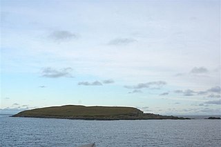
Isbister Holm is a small islet in the Shetland islands of Scotland, situated roughly 2 kilometres (1.2 mi) east off the coast of Isbister, Whalsay. The highest point of the islet is about 65 feet (20 m) and it measures roughly 500 metres (1,600 ft) by 250 metres (820 ft). To the north are the islets of Mooa and Nista. On 12 November 1778 Jufron Ingester was shipwrecked, probably on the holm, the precise location not being certain. It was carrying some 260 tons of skins, tallow and coarse hose from Ireland to Copenhagen. One crew member died and the cargo was not salvaged.

<span class="mw-page-title-main">Nista</span>

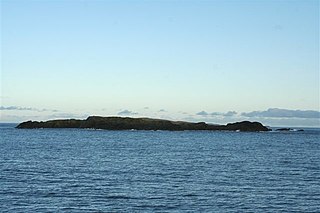
Nista is a small islet of the Shetland Islands of Scotland, situated roughly 2 kilometres (1.2 mi) east off the coast of Whalsay. It lies to the north of Mooa.

<span class="mw-page-title-main">Mooa</span> Small islet of the Shetland Islands of Scotland

Mooa is a small islet of the Shetland Islands of Scotland, situated roughly 2 kilometres (1.2 mi) east off the coast of Whalsay. It lies to the north of Isbister Holm and south of Nista. The highest point of the islet is 63 feet (19 m).

The Inner Holm of Skaw is a small, uninhabited islet off the northern tip of the island of Whalsay, in the Shetland Islands of Scotland, north of the village of Skaw.

The Outer Holm of Skaw is a small, uninhabited islet, a rock outlier off the northeast coast of the island of Whalsay, in the Shetland Islands of Scotland.

The Holm of Skaw is a small islet off the northeast coast of the island of Unst. It is just northeast of the settlement of Skaw. The island is 57 feet (17 m) in height. There is a lighthouse on the island. Tidal currents are slack between Holm of Skaw and Herma Ness at high water, and the passage may be made by small boats. The Skaw Röst, a dangerous tidal race, forms off the shore of the Holm of Skaw and Lamba Ness.

<span class="mw-page-title-main">Skate of Marrister</span>

The Skate of Marrister is a flat ledge that extends about 300 yards (270 m) from the western shore of Whalsay, in the Shetland islands of Scotland. It is slightly more than 1 mile (1.6 km) north-north-west from Symbister Ness off the village of Marrister, in Linga Sound. At low tide the ledge rises 5 feet (1.5 m) above the water. There is a risk that the strong tide in Whalsay Sound will carry a boat onto the Skate. There is a minor light on the Skate with a nominal range of four miles, flashing green every six seconds.

<span class="mw-page-title-main">Rumble, Shetland</span>

Rumble is a skerry in the Shetland islands of Scotland, situated roughly 4 kilometres (2.5 mi) east off the coast of Huxter, southeastern Whalsay. It lies 0.75 miles (1.21 km) to southwest of East Linga. The main island, also known as Rumble Holm, is 27 feet (8.2 m) high. Nearby and to the north are the Flaeshans of Rumble, a series of small islets and stacks and Burlastack of Rumble lies to the east. On the northern side of the main island is an inlet, known as the Voe of Rumble. Lobsters and prawns are said to shelter here. It is also mentioned that a ship named Griften of unknown nationality was shipwrecked either here or on the Holm of Sandwick in 1611.

<span class="mw-page-title-main">Gossabrough</span> Human settlement in Scotland

Gossabrough is a coastal hamlet, wick and ness on the southeast side of the island of Yell, Shetland, Scotland. The Wick of Gossabrough lies between the northern extremity of Gossabrough Ness and the Saddle of Swarister. The hamlet is accessed via the B9081 road. The Loch of Hudon lies just to the southwest.

<span class="mw-page-title-main">Linga Sound, Shetland</span>

Linga Sound is the strait between the islands of Whalsay and West Linga in the Shetland islands of Scotland.

References

  1. Center, United States Defense Mapping Agency Hydrographic (1950). Sailing Directions for the North and East Coasts of Scotland: Cape Wrath to Fife Ness and Including the Orkney, Shetland and Faeroe Islands. U.S. Government Printing Office. p. 332.
  2. Office, United States Hydrographic (1950). Sailing Directions for the North and East Coasts of Scotland: Cape Wrath to Fife Ness and Including the Orkney, Shetland and Faeroe Islands. U.S. Government Printing Office. p. 333.
  3. 1 2 Haswell-Smith, Hamish (2008). The Scottish Islands: The Bestselling Guide to Every Scottish Island. Canongate. p. 11.25. ISBN   978-1-84767-277-3.
  4. 1 2 Haswell-Smith, Hamish (2004). The Scottish Islands: A Comprehensive Guide to Every Scottish Island. Canongate. p. 11.9. ISBN   978-1-84195-454-7.
  5. Sailing Directions (enroute) for Scotland. Defense Mapping Agency, Hydrographic Center. 1976. p. 367.
  6. Uney, Graham (30 April 2016). Walking on the Orkney and Shetland Isles: 80 walks in the northern isles. Cicerone Press Limited. p. 161. ISBN   978-1-78362-336-5.
  7. 1 2 3 Club, Clyde Cruising (25 March 2020). Orkney and Shetland. Imray, Laurie, Norie and Wilson Ltd. p. 74. ISBN   978-1-78679-171-9.
  8. Office, United States Hydrographic (1950). Sailing Directions for the North and East Coasts of Scotland: Cape Wrath to Fife Ness and Including the Orkney, Shetland and Faeroe Islands. U.S. Government Printing Office. p. 330.
  9. United States Hydrographic Office (1915). British Islands Pilot: Faroes, Shetlands, and Orkney Islands and north and east coasts of Scotland. Washington: U.S. Government Printing Office. p. 113.
  10. United States Hydrographic Office (1915). British Islands Pilot: Faroes, Shetlands, and Orkney Islands and north and east coasts of Scotland. Washington: U.S. Government Printing Office. p. 289.
  11. 1 2 3 Center, United States Defense Mapping Agency Hydrographic (1950). Sailing Directions for the North and East Coasts of Scotland: Cape Wrath to Fife Ness and Including the Orkney, Shetland and Faeroe Islands. U.S. Government Printing Office. p. 329.
  12. Office, United States Hydrographic (1950). Sailing Directions for the North and East Coasts of Scotland: Cape Wrath to Fife Ness and Including the Orkney, Shetland and Faeroe Islands. U.S. Government Printing Office. p. 326.
  13. 1 2 3 4 Office, United States Hydrographic (1950). Sailing Directions for the North and East Coasts of Scotland: Cape Wrath to Fife Ness and Including the Orkney, Shetland and Faeroe Islands. U.S. Government Printing Office. p. 328.
  14. Dept, Great Britain Hydrographic (1894). North Sea Pilot (4th ed.). London: J. D. Potter. p. 54.
  15. Office, United States Hydrographic (1962). Publications ... U.S. Government Printing Office. p. 276.
  16. 1 2 Office, United States Hydrographic (1950). Sailing Directions for the North and East Coasts of Scotland: Cape Wrath to Fife Ness and Including the Orkney, Shetland and Faeroe Islands. U.S. Government Printing Office. p. 326.
  17. Office, United States Hydrographic (1950). Sailing Directions for the North and East Coasts of Scotland: Cape Wrath to Fife Ness and Including the Orkney, Shetland and Faeroe Islands. U.S. Government Printing Office. p. 274.
  18. United States Hydrographic Office (1915). British Islands Pilot: Faroes, Shetlands, and Orkney Islands and north and east coasts of Scotland. Vol. VI. Washington: U.S. Government Printing Office. p. 162.
  19. United States Defense Mapping Agency Hydrographic Center (1950). Sailing Directions for the North and East Coasts of Scotland: Cape Wrath to Fife Ness and Including the Orkney, Shetland and Faeroe Islands (3rd ed.). Washington: U.S. Government Printing Office. p. 276.
  20. Office, United States Hydrographic (1950). Sailing Directions for the North and East Coasts of Scotland: Cape Wrath to Fife Ness and Including the Orkney, Shetland and Faeroe Islands. U.S. Government Printing Office. p. 330.
  21. Association, Cruising (20 September 2020). The Cruising Almanac 2021. Imray, Laurie, Norie and Wilson Ltd. p. 138. ISBN   978-1-78679-209-9.
  22. Center, United States Defense Mapping Agency Hydrographic (1950). Sailing Directions for the North and East Coasts of Scotland: Cape Wrath to Fife Ness and Including the Orkney, Shetland and Faeroe Islands. U.S. Government Printing Office. p. 277.
  23. North Sea Pilot: Faeroes, Shetland and Orkneys. Part I. Hydrographic Department, Admiralty. 1876. p. 71.
  24. Dept, Great Britain Hydrographic (1894). North Sea Pilot. J. D. Potter. p. 36.
  25. Office, United States Hydrographic Office (1961). Publications ... U.S. Government Printing Office. p. 306.
  26. United States Hydrographic Office (1950). Sailing Directions for the North and East Coasts of Scotland: Cape Wrath to Fife Ness and Including the Orkney, Shetland and Faeroe Islands (3rd ed.). Washington: U.S. Government Printing Office. p. 327.
  27. Hiscock, Keith (11 January 2022). Exploring Britain's Hidden World: A Natural History of Seabed Habitats. Princeton University Press. p. 181. ISBN   978-0-691-24041-1.
  28. Office, United States Hydrographic (1950). Sailing Directions for the North and East Coasts of Scotland: Cape Wrath to Fife Ness and Including the Orkney, Shetland and Faeroe Islands. U.S. Government Printing Office. p. 279.
  29. Center, United States Defense Mapping Agency Hydrographic (1950). Sailing Directions for the North and East Coasts of Scotland: Cape Wrath to Fife Ness and Including the Orkney, Shetland and Faeroe Islands. U.S. Government Printing Office. p. 318.
  30. Office, United States Hydrographic (1962). Publications ... U.S. Government Printing Office. p. 275.
  31. Center, United States Defense Mapping Agency Hydrographic (1976). Sailing Directions (enroute) for Scotland. Defense Mapping Agency, Hydrographic Center. p. 367.
  32. Office, United States Hydrographic (1950). Sailing Directions for the North and East Coasts of Scotland: Cape Wrath to Fife Ness and Including the Orkney, Shetland and Faeroe Islands. U.S. Government Printing Office. p. 272.
  33. Center, United States Defense Mapping Agency Hydrographic (1950). Sailing Directions for the North and East Coasts of Scotland: Cape Wrath to Fife Ness and Including the Orkney, Shetland and Faeroe Islands. U.S. Government Printing Office. p. 267.
  34. Center, United States Defense Mapping Agency Hydrographic (1950). Sailing Directions for the North and East Coasts of Scotland: Cape Wrath to Fife Ness and Including the Orkney, Shetland and Faeroe Islands. U.S. Government Printing Office. p. 308.
  35. Dept, Great Britain Hydrographic (1894). North Sea Pilot. J. D. Potter. p. 101.
  36. "West Voe". Visit Scotland. Retrieved 21 May 2016.
  37. Uney, Graham (30 April 2016). Walking on the Orkney and Shetland Isles: 80 walks in the northern isles. Cicerone Press Limited. p. 214. ISBN   978-1-78362-336-5.
  38. Uney, Graham (30 April 2016). Walking on the Orkney and Shetland Isles: 80 walks in the northern isles. Cicerone Press Limited. p. 193. ISBN   978-1-78362-336-5.
  39. 1 2 Pedersen, Anne; Sindbæk, Søren M. (25 September 2020). Viking encounters: Proceedings of the Eighteenth Viking Congress. Aarhus Universitetsforlag. p. 339. ISBN   978-87-7184-936-3.
  40. Office, United States Hydrographic (1915). British Islands Pilot: Faroes, Shetlands, and Orkney Islands and north and east coasts of Scotland. U.S. Government Printing Office. p. 89.
  41. Dept, Great Britain Hydrographic (1894). North Sea Pilot (4th ed.). London: J. D. Potter. p. 69.
  42. Club, Clyde Cruising (25 March 2020). Orkney and Shetland. Imray, Laurie, Norie and Wilson Ltd. p. 134. ISBN   978-1-78679-171-9.
  43. Center, United States Defense Mapping Agency Hydrographic (1950). Sailing Directions for the North and East Coasts of Scotland: Cape Wrath to Fife Ness and Including the Orkney, Shetland and Faeroe Islands. U.S. Government Printing Office. p. 339.
  44. O'Dell, Andrew Charles (1939). The Historical Geography of the Shetland Islands. Manson. p. 27.
  45. Lelong, Olivia (31 March 2019). Excavations at Milla Skerra Sandwick, Unst: Rythmns of Life in Iron Age Shetland. Oxford: Oxbow Books. p. 130. ISBN   978-1-78570-346-1.
  46. Office, United States Hydrographic (1950). Sailing Directions for the North and East Coasts of Scotland: Cape Wrath to Fife Ness and Including the Orkney, Shetland and Faeroe Islands. U.S. Government Printing Office. p. 345.
  47. United States Hydrographic Office (1915). British Islands Pilot: Faroes, Shetlands, and Orkney Islands and north and east coasts of Scotland. Vol. VI. Washington: U.S. Government Printing Office. p. 100.
  48. Uney, Graham (12 July 2022). Walking on the Orkney and Shetland Isles: 80 walks in the northern isles. Cicerone Press Limited. p. 163. ISBN   978-1-78362-336-5.
  49. United States Hydrographic Office (1950). Sailing Directions for the North and East Coasts of Scotland: Cape Wrath to Fife Ness and Including the Orkney, Shetland and Faeroe Islands. U.S. Government Printing Office. p. 335.
  50. United States Hydrographic Office (1950). Sailing Directions for the North and East Coasts of Scotland: Cape Wrath to Fife Ness and Including the Orkney, Shetland and Faeroe Islands. U.S. Government Printing Office. p. 421.
  51. Office, United States Hydrographic (1950). Sailing Directions for the North and East Coasts of Scotland: Cape Wrath to Fife Ness and Including the Orkney, Shetland and Faeroe Islands. U.S. Government Printing Office. p. 322.
  52. Great Britain Hydrographic Dept (1894). North Sea Pilot. Vol. 1 (4th ed.). J. D. Potter. p. 64.
  53. Club, Clyde Cruising (25 March 2020). Orkney and Shetland. Imray, Laurie, Norie and Wilson Ltd. p. 148. ISBN   978-1-78679-171-9.
  54. Gittings, Bruce; Munro, David. "Otters Wick". The Gazetteer for Scotland. School of GeoSciences, University of Edinburgh and The Royal Scottish Geographical Society. Retrieved 5 April 2023.
  55. United States Hydrographic Office (1950). Sailing Directions for the North and East Coasts of Scotland: Cape Wrath to Fife Ness and Including the Orkney, Shetland and Faeroe Islands (3rd ed.). U.S. Government Printing Office. p. 340.
  56. Club, Clyde Cruising (25 March 2020). Orkney and Shetland. Imray, Laurie, Norie and Wilson Ltd. p. 150. ISBN   978-1-78679-171-9.
  57. Great Britain Hydrographic Dept (1894). North Sea Pilot. J. D. Potter. p. 58.
  58. United States Defense Mapping Agency Hydrographic Center (1950). Sailing Directions for the North and East Coasts of Scotland: Cape Wrath to Fife Ness and Including the Orkney, Shetland and Faeroe Islands. U.S. Government Printing Office. p. 339.