List of local nature reserves in East Sussex

Last updated

Hempstead Meadow Hempstead Meadow (1).jpg
Hempstead Meadow

Local Nature Reserves (LNRs) are designated by local authorities under the National Parks and Access to the Countryside Act 1949. The local authority must have a legal control over the site, by owning or leasing it or having an agreement with the owner. LNRs are sites which have a special local interest either biologically or geologically, and local authorities have a duty to care for them. They can apply local byelaws to manage and protect LNRs. [1] [2]

Contents

East Sussex is a county in South East England. It is bordered by Kent to the north-east, West Sussex to the west, Surrey to the north and the English Channel to the south. [3] It has an area of 1,725 km2 (666.0 sq mi) [4] and a population as of 2018 of 552,000. [5]

As of July 2019, there are 26 LNRs in East Sussex. [6] Ten sites are Sites of Special Scientific Interest, three are Special Protection Areas, three are Special Areas of Conservation, one is a Ramsar site, two are Scheduled Monuments, two are Geological Conservation Review sites, one is a Nature Conservation Review site and six are managed by the Sussex Wildlife Trust.

Map all coordinates using: OpenStreetMap  
Download coordinates as: KML

Key

Other classifications

Sites

SitePhotographArea [lower-alpha 1] Location [lower-alpha 2] BoroughOther classificationsMap [lower-alpha 3] Details [lower-alpha 4] Description
Arlington Reservoir Arlington Reservoir.jpg 100.6 hectares
(249 acres)
Polegate
50°50′42″N0°10′44″E / 50.845°N 0.179°E / 50.845; 0.179 (Arlington Reservoir)
TQ 535 073
Wealden SSSI [8] Map Details More than 10,000 birds winter on this site, including over 1% of the UK population of wigeon. In addition, more than 170 species of birds on passage have been recorded. The River Cuckmere runs through the reservoir and there are areas of tall fen and exposed shingle. [9]
Beacon Hill A lonely windmill - panoramio.jpg 18.6 hectares
(46 acres)
Brighton
50°48′32″N0°03′54″W / 50.809°N 0.065°W / 50.809; -0.065 (Beacon Hill)
TQ 364 028
Brighton and Hove Map Details This chalk grassland site has extensive views out to sea and inland. Flora include round-headed rampion and several species of orchid, while there are birds such as skylarks. [10] Rottingdean Windmill is a grade II listed building towards the south of the site. [11]
Benfield Hill Benfield Hill - geograph.org.uk - 1656357.jpg 11.8 hectares
(29 acres)
Hove
50°51′18″N0°12′36″W / 50.855°N 0.210°W / 50.855; -0.210 (Benfield Hill)
TQ 261 077
Brighton and Hove Map Details

This area of grassland and scrub is on south and east facing slopes. There are many glow-worms. [12]

Bevendean Down Bevendean Down (Local Nature Reserve), Bevendean (May 2020) (3).JPG 64.6 hectares
(160 acres)
Brighton
50°50′35″N0°06′07″W / 50.843°N 0.102°W / 50.843; -0.102 (Bevendean Down)
TQ 337 066
Brighton and Hove Map Details This site is in five separate blocks. It is mainly chalk grassland and there are also areas of woodland and scrub. There is a dew pond, a variety of orchids and insects such as the Adonis blue butterfly and hornet robberfly. [13]
Castle Hill, Newhaven Newhaven from Castle Hill - geograph.org.uk - 576998.jpg 16.4 hectares
(41 acres)
Newhaven
50°46′55″N0°02′53″E / 50.782°N 0.048°E / 50.782; 0.048 (Castle Hill, Newhaven)
TQ 445 001
Lewes GCR, [14] SSSI [15] Map Details The hill has views to the sea to the south, the Downs to the north and Newhaven to the east. Habitats are geologically important cliffs, scrub and grassy glades. There are several badger setts and other fauna include sea birds, slow worms and common lizards. [16]
Chailey Common Chailey Common - geograph.org.uk - 1391050.jpg 173.3 hectares
(428 acres)
Lewes
50°58′23″N0°01′44″W / 50.973°N 0.029°W / 50.973; -0.029 (Chailey Common)
TQ 385 211
Lewes SSSI [17] Map Details This common on Ashdown Sands has areas of acidic grassland, marshy grassland, bracken, wet heath, dry heath, a stream, ditches and ponds. Butterfly species include the silver-studded blue, grayling, pearl-bordered fritillary, high brown fritillary, green hairstreak and small pearl-bordered fritillary. [18]
Church Wood and Robsack Wood Church-in-the-Wood, Hollington, Hastings (Churchyard).jpg 29.7 hectares
(73 acres)
St Leonards-on-Sea
50°52′19″N0°32′02″E / 50.872°N 0.534°E / 50.872; 0.534 (Church Wood and Robsack Wood)
TQ 784 111
Hastings Map Details This site in four separate areas has semi-natural woodland, semi-improved grassland and streams. Woodland flora include toothwort, goldilocks buttercup and early purple orchid. [19]
Crowborough Country Park Crowborough Country Park (10).jpg 7.3 hectares
(18 acres)
Crowborough
51°02′53″N0°10′48″E / 51.048°N 0.180°E / 51.048; 0.180 (Crowborough Country Park)
TQ 529 299
Wealden Map Details The park has diverse habitats including wet and dry woodland, grass and heath glades, marshes, streams and ponds. The main stream runs through a steep rocky gorge. Flora include the nationally rare moss Discelium nudum . [20]
Filsham Reed Beds Nature Reserve Nr Bulverhythe East Sussex - geograph.org.uk - 167871.jpg 18.5 hectares
(46 acres)
St Leonards-on-Sea
50°51′36″N0°31′26″E / 50.860°N 0.524°E / 50.860; 0.524 (Filsham Reed Beds)
TQ 777 097
Hastings SSSI, [21] SWT [22] Map Details This is one of the largest reedbeds in the county and it also has areas of grazing marsh, swamp and ancient woodland. There is a wide variety of plants and over 1000 species of invertebrates have been recorded. The bird life is important and diverse, with species such as Cetti's warbler, reed bunting, sedge warbler, purple heron, red-backed shrike and water rail. [23]
Hastings Country Park and Fairlight Place Farm Hastings countrypark 2.JPG 331.6 hectares
(819 acres)
Hastings
50°52′05″N0°37′34″E / 50.868°N 0.626°E / 50.868; 0.626 (Hastings Country Park and Fairlight Place Farm)
TQ 849 109
Hastings GCR, [24] [25] SAC, [26] SPA, [27] SSSI [28] Map Details The park has views of Hastings old town and of the cliffs towards Beachy Head. Dinosaur footprints can be seen in intertidal rocks and there are many fossils. Habitats include cliff top grassland, arable land, cliffs, heath and woodland, which has rare liverworts and mosses. [29]
Hempstead Meadow Hempstead Meadow (6).jpg 1.6 hectares
(4.0 acres)
Uckfield
50°58′08″N0°05′56″E / 50.969°N 0.099°E / 50.969; 0.099 (Hempstead Meadow)
TQ 475 210
Wealden Map Details The site is mainly wet grassland with scattered trees and scrub. Flora include primroses, tussock sedge and various ferns. The meadow is used as a foraging area by bats. [30]
Ladies Mile Communications mast, Patcham - geograph.org.uk - 62978.jpg 13.6 hectares
(34 acres)
Brighton
50°52′05″N0°07′48″W / 50.868°N 0.130°W / 50.868; -0.130 (Ladies Mile)
TQ 317 093
Brighton and Hove Map Details This grassland site has extensive areas of horseshoe vetch and kidney vetch. There are also areas of scrub and a wood at the southern end. [31]
Marline Wood Path in Marline Wood - geograph.org.uk - 419833.jpg 40.3 hectares
(100 acres)
St Leonards-on-Sea
50°52′44″N0°31′34″E / 50.879°N 0.526°E / 50.879; 0.526 (Marline Wood)
TQ 778 119
Hastings SSSI, [32] SWT [33] Map Details This site has ancient woodland and species-rich unimproved grassland. The wood has standards of pedunculate oak and coppice of hornbeam, hazel and sweet chestnut. A stream runs along a steep sided valley which has 61 species of mosses and liverworts, including uncommon species such as Fissidens rivularis , Tetrodontium brownianum and Metzgeria furcata . [34]
Old Lodge The Old Lodge, Ashdown Forest - geograph.org.uk - 6238.jpg 103.1 hectares
(255 acres)
Uckfield
51°03′18″N0°05′06″E / 51.055°N 0.085°E / 51.055; 0.085 (Old Lodge, Nutley)
TQ 462 305
Wealden NCR, [35] SAC, [36] SPA, [37] SSSI, [38] SWT [39] Map Details This highland site is mainly grassland and heather, with areas of gorse and scattered birch and oak trees. There are also small Scots pine plantations. Birds include common redstart and common crossbills and there are large nests of red wood ants. [39]
Old Roar Gill and Coronation Wood Coronation Wood - geograph.org.uk - 1743496.jpg 7.6 hectares
(19 acres)
Hastings
50°52′30″N0°33′47″E / 50.875°N 0.563°E / 50.875; 0.563 (Old Roar Gill and Coronation Wood)
TQ 804 115
Hastings Map Details This site has areas of open water, broadleaved woodland, fern and tall herbs. Old Roar Gill is a narrow steep-sided valley at the northern end of Alexandra Park. It has uncommon liverworts, mosses and lichens, together with rare and scarce invertebrates such as Rolph's door snail and the crane fly Lipsothrix nervosa . [40] [41]
Railway Land, Lewes Cliffe Cut.jpg 10.9 hectares
(27 acres)
Lewes
50°52′16″N0°01′05″E / 50.871°N 0.018°E / 50.871; 0.018 (Railway Land, Lewes)
TQ 421 099
Lewes Map Details This former railway goods yard has diverse habitats including grassland, wet willow woodland, floodplain grazing meadows, reedbeds, a network of drainage ditches and a tidal winterbourne stream. Birds include woodpeckers, kestrels and kingfishers. [42]
Rye Harbour Former Rye Harbour Branch Line - geograph.org.uk - 361182.jpg 325.4 hectares
(804 acres)
Rye
50°55′55″N0°44′35″E / 50.932°N 0.743°E / 50.932; 0.743 (Rye Harbour)
TQ 928 183
Rother Ramsar, [43] SAC, [44] SPA, [27] SSSI, [45] SWT [46] Map Details This large reserve has diverse coastal habitats, including saltmarsh, shingle, reedbeds, saline lagoons, grazing marsh and flooded gravel pits. [46] More than 280 species of birds have been recorded, of which 90 breed on the site. There are more than 450 flowering plant species, including twenty-seven which are scarce and two which are endangered, least lettuce and stinking hawksbeard. [47]
Seaford Head Cuckmere Haven from Cliff End - geograph.org.uk - 116544.jpg 150.2 hectares
(371 acres)
Seaford
50°45′47″N0°08′17″E / 50.763°N 0.138°E / 50.763; 0.138 (Seaford Head)
TV 509 981
Lewes SSSI, [48] SWT [49] Map Details The site has diverse habitats with chalk grassland, chalk cliffs, scrub, vegetated shingle, wet grassland, saltmarsh and rockpools. Grassland flora include kidney vetch, squinancywort, moon carrot and clustered bellflower. There are butterflies such as silver-spotted skipper, chalkhill blue and adonis blue. [50]
St Helen's Wood St Helen's Park or Woods - geograph.org.uk - 1358821.jpg 34.6 hectares
(85 acres)
Hastings
50°52′41″N0°34′37″E / 50.878°N 0.577°E / 50.878; 0.577 (St Helen's Wood)
TQ 814 119
Hastings Map Details The wood has many broad-leaved helleborines. There are also areas of grassland which are managed by horse grazing. Meadow flowers include red bartsia and green-winged orchids. [51]
Stanmer Park/Coldean Great Wood, Stanmer Park - geograph.org.uk - 596434.jpg 187.9 hectares
(464 acres)
Brighton
50°52′05″N0°06′14″W / 50.868°N 0.104°W / 50.868; -0.104 (Stanmer Park/Coldean)
TQ 335 093
Brighton and Hove Map Details This is an eighteenth century landscaped park. It has mature woodland with ancient beech trees and bluebells, coppiced woodland, chalk grassland and an arboretum. [52]
Summerfields Wood Red Campion (Silene dioica)2.jpg 6.3 hectares
(16 acres)
Hastings
50°51′32″N0°34′08″E / 50.859°N 0.569°E / 50.859; 0.569 (Summerfields Wood)
TQ 809 097
Hastings Map Details There are many paths through this semi-natural wood, which has a number of ponds. Birds include firecrest, whinchat, ring ouzel, wood warbler, spotted flycatcher and pied flycatcher. [53]
Weir Wood Reservoir Weir Wood Reservoir - geograph.org.uk - 625002.jpg 32.6 hectares
(81 acres)
East Grinstead
51°05′31″N0°01′41″W / 51.092°N 0.028°W / 51.092; -0.028 (Weirwood Reservoir)
TQ 382 344
Wealden SSSI [54] Map Details This is one of the largest bodies of open water in the county and it has rich and diverse communities of breeding, wintering and passage birds. Breeding birds include great crested grebe, teal, mute swan, tufted duck, little grebe, reed warbler, sedge warbler, coot and moorhen. [55]
West Park, Uckfield West Park, Uckfield (6).jpg 10.5 hectares
(26 acres)
Uckfield
50°58′23″N0°04′52″E / 50.973°N 0.081°E / 50.973; 0.081 (West Park, Uckfield)
TQ 462 214
Wealden Map Details This site has grassland, woodland and a marshy area which provides a habitat for several orchid species, including the southern marsh orchid. There is also a population of dormice. [56]
Whitehawk Hill Whitehawk Camp, Brighton (with the Grandstand behind) - geograph.org.uk - 52046.jpg 50.3 hectares
(124 acres)
Brighton
50°49′41″N0°06′36″W / 50.828°N 0.110°W / 50.828; -0.110 (Whitehawk Hill)
TQ 332 049
Brighton and Hove SM [57] Map Details This is species-rich chalk grassland which has views over Brighton and the sea, together with the Isle of Wight on clear days. There are colonies of chalkhill blue butterflies. [58]
Wild Park/Hollingbury Hollingbury Castle Triangulation Pillar - geograph.org.uk - 840731.jpg 239.8 hectares
(593 acres)
Brighton
50°51′18″N0°07′19″W / 50.855°N 0.122°W / 50.855; -0.122 (Wild Park/Hollingbury)
TQ 323 079
Brighton and Hove SM [59] Map Details The park has views over Brighton. Species-rich chalk grassland is managed by sheep grazing. There is also extensive woodland with a network of footpaths, large areas of scrub, an Iron Age hillfort, a golf course and a dew pond. [60]
Withdean and Westdene Woods Steps in Withdean Stadium Woods (geograph 3822887).jpg 7.9 hectares
(20 acres)
Brighton
50°51′14″N0°09′36″W / 50.854°N 0.160°W / 50.854; -0.160 (Withdean and Westdene Woods)
TQ 296 077
Brighton and Hove SWT [61] Map Details Many of the mature trees on this site were destroyed by the Great Storm of 1987, but it still has a range of mammals including foxes, badgers and common pipistrelle bats, while there are birds such as great spotted woodpecker and firecrests. [61]

See also

Notes

  1. The area is taken from the Natural England map of each site. (Click on the identify icon (i) in the "Feature Tools" and then click on the site.)
  2. The location is taken from the Natural England details page for the site.
  3. The maps are on the Natural England database of Local Nature Reserves.
  4. Details are on the pages on each site in the Natural England database of Local Nature Reserves. [7]

Related Research Articles

<span class="mw-page-title-main">Norfolk Wildlife Trust</span>

The Norfolk Wildlife Trust (NWT) is one of 46 wildlife trusts covering Great Britain, Northern Ireland, Isle of Man and Alderney. Founded in 1926, it is the oldest of all the trusts. It has over 35,500 members and eight local groups and it manages more than fifty nature reserves and other protected sites. It also gives conservation advice to individuals and organisations, provides educational services to young people on field trips and organises entertainment and information events at nature reserves. The NWT reserves include twenty-six Sites of Special Scientific Interests, nine national nature reserves, twelve Nature Conservation Review sites, sixteen Special Areas of Conservation, twelve Special Protection Areas, eleven Ramsar sites, two local nature reserves, four Geological Conservation Review sites and five which are in Areas of Outstanding Natural Beauty.

<span class="mw-page-title-main">Kent Wildlife Trust</span> Conservation charity in the UK

Kent Wildlife Trust (KWT) is a conservation charity in the United Kingdom that was founded in 1958, previously known as the Kent Trust for Nature Conservation. It aims to "work with people to restore, save and improve our natural spaces" and to "ensure that 30% of Kent and Medway – land and sea – is managed to create a healthy place for wildlife to flourish". In 2016 it had thirty-one thousand members and an annual income of £4 million. KWT manages over sixty-five nature reserves, of which twenty-four are Sites of Special Scientific Interest, two are national nature reserves, nine are Nature Conservation Review sites, seven are Special Areas of Conservation, three are Special Protection Areas, seven are local nature reserves, one is a Geological Conservation Review site, thirteen are in Areas of Outstanding Natural Beauty and one is a scheduled monument.

<span class="mw-page-title-main">Leicestershire and Rutland Wildlife Trust</span>

The Leicestershire and Rutland Wildlife Trust (LRWT) is one of 46 wildlife trusts across the United Kingdom. It manages nature reserves in Leicestershire and Rutland, and was founded in 1956 as the Leicestershire and Rutland Trust for Nature Conservation. As of January 2018, it has over 16,000 members, a staff of about 25 and more than 500 volunteers. It is based in Leicester, and is managed by a Council of Trustees which is elected by the members. It is a charity which covers all aspects of nature conservation, and works to protect wild places and wildlife.

<span class="mw-page-title-main">Suffolk Wildlife Trust</span>

Suffolk Wildlife Trust (SWT) describes itself as the county's "nature charity – the only organisation dedicated wholly to safeguarding Suffolk's wildlife and countryside." It is a registered charity, and its headquarters is at Brooke House in Ashbocking, near Ipswich. It was founded in 1961, and is one of 46 wildlife trusts covering the Great Britain and Northern Ireland. As of March 2017, it has 13,200 members, and it manages 3,120 hectares of land in 60 nature reserves, most of which are open to the public. It had an income of £3.9 million in the year to 31 March 2017.

<span class="mw-page-title-main">Surrey Wildlife Trust</span>

Surrey Wildlife Trust (SWT) was founded in 1959 as Surrey Naturalists' Trust and it is one of forty-six wildlife trusts covering Great Britain, Northern Ireland, Isle of Man and Alderney. SWT carries out conservation activities on a considerable area of Surrey County Council's large countryside estate and also manages land on behalf of the Ministry of Defence estate. As of 2022 the SWT manages more than 6,000 hectares of land for wildlife and employs more than 100 staff. It had an income of £5.1 million and expenditure of £5.7 million.

<span class="mw-page-title-main">Sussex Wildlife Trust</span> Conservation charity which aims to protect natural life

The Sussex Wildlife Trust (SWT) is a conservation charity which aims to protect natural life in Sussex. It was founded in 1961 and is one of 46 wildlife trusts across the UK and the Isle of Man and Alderney. As of 2019, it has 33,000 members and manages 2,000 hectares of land for nature. It is a registered charity and in the year to 31 March 2019 it had an income of £5.7 million and expenditure of £4 million, resulting in net income of £1.7 million.

<span class="mw-page-title-main">Berkshire, Buckinghamshire and Oxfordshire Wildlife Trust</span> Wildlife conservation charity

The Berkshire, Buckinghamshire and Oxfordshire Wildlife Trust (BBOWT), is a wildlife trust covering the counties of Berkshire, Buckinghamshire and Oxfordshire in England.

<span class="mw-page-title-main">Old Lodge</span>

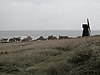
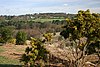
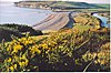
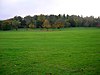
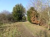
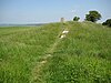
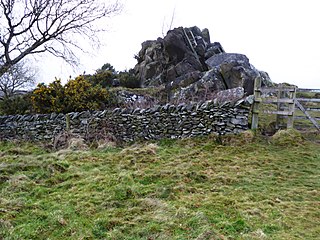
Old Lodge is a 103.1-hectare (255-acre) Local Nature Reserve west of Crowborough in East Sussex. It is privately owned. It is managed by Sussex Wildlife Trust. It is part of Ashdown Forest, which is a Nature Conservation Review site, Grade I, a Special Area of Conservation, a Special Protection Area and a Site of Special Scientific Interest.

References

  1. "Protected or designated areas". Department for Environment, Food & Rural Affairs and Natural England. 9 April 2013. Archived from the original on 4 May 2015. Retrieved 29 July 2015.
  2. "Local nature reserves: setting up and management". Department for Environment, Food & Rural Affairs and Natural England. 2 October 2014. Archived from the original on 4 July 2015. Retrieved 29 July 2015.
  3. "Map of East Sussex" (PDF). East Sussex County Council. Archived from the original (PDF) on 12 October 2007. Retrieved 6 April 2008.
  4. "Focus on East Sussex" (PDF). East Sussex County Council. 2012. p. 3. Archived (PDF) from the original on 28 March 2016. Retrieved 26 May 2019.
  5. "State of the County 2018 – Focus on East Sussex" (PDF). East Sussex County Council. Retrieved 26 May 2019.
  6. "Designated Sites View: East Sussex". Local Nature Reserves. Natural England. Archived from the original on 20 December 2018. Retrieved 3 July 2019.
  7. "Local Nature Reserves: Search results for East Sussex". Natural England. Archived from the original on 22 May 2018. Retrieved 31 October 2018.
  8. "Designated Sites View: Arlington Reservoir". Sites of Special Scientific Interest. Natural England. Retrieved 10 January 2019.
  9. "Arlington Reservoir citation" (PDF). Sites of Special Scientific Interest. Natural England. Archived (PDF) from the original on 20 December 2018. Retrieved 4 January 2019.
  10. "Beacon Hill". Local Nature Reserves. Natural England. Archived from the original on 20 December 2018. Retrieved 3 February 2019.
  11. "Rottingdean Windmill at NGR 365 024". Historic England. Archived from the original on 4 February 2019. Retrieved 3 February 2019.
  12. "Benfield Hill". Local Nature Reserves. Natural England. Archived from the original on 20 December 2018. Retrieved 3 February 2019.
  13. "Bevendean Down". Local Nature Reserves. Natural England. Archived from the original on 20 December 2018. Retrieved 6 February 2019.
  14. "Newhaven to Brighton (Cenomanian, Turonian, Senonian, Maastrichtian)". Geological Conservation Review. Joint Nature Conservation Committee. Archived from the original on 27 February 2019. Retrieved 26 February 2019.
  15. "Designated Sites View: Brighton to Newhaven Cliffs". Sites of Special Scientific Interest. Natural England. Archived from the original on 9 February 2019. Retrieved 10 January 2019.
  16. "Castle Hill, Newhaven". Local Nature Reserves. Natural England. Archived from the original on 20 December 2018. Retrieved 9 February 2019.
  17. "Designated Sites View: Chailey Common". Sites of Special Scientific Interest. Natural England. Retrieved 10 January 2019.
  18. "Chailey Common citation" (PDF). Sites of Special Scientific Interest. Natural England. Archived (PDF) from the original on 20 December 2018. Retrieved 11 January 2019.
  19. "Church Wood and Robsack Wood". Local Nature Reserves. Natural England. Archived from the original on 20 December 2018. Retrieved 9 February 2019.
  20. "Crowborough Country Park". Local Nature Reserves. Natural England. Archived from the original on 20 December 2018. Retrieved 23 January 2019.
  21. "Designated Sites View: Combe Haven". Sites of Special Scientific Interest. Natural England. Archived from the original on 12 February 2019. Retrieved 10 January 2019.
  22. "Filsham Reedbed". Sussex Wildlife Trust. Archived from the original on 21 December 2018. Retrieved 10 January 2019.
  23. "Filsham Reedbed Reserve Profile". Sussex Wildlife Trust. Retrieved 21 May 2019.
  24. "Fairlight (Wealden)". Geological Conservation Review. Joint Nature Conservation Committee. Archived from the original on 10 January 2019. Retrieved 15 January 2019.
  25. "Covehurst (Mesozoic Palaeobotany)". Geological Conservation Review. Joint Nature Conservation Committee. Archived from the original on 10 January 2019. Retrieved 15 January 2019.
  26. "Designated Sites View: Hastings Cliffs". Special Areas of Conservation. Natural England. Retrieved 10 January 2019.
  27. 1 2 "Designated Sites View: Dungeness, Romney Marsh and Rye Bay". Special Protection Area. Natural England. Archived from the original on 18 February 2019. Retrieved 16 January 2018.
  28. "Designated Sites View: Hastings Cliffs to Pett Beach". Sites of Special Scientific Interest. Natural England. Retrieved 10 January 2019.
  29. "Hastings Country Park and Fairlight Place Farm". Local Nature Reserves. Natural England. Archived from the original on 20 December 2018. Retrieved 11 February 2019.
  30. "Hempstead Meadow". Local Nature Reserves. Natural England. Archived from the original on 5 April 2019. Retrieved 25 February 2019.
  31. "Ladies Mile". Local Nature Reserves. Natural England. Archived from the original on 5 April 2019. Retrieved 13 February 2019.
  32. "Designated Sites View: Marline Valley Woods". Sites of Special Scientific Interest. Natural England. Retrieved 10 January 2019.
  33. "Marline Valley". Sussex Wildlife Trust. Archived from the original on 21 December 2018. Retrieved 10 January 2019.
  34. "Marline Valley Woods citation" (PDF). Sites of Special Scientific Interest. Natural England. Archived (PDF) from the original on 19 December 2018. Retrieved 17 January 2019.
  35. Ratcliffe, p. 115
  36. "Designated Sites View: Ashdown Forest". Special Areas of Conservation. Natural England. Archived from the original on 14 February 2019. Retrieved 10 January 2019.
  37. "Designated Sites View: Ashdown Forest". Special Protection Areas. Natural England. Archived from the original on 14 February 2019. Retrieved 10 January 2019.
  38. "Designated Sites View: Ashdown Forest". Sites of Special Scientific Interest. Natural England. Archived from the original on 14 February 2019. Retrieved 10 January 2019.
  39. 1 2 "Old Lodge". Sussex Wildlife Trust. Archived from the original on 21 December 2018. Retrieved 10 January 2019.
  40. "Old Roar Gill and Coronation Wood". Local Nature Reserves. Natural England. Archived from the original on 5 April 2019. Retrieved 14 February 2019.
  41. "Old Roar Gill & Coronation Wood Local Nature Reserve". Hastings Borough Council. Archived from the original on 15 February 2019. Retrieved 14 February 2019.
  42. "Railway Land, Lewes". Local Nature Reserves. Natural England. Archived from the original on 5 April 2019. Retrieved 17 February 2019.
  43. "Designated Sites View: Dungeness, Romney Marsh and Rye Bay". Ramsar Site. Natural England. Archived from the original on 16 July 2018. Retrieved 16 January 2018.
  44. "Designated Sites View: Dungeness". Special Area of Conservation. Natural England. Archived from the original on 18 February 2019. Retrieved 16 January 2018.
  45. "Designated Sites View: Dungeness, Romney Marsh and Rye Bay". Sites of Special Scientific Interest. Natural England. Archived from the original on 18 February 2019. Retrieved 10 January 2019.
  46. 1 2 "Rye Harbour". Sussex Wildlife Trust. Archived from the original on 21 December 2018. Retrieved 10 January 2019.
  47. "What you might see". Sussex Wildlife Trust. Archived from the original on 18 February 2019. Retrieved 17 February 2019.
  48. "Designated Sites View: Seaford to Beachy Head". Sites of Special Scientific Interest. Natural England. Archived from the original on 20 February 2019. Retrieved 10 January 2019.
  49. "Seaford Head". Sussex Wildlife Trust. Archived from the original on 21 December 2018. Retrieved 10 January 2019.
  50. "Seaford Head Local Nature Reserve Guide" (PDF). Sussex Wildlife Trust. Archived (PDF) from the original on 20 February 2019. Retrieved 19 February 2019.
  51. "St Helen's Wood". Local Nature Reserves. Natural England. Archived from the original on 5 April 2019. Retrieved 20 February 2019.
  52. "Stanmer Park/Coldean". Local Nature Reserves. Natural England. Archived from the original on 5 April 2019. Retrieved 21 February 2019.
  53. "Summerfields Wood Local Nature Reserve". Hastings Borough Council. Archived from the original on 23 February 2019. Retrieved 22 February 2019.
  54. "Designated Sites View: Weir Wood Reservoir". Sites of Special Scientific Interest. Natural England. Retrieved 12 December 2018.
  55. "Weir Wood Reservoir citation" (PDF). Sites of Special Scientific Interest. Natural England. Archived (PDF) from the original on 19 December 2018. Retrieved 25 January 2019.
  56. "West Park, Uckfield". Local Nature Reserves. Natural England. Archived from the original on 5 April 2019. Retrieved 25 February 2019.
  57. "Whitehawk Camp Causewayed Enclosure". Historic England. Archived from the original on 23 February 2019. Retrieved 22 February 2019.
  58. "Whitehawk Hill". Local Nature Reserves. Natural England. Archived from the original on 5 April 2019. Retrieved 22 February 2019.
  59. "Hillfort, the possible remains of a Romano-Celtic temple and a group of three bowl barrows at Hollingbury". Historic England. Archived from the original on 26 February 2019. Retrieved 25 February 2019.
  60. "Wild Park". Brighton and Hove City Council. Archived from the original on 1 April 2019. Retrieved 25 February 2019.
  61. 1 2 "Withdean Woods". Sussex Wildlife Trust. Archived from the original on 21 December 2018. Retrieved 10 January 2019.

Sources

Coordinates: 50°55′N0°20′E / 50.917°N 0.333°E / 50.917; 0.333