List of local nature reserves in Kent

Last updated

South Bank of the Swale Cleve Marshes foreshore. - geograph.org.uk - 1614125.jpg
South Bank of the Swale

Kent is a county in the south-eastern corner of England. It is bounded to the north by Greater London and the Thames Estuary, to the west by Sussex and Surrey, and to the south and east by the English Channel and the North Sea. The county town is Maidstone. [1] It is governed by Kent County Council, with twelve district councils, Ashford, Canterbury, Dartford, Dover, Folkestone and Hythe, Gravesham, Maidstone, Thanet, Tonbridge and Malling and Tunbridge Wells. Medway is a separate unitary authority. [2] [3] The chalk hills of the North Downs run from east to west through the county, with the wooded Weald to the south. The coastline is alternately flat and cliff-lined. [1]

Contents

Local nature reserves are designated by local authorities under the National Parks and Access to the Countryside Act 1949. The local authority must have legal control over the site, by owning or leasing it or having an agreement with the owner. Local nature reserves are sites which have a special local interest either biologically or geologically. Local authorities have a duty to care for them and can apply local bye-laws to manage and protect them. [4] [5]

As of May 2018, there are 42 local nature reserves in the county. [6] Thirteen are Sites of Special Scientific Interest, five are Ramsar internationally important wetland sites, three are Nature Conservation Review sites, five are Special Protection Areas under the European Union Directive on the Conservation of Wild Birds, two are Special Areas of Conservation, one is a Geological Conservation Review site, one includes a scheduled monument, one is a national nature reserve, five are managed by the Kent Wildlife Trust and one is owned by Plantlife.

Key

Other classifications

Sites

SitePhotographArea [lower-alpha 1] Location [lower-alpha 2] BoroughOther classificationsMap [lower-alpha 3] Details [lower-alpha 4] Description
Ambley Wood Footpath junction near West Hoath Wood - geograph.org.uk - 1505593.jpg 14.0 hectares
(35 acres)
Gillingham
51°21′40″N0°34′23″E / 51.361°N 0.573°E / 51.361; 0.573 (Ambley Wood)
TQ 792 656
Medway Map Details The site has ancient woodland with typical woodland flora. [7]
Ashford Community Woodland Ashford Community Woodland 2.jpg 13.8 hectares
(34 acres)
Ashford
51°08′10″N0°50′02″E / 51.136°N 0.834°E / 51.136; 0.834 (Ashford Community Woodland)
TQ 984 412
Ashford Map Details

Most of this broadleaf wood was planted in 1985, and there is also rough grassland and scrub. Birds include the endangered skylark and yellowhammer and there butterflies such as marbled whites and small skippers. [8]

Ashford Green Corridors The River Stour near Victoria Park - geograph.org.uk - 1279115.jpg 47.4 hectares
(117 acres)
Ashford
51°08′28″N0°52′30″E / 51.141°N 0.875°E / 51.141; 0.875 (Ashford Green Corridors)
TR 012 419
Ashford Map Details This site has a lake, ponds, pollarded trees, a meadow and parkland. Birds on Singleton Lake include kingfishers. [9]
Barnett's Wood Entrance to Barnett's Wood Nature Reserve off Blackthorn Avenue - geograph.org.uk - 1366722.jpg 12.4 hectares
(31 acres)
Tunbridge Wells
51°09′29″N0°16′41″E / 51.158°N 0.278°E / 51.158; 0.278 (Barnett's Wood)
TQ 594 423
Tunbridge Wells Map Details This site has ancient, semi-natural woodland and unimproved grassland. The meadows are grazed by cattle, and wildflowers include bird's-foot trefoil, common spotted orchid, cuckooflower, sneezewort, oxeye daisy and common knapweed. [10]
Baty's Marsh Entrance to Baty's Marsh, Borstal - geograph.org.uk - 1057895.jpg 10.4 hectares
(26 acres)
Rochester
51°22′37″N0°29′02″E / 51.377°N 0.484°E / 51.377; 0.484 (Baty's Marsh)
TQ 730 672
Medway Map Details This is one of the few remaining salt marshes in the Medway area, and it has a rich fauna, especially wading birds. [11]
Berengrave Chalk Pit Picnic area, Berengrave nature reserve - geograph.org.uk - 189214.jpg 9.5 hectares
(23 acres)
Rainham
51°22′23″N0°36′47″E / 51.373°N 0.613°E / 51.373; 0.613 (Berengrave Chalk Pit)
TQ 820 670
Medway Map Details There is a small lake in a disused chalk pit, and other habitats are scrub, woodland and reedbeds, which flood an area of willow carr. [12]
Bishopstone Cliffs Sandstone cliff east of Bishopstone Glen - geograph.org.uk - 1470631.jpg 67.4 hectares
(167 acres)
Herne Bay
51°22′34″N1°10′37″E / 51.376°N 1.177°E / 51.376; 1.177 (Bishopstone Cliffs)
TR 212 689
Canterbury Ramsar, [13] SPA, [14] SSSI [15] Map Details This is a grassland site on the top of cliffs, and it has some rare insect species. Sand martins nest in holes in the cliffs, and other birds include skylarks, meadow pipits and corn buntings. [16]
Boxley Warren Boxley Warren 1.jpg 83.0 hectares
(205 acres)
Maidstone
51°18′54″N0°31′37″E / 51.315°N 0.527°E / 51.315; 0.527 (Boxley Warren)
TQ 762 603
Maidstone SAC, [17] SM, [18] SSSI [19] Map Details This site is yew woodland with a diverse fauna and flora. It includes the White Horse Stone, a Neolithic standing stone which is a scheduled monument. [18] [20]
Bus Company Island A little egret - geograph.org.uk - 773950.jpg 1.1 hectares
(2.7 acres)
Canterbury
51°16′59″N1°04′48″E / 51.283°N 1.080°E / 51.283; 1.080 (Bus Company Island)
TR 149 583
Canterbury Map Details This is important as a reptile monitoring site. [21] It was formerly a watermill, and then a bus park. It is now a meadow and orchard. [22]
Crane Valley Crane Valley 1.jpg 0.8 hectares
(2.0 acres)
Cranbrook
51°05′35″N0°31′55″E / 51.093°N 0.532°E / 51.093; 0.532 (Crane Valley)
TQ 774 357
Tunbridge Wells Map Details Much of this site is wet woodland with lush vegetation, including the locally rare large bitter-cress. There is semi-natural woodland in drier areas, with oak, hornbeam and field maple. [23]
Curtis Wood Curtis Wood 4.jpg 5.3 hectares
(13 acres)
Herne Bay
51°20′42″N1°07′37″E / 51.345°N 1.127°E / 51.345; 1.127 (Curtis Wood)
TR 179 653
Canterbury Map Details This wood has a diverse ground flora including early purple and greater butterfly orchids. There is also a semi-improved meadow. [24]
Darland Banks Darland Banks - geograph.org.uk - 1455053.jpg 29.1 hectares
(72 acres)
Gillingham
51°21′43″N0°33′54″E / 51.362°N 0.565°E / 51.362; 0.565 (Darland Banks)
TQ 787 657
Medway KWT [25] Map Details This area of grassland, scrub and woodland has diverse fauna and flora, including the largest population of man orchids in Britain. There are birds such as willow warbler, yellowhammer, linnet and lesser whitethroat. [25] [26]
Ditton Quarry Ditton Quarry - geograph.org.uk - 293740.jpg 5.6 hectares
(14 acres)
Aylesford
51°17′28″N0°27′29″E / 51.291°N 0.458°E / 51.291; 0.458 (Ditton Quarry)
TQ 715 575
Tonbridge and Malling Map Details This former quarry has grassland and scrub, with diverse fauna including butterflies, foxes, rabbits, frogs, toads and newts. The meadow is rich in wild flowers. [27]
Dryhill Ragstone outcrop, Dryhill Nature Reserve, Kent - geograph.org.uk - 168246.jpg 9.4 hectares
(23 acres)
Sevenoaks
51°16′34″N0°08′56″E / 51.276°N 0.149°E / 51.276; 0.149 (Dryhill)
TQ 499 552
Sevenoaks GCR, [28] SSSI [29] Map Details This former quarry exposes rocks dating to the Aptian stage in the early Cretaceous, around 120 million years ago. It is famous for its rich and diverse brachiopod and bivalve fossils, which are important for palaeoecological research. [30]
Farningham Wood Pond in Farningham Woods - geograph.org.uk - 1302785.jpg 69.3 hectares
(171 acres)
Dartford
51°23′28″N0°12′43″E / 51.391°N 0.212°E / 51.391; 0.212 (Farningham Wood)
TQ 540 681
Sevenoaks SSSI [31] Map Details This wood has a variety of soil conditions, resulting in a diverse ground flora and invertebrates, some of which are typical of ancient woodland. Ponds in the middle support several species of amphibian, and the nationally rare hoverfly volucella inanis has been recorded on the site. [32]
Foal Hurst Wood Entrance to Foal Hurst Wood - geograph.org.uk - 1436297.jpg 12.9 hectares
(32 acres)
Paddock Wood
51°10′19″N0°22′23″E / 51.172°N 0.373°E / 51.172; 0.373 (Foal Hurst Wood)
TQ 660 441
Tunbridge Wells Map Details This site is mainly coppiced woodland and there is grassland at the northern end. Birds include green and great spotted woodpeckers, and there are flora such as orchids. [33]
Folkestone Warren Samphire Hoe looking west - geograph.org.uk - 506227.jpg 83.6 hectares
(207 acres)
Folkestone
51°05′28″N1°12′11″E / 51.091°N 1.203°E / 51.091; 1.203 (Folkestone Warren)
TR 244 373
Folkestone and Hythe SSSI [34] Map Details These chalk cliffs have several nationally rare plants and they provide a location for cliff nesting and wintering birds. The SSSI also contains two internationally important reference sites for study of the Cretaceous period. [35]
Foxburrow Wood Foxburrow Wood 5.jpg 6.1 hectares
(15 acres)
Rainham
51°21′00″N0°35′56″E / 51.350°N 0.599°E / 51.350; 0.599 (Foxburrow Wood)
TQ 811 644
Medway Map Details This is a remnant of a much larger historic wood, and it has flora which are indicators of ancient woodland such as herb paris and bluebells. [36]
Foxes Cross Bottom Fox's Cross Bottom - geograph.org.uk - 340102.jpg 4.0 hectares
(9.9 acres)
Whitstable
51°19′55″N1°00′11″E / 51.332°N 1.003°E / 51.332; 1.003 (Foxes Cross Bottom)
TR 093 635
Canterbury Map Details This site has diverse habitats of grassland, scrub, broadleaved woodland, ponds, ditches and hedges. The meadows are grazed by ponies and highland cattle. [37]
Haysden Country Park Ballast Pit, Haysden Country Park - geograph.org.uk - 1529390.jpg 64 hectares
(160 acres)
[38]
Tonbridge
51°11′31″N0°14′49″E / 51.192°N 0.247°E / 51.192; 0.247 (Haysden Country Park)
TQ 571 460
Tonbridge and Malling Not
available
Details The River Medway goes through this site and there are two lakes. Other habitats are marshes, woods and grassland, and flora include Dyer's Greenweed and narrow leaved water dropwort. [39]
High Meadow High Meadow 11.jpg 21.3 hectares
(53 acres)
Dover
51°07′44″N1°17′20″E / 51.129°N 1.289°E / 51.129; 1.289 (High Meadow)
TR 302 418
Dover Map Details This hilltop meadow has views in all directions. It is grazed by konik horses, which help to preserve the variety of plants and animals. Flora include fragrant, common spotted and pyramidal orchids. [40]
Hilbert Woods Hilbert Woods Nature Reserve - geograph.org.uk - 1070374.jpg 14.3 hectares
(35 acres)
Tunbridge Wells
51°08′35″N0°16′34″E / 51.143°N 0.276°E / 51.143; 0.276 (Hilbert Woods)
TQ 593 407
Tunbridge Wells Map Details This gently sloping wood has oak, hazel and beech on the dry upper slopes, and alder on lower and wetter areas running down to a stream. The insect fauna is rich and diverse, including rare species. [41]
Hothfield Common Hothfield Heathlands - geograph.org.uk - 1092153.jpg 56.6 hectares
(140 acres)
Ashford
51°10′41″N0°48′50″E / 51.178°N 0.814°E / 51.178; 0.814 (Hothfield Common)
TQ 968 458
Ashford KWT, [42] SSSI [43] Map Details This site has areas of heath and the best valley bog in the county, both habitats which are uncommon in Kent. Over a thousand insect species have been recorded, several of which are nationally rare, such as the bee Lasioglossum semilucens and the cranefly Tipula holoptera . [44]
Jumping Downs Jumping Downs, nature reserve - geograph.org.uk - 335609.jpg 5.7 hectares
(14 acres)
Canterbury
51°11′38″N1°08′10″E / 51.194°N 1.136°E / 51.194; 1.136 (Jumping Downs)
TR 192 485
Canterbury Map Details Adders, viviparous lizards and slow worms have been recorded on this chalk downland site. Mammals include wood mice and pygmy shrews. [45]
Larkey Valley Wood Bridleway through Larkey Valley Woods - geograph.org.uk - 984254.jpg 44.4 hectares
(110 acres)
Canterbury
51°15′25″N1°02′38″E / 51.257°N 1.044°E / 51.257; 1.044 (Larkey Valley Wood)
TR 125 553
Canterbury SSSI [46] Map Details This wood has a diverse ground flora with some uncommon plants and many breeding birds, such as tree pipits, nuthatches and hawfinches. Flora include the scarce lady orchid. [47]
Levan Strice Eastern Entrance to Levan Strice Wood, Wigmore - geograph.org.uk - 1043767.jpg 2.8 hectares
(6.9 acres)
Gillingham
51°20′38″N0°35′10″E / 51.344°N 0.586°E / 51.344; 0.586 (Levan Strice)
TQ 802 637
Medway Map Details This site is a fragment of ancient woodland and associated flora surrounded by houses. [48]
No Man's Orchard Snake in No Man's Orchard - geograph.org.uk - 1588167.jpg 4.1 hectares
(10 acres)
Canterbury
51°16′30″N1°01′16″E / 51.275°N 1.021°E / 51.275; 1.021 (No Mans Orchard)
TR 108 572
Canterbury Map Details "No man's land" means an area which straddles two areas of ownership, in this case the boundary between the parishes of Chartham and Harbledown. It is one of the few remaining traditional orchards in the Stour Valley. [49]
Oare Marshes Freshwater lagoon, Oare Marshes - geograph.org.uk - 1601817.jpg 71.4 hectares
(176 acres)
Faversham
51°20′38″N0°53′10″E / 51.344°N 0.886°E / 51.344; 0.886 (Oare Marshes)
TR 011 645
Swale KWT, [50] NCR, [51] NNR, [52] Ramsar, [53] SPA [54] SSSI [55] Map Details This site has salt marshes, fresh water dykes and reed beds. It is of international importance for migratory, overwintering and breeding wetland birds, such as avocets, marsh harriers and shovelers. [50]
Poulton Wood Poulton Wood, Aldington 3.jpg 10.2 hectares
(25 acres)
Ashford
51°05′24″N0°56′13″E / 51.090°N 0.937°E / 51.090; 0.937 (Poulton Wood, Aldington)
TR 058 364
Ashford Map Details This is a woodland of coppiced oak, hornbeam and ash, and spring flowers include bluebells. [56] It is managed as a conservation project providing training in subjects such as coppice management and woodcrafts. [57]
Prince's Beachlands Sandwich Bay under National Trust - geograph.org.uk - 1004172.jpg 6.0 hectares
(15 acres)
Ramsgate
51°17′56″N1°22′26″E / 51.299°N 1.374°E / 51.299; 1.374 (Prince's Beachlands)
TR 353 610
Dover KWT, [58] NCR, [59] Ramsar, [60] SAC, [61] [62] SPA, [63] SSSI [64] Map Details This site has diverse habitats and it is internationally important for its seabirds. It is also notable for its butterflies, fungi and reptiles. [65]
Queendown Warren Cattle grazing near Holly House Farm - geograph.org.uk - 81584.jpg 22.2 hectares
(55 acres)
Rainham
51°20′10″N0°37′23″E / 51.336°N 0.623°E / 51.336; 0.623 (Queendown Warren)
TQ 828 629
Swale KWT, [66] NCR, [67] Plantlife, [68] SAC, [69] [70] SSSI [71] Map Details This site has dry grassland and woodland on a south facing slope. It has two rare plants, early spider orchid and meadow clary, and a rich variety of insects. [72]
Rectory Meadow Rectory Meadow 9.jpg 2.2 hectares
(5.4 acres)
Longfield
51°23′35″N0°18′11″E / 51.393°N 0.303°E / 51.393; 0.303 (Rectory Meadow)
TQ 603 685
Dartford Map Details This site has chalk grassland and woodland. 193 species of flora have been recorded, including man orchids and cornflowers. [73]
Rede Common
Rede Common - geograph.org.uk - 1053591.jpg
11.2 hectares Strood

51°23.7157N

0°28.3164E

TQ71946920

Strood Details Known locally as Sandy Banks due to the underlying geology of sandstone, Rede Common was formerly farmland used for grazing, arable and market gardening and is now an area of open acid grasslands surrounded by scrub and trees.
River Len River Len LNR 4.jpg 1.7 hectares
(4.2 acres)
Maidstone
51°16′16″N0°31′59″E / 51.271°N 0.533°E / 51.271; 0.533 (River Len)
TQ 768 555
Maidstone Map Details This small site in an urban area next the River Len has some uncommon species such as water voles and soldier beetles. [74]
Romney Warren Romney Warren 10.jpg 10.9 hectares
(27 acres)
New Romney
50°59′49″N0°57′36″E / 50.997°N 0.960°E / 50.997; 0.960 (Romney Warren)
TR 078 261
Folkestone and Hythe KWT, [75] Ramsar, [76] SSSI [77] Map Details This site is formed from ancient sand dunes which have been left behind as the sea has retreated over the last two thousand years, and it has plants such as sea spurrey. There are also ponds left by gravel extraction, some permanent and others which dry out in the summer. [78]
Seasalter Levels Seasalter Levels - geograph.org.uk - 145409.jpg 71.4 hectares
(176 acres)
Whitstable
51°20′17″N0°59′28″E / 51.338°N 0.991°E / 51.338; 0.991 (Seasalter Levels)
TR 084 641
Canterbury Ramsar, [53] SPA, [54] SSSI [55] Map Details This freshwater grazing marsh is important for wildfowl and wading birds such as wigeons, redshanks, lapwings, mallards and shelducks. [79]
South Bank of the Swale Cleve Marshes foreshore. - geograph.org.uk - 1614125.jpg 410.5 hectares
(1,014 acres)
Whitstable
51°21′00″N0°56′17″E / 51.350°N 0.938°E / 51.350; 0.938 (South Bank of the Swale)
TR 047 653
Canterbury KWT, [80] Ramsar, [53] SPA, [54] SSSI [55] Map Details This coastal site has wetland and grassland, with mudflats which attract a large population of waders and wildfowl in winter. Flora include yellow horned-poppies, sea-lavender, golden samphires and wild carrots. [80]
South Wood Entrance to South Wood - geograph.org.uk - 1043731.jpg 6.6 hectares
(16 acres)
Gillingham
51°20′46″N0°33′58″E / 51.346°N 0.566°E / 51.346; 0.566 (South Wood)
TQ 788 639
Medway Map Details This wood was formerly used for timber, and it is now managed as a nature reserve. It has a population of dormice, which are rare in Britain and continental Europe. [81]
Tyler Hill Meadow Tyler Hill Meadow 4.jpg 0.8 hectares
(2.0 acres)
Canterbury
51°18′29″N1°03′54″E / 51.308°N 1.065°E / 51.308; 1.065 (Tyler Hill Meadow)
TR 137 610
Canterbury Map Details The site has unimproved grassland, woodland and scrub. Reptiles include slow-worms and lizards, and eleven species of butterfly have been recorded. [82]
Vinters Valley Park Vinters Valley Nature Reserve Lake - geograph.org.uk - 1102036.jpg 30.2 hectares
(75 acres)
Maidstone
51°16′41″N0°32′42″E / 51.278°N 0.545°E / 51.278; 0.545 (Vinters Valley Park)
TQ 776 563
Maidstone Map Details This park has diverse habitats with grassland, woods, marshes, scrub, a lake and a stream. Birds include ducks, geese and kingfishers. [83]
Western Heights Knights Templar Church - geograph.org.uk - 74793.jpg 51.7 hectares
(128 acres)
Dover
51°07′01″N1°17′46″E / 51.117°N 1.296°E / 51.117; 1.296 (Western Heights)
TR 308 405
Dover Map Details This green area surrounds Dover Western Heights, fortifications dating to the Napoleonic Wars. It consists of chalk meadows which provide a habitat for wild flowers, butterflies and birds. [84]
Whinless Down Whinless Down, Dover - geograph.org.uk - 732771.jpg 19.3 hectares
(48 acres)
Dover
51°07′37″N1°16′48″E / 51.127°N 1.280°E / 51.127; 1.280 (Whinless Down)
TR 296 415
Dover Map Details Dover Castle can be viewed from the down, which has rare plants such as cypress spurge, horseshoe vetch and crown vetch. There are also uncommon butterflies and moths. [85]
Whitehall Meadows Horse and foal in field near River Stour - geograph.org.uk - 778690.jpg 11.6 hectares
(29 acres)
Canterbury
51°16′34″N1°03′54″E / 51.276°N 1.065°E / 51.276; 1.065 (Whitehall Meadows)
TR 139 574
Canterbury Map Details This wet meadow has typical damp loving wildlife including snails, butterflies, damselflies, dragonflies and reptiles. [86]

See also

Notes

  1. The area is taken from the Natural England map of each site. (Click on the identify icon (i) in the "Feature Tools" and then click on the site.)
  2. The location is taken from the Natural England details page for the site.
  3. The maps are on the Natural England database of Local Nature Reserves.
  4. Details are on the pages on each site in the Natural England database of Local Nature Reserves. [6]

Related Research Articles

<span class="mw-page-title-main">Norfolk Wildlife Trust</span> British nature reserve

The Norfolk Wildlife Trust (NWT) is one of 46 wildlife trusts covering Great Britain, Northern Ireland, Isle of Man and Alderney. Founded in 1926, it is the oldest of all the trusts. It has over 35,500 members and eight local groups and it manages more than fifty nature reserves and other protected sites. It also gives conservation advice to individuals and organisations, provides educational services to young people on field trips and organises entertainment and information events at nature reserves. The NWT reserves include twenty-six Sites of Special Scientific Interests, nine national nature reserves, twelve Nature Conservation Review sites, sixteen Special Areas of Conservation, twelve Special Protection Areas, eleven Ramsar sites, two local nature reserves, four Geological Conservation Review sites and five which are in Areas of Outstanding Natural Beauty.

<span class="mw-page-title-main">Kent Wildlife Trust</span> Conservation charity in the UK

Kent Wildlife Trust (KWT) is a conservation charity in the United Kingdom that was founded in 1958, previously known as the Kent Trust for Nature Conservation. It aims to "work with people to restore, save and improve our natural spaces" and to "ensure that 30% of Kent and Medway – land and sea – is managed to create a healthy place for wildlife to flourish". In 2023, they have reported over 30,000 members and an annual income of £8 million. KWT manages over ninety nature reserves in Kent, of which thirty-seven are Sites of Special Scientific Interest, three are national nature reserves, five are Special Areas of Conservation, four are Special Protection Areas, six are local nature reserves, thirty-eight are in Areas of Outstanding Natural Beauty and one is a scheduled monument.

<span class="mw-page-title-main">Leicestershire and Rutland Wildlife Trust</span> Charitable organisation focused on environmental conservation in Leicestershire and Rutland, UK

The Leicestershire and Rutland Wildlife Trust (LRWT) is one of 46 wildlife trusts across the United Kingdom. It manages nature reserves in Leicestershire and Rutland, and was founded in 1956 as the Leicestershire and Rutland Trust for Nature Conservation. As of January 2018, it has over 16,000 members, a staff of about 25 and more than 500 volunteers. It is based in Leicester, and is managed by a Council of Trustees which is elected by the members. It is a charity which covers all aspects of nature conservation, and works to protect wild places and wildlife.

<span class="mw-page-title-main">Suffolk Wildlife Trust</span>

Suffolk Wildlife Trust (SWT) describes itself as the county's "nature charity – the only organisation dedicated wholly to safeguarding Suffolk's wildlife and countryside." It is a registered charity, and its headquarters is at Brooke House in Ashbocking, near Ipswich. It was founded in 1961, and is one of 46 wildlife trusts covering the Great Britain and Northern Ireland. As of March 2017, it has 13,200 members, and it manages 3,120 hectares of land in 60 nature reserves, most of which are open to the public. It had an income of £3.9 million in the year to 31 March 2017.

<span class="mw-page-title-main">The Swale</span> Channel of the Thames Estuary in Kent, UK

The Swale is a tidal channel of the Thames estuary that separates the Isle of Sheppey from the rest of Kent. On its banks is a 6,509.4-hectare (16,085-acre) biological Site of Special Scientific Interest which stretches from Sittingbourne to Whitstable in Kent. It is also a Ramsar internationally important wetland site and a Special Protection Area under the European Union Directive on the Conservation of Wild Birds. Parts of it are a Nature Conservation Review site, Grade I, National Nature Reserves, a Kent Wildlife Trust nature reserve and a Local Nature Reserve.

<span class="mw-page-title-main">Sussex Wildlife Trust</span> Conservation charity which aims to protect natural life

The Sussex Wildlife Trust (SWT) is a conservation charity which aims to protect natural life in Sussex. It was founded in 1961 and is one of 46 wildlife trusts across the UK and the Isle of Man and Alderney. As of 2019, it has 33,000 members and manages 2,000 hectares of land for nature. It is a registered charity and in the year to 31 March 2019 it had an income of £5.7 million and expenditure of £4 million, resulting in net income of £1.7 million.

<span class="mw-page-title-main">Queendown Warren</span>

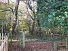
Queendown Warren is a 22.2-hectare (55-acre) biological Site of Special Scientific Interest south-east of Rainham in Kent. It is a Local Nature Reserve, a Nature Conservation Review site, Grade 2, and a Special Area of Conservation. It is in the Kent Downs Area of Outstanding Natural Beauty. It is managed by the Kent Wildlife Trust, and part of it is owned by Plantlife.

<span class="mw-page-title-main">Dungeness, Romney Marsh and Rye Bay</span> Conservation area in southeast England

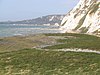
Dungeness, Romney Marsh and Rye Bay is a 10,172.9-hectare (25,138-acre) biological and geological Site of Special Scientific Interest which stretches from New Romney in Kent to Winchelsea in East Sussex. An area of 5,129.5 hectares is a Special Protection Area, an area of 3,141.1 hectares is a Special Area of Conservation, and an area of 6,377.6 hectares is a Ramsar Site, a wetland site designated of international importance under the Ramsar Convention. Part of the site is in the High Weald Area of Outstanding Natural Beauty, parts are Geological Conservation Review sites, part is a Local Nature Reserve, and part is a Royal Society for the Protection of Birds nature reserve, and part is a National Nature Reserve.

<span class="mw-page-title-main">Sandwich Bay to Hacklinge Marshes</span>

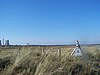
Sandwich Bay to Hacklinge Marshes is a 1,790.1-hectare (4,423-acre) biological and geological Site of Special Scientific Interest which stretches between Deal and Sandwich in Kent. It includes two Geological Conservation Review sites, and most of it is a Nature Conservation Review site, Grade I. Part of it is a Ramsar site, a Special Area of Conservation, a Special Protection Area and a National Nature Reserve, It also includes a Kent Wildlife Trust nature reserve and a Local Nature Reserve,

<span class="mw-page-title-main">Thanet Coast</span> Site of Special Scientific Interest in Kent

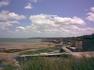
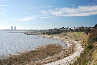
Thanet Coast is an 816.9-hectare (2,019-acre) biological and geological Site of Special Scientific Interest which stretches along the coast between Whitstable and Ramsgate in Kent. It is a Geological Conservation Review site, and overlaps two Special Area of Conservations. It is also part of a Ramsar Site and a Special Protection Area. Part of it is a Local Nature Reserve,

<span class="mw-page-title-main">Wouldham to Detling Escarpment</span>

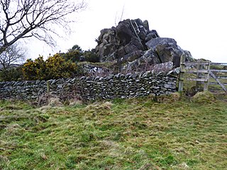
Wouldham to Detling Escarpment is a 311.2-hectare (769-acre) biological and geological Site of Special Scientific Interest which stretches from Wouldham to Detling, north of Maidstone in Kent. Part of it is a Geological Conservation Review site, and it is part of the North Downs Woodlands Special Area of Conservation and the Kent Downs Area of Outstanding Natural Beauty. It is a Nature Conservation Review site, Grade I and it includes three Kent Wildlife Trust nature reserves and a Local Nature Reserve,

<span class="mw-page-title-main">Prince's Beachlands</span>

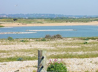
Prince's Beachlands is a 6-hectare (15-acre) Local Nature Reserve north of Sandwich in Kent. It is owned by Dover Town Council and managed by Kent Wildlife Trust as part of the Sandwich Bay to Hacklinge Marshes nature reserve. It is part of the Sandwich and Pegwell Bay Nature Conservation Review site, Grade I, Thanet Coast and Sandwich Bay Ramsar site, Sandwich Bay Special Area of Conservation, Thanet Coast and Sandwich Bay Special Protection Area and Sandwich Bay to Hacklinge Marshes Site of Special Scientific Interest.

<span class="mw-page-title-main">Sandwich and Pegwell Bay</span> Nature reserve in Kent, England

Sandwich and Pegwell Bay is a 615-hectare (1,520-acre) nature reserve in Kent, managed by the Kent Wildlife Trust. It is a National Nature Reserve, and it includes a Geological Conservation Review site, Prince's Beachlands Local Nature Reserve and two Special Areas of Conservation, Sandwich Bay and Thanet Coast. It is part of Sandwich Bay and Thanet Coast Ramsar site and Special Protection Area. It is also of Sandwich Bay to Hacklinge Marshes Site of Special Scientific Interest and Sandwich/Pegwell Bay Nature Conservation Review site, Grade I.

References

  1. 1 2 "Kent". Encyclopedia Britannica. Archived from the original on 22 April 2018. Retrieved 15 May 2018.
  2. "District councils". Kent County Council. Archived from the original on 27 October 2017. Retrieved 15 May 2018.
  3. "Council and democracy". Kent County Council. Archived from the original on 6 February 2007. Retrieved 19 April 2007.
  4. "Protected or Designated Areas". Department for Environment, Food & Rural Affairs and Natural England. 9 April 2013. Archived from the original on 4 May 2015. Retrieved 29 July 2015.
  5. "Local Nature Reserves: Setting up and Management". Department for Environment, Food & Rural Affairs and Natural England. 2 October 2014. Archived from the original on 4 July 2015. Retrieved 29 July 2015.
  6. 1 2 "Local Nature Reserves: Search results for Kent". Natural England. Archived from the original on 15 May 2018. Retrieved 1 January 2018.
  7. "Ambley Wood". Local Nature Reserves. Natural England. Archived from the original on 15 May 2018. Retrieved 3 March 2018.
  8. "Ashford Community Woodland". Local Nature Reserves. Natural England. Archived from the original on 15 May 2018. Retrieved 11 February 2018.
  9. "Ashford Green Corridors". Local Nature Reserves. Natural England. Archived from the original on 15 May 2018. Retrieved 4 March 2018.
  10. "Barnett's Wood". Kent High Weald Project. Archived from the original on 5 March 2018. Retrieved 4 March 2018.
  11. "Baty's Marsh". Local Nature Reserves. Natural England. Archived from the original on 15 May 2018. Retrieved 4 March 2018.
  12. "Berengrave Chalk Pit". Local Nature Reserves. Natural England. Archived from the original on 15 May 2018. Retrieved 4 March 2018.
  13. "Designated Sites View: Thanet Coast and Sandwich Bay". Ramsar Site. Natural England. Archived from the original on 15 May 2018. Retrieved 25 January 2018.
  14. "Designated Sites View: Thanet Coast and Sandwich Bay". Special Protection Area. Natural England. Archived from the original on 15 May 2018. Retrieved 25 January 2018.
  15. "Designated Sites View: Thanet Coast". Sites of Special Scientific Interest. Natural England. Archived from the original on 15 May 2018. Retrieved 25 January 2018.
  16. "Bishopstone Cliffs". Local Nature Reserves. Natural England. Retrieved 5 March 2018.
  17. "Designated Sites View: North Downs Woodlands". Special Area of Conservation. Natural England. Archived from the original on 15 May 2018. Retrieved 23 January 2018.
  18. 1 2 "White Horse Stone, Aylesford". Historic England. Archived from the original on 6 March 2018. Retrieved 5 March 2018.
  19. "Designated Sites View: Wouldham to Detling Escarpment". Sites of Special Scientific Interest. Natural England. Retrieved 23 January 2018.
  20. "Boxley Warren". Local Nature Reserves. Natural England. Retrieved 5 March 2018.
  21. "Bus Company Island". Local Nature Reserves. Natural England. Retrieved 5 March 2018.
  22. "Once a bus park, now a wildlife haven". Kentish Stour Countryside Partnership. Retrieved 5 March 2018.
  23. "Crane Valley". Local Nature Reserves. Natural England. Retrieved 4 February 2018.
  24. "Curtis Wood". Local Nature Reserves. Natural England. Retrieved 17 February 2018.
  25. 1 2 "Darland Banks". Kent Wildlife Trust. Archived from the original on 3 January 2018. Retrieved 25 January 2018.
  26. "Darland Banks". Local Nature Reserves. Natural England. Retrieved 5 March 2018.
  27. "Ditton Quarry". Local Nature Reserves. Natural England. Retrieved 5 March 2018.
  28. "Dryhill (Aptian-Albian)". Geological Conservation Review. Joint Nature Conservation Committee. Archived from the original on 12 January 2018. Retrieved 11 January 2018.
  29. "Designated Sites View: Dryhill". Sites of Special Scientific Interest. Natural England. Archived from the original on 3 February 2018. Retrieved 25 January 2018.
  30. "Dryhillcitation". Sites of Special Scientific Interest. Natural England. Retrieved 2 February 2018.
  31. "Designated Sites View: Farningham Wood". Sites of Special Scientific Interest. Natural England. Archived from the original on 6 February 2018. Retrieved 16 January 2018.
  32. "Farningham Wood citation" (PDF). Sites of Special Scientific Interest. Natural England. Archived (PDF) from the original on 2 January 2018. Retrieved 5 February 2018.
  33. "Foal Hurst Wood". Local Nature Reserves. Natural England. Retrieved 5 March 2018.
  34. "Designated Sites View: Folkestone Warren". Sites of Special Scientific Interest. Natural England. Retrieved 16 January 2018.
  35. "Folkestone Warren citation" (PDF). Sites of Special Scientific Interest. Natural England. Archived (PDF) from the original on 2 January 2018. Retrieved 6 February 2018.
  36. "Foxburrow Wood". Local Nature Reserves. Natural England. Retrieved 23 April 2018.
  37. "Foxes Cross Bottom". Local Nature Reserves. Natural England. Retrieved 5 March 2018.
  38. "Haysden Country Park". Kent County Council. Archived from the original on 14 April 2010. Retrieved 5 March 2018.
  39. "Haysden Country Park". Local Nature Reserves. Natural England. Retrieved 5 March 2018.
  40. "High Meadow". Local Nature Reserves. Natural England. Retrieved 29 January 2018.
  41. "Hilbert Woods". Local Nature Reserves. Natural England. Retrieved 5 March 2018.
  42. "Hothfield Heathlands". Kent Wildlife Trust. Archived from the original on 3 January 2018. Retrieved 15 January 2018.
  43. "Designated Sites View: Hothfield Common". Sites of Special Scientific Interest. Natural England. Retrieved 25 January 2018.
  44. "Hothfield Common citation" (PDF). Sites of Special Scientific Interest. Natural England. Archived (PDF) from the original on 2 January 2018. Retrieved 12 February 2018.
  45. "Jumping Downs". Local Nature Reserves. Natural England. Retrieved 5 March 2018.
  46. "Designated Sites View: Larkey Valley Wood". Sites of Special Scientific Interest. Natural England. Retrieved 16 January 2018.
  47. "Larkey Valley Wood citation" (PDF). Sites of Special Scientific Interest. Natural England. Archived (PDF) from the original on 2 January 2018. Retrieved 14 February 2018.
  48. "Levan Strice". Local Nature Reserves. Natural England. Retrieved 5 March 2018.
  49. "No Man's Orchard". Chartham Parish Council. Archived from the original on 7 March 2018. Retrieved 6 March 2018.
  50. 1 2 "Oare Marshes". Kent Wildlife Trust. Archived from the original on 23 January 2018. Retrieved 22 January 2018.
  51. Ratcliffe, p. 4
  52. "Designated Sites View: The Swale". National Nature Reserves. Natural England. Retrieved 22 January 2018.
  53. 1 2 3 "Designated Sites View: The Swale". Ramsar Site. Natural England. Retrieved 22 January 2018.
  54. 1 2 3 "Designated Sites View: The Swale". Special Protection Area. Natural England. Retrieved 22 January 2018.
  55. 1 2 3 "Designated Sites View: The Swale". Sites of Special Scientific Interest. Natural England. Retrieved 22 January 2018.
  56. "Poulton Wood, Aldington". Local Nature Reserves. Natural England. Retrieved 11 February 2018.
  57. "Poulton Wood". Canterbury Oast Trust. Archived from the original on 12 February 2018. Retrieved 11 February 2018.
  58. "Sandwich and Pegwell Bay". Kent Wildlife Trust. Archived from the original on 21 September 2017. Retrieved 25 January 2018.
  59. Ratcliffe, pp. 2-4
  60. "Designated Sites View: Thanet Coast and Sandwich Bay". Ramsar Site. Natural England. Retrieved 18 January 2018.
  61. "Designated Sites View: Sandwich Bay". Special Area of Conservation. Natural England. Retrieved 18 January 2018.
  62. "Designated Sites View: Thanet Coast". Special Area of Conservation. Natural England. Retrieved 18 January 2018.
  63. "Designated Sites View: Thanet Coast and Sandwich Bay". Special Protection Area. Natural England. Retrieved 18 January 2018.
  64. "Designated Sites View: Sandwich Bay to Hacklinge Marshes". Sites of Special Scientific Interest. Natural England. Archived from the original on 8 March 2018. Retrieved 25 January 2018.
  65. "Prince's Beachlands". Local Nature Reserves. Natural England. Retrieved 7 March 2018.
  66. "Queendown Warren". Kent Wildlife Trust. Archived from the original on 3 January 2018. Retrieved 18 January 2018.
  67. Ratcliffe, p. 120
  68. "Queendown Warren". Plantlife. Archived from the original on 19 January 2018. Retrieved 18 January 2018.
  69. "Designated Sites View: Queendown Warren". Special Area of Conservation. Natural England. Retrieved 18 January 2018.
  70. "Queendown Warren". Special Areas of Conservation. Joint Nature Conservation Committee. Archived from the original on 27 May 2016. Retrieved 18 January 2018.
  71. "Designated Sites View: Queendown Warren". Sites of Special Scientific Interest. Natural England. Retrieved 18 January 2018.
  72. "Queendown Warren citation" (PDF). Sites of Special Scientific Interest. Natural England. Archived (PDF) from the original on 2 January 2018. Retrieved 23 February 2018.
  73. "Rectory Meadow". Local Nature Reserves. Natural England. Retrieved 8 April 2018.
  74. "River Len". Local Nature Reserves. Natural England. Retrieved 18 March 2018.
  75. "Romney Marsh Visitor Centre". Kent Wildlife Trust. Archived from the original on 3 January 2018. Retrieved 7 February 2018.
  76. "Designated Sites View: Dungeness, Romney Marsh and Rye Bay". Ramsar Site. Natural England. Retrieved 25 January 2018.
  77. "Designated Sites View: Dungeness, Romney Marsh and Rye Bay". Sites of Special Scientific Interest. Natural England. Archived from the original on 11 January 2017. Retrieved 25 January 2018.
  78. "Romney Warren Country Park" (PDF). Romney Marsh Countryside Partnership. Archived (PDF) from the original on 20 August 2016. Retrieved 25 January 2018.
  79. "Seasalter Levels". Local Nature Reserves. Natural England. Retrieved 7 March 2018.
  80. 1 2 "South Swale". Kent Wildlife Trust. Archived from the original on 3 January 2018. Retrieved 26 January 2018.
  81. "South Wood". Local Nature Reserves. Natural England. Retrieved 7 March 2018.
  82. "Tyler Hill Meadow". Local Nature Reserves. Natural England. Retrieved 7 January 2018.
  83. "Vinters Valley Park". Local Nature Reserves. Natural England. Retrieved 7 March 2018.
  84. "Western Heights". Local Nature Reserves. Natural England. Retrieved 7 March 2018.
  85. "Whinless Down". Local Nature Reserves. Natural England. Retrieved 8 March 2018.
  86. "Whitehall Meadows". Local Nature Reserves. Natural England. Retrieved 8 March 2018.

Sources

51°11′N0°44′E / 51.19°N 0.73°E / 51.19; 0.73