Hothfield Common

Last updated

Hothfield Common
Site of Special Scientific Interest
Footpath junction in Hothfield Common - geograph.org.uk - 1605524.jpg
Location Kent
Grid reference TQ 968 458 [1]
InterestBiological
Area56.5 hectares (140 acres) [1]
Notification 1985 [1]
Location map Magic Map

Hothfield Common is a 56.5-hectare (140-acre) biological Site of Special Scientific Interest north-east of Ashford in Kent. [1] [2] It is also a Local Nature Reserve, [3] [4] and is part of the 86-hectare (210-acre)Hothfield Heathlands nature reserve owned by Ashford Borough Council and managed by Kent Wildlife Trust. [5]

Contents

Environment

Fifty-eight hectares of heathland and lowland valley bogs with secondary woodland around the perimeter, Hothfield contains Kent's last four valley bogs and one of its few remaining fragments of open heath with patches of acid grassland.

Until the early 20th century, livestock grazing maintained the open character of Hothfield Common. Once this ceased, bracken and birch began to overrun the reserve, leading to the loss of the heathland and bog habitat, and resulting in the loss of many rare and highly specialised plants and animals.

Habitat management work initiated by Kent Wildlife Trust with the support of Ashford Borough Council, Hothfield Parish Council and Natural England is now helping to restore and maintain a mosaic of open heath, grassland and bog. Once the initial invading scrub has been cut back, grazing with livestock is the key to maintaining suitable habitat. Grazing may occur at any time of the year so dogs should be kept under close control.

Many plants such as heather, cross-leaved heath, dwarf and common gorse, heath spotted-orchid, bog asphodel, and round-leaved sundew are now thriving, along with keeled skimmer dragonfly and tree pipit as a result of heath and bog habitat restoration.

History

The common once covered a large area, possibly stretching from Ashford to Charing. It was one of the extensive heaths of Kent which formed on the free-draining Greensand exposures of the county. [6] For some reason, Hothfield was spared the enclosures of the 19th century, unlike nearby Westwell Leacon, Charing and Lenham heaths. This may have been due to the landowners, the Tufton family, retaining the area for hunting. Encroachment upon Hothfield Heath began in the 18th century with the establishment of a school at Shipwash Farm and continued in 1835 with the construction of a workhouse by the West Ashford Union. From then on various households started encroaching upon the edges of the common. [7]

During World War II the common was used as a training camp for troops. Some 300 Nissen huts were left there at the end of the war, and these were re-used by Ashford Rural District Council as emergency accommodation for homeless families. By 1955 these had all been moved away and the common was returned to the ownership of the Tufton family. However, in the absence of any commoners there was no real use for the land, and it was occupied by travellers and became a dumping ground for used cars. Following pressure by naturalists such as Dr Scott of Westwell, the District Council eventually purchased the land from the estate for £1,400 and designated 150 acres (60 ha) of the common a nature reserve. Organisations such as Kent Wildlife Trust, the Nature Conservancy and educational groups were included in the management committee. [8]

Ecology

Hothfield Heath has long been of interest to naturalists. As long ago as the 1820s, botanists such as G.E. Smith were documenting the unusual plants that occur there, [9] particularly those of acid habitats such as Mat-grass and Bog Asphodel. The philosopher and economist John Stuart Mill was among the people collecting plants there in the 19th century. More systematic studies were undertaken by F.M. Webb and the local naturalists, W.R. Jeffrey and his son J.F. Jeffrey. Their findings are summarised in the Flora of Kent. [10]

Henry Russell was vicar at Hothfield at the end of the 19th century, when he compiled a manuscript History of the Village which is now housed at Maidstone Library. It includes lists of wildlife, including 110 species of plants, although not all of these were on the common. Another early survey of the heath was undertaken by Francis Rose in the 1940s, when he published a description of the bryoflora (mosses and liverworts) in the journal of the British Bryological Society between 1949 and 1951. More recently, the Kent Field Club published lists of plants and animals at Hothfield in 1975. [11] [12]

This information amounts to a comprehensive inventory of the wildlife of the reserve, mostly in the form of lists available from the NBN Atlas. [13] The flora and vegetation are described in detail in the Flora of Hothfield. [14]

The main features of conservation value at Hothfield Common are the bogs, the acid grassland and the woods. There are five bogs, of which one, which is isolated from the main part of the reserve by the A20, has degraded into wet woodland. The acid grassland occurs in patches throughout, mainly along the paths. Woodland and scrub covers the remainder of the Common and, although there are some ancient woodland species present, it is more recent in origin and less important for wildlife.

Key species in the bogs include the bog-mosses Sphagnum papillosum and S. capillifolium , bog asphodel, round-leaved sundew and marsh St John's-wort. In the grassland there is bird's-foot clover (Trifolium ornithopodioides), clustered clover and subterranean clover. One of the rarest plants on the reserve is three-lobed crowfoot, which occurs in pools in some of the bogs. It is also considered an important site for invertebrates, with rare species such as the small shiny furrow bee (Lasioglossum semilucens) and the cranefly Tipula holoptera. [15]

Access

The site is open to the public at all times.

Related Research Articles

<span class="mw-page-title-main">Thurstaston Common</span>

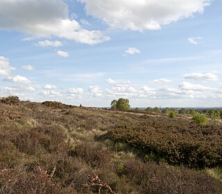
Thurstaston Common is an area of almost 250 acres (100 ha) of parklands, wood and heath between Frankby and Thurstaston, on the Wirral Peninsula in North West England. The common is jointly owned by the National Trust and the Metropolitan Borough of Wirral. Royden Country Park is nearby and offers additional facilities.

<span class="mw-page-title-main">Hothfield</span> Human settlement in England

Hothfield is a village and civil parish in the Ashford Borough of Kent, England and is 3 miles north-west of Ashford on the A20. It is completely split in two by Hothfield Common.

<span class="mw-page-title-main">Scotstown Moor</span>

Scotstown Moor is in the north of Aberdeen, Scotland.

<span class="mw-page-title-main">Gentleshaw Common</span>

Gentleshaw Common is an area of common land situated in Gentleshaw on the northern side of Burntwood in Staffordshire, England. The area is a Site of Special Scientific Interest as it is an area of globally rare lowland heathland. The common plays host to a series of fun public events throughout the year, including scrub bashing and countryside walks.

<span class="mw-page-title-main">Cors Caron</span> Raised bog in Ceredigion, Wales

Cors Caron is a raised bog in Ceredigion, Wales. Cors is the Welsh word for "bog". Cors Caron covers an area of approximately 349 hectares. Cors Caron represents the most intact surviving example of a raised bog landscape in the United Kingdom. About 44 different species groups inhabit the area including various land and aquatic plants, fish, insects, crustaceans, lichen, fungi, terrestrial mammals and birds.

<span class="mw-page-title-main">Dersingham Bog</span> English nature reserve

Dersingham Bog is a 159.1-hectare (393-acre) biological and geological Site of Special Scientific Interest in Norfolk, England. It is a Nature Conservation Review site, Grade 2, a National Nature Reserve and a Ramsar site It is part of the Norfolk Coast Area of Outstanding Natural Beauty, and the Roydon Common & Dersingham Bog Special Area of Conservation Part of it is a Geological Conservation Review site.

<span class="mw-page-title-main">Sound Heath</span>

Sound Heath, also known as Sound Common, is an area of common land in Sound, near Nantwich in Cheshire, England, which includes heathland, grassland, scrub, woodland and wetland habitats. The majority of the area is designated a Site of Special Scientific Interest and a Local Nature Reserve.

<span class="mw-page-title-main">Pow Hill Bog</span> Protected natural area in County Durham, England

Pow Hill Bog is a Site of Special Scientific Interest in the Wear Valley district of County Durham, England. It lies alongside Derwent Reservoir, approximately 2 km north-west of the village of Edmundbyers and adjacent to the Edmundbyers Common portion of the Muggleswick, Stanhope and Edmundbyers Commons and Blanchland Moor SSSI.

<span class="mw-page-title-main">Decoy Pit, Pools and Woods</span>

Decoy Pit, Pools and Woods is a 17.7-hectare (44-acre) biological Site of Special Scientific Interest south of Aldermaston in Berkshire. An area of 8 hectares is a nature reserve called Decoy Heath, which is managed by the Berkshire, Buckinghamshire and Oxfordshire Wildlife Trust.

<span class="mw-page-title-main">Rosenannon Downs</span> Nature reserve in mid Cornwall, England

Rosenannon Downs is a nature reserve in mid Cornwall, England, UK, being designated Rosenannon Bog and Downs Site of Special Scientific Interest (SSSI), noted for its biological characteristics. The site supports a wide variety of flora and fauna and includes Bronze Age barrows. Conservation work is carried out on the site by the owners, the Cornwall Wildlife Trust.

<span class="mw-page-title-main">Roydon Common</span>

Roydon Common is a 194.9-hectare (482-acre) biological Site of Special Scientific Interest east of King's Lynn in Norfolk. It is also a Grade I Nature Conservation Review site, a National Nature Reserve and a Ramsar site. It is part of the Roydon Common and Dersingham Bog Special Area of Conservation and Roydon Common and Grimston Warren nature reserve, which is managed by the Norfolk Wildlife Trust,

<span class="mw-page-title-main">Cleddon Bog</span>

Cleddon Bog is a bog in the vice-county of Monmouthshire which has been notified as a biological Site of Special Scientific Interest. It lies within the Wye Valley Area of Outstanding Natural Beauty. It was declared a Local Nature Reserve in May 1970.

<span class="mw-page-title-main">Poor's Allotment</span>

Poor's Allotment is a 28.57-hectare (70.6-acre) biological Site of Special Scientific Interest in Gloucestershire, notified in 1954. The site is listed in the 'Forest of Dean Local Plan Review' as a Key Wildlife Site (KWS).

<span class="mw-page-title-main">Wigpool</span>

Wigpool is a 7.5-hectare (19-acre) nature reserve in Gloucestershire in the Forest of Dean, England.

<span class="mw-page-title-main">Mitcheldean Meend Marsh</span>

Mitcheldean Meend Marsh is a 0.7-hectare (1.7-acre) nature reserve in Gloucestershire in the Forest of Dean. The site is listed in the 'Forest of Dean Local Plan Review' as a Key Wildlife Site (KWS).

<span class="mw-page-title-main">Bewick and Beanley Moors</span>

Bewick and Beanley Moors is the name given to a Site of Special Scientific Interest (SSSI) in north Northumberland, in the north-east of England. The moors are asserted to be of national importance by Natural England for the extent, quality and diversity of upland types including heaths, fens, wet grassland, flushes, mires and blanket bogs, together creating an extensive mosaic habitat supporting an exceptional community of amphibians. The moors are important, too, for their relict juniper woodland and scrub.

<span class="mw-page-title-main">Thetford Heaths</span>

Thetford Heaths is a 270.6-hectare (669-acre) biological and geological Site of Special Scientific Interest in Suffolk. It is a Nature Conservation Review site, Grade I, and parts of it are a national nature reserve, and a Geological Conservation Review, It is part of the Breckland Special Area of Conservation, and Special Protection Area A large part of this dry heathland site is calcareous grassland, and some areas are grazed by sheep or rabbits. There are several nationally rare plants and an uncommon heathland bird, and many lichens and mosses.

<span class="mw-page-title-main">Brentmoor Heath</span> Nature reserve in Surrey, United Kingdom

Brentmoor Heath is a 28.6-hectare (71-acre) Local Nature Reserve east of Camberley in Surrey. It is part of Brentmoor Heath and Folly Bog nature reserve, the ownership of which is divided between the Ministry of Defence, Surrey County Council and Surrey Heath Borough Council, and is managed by Surrey Wildlife Trust. The site is also part of Colony Bog and Bagshot Heath site of Special Scientific Interest, Thursley, Ash, Pirbright & Chobham Special Area of Conservation and Thames Basin Heaths Special Protection Area.

<span class="mw-page-title-main">Tadnoll and Winfrith Heath</span>

Tadnoll and Winfrith Heath is a nature reserve of the Dorset Wildlife Trust, near the village of Winfrith Newburgh in Dorset, England. There is heathland and wetland in the reserve.

<span class="mw-page-title-main">Whitelee Moor</span>

Whitelee Moor is nature reserve of the Northumberland Wildlife Trust, in Northumberland, England, near Carter Bar. A large part of the moor is blanket bog.

References

  1. 1 2 3 4 "Designated Sites View: Hothfield Common". Sites of Special Scientific Interest. Natural England. Retrieved 12 February 2018.
  2. "Map of Hothfield Common". Sites of Special Scientific Interest. Natural England. Retrieved 12 February 2018.
  3. "Hothfield Common". Local Nature Reserves. Natural England. Retrieved 12 February 2018.
  4. "Map of Hothfield Common". Local Nature Reserves. Natural England. Retrieved 12 February 2018.
  5. "Hothfield Heathlands". Kent Wildlife Trust. Archived from the original on 3 January 2018. Retrieved 12 February 2018.
  6. Burnham, C.P. (1975). "The Geology of Hothfield Common". Transactions of the Kent Field Club. 5 (3): 122–125.
  7. Phillips, M.R. (1975). "The History of the Common". Transactions of the Kent Field Club. 5 (3): 105–107.
  8. Pym, Martin (1975). "The Reserve as an Amenity". Transactions of the Kent Field Club. 5 (3): 179–183.
  9. Cowell, M.H. (1839). Floral Guide for East Kent, etc. Faversham: W. Ratcliffe.
  10. Hanbury, F.J.; Marshall, E.S. (1899). Flora of Kent. London: Frederick J. Hanbury.
  11. Philp, Eric (1975). "The Biology of the Reserve". Transactions of the Kent Field Club. 5 (3): 108–121.
  12. Felton, J.C. (1975). "Insects on Hothfield Local Nature Reserve". Transactions of the Kent Field Club. 5 (3): 150–174.
  13. National Biodiversity Network. "Atlas".
  14. Lockton, Alex (2022). Flora and vegetation of Hothfield Heath.
  15. Natural England. "Hothfield Common citation" (PDF).

51°10′41″N0°48′50″E / 51.178°N 0.814°E / 51.178; 0.814