
This is a link page for railway, road and waterway tunnels, including hydroelectric intakes and tailraces and gun battery tunnels. It includes artificial chambers but excludes New Zealand caves and New Zealand mines.
This is a link page for railway, road and waterway tunnels, including hydroelectric intakes and tailraces and gun battery tunnels. It includes artificial chambers but excludes New Zealand caves and New Zealand mines.
From longest to shortest.


In rural Taranaki, all single lane:
There are 3 other tunnels on tracks in the Taranaki area; Aukopae (closed), Graylings cattle tunnel, Waikawau beach tunnel. [9]
In Wellington:

The Rimutaka Incline was a 3-mile-long (4.8 km), 3 ft 6 in gauge railway line on an average grade of 1-in-15 using the Fell system between Summit and Cross Creek stations on the Wairarapa side of the original Wairarapa Line in the Wairarapa district of New Zealand. The term "Rimutaka Incline" is sometimes used incorrectly to refer to other parts or all of the closed and deviated section of the Wairarapa Line between Upper Hutt and Speedy's Crossing, near Featherston. The incline formation is now part of the Remutaka Rail Trail.

Rail transport in New Zealand is an integral part of New Zealand's transport network, with a nationwide network of 4,375.5 km (2,718.8 mi) of track linking most major cities in the North and South Islands, connected by inter-island rail and road ferries. Rail transport in New Zealand has a particular focus on bulk freight exports and imports, with 19 million net tonnes moved by rail annually, and 99.5% of New Zealand's exports and imports being transported through the country's seaports.

The North Island Main Trunk (NIMT) is the main railway line in the North Island of New Zealand, connecting the capital city Wellington with the country's largest city, Auckland. The line is 682 kilometres (424 mi) long, built to the New Zealand rail gauge of 1,067 mm and serves the large cities of Palmerston North and Hamilton.

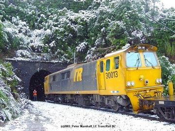
The Remutaka Tunnel is a railway tunnel through New Zealand's Remutaka Range, between Maymorn, near Upper Hutt, and Featherston, on the Wairarapa Line.

The North Auckland Line is a major section of New Zealand's national rail network, and is made up of the following parts: the portion of track that runs northward from Westfield Junction to Newmarket Station; from there, westward to Waitakere; from there, northward to Otiria via Whangārei. The first section was opened in 1868 and the line was completed in 1925. The line, or sections of it, have been known at various times as the Kaipara Line, the Waikato-Kaipara Line, the Kaipara Branch and the North Auckland Main Trunk.

The Okaihau Branch, sometimes known as the Kaikohe Branch and rarely the Rangiahua Branch, was a branch line railway that joined the North Auckland Line of the national rail network of New Zealand at Otiria. It was the most northerly line in New Zealand and was intended to run all the way to Kaitaia. It opened to Ōkaihau in 1923 and closed in 1987.
The New Zealand Railways Department, NZR or NZGR and often known as the "Railways", was a government department charged with owning and maintaining New Zealand's railway infrastructure and operating the railway system. The Department was created in 1880 and was corporatised on 1 April 1982 into the New Zealand Railways Corporation. Originally, railway construction and operation took place under the auspices of the former provincial governments and some private railways, before all of the provincial operations came under the central Public Works Department. The role of operating the rail network was subsequently separated from that of the network's construction. From 1895 to 1993 there was a responsible Minister, the Minister of Railways. He was often also the Minister of Public Works.

The Wairarapa Line is a secondary railway line in the south-east of the North Island of New Zealand. The line runs for 172 kilometres (107 mi), connects the capital city Wellington with the Palmerston North - Gisborne Line at Woodville, via Lower Hutt, Upper Hutt and Masterton.

The 8.38 miles (13.49 km) Tawa Flat deviation is a double-track section of the Kapiti Line just north of Wellington, New Zealand with two tunnels; the southernmost section of the North Island Main Trunk railway (NIMT) between Wellington and Auckland. It was built to bypass a limited capacity single track section of the original Wellington and Manawatu Railway (WMR) line which ascended from Wellington to Johnsonville and then descended to Tawa Flat. The original name of Tawa Flat was changed to Tawa in 1959.

The East Coast Main Trunk (ECMT) is a railway line in the North Island of New Zealand, originally running between Hamilton and Taneatua via Tauranga, connecting the Waikato with the Bay of Plenty. The ECMT now runs between Hamilton and Kawerau, with a branch line to Taneatua from the junction at Hawkens. The line is built to narrow gauge of 1,067 mm, the uniform gauge in New Zealand. It was known as the East Coast Main Trunk Railway until 2011, when the word "Railway" was dropped.

Maymorn railway station is a twin platform, rural request stop railway station serving the small settlement of Maymorn on the Maymorn Plateau, east of Upper Hutt, in New Zealand’s North Island. It is served by the Wairarapa Connection, and sees five services each way Monday to Thursday, six on Friday and two on Saturday and Sunday.

The Eastern Line is the name of the suburban rail service in Auckland, New Zealand between Britomart and Manukau via the North Island Main Trunk (NIMT) and Manukau Branch. Services are operated by Auckland One Rail under the Auckland Transport brand.

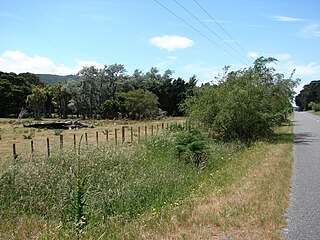
Mangaroa railway station was a single-platform rural railway station on the Wairarapa Line between Upper Hutt and Featherston in the Wellington region of New Zealand’s North Island, on the section that was replaced by the Rimutaka Tunnel deviation in 1955. It served the small rural settlement of Mangaroa, in the Mangaroa Valley, east of Upper Hutt.
Pigeon Bush railway station was a single platform, rural railway station in an area of the South Wairarapa district known as Pigeon Bush, about 6 kilometres (3.7 mi) south-west of Featherston, in New Zealand's North Island. The station was between Featherston and Cross Creek stations on the Wairarapa Line. The station was bypassed when the Rimutaka Tunnel was opened.
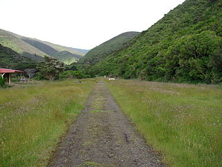
The Remutaka Rail Trail is a walking and cycling track in the North Island of New Zealand. It runs between Maymorn and Cross Creek, and follows 22 kilometres (14 mi) of the original route of the Wairarapa Line over the Remutaka Range between the Mangaroa Valley and the Wairarapa, including the world-famous Rimutaka Incline. Parts of the trail are also used by vehicles both from the regional council and from forestry companies with tree plantations in the area; members of the public have limited vehicular access from the Kaitoke end to a car park, go-kart track and gun range. Access is also granted by permission to horse riders. Touring coaches have been used upon occasion to convey tourists and other visitors to various parts of the route.
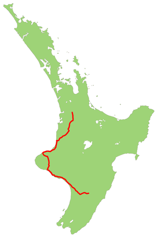
State Highway 3 (SH 3) is one of New Zealand's eight national state highways. It serves the west coast of the country's North Island and forms a link between State Highway 1 and State Highway 2. Distances are measured from north to south.

State Highway 2 runs north–south through eastern parts of the North Island of New Zealand from the outskirts of Auckland to Wellington. It runs through Tauranga, Gisborne, Napier, Hastings and Masterton. It is the second-longest highway in the North Island, after State Highway 1, which runs the length of both of the country's main islands.

The Kaimai Tunnel is a railway tunnel through the Kaimai Range in the North Island of New Zealand. Since it was opened in 1978, it has held the title of longest tunnel, at 8.879 kilometres (5.517 mi), in New Zealand, assuming this distinction from the previous title holder, the Rimutaka Tunnel. It is part of the Kaimai Deviation, which was constructed to bypass the old route of the East Coast Main Trunk Railway through the Karangahake Gorge.
The Paeroa-Pokeno railway line or deviation in the upper North Island of New Zealand between Paeroa on the East Coast Main Trunk (ECMT) and Pokeno on the North Island Main Trunk (NIMT) was a proposed route with construction started but abandoned. The proposal has been revived in recent years as part of a more direct route between Auckland and Tauranga.
Railway electrification in New Zealand consists of three separate electric systems, all on the North Island. Electrification was initially adopted by the New Zealand Railways for long tunnels; the Otira Tunnel, the Lyttelton Rail Tunnel and the two Tawa Tunnels of the Tawa Flat Deviation. Electrification of Wellington suburban services started with the Johnsonville Line and Kapiti Line out of Wellington from the 1930s. Auckland suburban services were electrified in 2014–2015. Electrification of long-distance services on the North Island Main Trunk (NIMT) dates from 1986. New long tunnels, for example the Rimutaka Tunnel and the Kaimai Tunnel, were operated by diesels, and the Otira and Lyttelton Tunnels have converted to diesel operation.