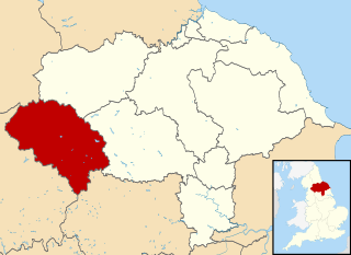
Craven was a non-metropolitan district in the west of North Yorkshire, centred on the market town of Skipton.
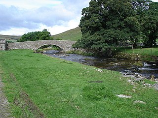
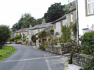
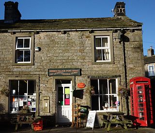
Arncliffe is a small village and civil parish in Littondale, one of the Yorkshire Dales in England. Littondale is a small valley beside Upper Wharfedale, 3 miles (4.8 km) beyond Kilnsey and its famous crag. It is part of the Craven district of the non-metropolitan county of North Yorkshire, but is in the historic West Riding of Yorkshire. The population of the civil parish was estimated at 80 in 2015.

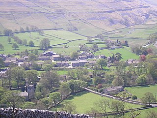
Kettlewell is a village in Upper Wharfedale, North Yorkshire, England. Historically part of the West Riding of Yorkshire, it lies 6 miles (10 km) north of Grassington, at the point where Wharfedale is joined by a minor road which leads north-east from the village over Park Rash Pass to Coverdale. Great Whernside rises to the east. The population of the civil parish was 322 at the 2011 census, with an estimated population of 340 in 2015.

Grassington is a village and civil parish in North Yorkshire, England. The population of the parish at the 2011 Census was 1,126. Historically part of the West Riding of Yorkshire, and now in the lieutenancy area of North Yorkshire, the village is situated in Wharfedale, about 8 miles (10 km) north-west from Bolton Abbey, and is surrounded by limestone scenery. Nearby villages include Linton, Threshfield, Hebden, Conistone and Kilnsey.

Kilnsey is a small village in Wharfedale, North Yorkshire, England. It lies on the B6160 road, between the villages of Grassington and Kettlewell, near Arncliffe and just across the River Wharfe from Conistone. The village is 12 miles (19 km) north of Skipton and 3 miles (5 km) south of Kettlewell.
Malham is a village and civil parish in the Craven district of North Yorkshire, England. Before 20th century boundary changes, the village was part of the Settle Rural District, in the historic West Riding of Yorkshire. In the Domesday Book, the name is given as Malgun, meaning "settlement by the gravelly places". In 2001 the parish had a population of approximately 150. Malham parish increased in size geographically and so at the 2011 Census had a population of 238.

Barden is a civil parish in the Craven district of North Yorkshire, England. It consists of the hamlet of Drebley and a few scattered houses in Wharfedale in the Yorkshire Dales. The parish also includes two areas of moorland, Barden Fell to the east of the River Wharfe and Barden Moor to the west of the river. Both moorlands are access land, and are popular with walkers. Barden Fell rises to the prominent peak of Simon's Seat, and Barden Moor includes two scenic 19th century reservoirs. Much of the parish is on the Bolton Abbey estate.

Buckden is a village and civil parish in the Craven district of North Yorkshire, England. Historically part of the West Riding of Yorkshire, Buckden is situated in the Yorkshire Dales National Park, and on the east bank of the River Wharfe in Wharfedale. The civil parish includes the hamlet of Cray and the whole of Langstrothdale. According to the 2011 Census the parish had a population of 187.

Litton is a village and civil parish in Littondale in the Yorkshire Dales in England. It lies in the Craven District of North Yorkshire, 1.5 miles (2.4 km) up Littondale from Arncliffe. From Litton a footpath leads 3 miles (4.8 km) over the fells to the north east to Buckden in Wharfedale. The population of the civil parish was estimated at 70 in 2015.

Halton Gill is a hamlet and civil parish in Littondale in the Yorkshire Dales in North Yorkshire, England. It is situated 2 miles (3.2 km) up Littondale from Litton. A minor road leads south west to Silverdale and Stainforth in Ribblesdale.
Foxup is a hamlet in the Yorkshire Dales in the Craven district of North Yorkshire, England. The hamlet is near Halton Gill and Litton and is 13 miles (21 km) north west of Grassington. Foxup is in the civil parish of Halton Gill.

Cray is a hamlet on the B6160 road on a steep hill above Wharfedale in the Yorkshire Dales, North Yorkshire, England. It is near Buckden and the River Wharfe. It is a very popular walking area and is renowned for several waterfalls known collectively as Cray Waterfalls. The name of the settlement derives from the same name for the nearby beck ; Old Welsh Crei, meaning fresh. The settlement was not mentioned in the Domesday Book, first being recorded in 1202 when a meadow was granted as a fine to William de Arches at Creigate.
River Skirfare is a small river in North Yorkshire, England, that flows through Littondale and ends where it joins the larger River Wharfe. The source is the confluence of Foxup Beck and Cosh Beck at the hamlet of Foxup.
Hawkswick is a hamlet and civil parish in the Craven district of North Yorkshire, England. Situated in the Yorkshire Dales, it lies in Littondale on the River Skirfare.
Hebden is a village and civil parish in the Craven District of North Yorkshire, England, and one of four villages in the ecclesiastical parish of Linton. It lies near Grimwith Reservoir and Grassington, in Wharfedale in the Yorkshire Dales National Park. In 2011 it had a population of 246.

Hesleden is a hamlet in Littondale in the Yorkshire Dales in England. It lies within the civil parish of Halton Gill in the Craven district of North Yorkshire. Nether Hesleden is 1.1 miles (1.8 km) west of Litton, and Upper Hesleden is a further 1.4 miles (2.3 km) west, on the road from Halton Gill to Stainforth.
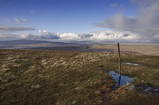
Plover Hill is an area of moorland lying to the north of Pen-y-ghent in the Yorkshire Dales and connected to it by an unbroken area of high ground. Whilst the whole area is now "open access land", the main right-of-way footpaths come directly from the north off Foxup Road and directly from the south from the summit of Pen-y-ghent.
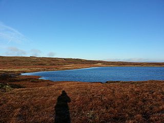
Fountains Fell Tarn, is an upland lake between the two peaks of Fountains Fell, in North Yorkshire, England. The tarn is close to the Pennine Way, some 4.3 miles (7 km) north west of Malham Tarn, and 4.3 miles (7 km) east of Horton in Ribblesdale. Water from the tarn flows eastwards through Cowside Beck, which is a tributary of the River Skirfare in Littondale. Whilst the water in the lake is acidic, as it runs off the mountain, it flows over Yoredale beds limestone and so becomes a harder water.

Scoska Wood is an IUCN Category IV – habitat or species management area, a British national nature reserve (NNR), and a Site of Special Scientific Interest (SSSI) in Littondale, North Yorkshire, England. It is a managed ancient woodland, known for its ash trees, grasses and moths. It was designated as an SSSI in 1975, and was awarded its IUCN status in 1992.

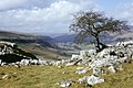
Cowside is a side dale of Littondale in North Yorkshire, England. The valley, which faces in a north east direction, carries the waters of Cowside Beck to the River Skirfare at Arncliffe, draining an area of 8.9 square miles (23 km2), and flowing for 7.5 miles (12 km). Cowside is one of the few 'V'-shaped valleys in the Yorkshire Dales which had ice run across the valley, but not down it. The only settlement in the valley is Darnbrook, a very small hamlet at the foot of Darnbrook Fell. Cowside is a common name in the Craven area of the Yorkshire Dales, and it is not to be confused with the Cowside in Upper Wharfedale near Buckden, nor the Cowside Beck near Stainforth.