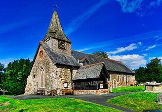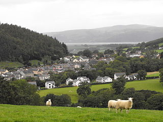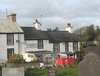
Michaelston-super-Ely is a village, to the west of the city of Cardiff, Wales.

Y Rhiw is a small village on the south west tip of the Llŷn Peninsula in Gwynedd in Wales.

Llansantffraid-ym-Mechain is a large village in Powys, Mid Wales, close to the border with Shropshire in England, about 7 miles (11 km) south west of Oswestry and 8 miles (13 km) north of Welshpool. It is on the A495 road and is at the confluence of the River Vyrnwy and the River Cain. The population as of the 2011 UK census was 1,415. The community includes the village of Deuddwr and several hamlets.

Llanarmon-yn-Iâl is a village, and local government community, in Denbighshire, Wales, lying in limestone country in the valley of the River Alyn.

Betws yn Rhos is a village and community in Conwy County Borough, Wales.

Llandegla or Llandegla-yn-Iâl is a village and community in the county of Denbighshire in Wales. In the 2011 census, the community had a population of 567.

Llandrillo is a small village and community in the Edeirnion area of Denbighshire in Wales, between Bala, and Corwen on the B4401 road. It was historically in the county of Merionethshire, and has a population of 580. The community includes the hamlets of Cadwst and Pennant.

Tal-y-bont is a village in Ceredigion, Wales, located on the A487 road about halfway between Aberystwyth and Machynlleth. At the 2011 census the population was 662 with 63% born in Wales. Tal-y-bont is in the community of Ceulanamaesmawr.
Mihangel Morgan is a Welsh author.

Llanrug is a medium-sized village and community in Gwynedd, north-west Wales. It lies about 4 miles (6.4 km) to the east of Caernarfon, 7 miles (11 km) south of Bangor and 3 miles (4.8 km) northwest of Llanberis. It is the largest populated village in the Arfon area of Gwynedd, Wales. The old name of the village was Llanfihangel-y-Rug, derived from Eglwys Sant Mihangel, which is situated about half a mile west of the village.

Llanfihangel-y-Creuddyn is an ancient parish in the upper division of the hundred of Ilar, Ceredigion, West Wales, 7 miles south east from Aberystwyth, on the road to Rhayader, comprising the chapelry of Eglwys Newydd, or Llanfihangel y Creuddyn Uchaf, and the township of Llanfihangel y Creuddyn Isaf. It was also known as Lower Llanfihangel y Creuddyn, Lower Llanfihangel y Croyddin and Lower Llanfihangel y Croyddyn. This parish is situated on the rivers Ystwyth, Mynach and Rheidol and intersected by various other streams. An ancient parish was a village or group of villages or hamlets and the adjacent lands. Originally they held ecclesiastical functions, but from the sixteenth century onwards they also acquired civil roles. The parish may have been established as an ecclesiastical parish. Originally a medieval administrative unit, after 1597 ecclesiastical units acquired civil functions with the Elizabethan Poor Laws, which made the parishes responsible for welfare. The civil function was exercised through vestry meetings which administered the Poor Law and were responsible for local roads and bridges.

Llanfechain is a village and community in Powys, Wales, on the B4393 road between Llanfyllin and Llansantffraid-ym-Mechain. Historically it belonged to Montgomeryshire. The River Cain runs through. The population of 465 at the 2011 Census was estimated at 476 in 2019.
Llan and its variants are a common element of Celtic placenames in the British Isles and Brittany, especially of Welsh toponymy. In Welsh an name of a local saint or a geomorphological description follows the Llan morpheme to form a single word: for example Llanfair is the parish or settlement around the church of St. Mair. Goidelic toponyms end in -lann.

Llanrhaeadr-yng-Nghinmeirch is a village and local government community in Denbighshire, Wales, including the villages of Llanrhaeadr and Pentre Llanrhaeadr and several hamlets, including Saron, Pant Pastynog, Prion, Peniel and part of Mynydd Hiraethog. It lies in the Vale of Clwyd near the A525 road between Denbigh and Ruthin. It was also known under the anglicised spellings of Llanrhaiadr in Kinmerch in the nineteenth century, and Llanrhaiadr yn Cinmerch, officially until 6 September 1968. The Community population taken at the 2011 census was 1,038.

Llanfaelog is a village and community in western Anglesey, Wales. It is situated some 13 kilometres south-east of Holyhead and 22 kilometres west of the city of Bangor. At the 2001 census, it had a population of 1,679, increasing to 1,758 at the 2011 Census. The community includes Rhosneigr, Bryn Du, and Pencarnisiog. The population of the village itself is less than 400.

St Mary's Church, Llanfair-yn-y-Cwmwd is a small medieval parish church near the village of Dwyran, in Anglesey, north Wales. The building probably dates from the 15th century, with some alterations. It contains a 12th-century carved stone font and a 13th-century decorated coffin lid. The bell is inscribed with the year of its casting, 1582. The historian Henry Rowlands was vicar of St Mary's in the late 17th and early 18th centuries. Maurice Wilks, who invented the Land Rover, is buried in the churchyard.

St Enghenedl's Church, Llanynghenedl, is a former parish church in Anglesey, north Wales, dedicated to the son of a 6th-century King of Powys. According to the 19th-century antiquarian Angharad Llwyd, the first church in Llanynghenedl was erected in about 620. A new church was erected in 1862, replacing a building that the 19th-century clergyman and antiquarian Harry Longueville Jones noted as dating in part from the late 13th or early 14th century, based on the decorations on the south doorway. The church later fell into disuse as a result of the growth of the nearby village of Valley and the church there. In 1988, St Enghenedl's was dismantled and re-erected as an extension to St Mihangel's, Llanfihangel yn Nhowyn, so that St Mihangel's could serve as the church for RAF Valley. The former churchyard of St Enghenedl's is still visible but is now overgrown.(The churchyard is being cared for and no longer overgrown 2020 update)

St Mihangel's Church in the village of Llanfihangel yn Nhowyn is a former parish church now used as the chapel for RAF Valley in Anglesey, north Wales. The date of the first church on the site is uncertain, but in 1862 the then-existing church was rebuilt. St Mihangel's became the chapel for the nearby Royal Air Force base in 1998, after the Church in Wales had ceased using it for services. It was then extended by dismantling and reassembling another Anglesey church, St Enghenedl's, at the west end of the building.

Whitton is a village and a community in Radnorshire, Powys, Wales. It is located on the B4356 road 4 miles (6.4 km) south of Knighton. Hamlets in the community include Rhos-y-meirch and Pilleth.
Henry Kennedy was a British architect.

![]() Welsh pronunciation ) is a village in Anglesey, in north-west Wales.[ citation needed ] The church in the village, St Mihangel's, is a Grade II listed building and is the chapel for the nearby airbase, RAF Valley. [1] It is in the community of Llanfair-yn-Neubwll
Welsh pronunciation ) is a village in Anglesey, in north-west Wales.[ citation needed ] The church in the village, St Mihangel's, is a Grade II listed building and is the chapel for the nearby airbase, RAF Valley. [1] It is in the community of Llanfair-yn-Neubwll 


