
The old Barony and castle, fortalice, or tower house of Hill of Beith lay in the feudal Regality of Kilwinning, within the Baillerie of Cunninghame, and the Sherrifdom of Ayr, now the Parish of Beith, North Ayrshire, Scotland.

Lambroughton Loch or Wheatrig Loch was situated in a low-lying area between the farms and dwellings of Hillhead, Lambroughton, Wheatrig, Titwood and Lochridge mainly in the Parish of Dreghorn, North Ayrshire. The loch was mainly fed by the Lochridge Burn, the Garrier Burn and surface runoff, such as from the old rig and furrows indicated by Roy's maps of the mid-18th century. The loch outflow was via the Lochridge Burn that runs into the Garrier Burn, passes the site of the old Lochend habitation and into the Bracken Burn near Little Alton. The rivulet or watercourse is known as the Garrier Burn beyond this point.
Littlestane Loch, was situated in the mid-Ayrshire clayland near Stanecastle, Irvine, North Ayrshire, Scotland. It is nowadays (2011) only visible as an area of permanent water in the Scottish Wildlife Trust Sourlie Nature Reserve. The loch was natural, sitting in a hollow created by glaciation. The loch waters outflow was via the Red Burn that flows into the River Garnock. The site of Littlestane Loch site is partly built over and much of the site is now public open space lying within the Parish of Girdle Toll.

Fail Loch or Faile Loch was situated in a low-lying area near the old monastery of Fail in the Parish of Tarbolton, South Ayrshire, Scotland. The old Lochlea Loch lies nearby and its waters still feed into Fail Loch via the Mill Burn.

Knockewart Loch or Loch Jargon was situated in a hollow lying area beneath Knockewart Hill in the Parish of Ardrossan, North Ayrshire, Scotland. The old loch has become largely drained and overgrown since the late 19th century.

The Blae Loch is a small freshwater loch situated in a hollow in a low-lying area beneath Blaelochhead Hill in the Parish of Beith, North Ayrshire, Scotland.

The Galrigs Loch was a substantial freshwater loch situated in low lying area between Newfield and Dundonald in South Ayrshire, Scotland. It was drained in the early 18th century.

Clevens Loch was a substantial freshwater loch situated in a low-lying area below Clevance Farm and Langholm Farm in Dundonald parish, South Ayrshire, Scotland.

The Loch of Trabboch or Dalrympleston Loch (NS440211) was situated in a low-lying area below the old Castle of Trabboch, once held by the Boyd family in the Parish of Stair, East Ayrshire, Scotland.
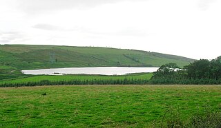
The Loch of Stair was a typical Ayrshire post-glacial 'Kettle Hole', situated in a low-lying area below the farm of Loch Hill, in the Parish of Stair, East Ayrshire, Scotland. This freshwater loch was drained in the 19th century, leaving a wetland area which still periodically floods.

Lowes Loch, The Lochs or Loch of Hill is now a small natural freshwater loch in the North Ayrshire Council Areas, lying in a glacial kettle hole, once of greater extent, lying below Brownmuir and Lochland Hills on the Threepwood Road, near Beith, in the Parish of Beith. The loch may once have had a small island within it.

Carcluie Loch is a small freshwater loch in the South Ayrshire Council Area, lying in a glacial Kettle Hole, Parish of Dalrymple, Scotland.
Kerse Loch, also recorded as Carse Loch (1841) is a small freshwater loch in the East Ayrshire Council Area, lying in a glacial Kettle Hole, Parish of Dalrymple, Scotland.

Auchencloigh Castle or Auchincloigh Castle is a ruined fortification near the Burnton Burn, lying within the feudal lands of the Craufurd Clan, situated in the Parish of Ochiltree, East Ayrshire, Scotland.

Belston Loch, also recorded as Dromsmodda Loch is a small freshwater loch in the East Ayrshire Council Area, near Sinclairston, 2 miles south-east of Drongan, lying in a glacial Kettle Hole. Parish of Ochiltree, Scotland.
Plaid Loch was a freshwater loch in East Ayrshire, now a remnant due to drainage, near Sinclairston and 2 miles (3 km) south-east of Drongan, lying in a glacial kettle hole,.
South Palmerston Loch or Flush, previously known as Loch of the Hill, lying to the east of the 500 ft Back hill Mount. It was one of several small lochs within the Parish of Ochiltree. The loch, lying in a glacial kettle hole, drained into the Lugar Water via the Burnock Water.

Whitehill Loch, previously known as Hillhouse Loch was a freshwater loch in the East Ayrshire Council Area, now drained, near Galston, in the Parish of Riccarton, lying in a glacial Kettle Hole.

Black Loch is a freshwater loch, named from its dark waters, situated in the East Ayrshire Council Area, between Cumnock and New Cumnock, lying in a glacial Kettle Hole mainly within the Parish of New Cumnock, a small portion protruding into Old Cumnock Parish. It is said to be one of only two lochs or lakes in the world that have outflows running to two separate destinations. The 'Runner' is a deep and broad ditch that was dug many years back to link the three lochs of Lowes, Black, and Creoch.
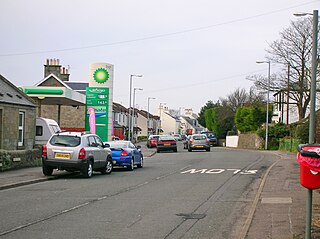
Loans is a village in South Ayrshire near Troon, Scotland. It is located in Dundonald parish on the A759 at the junction with the B746 and a minor road to Dundonald.


