Related Research Articles

Osage County is a county located in the U.S. state of Kansas. Its county seat is Lyndon, and its most populous city is Osage City. As of the 2020 census, the county population was 15,766. The county was originally organized in 1855 as Weller County, then renamed in 1859 after the Osage tribe.

Leavenworth County is located in the U.S. state of Kansas and is part of the Kansas City metropolitan area. Its county seat and most populous city is Leavenworth. As of the 2020 census, the county population was 81,881. The county was named after Henry Leavenworth, a general in the Indian Wars who established Fort Leavenworth.

Franklin County is a county located in the eastern portion of the U.S. state of Kansas. Its county seat and most populous city is Ottawa. As of the 2020 census, the county population was 25,996. The county was named for Benjamin Franklin, a founding father of the United States. Formerly it was considered part of the Kansas City metropolitan area, but was removed in 2013.

Douglas County is located in the U.S. state of Kansas. Its county seat and most populous city is Lawrence. As of the 2020 census, the county population was 118,785, making it the fifth-most populous county in Kansas. The county was named after Stephen Douglas, a U.S. Senator from Illinois and advocate for the popular sovereignty choice in the Kansas slavery debate.

The Midland Railway was a heritage railroad operating 16 miles of line in Franklin County and Douglas County in Kansas between Ottawa, Kansas and Baldwin City, Kansas.

The sacking of Lawrence occurred on May 21, 1856, when pro-slavery settlers, led by Douglas County Sheriff Samuel J. Jones, attacked and ransacked Lawrence, Kansas, a town that had been founded by anti-slavery settlers from Massachusetts who were hoping to make Kansas a free state. The incident fueled the irregular conflict in Kansas Territory that later became known as Bleeding Kansas.

Kansas' 2nd congressional district is a congressional district in the U.S. state of Kansas that covers most of the eastern part of the state, except for the core of the Kansas City Metropolitan Area. The district encompasses less than a quarter of the state. The state capital of Topeka, the cities of Emporia, Junction City and Leavenworth and most of Kansas City are located within this district. The district is currently represented by Republican Jake LaTurner.

Stull is an unincorporated community in Douglas County, Kansas, United States. Founded in 1857, the settlement was initially known as Deer Creek until it was renamed after its only postmaster, Sylvester Stull. As of 2018, only a handful of structures remain in the area.
Grant Township is a township in Douglas County, Kansas, USA. As of the 2000 census, its population was 442.

Marion Township is a township in Douglas County, Kansas, USA. As of the 2000 census, its population was 836. It was named after the former town of Marion which in turn was named after Francis Marion.
Palmyra Township is a township in Douglas County, Kansas, USA. As of 2000 census, its population was 5,760. It was named after a small trail stop on the Santa Fe Trail that was later absorbed into Baldwin City. When it was first established in 1855, it was called Calhoun, until 1858.

Wakarusa Township is a township in Douglas County, Kansas, USA. As of the 2010 census, its population was 2,318. It was named for the Wakarusa River which flows through Douglas County from Wabaunsee County to the Kansas River near Eudora.

Willow Springs Township is a township in Douglas County, Kansas, USA. As of the 2000 census, its population was 1,409. Willow Springs Township was formed in 1856. It was named after a small watering stop along the Santa Fe Trail.

Silkville is a ghost town in Williamsburg Township, Franklin County, Kansas, United States. It was located approximately 2 miles southwest of Williamsburg at the intersection of U.S. 50 highway and Arkansas Road.
Two structures in Lawrence have been known as the Lawrence Armory - the Civil War era armory and the Lawrence Kansas Army National Guard Armory.
The Lawrence blockhouses were a series of blockhouses built in the spring of 1864 in Lawrence, Kansas, to provide defensive structures in case of attack by Confederate guerrillas. On August 21, 1863, Lawrence had been attacked by 400 guerrillas and Confederate Army recruits under the command of William C. Quantrill. Lawrence was caught virtually defenseless and much of the town was destroyed and about 180 men and boys were killed, most of them defenseless. A militia became active by spring 1864 to prevent another attack.
Little is known about Fort Wakarusa, which was built by free-state partisans between 1855 and 1857. Historian William E. Connelley drew a map in the 1920s that located the fort on the north side of the Wakarusa River, at Blue Jacket's Crossing. The town of Sebastian, Kansas, was on the south side of the river. Considering that the area is very flat and that there are some meander scars showing that the river has changed course various times, the site of Fort Wakarusa may today be on the south side of the river. The fort was located about midway between Lawrence, Kansas, and Eudora, Kansas.
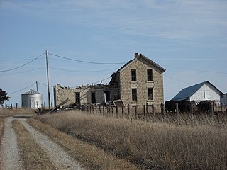
Franklin is a ghost town in Douglas County, Kansas, United States. Established as a proslavery stronghold, the town played a key role in the "Bleeding Kansas" conflict that troubled the territory in the 1850s.
Black Jack is an unincorporated community in Douglas County, Kansas, United States.
Simmons Point Station is the name of a house near the unincorporated settlement of Globe in Marion Township, Douglas County, Kansas. The building was constructed in the 1880s as a way station for travelers on the Santa Fe Trail, and it was run by Phillip and Elmira Dodder Simmons.
References
- ↑ U.S. Geological Survey Geographic Names Information System: Louisiana (historical)
- 1 2 3 Cleland, Nora (June 12, 1961). "Only few of 45 county settlements left". Lawrence Journal-World. pp. 12A. Retrieved November 1, 2015.
- ↑ "Douglas County". Jim Forte Postal History. Retrieved November 1, 2015.
