Marion Township | |
|---|---|
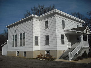
 Globe Glass Works in Globe (2009). | |
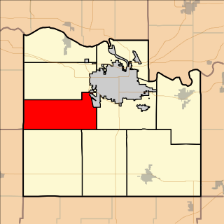
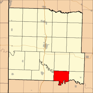
 Location in Douglas County | |
| Coordinates: 38°48′20″N095°25′41″W / 38.80556°N 95.42806°W Coordinates: 38°48′20″N095°25′41″W / 38.80556°N 95.42806°W | |
| Country | United States |
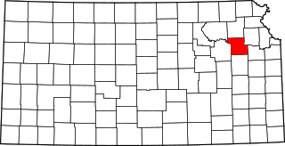
| State | Kansas |
| County | Douglas |
| Area | |
| • Total | 71.93 sq mi (186.29 km2) |
| • Land | 71.55 sq mi (185.32 km2) |
| • Water | 0.37 sq mi (0.96 km2) 0.52% |
| Elevation | 1,099 ft (335 m) |
| Population (2000) | |
| • Total | 836 |
| • Density | 11.7/sq mi (4.5/km2) |
| GNIS feature ID | 0479476 |
Marion Township is a township in Douglas County, Kansas, USA. As of the 2000 census, its population was 836. It was named after the former town of Marion which in turn was named after Francis Marion.
A civil township is a widely used unit of local government in the United States that is subordinate to a county. The term town is used in New England, New York, and Wisconsin to refer to the equivalent of the civil township in these states. Specific responsibilities and the degree of autonomy vary based on each state. Civil townships are distinct from survey townships, but in states that have both, the boundaries often coincide and may completely geographically subdivide a county. The U.S. Census Bureau classifies civil townships as minor civil divisions. Currently, there are 20 states with civil townships.

Douglas County is a county located in the U.S. state of Kansas. As of the 2010 census, the county population was 110,826, making it the fifth-most populous county in Kansas. Its county seat and most populous city is Lawrence.

Kansas is a U.S. state in the Midwestern United States. Its capital is Topeka and its largest city is Wichita, with its most populated county being Johnson County. Kansas is bordered by Nebraska on the north; Missouri on the east; Oklahoma on the south; and Colorado on the west. Kansas is named after the Kansas River, which in turn was named after the Kansa Native Americans who lived along it banks. The tribe's name is often said to mean "people of the (south) wind" although this was probably not the term's original meaning. For thousands of years, what is now Kansas was home to numerous and diverse Native American tribes. Tribes in the eastern part of the state generally lived in villages along the river valleys. Tribes in the western part of the state were semi-nomadic and hunted large herds of bison.