
Ponderay is a city in Bonner County, Idaho. The population was 1,137 at the 2010 census, up from 638 in 2000. Ponderay's city motto is "Little City with the Big Future". Its name is an english phonetic spelling of the french words “Pend Oreille”, the name of the lake the city sits upon.

Wood Lake is a city in Yellow Medicine County, Minnesota, United States. The population was 439 at the 2010 census.

Catron is a city in New Madrid County, Missouri, United States. The population was 67 at the 2010 census.

Palmyra is a village in Otoe County, Nebraska, United States. The population was 545 at the 2010 census.

Marshallton is a census-designated place (CDP), located in Coal Township, in Northumberland County, Pennsylvania, United States. The population was 1,441 at the 2010 census.

Tennyson is a village in Grant County, Wisconsin, United States, originally called Dutch Hollow. The population was 355 at the 2010 census.

Birch is a town in Lincoln County, Wisconsin, United States. As of the 2010 census, the town had a population of 594, down from 801 at the 2000 census. The unincorporated community of Irma is located in the town.

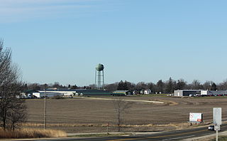
Frederic is a village in Polk County, Wisconsin, United States. The population was 1,137 at the 2010 census.

Bonduel is a village in Shawano County, Wisconsin, United States. The population was 1,478 at the 2010 census.

Big Falls is a village in Waupaca County, Wisconsin, United States. The population was 61 at the 2010 census.

Hewitt is a village in Wood County, Wisconsin, United States. The population was 828 at the 2010 census.

Unity is a village in Clark and Marathon counties in the U.S. state of Wisconsin. It is part of the Wausau, Wisconsin Metropolitan Statistical Area. The population was 343 at the 2010 census. Of this, 204 were in Marathon County, and 139 were in Clark County. The village is located in northeastern town of Unity in Clark County and northwestern town of Brighton in Marathon County.
Arlington is a village in Columbia County, Wisconsin, United States. The population was 819 at the 2010 census. The village is located within the Town of Arlington. It is part of the Madison Metropolitan Statistical Area.

Necedah is a village in Juneau County, Wisconsin, United States. The population was 916 at the 2010 census. The village is located within the Town of Necedah.

Casco is a village in Kewaunee County, Wisconsin, United States. The population was 583 at the 2010 census. It is part of the Green Bay Metropolitan Statistical Area. The village is located within the Town of Casco.

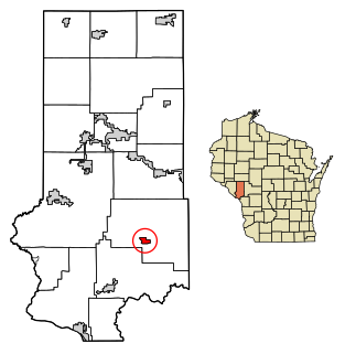
Luxemburg is a town in Kewaunee County, Wisconsin, United States. The population was 1,469 at the 2010 census. The village of Luxemburg, a separate municipality, is surrounded by the town. The unincorporated communities of Walhain and Casco Junction are in the town, and Neuern, Frog Station, and Tonet are partially in the town.

Pepin is a village in Pepin County, Wisconsin, United States. The population was 837 at the 2010 census. The village is located within the Town of Pepin.
Ettrick is a village in Trempealeau County, Wisconsin, United States. The population was 524 at the 2010 census. The village is surrounded by the Town of Ettrick.

Plainfield is a village in Waushara County, Wisconsin, United States. The village is located almost entirely within the Town of Plainfield. A tiny portion extends into adjacent Town of Oasis. The population was 897 at the 2010 census.

Norway is a census-designated place (CDP) in the town of Norway in Oxford County, Maine, United States. The population was 2,623 at the 2000 census.

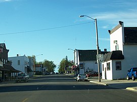 Looking north at downtown Luxemburg
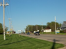 Looking east at Luxemburg
 Road sign
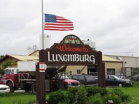 Welcome sign
 Ron's Cheese sign


