
The R24 is a major East-West provincial route in the Gauteng and North West provinces that links OR Tambo International Airport with Rustenburg via Johannesburg, Krugersdorp and Magaliesburg. The process of renaming the streets and freeway that form the route from Krugersdorp eastward to OR Tambo International after anti-apartheid stalwart Albertina Sisulu was completed in 2013.

The R28 is a provincial route in Gauteng, South Africa that connects Krugersdorp with Vereeniging via Randfontein. The R28 used to connect with Pretoria, but that section of the road is now part of the N14.

The R30 is a provincial route in South Africa that connects Bloemfontein with Rustenburg via Brandfort, Welkom, Bothaville, Klerksdorp and Ventersdorp. The southern part of the route is tolled, as the R30 forms the first section of the ZR Mahabane Toll Route, with the Brandfort Toll Plaza found 10 kilometres north of its Southern junction with the N1 National Route. The tolled portion ends at the junction with the R730.
The R41 is a provincial route in Gauteng, South Africa, that connects Johannesburg with Randfontein via Roodepoort.
The R104 is a regional route in South Africa that is the designation for some of the old sections of roads that were previously the N4, prior to upgrading. It connects Rustenburg in the North West province with Witbank in Mpumalanga province via Mooinooi, Hartbeespoort, Pretoria and Bronkhorstspruit. There is also a 50km section in Mpumalanga province connecting Middelburg and Wonderfontein.

The N12 is a national route in South Africa which runs from George through Beaufort West, Kimberley, Klerksdorp and Johannesburg to eMalahleni.

The N4 is a national route in South Africa that runs from Skilpadshek on the Botswana border, past Rustenburg, Pretoria, eMalahleni and Mbombela, to Komatipoort on the Mozambique border. The entire route is a toll road.

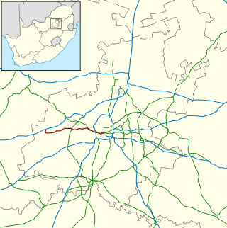
The N14 is a national route in South Africa which runs from Springbok in the Northern Cape to Pretoria in Gauteng. It passes through Upington, Kuruman, Vryburg, Krugersdorp and Centurion. The section between Pretoria and Krugersdorp is maintained by the Gauteng Provincial government and is also designated the P158.

The N17 is a national route in South Africa which runs from Johannesburg to Oshoek (Ngwenya) on the border with Eswatini. It passes through Springs, Bethal and Ermelo.
The R512 is a Regional Route in South Africa that connects Brits, North West with Randburg, Gauteng via the western side of Hartbeespoort. It is an alternative route to the R511 for travel between the Johannesburg Metropole and Brits.
The M5 is a long metropolitan route in the Greater Johannesburg metropolitan area in South Africa. It starts in Ridgeway in the southern suburbs of Johannesburg. It passes through Mayfair and Brixton before travelling through Melville, Roosevelt Park, Northcliff, Blackheath and traversing the N1 Western Bypass at Randpark Ridge. It passes under the N14 freeway near Muldersdrift passing through the agricultural holding before ending at Kromdraai Road in the Lindley Agricultural Holdings. The main part of the route runs along Beyers Naudé Drive.
The M10 is a long metropolitan route in Greater Johannesburg, South Africa. It connects Lenasia with Johannesburg Central via Soweto.
The M18 is a long metropolitan route in Greater Johannesburg, South Africa. It connects Krugersdorp with Bruma via Constantia Kloof, Florida, Auckland Park, Braamfontein and Observatory.
The M39 is a long metropolitan route in Greater Johannesburg, South Africa. It connects Kyalami with Germiston via Midrand, Kempton Park & Isando.
The M40 is a metropolitan route in Greater Johannesburg, South Africa that connects Sandton with Bedfordview via Wynberg, Kew, Lyndhurst and Senderwood.
The M44 is a short metropolitan route in Greater Johannesburg, South Africa. It connects the Elandsfontein industrial suburb in the northern part of Germiston with Petit in the north-eastern part of Benoni.
The M47 is a short metropolitan route in Roodepoort, South Africa. It connects the N14 at Cradlestone Mall with the M18 at Maraisburg in Roodepoort. It consists of only one street, named Hendrik Potgieter Road.
The M59 is a short metropolitan route in Greater Johannesburg, South Africa. The entire route is in the western part of the City of Ekurhuleni Metropolitan Municipality, particularly in Kempton Park and Edenvale.
The M86 is a short metropolitan route in the Greater Johannesburg, South Africa. It connects Krugersdorp with Randpark Ridge via Roodepoort.
The M99 is a short metropolitan route in Greater Johannesburg, South Africa. For its entire route, it parallels the R24 highway in the City of Ekurhuleni Metropolitan Municipality.
