M18 (Johannesburg)

Last updated

Joburg road M18.svg
Metropolitan route M18
Route information
Maintained by Johannesburg Roads Agency and Gauteng Department of Roads and Transport
Length39.4 km (24.5 mi)
Major junctions
West endSA road R28.svg R28 at Noordheuwel
Major intersectionsM36 ZAF jct.svg M36 at Factoria
M67 ZAF jct.svg M67 at Princess
SA road R564.svg R564 at Constantia Kloof
M69 ZAF jct.svg M69 at Constantia Kloof
M8 ZAF jct.svg M8 at Florida Park
M47 ZAF jct.svg M47 at Maraisburg
M30 ZAF jct.svg M30 at Delarey
M10 ZAF jct.svg M10 at Westbury
M5 ZAF jct.svg M5 at Auckland Park
M17 ZAF jct.svg M17 at Auckland Park
M7 ZAF jct.svg M7 at Cottesloe
M27 ZAF jct.svg M27 at Braamfontein
M9 ZAF jct.svg M9 at Braamfontein
M11 ZAF jct.svg M11 at Hillbrow
M31 ZAF jct.svg M31 at Hillbrow
M10 ZAF jct.svg M10 at Observatory
M33 ZAF jct.svg M33 at Cyrildene
East endSA road R24.svg R24 at Bruma
Location
Country South Africa
Highway system
M17 ZAF jct.svg M17 M19 ZAF jct.svg M19

The M18 is a long metropolitan route in Greater Johannesburg, South Africa. [1] [2] It connects Krugersdorp with Bruma via Constantia Kloof, Florida, Auckland Park, Braamfontein and Observatory. [3]

It is an alternative route to the R24 route for travel between Krugersdorp and Bruma.

Route

The M18 begins at a junction with the R28 road (Paardekraal Drive) in the Noordheuwel suburb of Krugersdorp (just north of the Krugersdorp CBD) in the Mogale City Local Municipality, heading east-south-east as Voortrekker Road. It bypasses the Coronation Park, meets the M36 road and enters the Silverfields suburb, where it becomes parallel to the R24 road (Albertina Sisulu Road) eastwards for a few kilometres. Just after, at the suburb of Mindalore, the M18 changes its street name to Ontdekkers Road and leaves the Mogale City Local Municipality to enter Roodepoort in the City of Johannesburg Metropolitan Municipality. [3]

It enters the Princess suburb of Roodepoort, where it meets the M67 road and bypasses the Westgate Shopping Centre. It continues east-south-east, through Horizon Park and Ontdekkers Park, to reach a junction with the R564 road (Christiaan De Wet Avenue) west of Constantia Kloof. It continues east-south-east, through Florida Park (where it meets the M69 road), Floracliffe (where it meets the M8 road), Florida Hills and Florida Central, to meet the south-eastern terminus of the M47 road (Hendrik Potgieter Road) just north of the Maraisburg suburb. Immediately after, it flies over the N1 highway (Johannesburg Western Bypass) and leaves the city of Roodepoort to enter the city of Johannesburg. [3]

It heads eastwards as Main Road, passing through the Delarey and Newlands suburbs (meeting the M30 road), becoming Perth Road and turning east-south-east, to meet the M10 road at a junction. Here, they switch roads, with the M10 becoming the east-south-easterly road and the M18 becoming the east-north-easterly road (still named Perth Road). It becomes Kingsway Avenue eastwards, bypassing the University of Johannesburg Kingsway Campus and meeting the M5 road (Beyers Naudé Drive), to meet the M17 road (Henley Drive). [3]

Just after meeting the M17, the M18 turns south-eastwards as Annet Road to reach a junction with the M7 road (Barry Hertzog Avenue). The M18 joins the M7 and they are one road southwards as Annet Road, then as Solomon Street, before the M18 becomes Enoch Sontonga Avenue eastwards and flies over the M1 highway, bypassing the University of the Witwatersrand to the south. [3]

It continues eastwards as two one-way-streets (Jorissen Street eastwards and De Korte Street westwards), meeting the M27 road (Jan Smuts Avenue) north of the Nelson Mandela Bridge in Braamfontein, to meet the M9 road (Civic Boulevard) adjacent to the Joburg Theatre and the Johannesburg City Council. The M18 joins the M9, passing around the City Council offices, to reach the eastern side of the City Council, where the M9 becomes Joubert Street northwards and the M18 becomes Kotze Road eastwards. It enters the suburb of Hillbrow, where it becomes two one-way-streets (Pretoria Street eastwards and Kotze Street westwards) and meets the M11 road (Klein Street). [3]

At the junction with Catherine Avenue, the M18 becomes one street eastwards (Abel Road). It proceeds to reach a junction with the M31 road (Joe Slovo Drive). The M18 joins the M31 and they are one road northwards for 750 metres up to the junction with Raleigh Street, where the M18 becomes Raleigh Street eastwards and separates the Yeoville suburb from the Bellevue suburb. It becomes two one-way-streets (Hunter Street westwards and Rockey Street eastwards) for a few metres before becoming Observatory Avenue eastwards, passing through the Observatory suburb and bypassing the Observatory Golf Course and the Bezidenhout Park. [3]

It meets the M10 road again and proceeds eastwards as Marcia Street and reaches a junction with the M33 road (Friedland Avenue; Queen Street) in the Cyrildene suburb. After a few metres eastwards, it turns towards the south-south-east and crosses the Jukskei River, bypasses the Bruma Lake Market and reaches its end at a junction with the R24 road (Albertina Sisulu Road) in the suburb of Bruma, just west of the Eastgate Shopping Centre and just north-east of Kensington. [3]

Related Research Articles

<span class="mw-page-title-main">N1 Western Bypass (Johannesburg)</span> Road in South Africa

The Western Bypass is a section of the N1 and the Johannesburg Ring Road located in the city of Johannesburg, South Africa. Known at the time as the Concrete Highway, the freeway was initially opened in 1975 as a route to avoid the city centre of Johannesburg and to provide access to the western areas of the Witwatersrand. From the south, the Western Bypass begins at the Diepkloof Interchange in Soweto, where it splits from the N12 freeway and ends at the Buccleuch Interchange, where it merges with the N3 Eastern Bypass, M1 South and N1 Ben Schoeman freeways.

<span class="mw-page-title-main">R24 (South Africa)</span> Road in South Africa

The R24 is a major East-West provincial route in the Gauteng and North West provinces that links OR Tambo International Airport with Rustenburg via Johannesburg, Krugersdorp and Magaliesburg. The process of renaming the streets and freeway that form the route from Krugersdorp eastward to OR Tambo International after anti-apartheid stalwart Albertina Sisulu was completed in 2013.

<span class="mw-page-title-main">R28 (South Africa)</span>

The R28 is a provincial route in Gauteng, South Africa that connects Krugersdorp with Vereeniging via Randfontein. The R28 used to connect with Pretoria, but that section of the road is now part of the N14.

<span class="mw-page-title-main">R41 (South Africa)</span> Road in South Africa

The R41 is a provincial route in Gauteng, South Africa, that connects Johannesburg with Randfontein via Roodepoort.

<span class="mw-page-title-main">N14 (South Africa)</span> National road in South Africa

The N14 is a national route in South Africa which runs from Springbok in the Northern Cape to Pretoria in Gauteng. It passes through Upington, Kuruman, Vryburg, Krugersdorp and Centurion. The section between Pretoria and Krugersdorp is maintained by the Gauteng Provincial government and is also designated the P158.

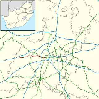
The R564 is a Regional Route in the City of Johannesburg Metropolitan Municipality in Gauteng, South Africa. It connects Roodepoort with Buccleuch via Northriding and Fourways.

The M17 is a metropolitan route in Johannesburg, South Africa. It runs north from the southern suburb of Ridgeway through Mayfair a suburb just west of the Johannesburg Central Business District and ends in the north in Auckland Park. It intersect two main Johannesburg freeways, starting with an intersection to the N12 Southern Bypass and the north–south M1 freeway.

M7 is a metropolitan route in the Greater Johannesburg metropolitan area. The road connects Thokoza and the southern suburbs of Alberton with suburbs to the west of the Johannesburg CBD.

The M8 is a short metropolitan route in the City of Johannesburg, South Africa. It starts in Florida Park, Roodepoort and ends in Linden, Randburg to the east.

M11 is a major metropolitan route in Greater Johannesburg, South Africa. Historically it was part of the main road between Johannesburg and Pretoria; it now runs through the central and north-eastern parts of the city from Bassonia, passing through Johannesburg CBD and Hillbrow, passing through numerous older suburbs, including Houghton and Orange Grove and the Alexandra Township as Louis Botha Avenue, before it becomes the Old Pretoria Road (R101) and continues to Midrand and Pretoria.

M16 is a metropolitan route in the Greater Johannesburg metropolitan area, South Africa. It begins in the north-western suburb of Greenside and heads eastwards through some of Johannesburg's northern suburbs and through Edenvale to end at the East Rand town of Kempton Park.

M71 is a major metropolitan route in the City of Johannesburg, South Africa. Starting in the northern CBD, it connects the centre of Johannesburg with the northern suburbs before ending in the outer northern city of Midrand.

The M10 is a long metropolitan route in Greater Johannesburg, South Africa. It connects Lenasia with Johannesburg Central via Soweto.

The M36 is a short metropolitan route in Greater Johannesburg, South Africa. The entire route is within the city of Krugersdorp in the Mogale City Local Municipality.

The M39 is a long metropolitan route in Greater Johannesburg, South Africa. It connects Kyalami with Germiston via Midrand, Kempton Park & Isando.

The M40 is a metropolitan route in Greater Johannesburg, South Africa that connects Sandton with Bedfordview via Wynberg, Kew, Lyndhurst and Senderwood.

The M47 is a short metropolitan route in Roodepoort, South Africa. It connects the N14 at Cradlestone Mall with the M18 at Maraisburg in Roodepoort. It consists of only one street, named Hendrik Potgieter Road.

The M86 is a short metropolitan route in the Greater Johannesburg, South Africa. It connects Krugersdorp with Randpark Ridge via Roodepoort.

The M10 road is a long metropolitan route in the City of Tshwane in Gauteng, South Africa. It connects Sunderland Ridge with Mamelodi via Lyttelton and Garsfontein.

The M11 road is a short metropolitan route in the City of Tshwane in Gauteng, South Africa. It connects the Pretoria CBD with Faerie Glen and Garsfontein via Sunnyside, Brooklyn and Menlyn.

References

  1. "Johannesburg Roads Agency - Company documents". www.jra.org.za. Retrieved 23 March 2021.
  2. "Johannesburg Road Agency Q2 2021 Report" (PDF). Johannesburg Road Agency Website. Retrieved 23 March 2021.
  3. 1 2 3 4 5 6 7 8 "RDDA SOUTH AFRICAN NUMBERED ROUTE DESCRIPTION AND DESTINATION ANALYSIS". NATIONAL DEPARTMENT OF TRANSPORT. May 2012. Retrieved 25 March 2021.