Union Observatory also known as Johannesburg Observatory (078) is a defunct astronomical observatory in Johannesburg, South Africa that was operated between 1903 and 1971. It is located on Observatory Ridge, the city's highest point at 1,808 metres altitude in the suburb Observatory.

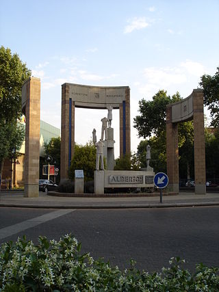
Alberton is a city situated on the southern part of the East Rand of the Gauteng Province in South Africa and is situated very close to the major urban centre of Johannesburg.

Northcliff is a wealthy residential suburb of Johannesburg, South Africa. The suburb is located on Northcliff Ridge which provides views to both the north and the south. Northcliff's huge homes are nestled around a steep incline of the hill, and on the foot of Northcliff borders the suburbs of Fairland, Blackheath, Cresta and Berario. Recently some streets have been secured with boom gates. Although erroneously included by Google Maps as part of Randburg, Northcliff has never been part of Randburg. It is located in Region B of the City of Johannesburg Metropolitan Municipality.

The suburbs of Johannesburg are officially demarcated areas within the City of Johannesburg Metropolitan Municipality, South Africa. As in other Commonwealth countries, the term suburb refers to a "neighbourhood", although in South Africa as most "suburbs" have legally recognised borders and often separate postal codes. The municipal functions for the area, such as municipal policing and social services, are still managed by the city government.

Kempton Park is a city in the East Rand region of Gauteng province, South Africa. It is part of the City of Ekurhuleni Metropolitan Municipality. It is situated south of Tembisa, one of the largest townships in South Africa, which is also part of Ekurhuleni. South Africa's busiest airport, O. R. Tambo International Airport is located in Kempton Park.

Melville is a bohemian suburb of Johannesburg, Gauteng, South Africa. It is the location of many restaurants and taverns, which are mostly frequented by students from the nearby University of Johannesburg, located in Auckland Park, and the University of the Witwatersrand, located in Braamfontein. It is one of the city's most popular tourist destinations. The suburb is to the west of the Johannesburg CBD. It is located in Region B of the City of Johannesburg Metropolitan Municipality.
Bordeaux is a suburb of Johannesburg, South Africa. Found north of the Johannesburg CBD, it is next to the suburbs of Ferndale, Blairgowrie and Hurlingham. It is located in Region B of the City of Johannesburg Metropolitan Municipality.
Houghton Estate, often simply called Houghton is an affluent suburb of Johannesburg, South Africa, north-east of the city centre.
Kensington is a hilly suburb of Johannesburg, South Africa. It was established in 1897 by Max Langermann. It is located in Region F of the City of Johannesburg Metropolitan Municipality and is bounded to the west by the suburb of Troyeville, to the east by Bedfordview and the north by Bruma and Cyrildene.
Moodie Hill is a small affluent suburb consisting of four roads; Springhill Road, Springhill Close, Van Meurs Avenue and a small section of Coleraine Drive. It is situated in Johannesburg, Region E of the City of Johannesburg Metropolitan Municipality, Sandton. South Africa.
Bellevue is an inner city neighbourhood of Johannesburg, Gauteng Province, South Africa. Close to the Johannesburg CBD with the neighbourhood surrounded by Yeoville and Observatory. It is located in Region F of the City of Johannesburg Metropolitan Municipality. It shares the same praise and notoriety as its surrounding neighbourhood Yeoville.
Bellevue East is a suburb of Johannesburg, South Africa. It is located in Region F of the City of Johannesburg Metropolitan Municipality.
Greenside, is a suburb of Johannesburg, South Africa. Greenside borders on the suburbs Emmarentia, Parkview, Parkhurst and Victory Park.

Observatory is a suburb in Cape Town, South Africa, colloquially known as Obs. Bordered by Mowbray to the south and Salt River to the northwest, the area is best known as a student neighbourhood associated with the nearby University of Cape Town and Groote Schuur Hospital. It takes its name from the South African Astronomical Observatory headquarters, built in 1829 by the Royal Observatory.
Bunting Road Campus Auckland Park, also known as APB, is one of the four urban campuses of the University of Johannesburg. The APB was originally a campus of the Technikon Witwatersrand.

Wemmer Pan is a lake and recreational area in Johannesburg, South Africa. It's located to the south of the city centre, in the suburb of La Rochelle.
Linksfield is a suburb of Johannesburg, South Africa. It is a suburb lying north-east of the Johannesburg CBD and is surrounded southerly by Linksfield Ridge, easterly by Linksfield North and Bedford, St Andrews and Senderwood. Linksfield itself is located in Region E of the City of Johannesburg Metropolitan Municipality. On the southerly side and over the ridge are the areas of Cyrildene, Observatory and Morninghill, but these suburbs are not visible to Linksfield as they are hidden behind the Linksfield Ridge.

Westdene is a suburb of Johannesburg, South Africa. Westdene lies between the historic suburb of Sophiatown and Melville with the Melville Koppies West nature reserve to the north of the suburb. Westdene derives its name from its location, literally meaning west-valley. 'West' since it is located west from the city centre and with 'dene' derived from the Old English denu, meaning valley.
M11 is a major metropolitan route in Greater Johannesburg, South Africa. Historically it was part of the main road between Johannesburg and Pretoria; it now runs through the central and north-eastern parts of the city from Bassonia, passing through Johannesburg CBD and Hillbrow, passing through numerous older suburbs, including Houghton and Orange Grove and the Alexandra Township as Louis Botha Avenue, before it becomes the (R101) Old Pretoria Road and continues to Midrand and Pretoria.
The M18 is a long metropolitan route in Greater Johannesburg, South Africa. It connects Krugersdorp with Bruma via Constantia Kloof, Florida, Auckland Park, Braamfontein and Observatory.


