The area referred to as Fourways is the fastest-developing commercial and residential hub in Sandton, north of Johannesburg, South Africa. The main access routes to Fourways are off the N1 at R511 William Nicol Drive, or alternatively along R564 Witkoppen Road. It is located mostly in Region E of the City of Johannesburg Metropolitan Municipality. It is roughly as far as one can go in the Johannesburg Metropolitan area before it dissolves into rolling hills, game farms and the capital Pretoria, 55 kilometres to the northeast. Hartebeespoort Dam and the Magaliesberg Mountains lie half an hour to the north-west. It is bordered by Bryanston to the east and south and Randburg to the west.

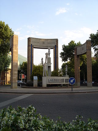
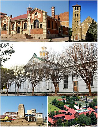
Alberton is a town situated on the southern part of the East Rand of the Gauteng Province in South Africa and is situated very close to the major urban centre of Johannesburg.

Boksburg is a city on the East Rand (Ekhuruleni) of Gauteng province of South Africa. Gold was discovered in Boksburg in 1887. Boksburg was named after the State Secretary of the South African Republic, W. Eduard Bok. The Main Reef Road linked Boksburg to all the other major mining towns on the Witwatersrand and the Angelo Hotel (1887) was used as a staging post.
Florida is a location in Gauteng province, South Africa. It is located about 16 kilometres west of Johannesburg. The area which is referred to as Florida was originally established as the farm Vogelstruisfontein. Today, it is a suburb of Roodepoort.

Melville is a bohemian suburb of Johannesburg, Gauteng, South Africa. It is the location of many restaurants and taverns, which are mostly frequented by students from the nearby University of Johannesburg, located in Auckland Park, and the University of the Witwatersrand, located in Braamfontein. It is one of the city's most popular tourist destinations. The suburb is to the west of the Johannesburg CBD. It is located in Region B of the City of Johannesburg Metropolitan Municipality.
Auckland Park is a suburb of Johannesburg, South Africa. It lies on a gentle slope, and is in close proximity to the suburbs of Melville, Brixton, Westdene and Richmond. Auckland Park is one of the few suburbs close to the Johannesburg city centre that has remained largely unaffected by the recent migration of Johannesburg residents to the city's northern suburbs. Auckland Park is home to a mix of nationalities and cultures, and the suburb is well known as the location of the South African Broadcasting Corporation headquarters.
The Hill is a suburb of Johannesburg, South Africa. The area lies to the south of the Johannesburg CBD and is surrounded by the suburbs of Regents Park, Rosettenville and Linmeyer. It is located in Region F of the City of Johannesburg Metropolitan Municipality.
Kensington is a hilly suburb of Johannesburg, South Africa. It was established in 1897 by Max Langermann. It is located in Region F of the City of Johannesburg Metropolitan Municipality and is bounded to the west by the suburb of Troyeville, to the east by Bedfordview and the north by Bruma and Cyrildene.
Orange Grove is a suburb of Johannesburg, South Africa. It is located in Region E of the City of Johannesburg Metropolitan Municipality.
Saxonwold is an affluent suburb of Johannesburg, South Africa. It is situated in what was once the Sachsenwald Forest in the early 20th century. It is located in Region E of the City of Johannesburg Metropolitan Municipality.

The Johannesburg Zoo is a 55-hectare (140-acre) zoo in Johannesburg, South Africa. The zoo is dedicated to the accommodation, enrichment, husbandry, and medical care of wild animals, and houses about 2000 individuals of 320 species. Established in 1904, it has traditionally been owned and operated by the Johannesburg City Council. However, it has been turned into a corporation and registered as a Section 21 non-profit organisation.
Parktown is a wealthy suburb of Johannesburg, South Africa, the first suburb north of the inner city. It is affectionately known as one of the Parks, others including Parkview, Parkwood, Westcliff, Parktown North, Parkhurst and Forest Town. Parktown is one of Johannesburg's largest suburbs, neighbouring Hillbrow, Braamfontein and Milpark to the South; Berea and Houghton to the East; Killarney and Forest Town to the North, and Westcliff, Melville and Richmond to the West. Originally established by the Randlords in the 1890s, Parktown is now home to many businesses, hospitals, schools, churches and restaurants, whilst still maintaining quiet residential areas. It is also home to three of the five campuses of the University of the Witwatersrand including the education campus, medical school and Wits Business School. It is located in Region F of the City of Johannesburg Metropolitan Municipality.
Troyeville is a suburb of Johannesburg, South Africa. It is a small suburb found on the eastern edge of the Johannesburg central business district (CBD), with the suburbs of New Doornfontein, Bertrams and Lorentzville to the north, Fairview to the south and Kensington to its east. The main road through the suburb is Albertina Sisulu, has its eastern end in the suburb and connects the CBD to Johannesburg's eastern suburbs and towns of the East Rand. It is located in Region F of the City of Johannesburg Metropolitan Municipality.
Bosmont is a suburb of Johannesburg, South Africa. Bosmont is located in Region 4. Bosmont is located in the West Rand of Johannesburg and nearly all of its residents are Coloured.
Emmarentia is a suburb of Johannesburg, South Africa.
Greenside, is a suburb of Johannesburg, South Africa. Greenside borders on the suburbs Emmarentia, Parkview, Parkhurst and Victory Park.
Jan Smuts Avenue is a major street in Johannesburg, South Africa. It begins in Randburg, and passes through important business areas like Rosebank. It passes the Johannesburg Zoo, Zoo Lake and Wits University before becoming Bertha Street, and the Nelson Mandela Bridge near the Johannesburg CBD. It has been described as "the most important road for a tourist" in Johannesburg. It forms part of Johannesburg's M27 route.
Linksfield is a suburb of Johannesburg, South Africa. It is a suburb lying north-east of the Johannesburg CBD and is surrounded southerly by Linksfield Ridge, easterly by Linksfield North and Bedford, St Andrews and Senderwood. Linksfield itself is located in Region E of the City of Johannesburg Metropolitan Municipality. On the southerly side and over the ridge are the areas of Cyrildene, Observatory and Morninghill, but these suburbs are not visible to Linksfield as they are hidden behind the Linksfield Ridge.
M27 is a major road in Johannesburg, South Africa. A large part of the route is named Jan Smuts Avenue which is roughly 12 km long. It begins in the southern suburb of Booysens and heads northwards through the Johannesburg CBD and the northern suburbs of Randburg.
M16 is a metropolitan route in Johannesburg, South Africa. It begins in the north-western suburb of Greenside and heads eastwards through some of Johannesburg's northern suburbs and through Edenvale to end at the East Rand town of Kempton Park.


