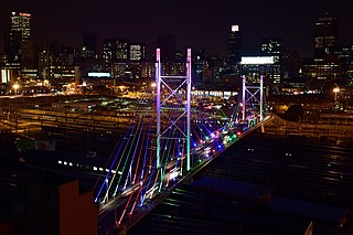
Johannesburg is the most populous city in South Africa with 4,803,262 people, and is classified as a megacity; it is one of the 100 largest urban areas in the world. It is the provincial capital of Gauteng, the wealthiest province in South Africa. Johannesburg is the seat of the Constitutional Court, the highest court in South Africa. Most of the major South African companies and banks have their head offices in Johannesburg. The city is located within the mineral-rich Witwatersrand hills, the epicentre of the international-scale mineral, gold and (specifically) diamond trade.

Alberton is a town situated on the southern part of the East Rand of the Gauteng Province in South Africa and is situated very close to the major urban centre of Johannesburg.

The suburbs of Johannesburg are officially demarcated areas within the City of Johannesburg Metropolitan Municipality, South Africa. As in other Commonwealth countries, the term suburb refers to a "neighbourhood", although in South Africa most "suburbs" have legally recognised borders and often separate postal codes. The municipal functions for the area, such as municipal policing and social services, are still managed by the city government.

The R24 is a major East-West provincial route in the Gauteng and North West provinces that links OR Tambo International Airport with Rustenburg via Johannesburg, Krugersdorp and Magaliesburg. The section of the route from OR Tambo International westwards up to a point in Roodepoort is has been named Albertina Sisulu Road since 2013, named after anti-apartheid stalwart Albertina Sisulu.

The R82 is a provincial route in South Africa that connects Johannesburg with Kroonstad via Vereeniging and Sasolburg. It starts just south of the M1 Johannesburg Municipal Highway's interchange with the N12 Southern Bypass, going south, meeting the R59, R54, R42 & R28 routes at Vereeniging before crossing the Vaal River into the Free State & proceeding to Kroonstad. It is an alternative, but longer route to the N1 national route between Johannesburg & Kroonstad.
Glenvista is a suburb in the south of Johannesburg, South Africa. It is located in Region F of the City of Johannesburg Metropolitan Municipality. It has a large Portuguese community and a distinctly cosmopolitan character. Alberton is located 5 kilometres to the East of Glenvista.
Liefde en Vrede is a suburb of Johannesburg, South Africa. It is located in Region F of the City of Johannesburg Metropolitan Municipality.
Mulbarton is a suburb that is located in the South of Johannesburg, Gauteng, South Africa. It is located in Region F of the City of Johannesburg Metropolitan Municipality.
The M2 is a major highway and metropolitan route in Greater Johannesburg, South Africa. It is named the Francois Oberholzer Freeway. It runs just to the south of the Johannesburg Central Business District eastwards where it connects with the N3 and enters Germiston, ending near its CBD. The north–south M1 intersects with the M2 just to the south-west of the Johannesburg CBD.

The N12 is a national route in South Africa which runs from George through Beaufort West, Kimberley, Klerksdorp and Johannesburg to eMalahleni.

Rosebank is one of the Southern Suburbs of Cape Town, South Africa, located between the suburbs of Mowbray and Rondebosch.

The N17 is a national route in South Africa which runs from Johannesburg to Oshoek (Ngwenya) on the border with Eswatini. It passes through Springs, Bethal and Ermelo.
M7 is a metropolitan route in the Greater Johannesburg metropolitan area. The road connects Thokoza and the southern suburbs of Alberton with suburbs to the west of the Johannesburg CBD.

Westdene is a suburb of Johannesburg, South Africa. Westdene lies between the historic suburb of Sophiatown and Melville with the Melville Koppies nature reserve to the north of the suburb. Westdene derives its name from its location, literally meaning west-valley. 'West' since it is located west from the city centre and with 'dene' derived from the Old English denu, meaning valley.
Claremont is a suburb of Johannesburg, South Africa, around 9 km west-northwest of City Hall. Under the old municipal borders, it was one of the westernmost suburbs of the city and bordered Roodepoort.
Denver is an industrial suburb in eastern Johannesburg, South Africa, on the railway to Germiston and Hoofrif Road, around 6 km east of City Hall. It borders Benrose to the west, Jeppestown and Malvern to the north, Cleveland to the east, and the François Oberholzer Freeway to the south. There is just a small portion of the suburb in the northwest that has residential zoning; otherwise, Denver consists of industrial land and squatter camps both in the west and up north, the latter largely on Hoofrif Road.
M11 is a major metropolitan route in Greater Johannesburg, South Africa. Historically it was part of the main road between Johannesburg and Pretoria; it now runs through the central and north-eastern parts of the city from Bassonia, passing through Johannesburg CBD and Hillbrow, passing through numerous older suburbs, including Houghton and Orange Grove and the Alexandra Township as Louis Botha Avenue, before it becomes the Old Pretoria Road (R101) and continues to Midrand and Pretoria.
The M38 is a short metropolitan route in Johannesburg, South Africa. The entire route is in the Johannesburg South area, connecting Southgate with Tulisa Park via Ridgeway. It is parallel to the Johannesburg Southern Bypass for its entire route.
The M44 is a short metropolitan route in Greater Johannesburg, South Africa. It connects the Elandsfontein industrial suburb in the northern part of Germiston with Petit in the north-eastern part of Benoni.
The M68 is a short metropolitan route in the City of Johannesburg, South Africa. It connects the south-western part of Soweto with Mulbarton via Diepkloof, Southgate and Glenvista.
