
Chatswood is a major business and residential district in the Lower North Shore of Sydney, in the state of New South Wales, Australia, 10 kilometres north of the Sydney central business district. It is the administrative centre of the local government area of the City of Willoughby. It is often colloquially referred to as "Chatty".

Randburg is an area located in the Gauteng province of South Africa. Formerly a separate municipality, its administration devolved to the newly created City of Johannesburg Metropolitan Municipality, along with neighbouring Sandton and Roodepoort, in the late 1990s. During the transitional period of 1996–2000, Randburg was part of the Northern Metropolitan Local Council (MLC).
The area referred to as Fourways is the fastest-developing commercial and residential hub in Sandton, north of Johannesburg, South Africa. The main access routes to Fourways are off the N1 at R511 William Nicol Drive, or alternatively along R564 Witkoppen Road. It is located mostly in Region E of the City of Johannesburg Metropolitan Municipality. It is roughly as far as one can go in the Johannesburg Metropolitan area before it dissolves into rolling hills, game farms and the capital Pretoria, 55 kilometres to the northeast. Hartebeespoort Dam and the Magaliesberg Mountains lie half an hour to the north-west. It is bordered by Bryanston to the east and south and Randburg to the west.

Northcliff is a wealthy residential suburb of Johannesburg, South Africa. The suburb is located on Northcliff Ridge which provides views to both the north and the south. Northcliff's huge homes are nestled around a steep incline of the hill, and on the foot of Northcliff borders the suburbs of Fairland, Blackheath, Cresta and Berario. Recently some streets have been secured with boom gates. It is located in Region B of the City of Johannesburg Metropolitan Municipality.
Bruma is a suburb of Johannesburg, South Africa. In the 1990s Bruma was well known for South Africa's first manmade lake-side shopping centre, and for its popular African curios and crafts market which attracted tourists and day visitors from around the country. As a popular entertainment destination Bruma boasted many activities and a plethora of restaurants and retail stores. Many of South Africa's large restaurant chain stores can find their routes at the then-called Fishermans Village. Well remembered restaurants and entertainment venues included Late Night Al's, Norma Jeans Diner, The Grillhouse, Maresol, Helen of Troy, Johnny Rockets, Cocktails and The Magic Company. Other well-known stores were The Spy Shop, Sweets from Heaven, Woolworths Foods, The Swatch Shop, the current Caltex Fuel station and many more.
Florida is a location in Gauteng province, South Africa. It is located about 16 kilometres west of Johannesburg. The area which is referred to as Florida was originally established as the farm Vogelstruisfontein. Today, it is a suburb of Roodepoort.

Melville is a bohemian suburb of Johannesburg, Gauteng, South Africa. It is the location of many restaurants and taverns, which are mostly frequented by students from the nearby University of Johannesburg, located in Auckland Park, and the University of the Witwatersrand, located in Braamfontein. It is one of the city's most popular tourist destinations. The suburb is to the west of the Johannesburg CBD. It is located in Region B of the City of Johannesburg Metropolitan Municipality.

Jeppe High School for Boys is a public English medium high school for boys in Kensington, a suburb of Johannesburg in the Gauteng province of South Africa. It is one of the 23 Milner Schools, and its sister school is Jeppe High School for Girls.

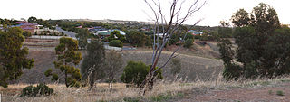
Kellyville Ridge is a suburb of Sydney, in the state of New South Wales, Australia. Kellyville Ridge is located 41 kilometres north-west of the Sydney central business district in the local government area of City of Blacktown. It is part of Greater Western Sydney.

Toorak Gardens is a leafy, mainly residential inner eastern suburb of Adelaide, South Australia, located 2 km east of the Adelaide city centre.
Marryatville is a small suburb about 4–5 kilometres (2.5–3.1 mi) east of Adelaide's central business district, in the local council area of City of Norwood Payneham St Peters. Comprising low- to medium-density housing, two large schools, a church and several shops, it also has two creeks running through it. The first European settler on the land was George Brunskill in 1839, with part of the land purchased and laid out as a village in 1848 by James Philcox.
Brixton is a predominantly working class suburb of Johannesburg, South Africa. It is the site of the landmark Sentech Tower, and is near the suburbs of Auckland Park and Melville.
Emmarentia is a suburb of Johannesburg, South Africa.
Greenside, is a suburb of Johannesburg, South Africa. Greenside borders on the suburbs Emmarentia, Parkview, Parkhurst and Victory Park.
Randpark Ridge is an upmarket suburb of Randburg, South Africa. It is located in the Randburg region of the City of Johannesburg. It fell into the town of Randburg during the apartheid era. Developed in the early 1980s and still relatively new, Randpark Ridge is bordered by several other suburbs including Weltevreden Park, Sundowner, Boskruin, Bromhof, Honeydew and Fairland. It is located on the north-west extremity of Johannesburg.

Earnock Estate is a residential area in Hamilton, South Lanarkshire, Scotland, which is located just east of High Earnock and south of Hillhouse. The area was developed in the 1960s and is home to some of the oldest buildings in the area.
Jeppe High School for Girls is a public English medium high school for girls situated in the suburb of Kensington in Johannesburg in the Gauteng province of South Africa, The school's address is 160 Roberts Ave, Kensington, Johannesburg, 2094, South Africa. The school boasted a 100% matric pass rate in 2014. It was once part of the oldest public school in Johannesburg, Jeppe High School for Boys until 1919, when a separate premises for the girls was built.
Craigmore is a large suburb north of Adelaide, South Australia. It is in the City of Playford local government area, just east of Elizabeth and south of Gawler.
Linksfield is a suburb of Johannesburg, South Africa. It is a suburb lying north-east of the Johannesburg CBD and is surrounded southerly by Linksfield Ridge, easterly by Linksfield North and Bedford, St Andrews and Senderwood. Linksfield itself is located in Region E of the City of Johannesburg Metropolitan Municipality. On the southerly side and over the ridge are the areas of Cyrildene, Observatory and Morninghill, but these suburbs are not visible to Linksfield as they are hidden behind the Linksfield Ridge.
The Scottish Horse War Memorial is a monument in Kensington, Johannesburg, South Africa. It was built on Caledonia Hill, between Somerset Road on the north side, Katoomba Street on the east, Highland Rd on the south, and Good Hope Street on the west.


