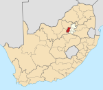
Mohlakeng

Last updated

Mohlakeng
Didi
South Africa Gauteng location map.svg
Red pog.svg
Mohlakeng
South Africa adm location map.svg
Red pog.svg
Mohlakeng
Coordinates: 26°13′32″S27°41′49″E / 26.22556°S 27.69694°E / -26.22556; 27.69694 Coordinates: 26°13′32″S27°41′49″E / 26.22556°S 27.69694°E / -26.22556; 27.69694
Country South Africa
Province Gauteng
District West Rand
Municipality Rand West City Local Municipality
Area
[1]
  Total7.20 km2 (2.78 sq mi)
Population
 (2011) [1]
  Total55,033
  Density7,600/km2 (20,000/sq mi)
Racial makeup (2011)
[1]
   Black African 98.7%
   Coloured 0.7%
   Indian/Asian 0.1%
   White 0.3%
  Other0.2%
First languages (2011)
[1]
   Tswana 55.0%
   Xhosa 12.6%
   Zulu 9.3%
   Sotho 7.2%
  Other15.9%
Time zone UTC+2 (SAST)
Postal code (street)
1759
PO box
1766

Mohlakeng is a township west of Johannesburg in Gauteng, South Africa.

Contents

History

The township was established in 1954. The new location of Mohlakeng was established after African residents of the then old Randfontein township of Madubulaville was abolished by the apartheid regime to make way for the industrial site closer to Randfontein town.

Geography

Mohlakeng is where the large part of the Randfontein population is situated. It lies 7 kilometres south of Randfontein, and around 38 kilometres West of Johannesburg. Mohlakeng has now grown about 15% in size in 2012 as compared to 2002. The former Executive Mayor of The West Rand District Municipality hails from Mohlakeng.

Attractions

Mohlakeng is home to some of the most popular nightlife spots. Rooftop Junxion, a new establishment at Extension 5 is among these.

Infrastructure

The community is served with Mphakathi mall, a police station, Mohlakeng Medical Centre, a refurbished Ramosa Hall, a soccer stadium and a recreation centre. Mohlakeng is surrounded by Soweto in the east, Randfontein in the north and Westonaria in the south. Mohlakeng is accessible by the R28 Main Reef Road and the R559 Main Road.

Education

There are four high schools and eight primary schools in Mohlakeng.

Notable people

Other well-known people from Mohlakeng include: Peter Mathebula, the first African World WBA Light-Weight Boxing Champion, Oupa Manyisa,Donald Khuse, the late footballer Patrick Ntsoelengoe and Roger Majafa and Thembi Kgatlana and Linda Motlhalo and Makhehlene Makhaula.

Related Research Articles

<span class="mw-page-title-main">Soweto</span> Township in Gauteng, South Africa

Soweto is a township of the City of Johannesburg Metropolitan Municipality in Gauteng, South Africa, bordering the city's mining belt in the south. Its name is an English syllabic abbreviation for South Western Townships. Formerly a separate municipality, it is now incorporated in the City of Johannesburg Metropolitan Municipality, and one of the suburbs of Johannesburg.

<span class="mw-page-title-main">Johannesburg</span> Largest city in South Africa

Johannesburg is the most populous city in South Africa, classified as a megacity; it is one of the 100 largest urban areas in the world. According to Demographia, the Johannesburg–Pretoria urban area is the 26th-largest in the world in terms of population, with 14,167,000 inhabitants. It is the provincial capital and largest city of Gauteng, which is the wealthiest province in South Africa. Johannesburg is the seat of the Constitutional Court, the highest court in South Africa. Most of the major South African companies and banks have their head offices in Johannesburg. The city is located within the mineral-rich Witwatersrand hills, the epicentre of the international-scale mineral, gold and (specifically) diamond trade.

Midrand is a former municipality in central Gauteng, South Africa. Situated in-between Centurion and Sandton, Midrand now forms part of the City of Johannesburg Metropolitan Municipality.

<span class="mw-page-title-main">Randburg</span> Place in Gauteng, South Africa

Randburg is an area located in the Gauteng province of South Africa. Formerly a separate municipality, its administration devolved to the newly created City of Johannesburg Metropolitan Municipality, along with neighbouring Sandton and Roodepoort, in the late 1990s. During the transitional period of 1996–2000, Randburg was part of the Northern Metropolitan Local Council (MLC).

<span class="mw-page-title-main">Alberton, South Africa</span> Place in Gauteng, South Africa

Alberton is a town situated on the southern part of the East Rand of the Gauteng Province in South Africa and is situated very close to the major urban centre of Johannesburg.

<span class="mw-page-title-main">Suburbs of Johannesburg</span>

The suburbs of Johannesburg are officially demarcated areas within the City of Johannesburg Metropolitan Municipality, South Africa. As in other Commonwealth countries, the term suburb refers to a "neighbourhood", although in South Africa most "suburbs" have legally recognised borders and often separate postal codes. The municipal functions for the area, such as municipal policing and social services, are still managed by the city government.

<span class="mw-page-title-main">Kempton Park, South Africa</span> Place in Gauteng, South Africa Postal address 1619

Kempton Park is a city in the East Rand region of Gauteng province, South Africa. It is part of the City of Ekurhuleni Metropolitan Municipality. It is situated south of Tembisa, one of the largest townships in South Africa, which is also part of Ekurhuleni. South Africa's busiest airport, O. R. Tambo International Airport is located in Kempton Park.

Carletonville is a town in Gauteng and the seat of the Merafong City Local Municipality in the West Rand District Municipality in Gauteng, South Africa, just north of the richest gold-mining area in the world. At 3,749 m, Western Deep Levels holds the record for the world's deepest gold mine.

<span class="mw-page-title-main">Randfontein</span> Place in Gauteng, South Africa

Randfontein is a gold mining town in the West Rand, Gauteng, South Africa, 40 km (25 mi) west of Johannesburg. With the Witwatersrand gold rush in full swing, mining financier JB Robinson bought the farm Randfontein and, in 1889, floated the Randfontein Estates Gold Mining Company. The town was established in 1890 to serve the new mine and was administered by Krugersdorp until it became a municipality in 1929. Apart from having the largest stamp mill in the world, Randfontein, like many of the other outlying areas of Johannesburg, is essentially a rural collection of farms and small holdings in a particularly beautiful part of Gauteng.

Westonaria is a town in the west of Gauteng province of South Africa. It is situated in the Rand West City Local Municipality, part of the West Rand District Municipality. During the apartheid era, Africans lived outside town in Bekkersdal. The town is some 45 km west of Johannesburg and 18 km south of Randfontein.

<span class="mw-page-title-main">Bethlehem, South Africa</span> Place in Free State, South Africa

Bethlehem is a city in the eastern Free State province of South Africa that is situated on the Liebenbergs river along a fertile valley just north of the Rooiberg Mountains on the N5 road. It is the fastest growing city in the Free state province, with its target of being the third largest city after Bloemfontein and Welkom.

Florida is a location in Gauteng province, South Africa. It is located about 16 kilometres west of Johannesburg. The area which is referred to as Florida was originally established as the farm Vogelstruisfontein. Today, it is a suburb of Roodepoort.

<span class="mw-page-title-main">R28 (South Africa)</span>

The R28 is a provincial route in Gauteng, South Africa that connects Krugersdorp with Vereeniging via Randfontein. The R28 used to connect with Pretoria, but that section of the road is now part of the N14.

<span class="mw-page-title-main">R41 (South Africa)</span> Road in South Africa

The R41 is a provincial route in Gauteng, South Africa, that connects Johannesburg with Randfontein via Roodepoort.

<span class="mw-page-title-main">R82 (South Africa)</span> Road in South Africa

The R82 is a provincial route in South Africa that connects Johannesburg with Kroonstad via Vereeniging and Sasolburg. It starts just south of the M1 Johannesburg Municipal Highway's interchange with the N12 Southern Bypass, going south, meeting the R59, R54, R42 & R28 routes at Vereeniging before crossing the Vaal River into the Free State & proceeding to Kroonstad. It is an alternative, but longer route to the N1 National Route between Johannesburg & Kroonstad.

Rivonia is a suburb of Johannesburg, South Africa in the Sandton area. It is located in Region E of the City of Johannesburg Metropolitan Municipality. Rivonia is one of the most affluent residential and business suburbs of Johannesburg, and regarded as the hub of upstart and established I.T. companies. The main retail thoroughfare in the area, Rivonia Boulevard, is the location of several shopping complexes as well as many other shops and restaurants. The area known as Rivonia includes the original township of Edenburg, Edenburg Extension 1, and 19 smaller extensions designated 'Rivonia Extension ...', numbered from 0 to 25. There is no designated township called Rivonia. The post code for Rivonia is 2128.

Patrick Pule "Ace" Ntsoelengoe OIS was a South African soccer player who is widely considered as one of the greatest the country has ever produced.

<span class="mw-page-title-main">Thembisa</span> Place in Gauteng, South Africa

Thembisa, formerly Tembisa, is a large township situated to the north of Kempton Park on the East Rand, Gauteng, South Africa. It was established in 1957 when black people were resettled from Alexandra and other areas in Edenvale, Kempton Park, Midrand and Germiston.

<span class="mw-page-title-main">Metrorail Gauteng</span> South African commuter rail network

Metrorail Gauteng is a network of commuter rail services in Gauteng province in South Africa, serving the Johannesburg and Pretoria metro areas. It is operated by Metrorail, a division of the Passenger Rail Agency of South Africa (PRASA).

References

  1. 1 2 3 4 "Main Place Mohlakeng". Census 2011.