Johannesburg is a large city in Gauteng Province of South Africa. It was established as a small village controlled by a Health Committee in 1886 with the discovery of an outcrop of a gold reef on the farm Langlaagte. The population of the city grew rapidly, becoming a municipality in 1898. In 1928 it became a city making Johannesburg the largest city in South Africa. In 2002 it joined ten other municipalities to form the City of Johannesburg Metropolitan Municipality. Today, it is a centre for learning and entertainment for all of South Africa. It is also the capital city of Gauteng.

The suburbs of Johannesburg are officially demarcated areas within the City of Johannesburg Metropolitan Municipality, South Africa. As in other Commonwealth countries, the term suburb refers to a "neighbourhood", although in South Africa most "suburbs" have legally recognised borders and often separate postal codes. The municipal functions for the area, such as municipal policing and social services, are still managed by the city government.

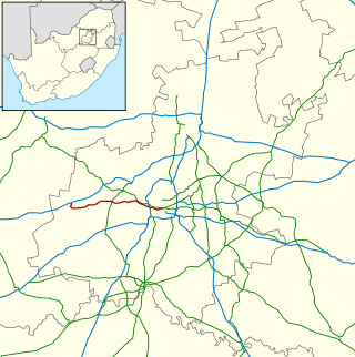
The R24 is a major East-West provincial route in the Gauteng and North West provinces that links OR Tambo International Airport with Rustenburg via Johannesburg, Krugersdorp and Magaliesburg. The section of the route from OR Tambo International westwards up to a point in Roodepoort is has been named Albertina Sisulu Road since 2013, named after anti-apartheid stalwart Albertina Sisulu.
The R41 is a provincial route in Gauteng, South Africa, that connects Johannesburg with Randfontein via Roodepoort.
Kensington is a hilly suburb of Johannesburg, South Africa. It was established in 1897 by Max Langermann. It is located in Region F of the City of Johannesburg Metropolitan Municipality and is bounded to the west by the suburb of Troyeville, to the east by Bedfordview and the north by Bruma and Cyrildene.
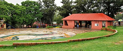
Orange Grove is a suburb of Johannesburg, South Africa. It is located in Region E of the City of Johannesburg Metropolitan Municipality.
The M2 is a major highway and metropolitan route in Greater Johannesburg, South Africa. It is named the Francois Oberholzer Freeway. It runs just to the south of the Johannesburg Central Business District eastwards where it connects with the N3 and enters Germiston, ending near its CBD. The north–south M1 intersects with the M2 just to the south-west of the Johannesburg CBD.
Bertrams is a suburb of Johannesburg, South Africa. It is a small suburb found on the eastern edge of the Johannesburg central business district (CBD), tucked between the suburbs of New Doornfontein and Lorentzville, with Troyeville to the south. It is located in Region F of the City of Johannesburg Metropolitan Municipality.
Doornfontein is an inner-city suburb of Johannesburg, South Africa, located to the east of the city centre, Region 8. In the 1930s, it attracted many Jewish immigrants, becoming the main hub for the city's Jewish community. Black African residents, then a minority in the suburb, lived in slum-yards. Under the Slums Clearance Act 1934, the slum-yards were cleared and many residents were relocated to Orlando, Soweto. Since the late 1970s, Doornfontein and other inner-city suburbs of Johannesburg have underdone high levels of white flight to the city's northern suburbs.
Fairview is a suburb of Johannesburg, South Africa. It is a small suburb found on the eastern edge of the Johannesburg central business district (CBD), with the suburb of Troyeville to the north, Jeppestown to the south and Malvern to its east. Commissioner Street, the main street in the CBD, has its eastern end in the suburb. It is located in Region F of the City of Johannesburg Metropolitan Municipality.
Judith's Paarl is a suburb of Johannesburg, South Africa. It is a small suburb found on the eastern edge of the Johannesburg central business district (CBD), tucked between the suburbs of Lorentzville and Bezuidenhout Valley, with Troyeville and Kensington to the south. It is located in Region F of the City of Johannesburg Metropolitan Municipality.
Lorentzville is a suburb of Johannesburg, South Africa. It is a small suburb found on the eastern edge of the Johannesburg central business district (CBD), tucked between the suburbs of Bertrams and Judith's Paarl, with Troyeville to the south. It is located in Region F of the City of Johannesburg Metropolitan Municipality.
Louis Botha Avenue is a major street in Johannesburg, South Africa. Originally part of the main road between central Johannesburg and Pretoria, it runs along through the north-eastern parts of the city from Hillbrow to Sandton, passing through numerous older suburbs, including Houghton and Orange Grove, before it becomes the Pretoria Main Road (R101) which passes the Alexandra Township and continues to Midrand and Pretoria.
Cyrildene is a suburb of Johannesburg, South Africa, predominantly home to Chinese people. The area is found east of the Johannesburg CBD and is surrounded by the suburbs of Linksfield, Observatory and Bruma. It is noted for a new Chinatown that exists on Derrick Avenue. This new Chinatown is now considered as the main Chinatown in Johannesburg, replacing the declining Chinatown on Commissioner Street in the inner-city of Johannesburg. It is located in Region F of the City of Johannesburg Metropolitan Municipality.
Bezuidenhout Valley is a suburb of Johannesburg, South Africa. The area lies to the east of the Johannesburg CBD and is surrounded by the suburbs of Kensington to the south and Observatory to the north. It is located in Region E of the City of Johannesburg Metropolitan Municipality. It is colloquially known as the Bez Valley.
The M9 is a major metropolitan route in the City of Johannesburg, South Africa. Passing through the heart of the Witwatersrand, it connects the southern suburbs of Johannesburg via the centre of Johannesburg, with the northern suburbs and business centres of Rosebank and Sandton before ending in the outer northern suburbs.
The M31 is a metropolitan route in the City of Johannesburg, South Africa. The road connects the southern suburbs of Alberton with Johannesburg's northern suburbs. The route's eastern bypass in the Johannesburg CBD connects the M2 motorway at the Heidelberg Interchange with M1 North motorway in Houghton and then the route follows the M1 motorway northwards until the M31 ends in Bramley.
The M10 is a long metropolitan route in Greater Johannesburg, South Africa. It connects Lenasia with Johannesburg Central via Soweto.
The M37 is a metropolitan route in Greater Johannesburg, South Africa. It connects the N3 at Greenstone Shopping Mall with Katlehong via Edenvale and Germiston.
The M78 is a short metropolitan route in Greater Johannesburg, South Africa. It is a short route connecting Illiondale with Klopper Park in the Edenvale/Germiston area of Ekurhuleni Metropolitan Municipality.