
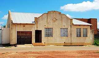
Soweto is a township of the City of Johannesburg Metropolitan Municipality in Gauteng, South Africa, bordering the city's mining belt in the south. Its name is an English syllabic abbreviation for South Western Townships. Formerly a separate municipality, it is now incorporated in the City of Johannesburg Metropolitan Municipality, and one of the suburbs of Johannesburg.
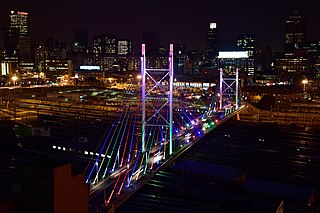
Johannesburg is the most populous city in South Africa, classified as a megacity; it is one of the 100 largest urban areas in the world. According to Demographia, the Johannesburg–Pretoria urban area is the 26th-largest in the world in terms of population, with 14,167,000 inhabitants. It is the provincial capital and largest city of Gauteng, which is the wealthiest province in South Africa. Johannesburg is the seat of the Constitutional Court, the highest court in South Africa. Most of the major South African companies and banks have their head offices in Johannesburg. The city is located within the mineral-rich Witwatersrand hills, the epicentre of the international-scale mineral, gold and (specifically) diamond trade.

Gauteng is one of the nine provinces of South Africa.

Sandton is an area in the northern part of the City of Johannesburg Metropolitan Municipality. Formerly an independent municipality, Sandton's name came from the combination of two of its suburbs, Sandown and Bryanston.

Randburg is an area located in the Gauteng province of South Africa. Formerly a separate municipality, its administration devolved to the newly created City of Johannesburg Metropolitan Municipality, along with neighbouring Sandton and Roodepoort, in the late 1990s. During the transitional period of 1996–2000, Randburg was part of the Northern Metropolitan Local Council (MLC).

Sandton City is a large shopping centre situated in Sandton, Johannesburg, South Africa. It was built and owned by property development company Rapp and Maister, in partnership with brothers Hilliard and Eli Leibowitz, and was later taken over by Liberty Life.
Eastgate Shopping Centre is a super-regional shopping centre in Bedfordview, near Bedford Gardens and the Johannesburg city centre in Gauteng. It remains one of the largest centres in the country and is the fourth largest shopping centre in Gauteng, after Mall of Africa, Sandton City and Menlyn Park. The centre lies next to the R24 airport freeway, between the Johannesburg CBD to the west and O. R. Tambo International Airport to the east.

The suburbs of Johannesburg are officially demarcated areas within the City of Johannesburg Metropolitan Municipality, South Africa. As in other Commonwealth countries, the term suburb refers to a "neighbourhood", although in South Africa most "suburbs" have legally recognised borders and often separate postal codes. The municipal functions for the area, such as municipal policing and social services, are still managed by the city government.

The R24 is a major East-West provincial route in the Gauteng and North West provinces that links OR Tambo International Airport with Rustenburg via Johannesburg, Krugersdorp and Magaliesburg. The process of renaming the streets and freeway that form the route from Krugersdorp eastward to OR Tambo International after anti-apartheid stalwart Albertina Sisulu was completed in 2013.
The R41 is a provincial route in Gauteng, South Africa, that connects Johannesburg with Randfontein via Roodepoort.

Ponte City is a skyscraper in the Berea suburb of Johannesburg, South Africa, just next to Hillbrow. It was built in 1975 to a height of 173 m (567.6 ft), making it the tallest residential skyscraper in Africa. The 55-storey building is cylindrical, with an open centre allowing additional light into the apartments. The centre space is known as "the core" and rises above an uneven rock floor. When built, Ponte City was seen as an extremely desirable address due to its location and views over Johannesburg, but it became infamous for its crime and poor maintenance in the late 1980s to 1990s. It has since been refurbished into a safe property. The neon sign on top of the building is the largest sign in the Southern Hemisphere. It currently advertises the South African mobile phone company Vodacom. Prior to 2000, it advertised for The Coca-Cola Company.

The City of Johannesburg Metropolitan Municipality is a metropolitan municipality that manages the local governance of Johannesburg, the largest city in South Africa. It is divided into several branches and departments in order to expedite services for the city. Zulu is the most spoken home language at 23.4% followed by English at 20.1%.
The M1 De Villiers Graaff motorway is a metropolitan route and major freeway in the City of Johannesburg, South Africa. The highway connects the southern areas with the city centre and extends further north through Sandton into the Ben Schoeman Highway towards Pretoria. Construction began in 1962 and resulted in the demolition of many properties and houses including numerous historical Parktown Mansions.
Pageview is a suburb of Johannesburg, South Africa. It is located in Region F of the City of Johannesburg Metropolitan Municipality. Populated by non-whites, predominantly Indians, until the 1970s, it was one of two adjacent suburbs commonly known as Fietas.

The Johannesburg Regiment is an infantry regiment of the South African Army. As a reserve unit, it has a status roughly equivalent to that of a British Army Reserve or United States Army National Guard unit.

Museum Africa or MuseuMAfricA is a historical museum in Newtown, Johannesburg, South Africa.

The N12 is a national route in South Africa which runs from George through Beaufort West, Kimberley, Klerksdorp and Johannesburg to eMalahleni.

The Consolidated Building, or ‘Johnnies’ as it became affectionately known, is an office building situated in the Marshalltown district of Johannesburg, on stands 149, 150 and 152 at 84/86 Fox Street and 29/31 Harrison Street. In 1895, before the Consolidated Building was built, these stands were home to the Jewish Social Club and in 1897, Johannesburg Waterworks had its offices there.
A The City of Johannesburg Metropolitan Municipality council consists of 270 City Councillors elected by mixed-member proportional representation. The councillors are divided into two kinds: (a) 135 Ward councillors who have been elected by first-past-the-post voting in 135 wards; and (b) 135 councillors elected from party lists.

