Randburg is an area located in the Gauteng province of South Africa. Formerly a separate municipality, its administration devolved to the newly created City of Johannesburg Metropolitan Municipality, along with neighbouring Sandton and Roodepoort, in the late 1990s. During the transitional period of 1996–2000, Randburg was part of the Northern Metropolitan Local Council (MLC).

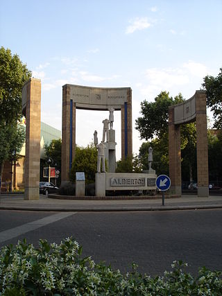
Alberton is a town situated on the southern part of the East Rand of the Gauteng Province in South Africa and is situated very close to the major urban centre of Johannesburg.

Kempton Park is a city in the East Rand region of Gauteng province, South Africa. It is part of the City of Ekurhuleni Metropolitan Municipality. It is situated south of Thembisa, one of the largest townships in South Africa, which is also part of Ekurhuleni. South Africa's busiest airport, O. R. Tambo International Airport is located in Kempton Park.
Parktown is a wealthy suburb of Johannesburg, South Africa, and is the first suburb north of the inner city. It is affectionately known as one of the Parks, others including Parkview, Parkwood, Westcliff, Parktown North, Parkhurst and Forest Town. Parktown is one of Johannesburg's largest suburbs, neighbouring Hillbrow, Braamfontein and Milpark to the South; Berea and Houghton to the East; Killarney and Forest Town to the North, and Westcliff, Melville and Richmond to the West. Originally established by the Randlords in the 1890s, Parktown is now home to many businesses, hospitals, schools, churches and restaurants, whilst still maintaining quiet residential areas. It is also home to three of the five campuses of the University of the Witwatersrand including the education campus, medical school and Wits Business School. It is located in Region F of the City of Johannesburg Metropolitan Municipality.
Doornfontein is an inner-city suburb of Johannesburg, South Africa, located to the east of the city centre, Region 8.
Malvern is a suburb of Johannesburg, South Africa. Situated east of the Johannesburg CBD, it lies south of Kensington and north of the industrial suburb of Denver. It is located in Region F of the City of Johannesburg Metropolitan Municipality and lies just west of Bedfordview in the City of Ekurhuleni Metropolitan Municipality.
Blackheath is a suburb of Johannesburg, South Africa. It is located in Region B of the City of Johannesburg Metropolitan Municipality. Situated north-west of the Johannesburg CBD, it is north of the suburb of Northcliff.
Linden is a suburb of Johannesburg, South Africa - situated towards the north western suburbs of the city on the border of the former independent town of Randburg. This established suburb between 5 km (3.1 mi) to 8 km (5.0 mi) north-west of the Johannesburg CBD was designed so that most of the streets and avenues form similar sized blocks. A number of shops, churches and schools can be found on 3rd Avenue and 4th Avenue. Attractions include arts, crafts, studios, coffee shops, pubs, restaurants and small shops. Bordering suburbs include Northcliff, Blairgowrie, Victory Park, Greenside and Cresta.
Bezuidenhout Valley is a suburb of Johannesburg, South Africa. The area lies to the east of the Johannesburg CBD and is surrounded by the suburbs of Kensington to the south and Observatory to the north. It is located in Region E of the City of Johannesburg Metropolitan Municipality. It is colloquially known as the Bez Valley.
Boysens is a suburb of Johannesburg, South Africa, located around 3.2 km southwest of city hall.
Claremont is a suburb of Johannesburg, South Africa, around 9 km west-northwest of City Hall. Under the old municipal borders, it was one of the westernmost suburbs of the city and bordered Roodepoort.
Denver is an industrial suburb in eastern Johannesburg, South Africa, on the railway to Germiston and Hoofrif Road, around 6 km east of City Hall. It borders Benrose to the west, Jeppestown and Malvern to the north, Cleveland to the east, and the François Oberholzer Freeway to the south. There is just a small portion of the suburb in the northwest that has residential zoning; otherwise, Denver consists of industrial land and squatter camps both in the west and up north, the latter largely on Hoofrif Road.
Parlshoop is a suburb of Johannesburg, South Africa, around 4 km west of City Hall. It borders Langlaagte to the north and Homestead Park to the northeast. The name comes from the village of Paarlshoop, the oldest private township on the Witwatersrand.
Rossmore is a suburb of Johannesburg, around 5 km northwest of City Hall. It borders Langlaagte to the north and Homestead Park. The name comes from the village of Paarlshoop, the oldest private township on the Witwatersrand.
Rouxville is a suburb of Johannesburg, South Africa, around 8 kilometres (5.0 mi) northeast of City Hall.
Talboton is a suburb of Johannesburg, South Africa, around 7 km northeast of City Hall.
Unigray is a suburb of Johannesburg, South Africa, around 6 km southeast of City Hall. It lies north of Queenshaven, east of Elladoone, and west of Electron.
Victory Park is a suburb of Johannesburg, South Africa, around 8 km northwest of City Hall.
Wanderers View is a suburb of Johannesburg, South Africa, about 1.2 km north of City Hall.
Wemmer is a suburb of Johannesburg, South Africa, around 800 m south-southeast of City Hall.


