Mountain View may refer to:

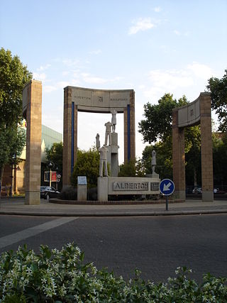
Alberton is a city situated on the southern part of the East Rand of the Gauteng Province in South Africa and is situated very close to the major urban centre of Johannesburg.
Auckland Park is a suburb of Johannesburg, South Africa. It lies on a gentle slope, and is in close proximity to the suburbs of Melville, Brixton, Westdene and Richmond. Auckland Park is one of the few suburbs close to the Johannesburg city centre that has remained largely unaffected by the recent migration of Johannesburg residents to the city's northern suburbs. Auckland Park is home to a mix of nationalities and cultures, and the suburb is well known as the location of the South African Broadcasting Corporation headquarters.
Moffat View is a suburb of Johannesburg, South Africa. The area lies to the south of the Johannesburg CBD. It is located in Region F of the City of Johannesburg Metropolitan Municipality.
Regents Park is a suburb of Johannesburg, South Africa. The suburb is found north of The Hill. It is located in Region F of the City of Johannesburg Metropolitan Municipality.
Robertsham is a suburb of Johannesburg, South Africa. It is situated in the city's southern suburbs just south of the CBD. It is located in Region F of the City of Johannesburg Metropolitan Municipality.
The Hill is a suburb of Johannesburg, South Africa. The area lies to the south of the Johannesburg CBD and is surrounded by the suburbs of Regents Park, Rosettenville and Linmeyer. It is located in Region F of the City of Johannesburg Metropolitan Municipality.
Craighall Park is a suburb of Johannesburg, South Africa. It is located in Region B of the City of Johannesburg Metropolitan Municipality. Residents of the suburb are represented by the CraigPark Residents Association.
Gallo Manor is a suburb of Johannesburg, South Africa. It is located in Region 3 and Region 7.
Kensington is a hilly suburb of Johannesburg, South Africa. It was established in 1897 by Max Langermann. It is located in Region F of the City of Johannesburg Metropolitan Municipality and is bounded to the west by the suburb of Troyeville, to the east by Bedfordview and the north by Bruma and Cyrildene.
Raumarais Park is a suburb of Johannesburg, South Africa. The suburb lies north of Bramley. It is located in Region E of the City of Johannesburg Metropolitan Municipality.
Parkview is a suburb of Johannesburg, South Africa. It borders the suburb of Greenside and overlooks Zoo Lake, a park which lies on the opposite side of Jan Smuts Avenue from the Johannesburg Zoo. All of its streets are named after Irish counties. Parkview, established more than a century ago, is one of the oldest suburbs in Johannesburg, and much of its historic architecture remains intact. The Alliance Française in Johannesburg is situated in Parkview.
Greymont is a suburb of Johannesburg, South Africa. Greymont is located quite close to both the University of Johannesburg as well as the University of the Witwatersrand, which means it has a rather large number of students living in this area. It is located in Region B of the City of Johannesburg Metropolitan Municipality.
North Riding is a suburb of Randburg, in Region C - formerly Johannesburg Region 5, South Africa. The suburb was named after one of the three historic subdivisions of Yorkshire. 'North' was favoured at the time due to North Riding's location north of the CBD of Johannesburg. The Suburb formerly fell under the jurisdiction of the Randburg Town Council before it was incorporated into the City of Johannesburg Metropolitan area. Of the original 3 farms that were joined to form Randburg, North riding was located on the Olievenhout farm.
Bezuidenhout Valley is a suburb of Johannesburg, South Africa. The area lies to the east of the Johannesburg CBD and is surrounded by the suburbs of Kensington to the south and Observatory to the north. It is located in Region E of the City of Johannesburg Metropolitan Municipality. It is colloquially known as the Bez Valley.

Westdene is a suburb of Johannesburg, South Africa. Westdene lies between the historic suburb of Sophiatown and Melville with the Melville Koppies West nature reserve to the north of the suburb. Westdene derives its name from its location, literally meaning west-valley. 'West' since it is located west from the city centre and with 'dene' derived from the Old English denu, meaning valley.
Parlshoop is a suburb of Johannesburg, South Africa, around 4 km west of City Hall. It borders Langlaagte to the north and Homestead Park to the northeast. The name comes from the village of Paarlshoop, the oldest private township on the Witwatersrand.
Rossmore is a suburb of Johannesburg, around 5 km northwest of City Hall. It borders Langlaagte to the north and Homestead Park. The name comes from the village of Paarlshoop, the oldest private township on the Witwatersrand.
M16 is a metropolitan route in Johannesburg, South Africa. It begins in the north-western suburb of Greenside and heads eastwards through some of Johannesburg's northern suburbs and through Edenvale to end at the East Rand town of Kempton Park.
The M10 is a long metropolitan route in Greater Johannesburg, South Africa. It connects Lenasia with Johannesburg Central via Soweto.


