 | ||||
|---|---|---|---|---|
| Route information | ||||
| Length | 71 km (44 mi) | |||
| Major junctions | ||||
| East end | ||||
| West end | ||||
| Location | ||||
| Country | South Africa | |||
| Highway system | ||||
| ||||
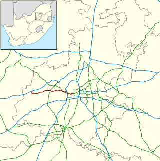
The R559 is a Regional Route in Gauteng, South Africa that connects Protea Glen with Carletonville via Randfontein. [1]
| | ||||
|---|---|---|---|---|
| Route information | ||||
| Length | 71 km (44 mi) | |||
| Major junctions | ||||
| East end | ||||
| West end | ||||
| Location | ||||
| Country | South Africa | |||
| Highway system | ||||
| ||||
The R559 is a Regional Route in Gauteng, South Africa that connects Protea Glen with Carletonville via Randfontein. [1]
The R559 begins at a junction with the R558 road in Protea Glen, Soweto, just north of the R558's intersection with the N12. It goes north-west for 17 kilometres to reach a junction with the R28 road in the southern suburbs of Randfontein.
From Randfontein, it turns to the south-west and goes for 22 kilometres, through Hillside, to reach a junction with Station Street. It becomes Station Street westwards and goes for 17 kilometres to enter the towns of Oberholzer and Carletonville. It reaches a junction with the R500 road and bypasses Carletonville Mall. From the R500 junction, it goes westwards for 18 kilometres, passing south of Khutsong, to reach its western terminus at a junction with the R501 road.

Randfontein is a gold mining town in the West Rand, Gauteng, South Africa, 40 km (25 mi) west of Johannesburg. With the Witwatersrand gold rush in full swing, mining financier JB Robinson bought the farm Randfontein and, in 1889, floated the Randfontein Estates Gold Mining Company. The town was established in 1890 to serve the new mine and was administered by Krugersdorp until it became a municipality in 1929. Apart from having the largest stamp mill in the world, Randfontein, like many of the other outlying areas of Johannesburg, is essentially a rural collection of farms and small holdings in a particularly beautiful part of Gauteng.

The R28 is a provincial route in Gauteng, South Africa that connects Krugersdorp with Vereeniging via Randfontein. The R28 used to connect with Pretoria, but that section of the road is now part of the N14.

The R36 is a provincial route in South Africa that connects the N1 with Ermelo, via Tzaneen and Lydenburg. It is co-signed with the N4 for 8 kilometres between Machadodorp and Patattanek, with a tollgate on this section. It used to extend further south past Ermelo to Amersfoort, but that section is now designated as part of the N11.
The R41 is a provincial route in Gauteng, South Africa, that connects Johannesburg with Randfontein via Roodepoort.

The R42 is a provincial route in South Africa that connects Vanderbijlpark with Bronkhorstspruit via Vereeniging, Heidelberg, Nigel and Delmas.

The R53 is a provincial route in South Africa that connects Swartruggens with Parys via Ventersdorp and Potchefstroom.

The R54 is a provincial route in South Africa that connects Potchefstroom with Villiers via Vereeniging.

The R59 is a provincial route in South Africa that connects Hertzogville with Alberton via Bothaville, Parys and Vereeniging. The R59 is a freeway from the R57 Junction in Sasolburg until the N12 Reading Interchange in Alberton, signposted as the Sybrand van Niekerk Freeway.

The R61 is a long provincial route in South Africa that connects Beaufort West with Port Shepstone via Graaff-Reinet, Komani, Mthatha and Port Edward.
The R104 is a regional route in South Africa that is the designation for some of the old sections of roads that were previously the N4, prior to upgrading. It connects Rustenburg in the North West province with Witbank in Mpumalanga province via Hartbeespoort, Mooinooi, Pretoria and Bronkhorstspruit. There is also a 50km section in Mpumalanga province connecting Middelburg and Wonderfontein.
Mohlakeng is a township west of Johannesburg in Gauteng, South Africa.

The N12 is a national route in South Africa which runs from George through Beaufort West, Kimberley, Klerksdorp and Johannesburg to eMalahleni.

The N4 is a national route in South Africa that runs from Skilpadshek on the Botswana border, past Rustenburg, Pretoria, eMalahleni and Mbombela, to Komatipoort on the Mozambique border. It forms the South African section of the Trans-Kalahari Corridor, which runs from Walvis Bay to Maputo, meaning that it links the east and west coasts of Southern Africa.

The N6 is a national route in South Africa that connects East London with Bloemfontein, via Komani and Maletswai. It runs roughly from north to south, connecting the N1 with the N2.

The N17 is a national route in South Africa which runs from Johannesburg to Oshoek (Ngwenya) on the border with Eswatini. It passes through Springs, Bethal and Ermelo.
The R500 is a Regional Route in South Africa that connects Magaliesburg with Parys via Carletonville and Fochville.
The R501 is a Regional Route in South Africa that connects Carletonville with Viljoenskroon via Potchefstroom.
The R503 is a Regional Route in North West, South Africa that connects Mahikeng with Klerksdorp via Lichtenburg and Coligny.
The M10 is a long metropolitan route in Greater Johannesburg, South Africa. It connects Lenasia with Johannesburg Central via Soweto.
The M18 road is a long metropolitan route in Gauteng, South Africa. It connects Pretoria with Thembisa via Centurion and Olifantsfontein.
| | This South African road or road transport-related article is a stub. You can help Wikipedia by expanding it. |