 | ||||
|---|---|---|---|---|
| Route information | ||||
| Length | 123 km (76 mi) | |||
| Major junctions | ||||
| Northeast end | ||||
| Southwest end | ||||
| Location | ||||
| Country | South Africa | |||
| Highway system | ||||
| ||||
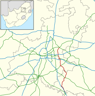
The R501 is a Regional Route in South Africa that connects Carletonville with Viljoenskroon via Potchefstroom. [1]
| | ||||
|---|---|---|---|---|
| Route information | ||||
| Length | 123 km (76 mi) | |||
| Major junctions | ||||
| Northeast end | ||||
| Southwest end | ||||
| Location | ||||
| Country | South Africa | |||
| Highway system | ||||
| ||||
The R501 is a Regional Route in South Africa that connects Carletonville with Viljoenskroon via Potchefstroom. [1]
It begins at a junction with the N12 national route in Gauteng province (south-west of Westonaria), just west of the N12's intersection with the R28. It goes west for 19 kilometres and the first town it comes to is Carletonville, where it intersects with the R500 just south of the Carletonville city centre.
After bypassing the town centre, it continues westwards to meet the south-western terminus of the R559. Just after, it crosses into the North West province, and gradually turns into a more southerly direction, bypassing the Boskop Dam, to reach Potchefstroom to the south-west.
In Potchefstroom, it enters as Thabo Mbeki Drive and reaches a junction with the R53 (Albert Luthuli Drive). The R501 and R53 become one road eastwards on Albert Luthuli Avenue, then southwards on Govan Mbeki Avenue, before the R53 leaves Govan Mbeki Avenue and becomes its own road eastwards in the town centre. Just after, by Mooirivier Mall, the R501 meets the N12 national route for the 2nd time.
It leaves the city in a south-south-westerly direction, initially following the Mooi River. It proceeds to cross the Vaal River into the Free State at the Scandinavia Drift and end at an intersection with the R59 north of Viljoenskroon.

The R28 is a provincial route in Gauteng, South Africa that connects Krugersdorp with Vereeniging via Randfontein. The R28 used to connect with Pretoria, but that section of the road is now part of the N14.

The R29 is a provincial route in South Africa that connects Johannesburg with Leandra and Kinross via Germiston, Boksburg, Benoni and Springs. For much of its route it is named Main Reef Road. The R29 used to end near the Golela border post, however the section from Evander to Ermelo is now part of the N17 and the section from Ermelo to the Golela border post just after Pongola is now part of the N2.

The R30 is a provincial route in South Africa that connects Bloemfontein with Rustenburg via Brandfort, Welkom, Bothaville, Klerksdorp and Ventersdorp. The southern part of the route is tolled, as the R30 forms the first section of the ZR Mahabane Toll Route, with the Brandfort Toll Plaza found 10 kilometres north of its Southern junction with the N1 National Route. The tolled portion ends at the junction with the R730.

The R33 is a provincial route in South Africa that connects Pietermaritzburg with Lephalale via Greytown, Paulpietersburg, Carolina, Belfast and Vaalwater. It is a very long road, passing through 3 provinces.

The R34 is a long provincial route in South Africa that connects Vryburg with Richards Bay via Kroonstad and Newcastle. It passes through three provinces, North West, the Free State and KwaZulu-Natal.
The R51 is a provincial route in South Africa that connects Bapsfontein with the N3 north of Villiers, via Springs, Nigel and Balfour.

The R53 is a provincial route in South Africa that connects Swartruggens with Parys via Ventersdorp and Potchefstroom.

The R54 is a provincial route in South Africa that connects Potchefstroom with Villiers via Vereeniging.

The R59 is a provincial route in South Africa that connects Hertzogville with Alberton via Bothaville, Parys and Vereeniging. The R59 is a freeway from the R57 Junction in Sasolburg until the N12 Reading Interchange in Alberton, signposted as the Sybrand van Niekerk Freeway.

The R82 is a provincial route in South Africa that connects Johannesburg with Kroonstad via Vereeniging and Sasolburg. It starts just south of the M1 Johannesburg Municipal Highway's interchange with the N12 Southern Bypass, going south, meeting the R59, R54, R42 & R28 routes at Vereeniging before crossing the Vaal River into the Free State & proceeding to Kroonstad. It is an alternative, but longer route to the N1 National Route between Johannesburg & Kroonstad.

The N12 is a national route in South Africa which runs from George through Beaufort West, Kimberley, Klerksdorp and Johannesburg to eMalahleni.

The N8 is a national route in South Africa that connects Groblershoop with Maseru in Lesotho via Kimberley and Bloemfontein. It is maintained by the South African National Roads Agency.

The N11 is a national route in South Africa which runs from the Botswana border at Groblersbrug, through Mokopane, Middelburg, Ermelo and Newcastle to end at the N3 just after Ladysmith.

The N14 is a national route in South Africa which runs from Springbok in the Northern Cape to Pretoria in Gauteng. It passes through Upington, Kuruman, Vryburg, Krugersdorp and Centurion. The section between Pretoria and Krugersdorp is maintained by the Gauteng Provincial government and is also designated the P158.

The N17 is a national route in South Africa which runs from Johannesburg to Oshoek (Ngwenya) on the border with Eswatini. It passes through Springs, Bethal and Ermelo.
The R101 is a Regional Route in South Africa that is the designation for some of the old sections of roads that were previously the N1, prior to upgrading. It only has 2 sections, from Bellville to Worcester and from Johannesburg to Polokwane.
The R500 is a Regional Route in South Africa that connects Magaliesburg with Parys via Carletonville and Fochville.
The R555 is a Regional Route in South Africa that connects Springs with Ohrigstad via Delmas, Ogies, Witbank, Middelburg, Stoffberg and Burgersfort.
The R559 is a Regional Route in Gauteng, South Africa that connects Protea Glen with Carletonville via Randfontein.
The M68 is a short metropolitan route in the City of Johannesburg, South Africa. It connects the south-western part of Soweto with Mulbarton via Diepkloof, Southgate and Glenvista.
| | This South African road or road transport-related article is a stub. You can help Wikipedia by expanding it. |