
Benoni is a town on the East Rand, Gauteng, South Africa, some 26 kilometres (16 mi) east of Johannesburg, within the City of Ekurhuleni municipality.
Brakpan is a mining town on the East Rand of Gauteng, South Africa, approximately 38 kilometres east of Johannesburg.

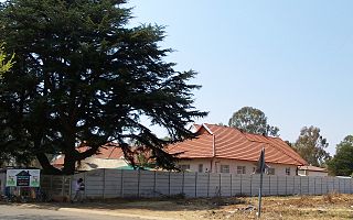
Bedfordview is an affluent suburb in western Ekurhuleni, sharing an administrative boundary with the City of Johannesburg Metropolitan Municipality, Gauteng, South Africa. Bedfordview has been part of the City of Ekurhuleni Metropolitan Municipality since 2000. The Eastgate Shopping Centre, one of the biggest in Africa when first built, is also located here.

The R21 is a major north–south provincial route in eastern Gauteng Province, South Africa. Built in the early 1970s, it remains one of two freeways linking Pretoria with Johannesburg, via the R24. As the eastern of the two freeways, it links the Pretoria city centre with OR Tambo International Airport, the N12 freeway, and Boksburg. Between the Solomon Mahlangu Drive on-ramp in Monument Park, Pretoria, and the N12 in Boksburg, the R21 is an 8 lane highway and motorway (freeway), with 4 lanes in each direction. It has off-ramps leading to Irene, Olifantsfontein, Benoni, and Kempton Park, including a partial offramp to Atlas Road. The route intersects the N1 highway near Centurion, the R24 near the airport, the N12 and N17 in Boksburg, and the N3 near Vosloorus on the East Rand, where it ends. The section from the N12 to the N3 is not a freeway. The R21 is also designated as the P157.

The R23 is a provincial route in South Africa that links Benoni with Volksrust via Brakpan, Heidelberg and Standerton.

The R29 is a provincial route in South Africa that connects Johannesburg with Leandra and Kinross via Germiston, Boksburg, Benoni and Springs. For much of its route it is named Main Reef Road. The R29 used to end near the Golela border post, however the section from Evander to Ermelo is now part of the N17 and the section from Ermelo to the Golela border post just after Pongola is now part of the N2.

The N12 is a national route in South Africa which runs from George through Beaufort West, Kimberley, Klerksdorp and Johannesburg to eMalahleni.

The N17 is a national route in South Africa which runs from Johannesburg to Oshoek (Ngwenya) on the border with Eswatini. It passes through Springs, Bethal and Ermelo.
The R554 is a Regional Route in Gauteng, South Africa. The road connects the southern suburbs of Soweto with Springs on the East Rand via Lenasia, Alberton and Brakpan.
The M43 is a major metropolitan road in Greater Johannesburg, South Africa which begins in Vosloorus and heads northwards to Birchleigh, Kempton Park on the East Rand.
The M57 is a major metropolitan route in Greater Johannesburg, South Africa. A north/south route, it connects Germiston with the south-eastern suburbs of Pretoria via Kempton Park and Olifantsfontein. For most of its length, it is an alternative route to the R21 freeway.
The M10 is a long metropolitan route in Greater Johannesburg, South Africa. It connects Lenasia with Johannesburg Central via Soweto.
The M32 is a short metropolitan route in Greater Johannesburg, South Africa. The entire route is in the City of Ekurhuleni Metropolitan Municipality. It goes from the western part of Kempton Park eastwards to the northern parts of Benoni.
The M37 is a metropolitan route in Greater Johannesburg, South Africa. It connects the N3 at Greenstone Shopping Mall with Katlehong via Edenvale and Germiston.
The M38 is a short metropolitan route in Johannesburg, South Africa. The entire route is in the Johannesburg South area, connecting Southgate with Tulisa Park via Ridgeway. It is parallel to the Johannesburg Southern Bypass for its entire route.
The M39 is a long metropolitan route in Greater Johannesburg, South Africa. It connects Kyalami with Germiston via Midrand, Kempton Park & Isando.
The M41 is a short metropolitan route in Boksburg, South Africa. It is a very short route connecting Jet Park with Boksburg North.
The M45 is a long metropolitan route in Greater Johannesburg, South Africa. It connects Kempton Park with Dunnottar via Benoni, Brakpan, KwaThema and Tsakane. The entire route is in the City of Ekurhuleni Metropolitan Municipality.
The M46 is a short metropolitan route in Greater Johannesburg, South Africa. It connects Tulisa Park in Johannesburg South with Springs via Germiston, Boksburg and Brakpan.
The M56 is a short metropolitan route in Greater Johannesburg, South Africa. It connects Boksburg with the northern part of Springs via Brakpan.
