Madisonburg, Pennsylvania

Last updated

Madisonburg, Pennsylvania
Madisonburg, Pennsylvania.jpg
The post office in Madisonburg
Map of Madisonburg, Centre County, Pennsylvania Highlighted.png
Location within Centre County
USA Pennsylvania location map.svg
Red pog.svg
Madisonburg
Location within the U.S. state of Pennsylvania
Coordinates: 40°55′37″N77°31′2″W / 40.92694°N 77.51722°W / 40.92694; -77.51722
Country United States
State Pennsylvania
County Centre
Township Miles
Area
[1]
  Total0.22 sq mi (0.56 km2)
  Land0.22 sq mi (0.56 km2)
  Water0.00 sq mi (0.00 km2)
Elevation
1,290 ft (390 m)
Population
 (2020) [2]
  Total209
  Density967.59/sq mi (374.22/km2)
Time zone UTC-5 (Eastern (EST))
  Summer (DST) UTC-4 (EDT)
ZIP code
16852
FIPS code 42-46504
GNIS feature ID1180186

Madisonburg is an unincorporated community and census-designated place (CDP) in Miles Township, Centre County, Pennsylvania, United States. It is part of the State College, Pennsylvania Metropolitan Statistical Area. The population was 168 at the 2010 census. [3]

Contents

History

Geography

Madisonburg is located in eastern Centre County at 40°55′37″N77°31′2″W / 40.92694°N 77.51722°W / 40.92694; -77.51722 (40.927049, -77.517123), [4] in the western part of Miles Township. It is in the Brush Valley, part of the Ridge-and-Valley Province of the Appalachian Mountains. The valley lies between the parallel ridges of Nittany Mountain to the north and Brush Mountain to the south.

Pennsylvania Route 445 is the main street of the town, leading north across Nittany Mountain 7 miles (11 km) to Pennsylvania Route 64 in Nittany, which itself is 3 miles (5 km) southwest of Interstate 80. PA 445 intersects PA 192 at the southern end of Madisonburg; PA 192 leads east 4 miles (6 km) to Rebersburg and southwest 10 miles (16 km) to Centre Hall, while PA 445 follows PA 192 east for a short distance, then leads south through Brush Mountain and Shriner Mountain 4 miles (6 km) to Millheim.

According to the United States Census Bureau, Madisonburg has a total area of 0.08 square miles (0.20 km2), all land. [3]

Demographics

Historical population
CensusPop.Note
2020 209
U.S. Decennial Census [5]

As of the census [6] of 2000, there were 135 people, 53 households, and 41 families residing in the CDP. The population density was 1,085.2 people per square mile (419.0 people/km2). There were 56 housing units at an average density of 450.2 per square mile (173.8/km2). The racial makeup of the CDP was 100.00% White.

There were 53 households, out of which 32.1% had children under the age of 18 living with them, 66.0% were married couples living together, 11.3% had a female householder with no husband present, and 22.6% were non-families. 17.0% of all households were made up of individuals, and 7.5% had someone living alone who was 65 years of age or older. The average household size was 2.55 and the average family size was 2.90.

In the CDP, the population was spread out, with 25.9% under the age of 18, 4.4% from 18 to 24, 28.1% from 25 to 44, 23.0% from 45 to 64, and 18.5% who were 65 years of age or older. The median age was 40 years. For every 100 females, there were 82.4 males. For every 100 females age 18 and over, there were 85.2 males.

The median income for a household in the CDP was $37,750, and the median income for a family was $39,750. Males had a median income of $30,313 versus $18,750 for females. The per capita income for the CDP was $16,231. There were no families and 2.4% of the population living below the poverty line, including no under eighteens and 12.0% of those over 64.

Related Research Articles

<span class="mw-page-title-main">Lake Heritage, Pennsylvania</span> Census-designated place in Pennsylvania, United States

Lake Heritage is a census-designated place (CDP) in Adams County, Pennsylvania, United States. Its population was 2,158 at the 2020 census.

Spring Ridge is a census-designated place (CDP) in Spring Township, Berks County, Pennsylvania, United States. The population was 1,003 at the 2010 census.

<span class="mw-page-title-main">Homeacre-Lyndora, Pennsylvania</span> Census-designated place in Pennsylvania, United States

Homeacre-Lyndora is a census-designated place (CDP) in Butler County, Pennsylvania, United States. The population was 6,906 at the 2010 census.

<span class="mw-page-title-main">Boalsburg, Pennsylvania</span> Census-designated place in Pennsylvania, United States

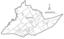
Boalsburg is an unincorporated community and census-designated place (CDP) in Harris Township, Centre County, Pennsylvania, United States. It is part of the State College, Pennsylvania Metropolitan Statistical Area. The population was 3,722 at the 2010 census. The village claims to be the birthplace of Memorial Day. However, that claim was brought into question by Bellware and Gardiner in their book, The Genesis of the Memorial Day Holiday in America, in 2014. In their book, Bellware and Gardiner point out that the Boalsburg story was first published in 1904, forty years after the fact with no indication that General Logan drew inspiration from any activities in Boalsburg and no evidence that it started the holiday.

<span class="mw-page-title-main">Julian, Pennsylvania</span> Census-designated place in Pennsylvania, United States

Julian is an unincorporated community and census-designated place (CDP) that is located in Centre County, Pennsylvania, United States. It is part of the State College, Pennsylvania Metropolitan Statistical Area. The population was 152 at the 2010 census. Most locals pronounce the name "Joo-lee-ānn".

<span class="mw-page-title-main">Lemont, Pennsylvania</span> Census-designated place in Pennsylvania, United States

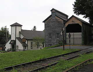
Lemont is an unincorporated community and census-designated place (CDP) in Centre County, Pennsylvania, United States, and is the location of the only remaining granary in Pennsylvania. It is part of the State College, Pennsylvania Metropolitan Statistical Area. The population was 2,270 at the 2010 census.

<span class="mw-page-title-main">Pine Grove Mills, Pennsylvania</span> Census-designated place in Pennsylvania, United States

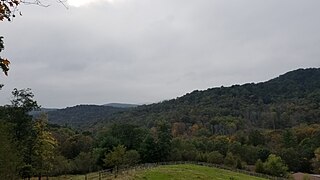
Pine Grove Mills is an unincorporated community, village, and census-designated place (CDP) in Ferguson Township, Centre County, Pennsylvania, United States. It is part of the State College, Pennsylvania Metropolitan Statistical Area. The population was 1,481 at the 2020 census.

<span class="mw-page-title-main">Pleasant Gap, Pennsylvania</span> Census-designated place in Pennsylvania, United States

Pleasant Gap is an unincorporated community and census-designated place (CDP) in Centre County, Pennsylvania, United States. It is part of the State College, Pennsylvania Metropolitan Statistical Area. The population was 2,879 at the 2010 census.

<span class="mw-page-title-main">Rebersburg, Pennsylvania</span> Census-designated place in Pennsylvania, United States

Rebersburg is an unincorporated community and census-designated place (CDP) in Centre County, Pennsylvania, United States. Rebersburg is part of the State College, Pennsylvania Metropolitan Statistical Area. The population was 494 at the 2010 census and includes many Amish in the area.

<span class="mw-page-title-main">Woodward, Pennsylvania</span> Census-designated place in Pennsylvania, United States

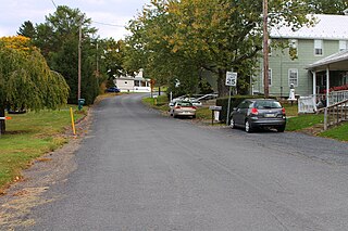
Woodward is an unincorporated community and census-designated place in Haines Township, Centre County, Pennsylvania, United States. It is part of the State College, Pennsylvania, Metropolitan Statistical Area. The population was 110 at the 2010 census.

<span class="mw-page-title-main">Zion, Pennsylvania</span> Census-designated place in Pennsylvania, United States

Zion is an unincorporated community and census-designated place (CDP) in Centre County, Pennsylvania, United States.

<span class="mw-page-title-main">Rupert, Pennsylvania</span> Census-designated place in Pennsylvania, United States

Rupert is a census-designated place (CDP) in Columbia County, Pennsylvania, United States. It is part of Northeastern Pennsylvania. The population was 154 at the 2020 census. It is part of the Bloomsburg-Berwick micropolitan area.

<span class="mw-page-title-main">Slabtown, Pennsylvania</span> Census-designated place in Pennsylvania, United States

Slabtown is a census-designated place in Columbia County, Pennsylvania, United States. It is part of Northeastern Pennsylvania. The population was 145 at the 2020 census. It is part of the Bloomsburg-Berwick micropolitan area.

Schlusser is a census-designated place (CDP) in North Middleton and Middlesex townships, Cumberland County, Pennsylvania, United States. The population was 5,265 at the 2010 census. It is part of the Harrisburg–Carlisle Metropolitan Statistical Area.

<span class="mw-page-title-main">McAlisterville, Pennsylvania</span> Census-designated place in Pennsylvania, United States

McAlisterville is an unincorporated community and census-designated place (CDP) in Fayette Township, Juniata County, Pennsylvania, United States. The population was 971 at the 2010 census.

<span class="mw-page-title-main">Richfield, Pennsylvania</span> Census-designated place in Pennsylvania, United States

Richfield is an unincorporated community and census-designated place (CDP) in Juniata and Snyder counties in Pennsylvania, United States. The population was 549 at the 2010 census.

<span class="mw-page-title-main">Reamstown, Pennsylvania</span> Census-designated place in Pennsylvania, United States

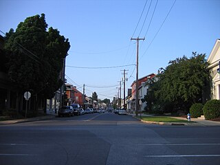
Reamstown is an unincorporated community and census-designated place (CDP) in Lancaster County, Pennsylvania, United States. The population was 3,361 at the 2010 census.

<span class="mw-page-title-main">Montgomeryville, Pennsylvania</span> Census-designated place in Pennsylvania, United States

Montgomeryville is a census-designated place (CDP) in Montgomery Township, Montgomery County, Pennsylvania, United States. The population was 12,624 at the 2010 census. According to a 2010 Forbes magazine/Yahoo.com survey, Montgomeryville ranks 5th in America's top 10 affordable suburbs. It is part of the North Penn Valley region that is centered on the borough of Lansdale.

<span class="mw-page-title-main">Hometown, Pennsylvania</span> CDP in Pennsylvania, United States

Hometown is a village in Rush Township, Schuylkill County, Pennsylvania, United States that sits astride a crossing point between important transportation corridors. The population was 1,399 at the 2000 census, and excepting for the area near the east–west PA 54 running mostly parallel to the tracks of the Reading, Blue Mountain, and Northern Railroad — once the important east-west shortline Nesquehoning & Mahanoy Railroad — and the PA 54 junction with PA 309.

<span class="mw-page-title-main">Pennsylvania Route 445</span> State highway in Centre County, Pennsylvania, US

Pennsylvania Route 445 is a 12-mile-long (19 km) state highway located in Centre County, Pennsylvania. The southern terminus is at PA 45 in Millheim. The northern terminus is at PA 64 in Nittany.

References

  1. "ArcGIS REST Services Directory". United States Census Bureau. Retrieved October 12, 2022.
  2. "Census Population API". United States Census Bureau. Retrieved October 12, 2022.
  3. 1 2 "Geographic Identifiers: 2010 Census Summary File 1 (G001): Madisonburg CDP, Pennsylvania". U.S. Census Bureau, American Factfinder. Archived from the original on April 16, 2015. Retrieved April 16, 2015.
  4. "US Gazetteer files: 2010, 2000, and 1990". United States Census Bureau. February 12, 2011. Retrieved April 23, 2011.
  5. "Census of Population and Housing". Census.gov. Retrieved June 4, 2016.
  6. "U.S. Census website". United States Census Bureau . Retrieved January 31, 2008.