Patton Township, Pennsylvania

Last updated
Patton Township,
Pennsylvania
Township
Frost museum pond with goose.jpg
Ten acre Pond
Map of Patton Township, Centre County, Pennsylvania Highlighted.png
Map of Centre County, Pennsylvania highlighting Patton Township
Map of Pennsylvania highlighting Centre County.svg
Map of Centre County, Pennsylvania
Country United States
State Pennsylvania
County Centre
Settled1788
Incorporated1794
Government
  TypeBoard of Supervisors
  Chair Elliot Abrams
  Vice ChairJeff Luck
  SupervisorsGeorge Downsbrough, Jr.
  SupervisorsJosh Troxell
  SupervisorsWalt Wise
Area
[1]
  Total24.55 sq mi (63.58 km2)
  Land24.53 sq mi (63.54 km2)
  Water0.02 sq mi (0.05 km2)
Population
 (2020) [2]
  Total15,801 Increase2.svg
  Estimate 
(2021) [2]
15,766
  Density651.75/sq mi (251.64/km2)
Zip code
16803
Area code 814
FIPS code 42-027-58440
Website twp.patton.pa.us
Historical population
CensusPop.Note
2000 11,420
2010 15,31134.1%
2020 15,8013.2%
[2]

Patton Township is a township in Centre County, Pennsylvania, United States. It is part of the State College, Pennsylvania Metropolitan Statistical Area. The population was 15,801 at the 2020 census, [2] which is a 3.2% increase from the 2010 census.

Contents

Patton Township is served by the Patton Township Police Department, Alpha Fire Company, and Centre LifeLink EMS. Alpha Fire Company maintains one of its two substations in Patton Township.

History

Patton Township was established in 1794 and named after Colonel John Patton, a revolutionary officer, who co-owned the Centre Furnace, along with Colonel Samuel Miles. The Peter Gray family and the Conrad Hartsock family were the earliest settlers to the area. They came to the Half Moon Valley in 1788, from Frederick County, Maryland, and settled in what is now Patton Township. The early days were strongly influenced by Methodism. As soon as Peter Gray had a roof on his log cabin, he began Sunday School classes, and founded what is today Grays United Methodist Church. These settlers also made pilgrimages to church at Warriors Mark, a 12-mile distance, because that was the nearest regular preaching point in the valley. [3] Iron mining was begun in the early days of Patton Township, affording supply of ore for Centre Furnace. Scotia mines are located in this township, which is still rich in iron ore. [4]

Geography

According to the United States Census Bureau, the township has a total area of 24.55 square miles (63.58 km2), of which 24.53 square miles (63.54 km2) is land and 0.019 square miles (0.05 km2), or 0.07%, is water. [5]

Patton Township is bordered by Huston Township to the northwest, Benner Township to the northeast, College Township to the southeast, Ferguson Township to the south, and Halfmoon Township to the southwest.

Demographics

As of a 2015 census estimate, the township was 77.3% Non-Hispanic White, 9.3% Black or African American, 1.5% Native American Alaska Native, 9.7% Asian, 1.3% Some other race, and 3.8% were Two or More Races. Hispanics and Latinos (of any race) were 3.6% of the population.

As of the census [6] of 2000, there were 11,420 people, 4,791 households, and 2,472 families residing in the township. The population density was 460.1 inhabitants per square mile (177.6/km2). There were 4,974 housing units at an average density of 200.4 per square mile (77.4/km2). The racial makeup of the township was 89.24% White, 3.55% African American, 0.13% Native American, 4.48% Asian, 0.06% Pacific Islander, 0.81% from other races, and 1.73% from two or more races. Hispanic or Latino of any race were 2.16% of the population.

There were 4,791 households, out of which 24.5% had children under the age of 18 living with them, 43.8% were married couples living together, 5.4% had a female householder with no husband present, and 48.4% were non-families. 28.1% of all households were made up of individuals, and 4.1% had someone living alone who was 65 years of age or older. The average household size was 2.38 and the average family size was 2.93.

In the township the population was spread out, with 19.1% under the age of 18, 24.5% from 18 to 24, 30.8% from 25 to 44, 19.0% from 45 to 64, and 6.6% who were 65 years of age or older. The median age was 28 years. For every 100 females there were 106.2 males. For every 100 females age 18 and over, there were 104.7 males.

The median income for a household in the township was $41,993, and the median income for a family was $61,503. Males had a median income of $41,064 versus $27,284 for females. The per capita income for the township was $22,860. About 3.9% of families and 18.1% of the population were below the poverty line, including 6.1% of those under age 18 and 1.9% of those age 65 or over.

Related Research Articles

<span class="mw-page-title-main">Hamiltonban Township, Adams County, Pennsylvania</span> Township in Pennsylvania, United States

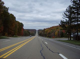
Hamiltonban Township is a township in Adams County, Pennsylvania, United States. The population was 2,372 at the 2010 census.

<span class="mw-page-title-main">Columbia Township, Bradford County, Pennsylvania</span> Township in Pennsylvania, United States

Columbia Township is a township in Bradford County, Pennsylvania, United States. It is part of Northeastern Pennsylvania. The population was 1,196 at the 2010 census. Children residing in the township are assigned to attend the Troy Area School District.

<span class="mw-page-title-main">Clearfield Township, Butler County, Pennsylvania</span> Township in Pennsylvania, United States

Clearfield Township is a township in Butler County, Pennsylvania, United States. The population was 2,430 at the 2020 census.

<span class="mw-page-title-main">Benner Township, Centre County, Pennsylvania</span> Township in Pennsylvania, United States

Benner Township is a township in Centre County, Pennsylvania, United States. It is part of the State College, Pennsylvania Metropolitan Statistical Area. It is located approximately at 40°54′48″N77°45′53″W along Buffalo Run Road, near Bellefonte.

<span class="mw-page-title-main">Snow Shoe Township, Pennsylvania</span> Township in Pennsylvania, United States

Snow Shoe Township is a township in Centre County, Pennsylvania, United States. It is part of the State College, Pennsylvania Metropolitan Statistical Area. The population was 1,638 at the 2020 census.

<span class="mw-page-title-main">Union Township, Centre County, Pennsylvania</span> Township in Pennsylvania, United States

Union Township is a township that is located in Centre County, Pennsylvania, United States. It is part of the State College, Pennsylvania Metropolitan Statistical Area.

<span class="mw-page-title-main">Halifax Township, Dauphin County, Pennsylvania</span> Township in Pennsylvania, United States

Halifax Township is a township in Dauphin County, Pennsylvania, United States. The population was 3,336 at the 2020 census.

<span class="mw-page-title-main">Nicholson Township, Fayette County, Pennsylvania</span> Township in Pennsylvania, United States

Nicholson Township is a township in Fayette County, Pennsylvania, United States. The population was 1,728 at the 2020 census, a decline from the figure of 1,805 tabulated in 2010. The Albert Gallatin Area School District serves the township. New Geneva, Martin, Gallatin, Old Frame, Bowood, Woodside, and Grays Landing are communities in the township.

<span class="mw-page-title-main">Peters Township, Franklin County, Pennsylvania</span> Township in Pennsylvania, United States

Peters Township is a township in Franklin County, Pennsylvania, United States. The population was 4,462 at the 2020 census.

<span class="mw-page-title-main">Barree Township, Pennsylvania</span> Township in Pennsylvania, United States

Barree Township is a township in Huntingdon County, Pennsylvania, United States. The population was 436 at the 2020 census.

<span class="mw-page-title-main">Bell Township, Jefferson County, Pennsylvania</span> Township in Pennsylvania, United States

Bell Township is a township in Jefferson County, Pennsylvania, United States. The population was 2,010 at the 2020 census, down from 2,056 at the 2010 census. It was named for John H. Bell, a prominent citizen of the township.

<span class="mw-page-title-main">Washington Township, Jefferson County, Pennsylvania</span> Township in Pennsylvania, United States

Washington Township is a township in Jefferson County, Pennsylvania, United States. The population was 1,892 at the 2020 census. It was named for President George Washington.

<span class="mw-page-title-main">Hector Township, Potter County, Pennsylvania</span> Township in Pennsylvania, United States

Hector Township is a township in Potter County, Pennsylvania, United States. The population was 343 at the 2020 census.

<span class="mw-page-title-main">Summit Township, Potter County, Pennsylvania</span> Township in Pennsylvania, United States

Summit Township is a township in Potter County, Pennsylvania, United States. The population was 134 at the 2020 census. Two of the smallest Pennsylvania state parks, Prouty Place State Park and Patterson State Park are in Summit Township.

<span class="mw-page-title-main">Delano Township, Schuylkill County, Pennsylvania</span> Township in Pennsylvania, United States

Delano Township is a township in Schuylkill County, Pennsylvania, United States. Formed in 1882 from part of Rush Township, it is named for Warren Delano Jr., maternal grandfather of Franklin Delano Roosevelt, 32nd President of the United States, 1933–1945.

<span class="mw-page-title-main">Adams Township, Snyder County, Pennsylvania</span> Township in Pennsylvania, United States

Adams Township in Snyder County, Pennsylvania, United States, is a township which had a population of 907 at the 2010 census. Per the US Census Bureau, by 2020 the population had reduced to 895 people.

<span class="mw-page-title-main">Spring Creek Township, Warren County, Pennsylvania</span> Township in Pennsylvania, United States

Spring Creek Township is a township in Warren County, Pennsylvania, United States. The population was 776 at the 2020 census, down from 852 at the 2010 census.

<span class="mw-page-title-main">Heidelberg Township, York County, Pennsylvania</span> Township in Pennsylvania, United States

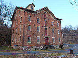
Heidelberg Township is a township in York County, Pennsylvania, United States. The township was erected in 1750 and encompassed the land grant known as "Digges' Choice". The township consisted of 9,030 acres and extended as far west as the borough (town) of McSherrystown. The township included the borough (town) of Hanover until Hanover was made a borough in 1815. When Adams County was formed from western York County in 1800, the portion of Heidelberg Township that was included in York County was subsequently renamed Conewago Township. In 1860, the western half of Heidelberg Township was split off to form Penn Township. Although residents of this township have a Hanover address, the children attend Spring Grove School District.

<span class="mw-page-title-main">Jackson Township, York County, Pennsylvania</span> Township in Pennsylvania, United States

Jackson Township is a township in York County, Pennsylvania, United States. The population was 8,737 at the 2020 census. It was founded in 1853 from parts of Paradise Township. Jackson Township education is served by the Spring Grove Area School District. Police Coverage is provided by Northern York County Regional Police Department, and EMS is provided by Spring Grove Area Ambulance. The township is home to York Airport.

<span class="mw-page-title-main">North Codorus Township, Pennsylvania</span> Township in Pennsylvania, United States

North Codorus Township is a township in York County, Pennsylvania, United States. The population was 9,149 at the 2020 census.

References

  1. "2016 U.S. Gazetteer Files". United States Census Bureau. Retrieved Aug 13, 2017.
  2. 1 2 3 4 Bureau, US Census. "City and Town Population Totals: 2020—2021". Census.gov. US Census Bureau. Retrieved August 13, 2022.
  3. "History". Grays United Methodist Church, Port Matilda, PA.
  4. History of Centre and Clinton Counties, by J.B. Linn
  5. "Geographic Identifiers: 2010 Census Summary File 1 (G001): Patton township, Centre County, Pennsylvania". U.S. Census Bureau, American Factfinder. Archived from the original on April 10, 2015. Retrieved April 10, 2015.
  6. "U.S. Census website". United States Census Bureau . Retrieved 2008-01-31.

40°50′00″N77°54′59″W / 40.83333°N 77.91639°W / 40.83333; -77.91639