Related Research Articles

Cwmbran is a town in the county borough of Torfaen in South Wales.

Newport is a city and county borough in Wales, situated on the River Usk close to its confluence with the Severn Estuary, 12 mi (19 km) northeast of Cardiff. The population grew considerably between the 2011 and the 2021 census, rising from 145,700 to 159,587, the largest growth of any unitary authority in Wales. Newport is the third-largest principal authority with city status in Wales, and sixth most populous overall. Newport became a unitary authority in 1996 and forms part of the Cardiff-Newport metropolitan area, and the Cardiff Capital Region.

Ebbw Vale is a town at the head of the valley formed by the Ebbw Fawr tributary of the Ebbw River in Wales. It is the largest town and the administrative centre of Blaenau Gwent county borough. The Ebbw Vale and Brynmawr conurbation has a population of roughly 33,000. It has direct access to the dualled A465 Heads of the Valleys trunk road and borders the Brecon Beacons National Park.

Risca is a town in the Caerphilly County Borough and the historic boundaries of Monmouthshire in south-east Wales. Risca has a railway station, re-opened on the Ebbw Valley Railway in February 2008, after a gap of 46 years. It is split into two communities; Risca East and Risca West. It has a population of 11,700. Cardiff the capital of Wales can be reached in under 28 minutes from the nearby railway station of Risca and Pontymister station which reopened in 2008 after a gap of nearly 60 years.

St Mellons is a district and suburb of eastern Cardiff, the capital city of Wales. Prior to 1996 St Mellons was the name given to the community largely north of Newport Road (B4487) which included the old St Mellons village. After 1996 the old community was divided and renamed as Old St Mellons and Pontprennau, with the newer, much larger area of modern housing and business parks to the south of Newport Road retaining the St Mellons name. Historically in Monmouthshire, St Mellons became part of South Glamorgan and Cardiff in 1974.
Gaer is a community and electoral district ("ward") of the city of Newport, South Wales.

Lliswerry, or Liswerry is an electoral district (ward) and community of the city of Newport, South Wales. The area is governed by Newport City Council. It is the largest community/ward in the city.

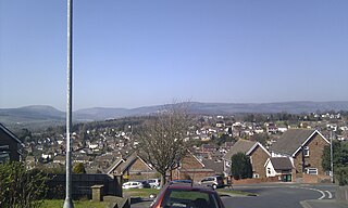
Rogerstone is a large village and community (parish) in Newport, Wales. The area is governed by Newport City Council. The village falls within the ancient parish of Bassaleg and historic county of Monmouthshire.

The Ebbw Valley Railway is a branch line of the South Wales Main Line in South Wales. Transport for Wales Rail provides an hourly passenger service each way between Ebbw Vale Town and Cardiff Central, and an hourly service each way between Ebbw Vale Town and Newport.
Rumney is a district and community in the east of the city of Cardiff, Wales. It lies east of the Rhymney River, and is historically part of Monmouthshire. On 1 April 1938 the Cardiff Extension Act 1937 incorporated it into the county borough of Cardiff, although it remained part of Monmouthshire, and England until the Local Government Act 1972 made Monmouthshire a part of Wales.
Pontprennau is a ward and community in the north of the city of Cardiff, Wales, lying north of Pentwyn and Cyncoed, between the village of Old St Mellons and the farmlands east of Lisvane. The community had a population of 7,353 in 2011.
Marshfield is a village and community of Newport, Wales. It sits approximately 5 miles southwest of Newport, and 7 miles northeast of Cardiff. The area is governed by Newport City Council. The community includes Castleton. Its population in 2011 was 3,054.

Coedkernew is a community in the south west of Newport, Wales, in the Marshfield ward.

Bassaleg is a village on the west side of Newport, Wales. It is in the Graig electoral ward and community.

Rhiwderin is a small village in the west of the city of Newport, South Wales.
Newport West Central railway station is a proposed station on the Ebbw Valley Railway in the city of Newport, Wales.

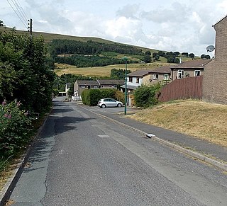
Waun-Lwyd or Waunlwyd is a village in the Ebbw Valley in Blaenau Gwent. It belongs in the community of Cwm.
Coalbrookvale is a village in the Ebbw Valley in Blaenau Gwent. It belongs in the community of Nantyglo and Blaina.
References
- ↑ "Maes-Glas, Newport". GetOutside. Ordnance Survey. Retrieved 17 February 2022.
- ↑ "Flickr image". January 2008. Retrieved 17 February 2022.
- ↑ "Geograph:: Newport East Retail Park © Paula Rogers cc-by-sa/2.0". www.geograph.org.uk. Retrieved 17 February 2022.
- ↑ An Inventory of the Ancient Monuments in Glamorgan. H.M. Stationery Office. 1991. p. 24.
- ↑ "Network Rail: Route Utilisation Strategy: Wales, p. 143" (PDF). Archived from the original (PDF) on 7 June 2011. Retrieved 1 December 2008.
- ↑ "Three new railway stations in Llanwern, Maesglas, and Somerton". South Wales Argus. 18 January 2024. Retrieved 29 January 2024.