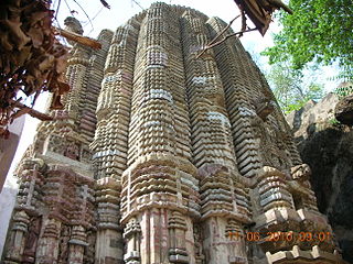
Mahasamund district is a district in Chhattisgarh state in central India. The city of Mahasamund is the district headquarters. The district is particularly famous for the historical temple town of Sirpur besides the Mahanadi river.
The present collector of Mahasamund is Mr Vinay Kumar Langeh, IAS.
Geography
Mahasamund district covers an area of 3902.39km² in the central eastern part of Chhattisgarh. The district lies between 20°47' to 21°31'30" latitude and 82°00' and 83°15'45" longitude. On the north the district is bounded by Raigarh and Baloda Bazar districts, on the south by Bargarh and Nuapada districts of Odisha, and on the west by Gariaband and Raipur districts.
Granite rocks can be found in the Bagbahra, Basna and Pithora region. Rocks are predominantly limestone of the Chhattisgarh group contemporary to the Cuddapah group of the Upper Pre-Cambrian age, consisting of limestone layers, shale, sandstone, or quartzite. Neo-granite, dolerite, and quartz in intrusive forms are also found in the district. Hence there is a great scope of intense mining activity.
According to the 2011 census Mahasamund district has a population of 1,032,754,[2] roughly equal to the nation of Cyprus[3] or the US state of Rhode Island.[4] This gives it a ranking of 438rd in India (out of a total of 640).[2] The district has a population density of 216 inhabitants per square kilometre (560/sqmi) .[2] Its population growth rate over the decade 2001–2011 was 20%.[2] Mahasamund has a sex ratio of 1018 females for every 1000 males,[2] and a literacy rate of 71.54%.[2] 11.63% of the population lives in urban areas. Scheduled Castes and Scheduled Tribes make up 13.52% and 27.10% of the population respectively.[2]
The main tribes in the district are the Gond, Binjhwar, Savar and Kawar.[5]
The East Coast Railway is one of the 19 railway zones of Indian Railways. It came into existence on 1 April 2003. The headquarters of the zone are at Bhubaneswar, Odisha.
Raipur district is a district in the Chhattisgarh state of India. Its administrative headquarters is the city of Raipur. The district is rich in mineral resources and there are many wildlife sanctuaries. With a population of 2 million, it is the most populous district of Chhattisgarh.
Bargarh is one of the major towns of Western Odisha and a municipality in Bargarh district in the state of Odisha in India. It is the administrative headquarters of Bargarh District and is one of the most important towns of Odisha because it is known as the "rice bowl of Odisha" due to its intense rice production, it is a agroindustrial hub and is also known as "city of handloom" because sambalpuri sari originated from here."Dhanujatra" of Bargarh is world famous and is known as the "world's largest open theatre". Bargarh was awarded with the "fastest moving city" award under the 50k-100k category in Swachh Sarbekhyan 2022 in the east zone.
Sambalpur District is a district in the western part of state of Odisha, India. The historic city of Sambalpur is the district headquarters.
Bilaspur district is a district of the Chhattisgarh state of India. Bilaspur city is the headquarters of the district. As of 2011, it is the second most populous district of Chhattisgarh, after Raipur.
Garhwa District is one of the twenty-four districts in the Indian state of Jharkhand. The Garhwa District is part of the Palamu division and has its administrative headquarters in Garhwa City.
Janjgir–Champa district is a district in the Indian state of Chhattisgarh. The district's headquarters, Janjgir, is the city of Maharaja Jajawalya Dev of the Kalachuri dynasty. Champa is the city named after Raja Veer bahadur's Horse called "Champak". Earlier a part of the Bilaspur district, Jangir-Champa was carved out in 1998 to a separate district of its own. The new district's name of Janjgir–Champa was the subject of a political controversy. Inhabitants are generally migrants from nearby villages.
Mahasamund is a city in Mahasamund District in the Indian state of Chhattisgarh.It is situated on the Mumbai-Kolkata and Raipur-Vishakhaptnam National Highways. It is one of the largest and most important cities in the State. The city is divided into 30 wards and 5 zones and is also the biggest city in the Trans-Mahanadi area. It is also the administrative headquarters of the Mahasamund District and part of the proposed new Mahasamund Municipal Corporation. The current mayor is Prakash Chandrakar. Reliance Trends, Vishal Megamart, Reliance Jio Smart Point, B mart and Zee Sale are prominent Shopping Centers of the City.
Bargarh District is an administrative district of Odisha state in eastern India. The city of Bargarh is its district headquarters. The district was carved out of the erstwhile district of Sambalpur on 1 April 1993.
Pithora is a town and a Nagar Panchayat and a Tehsil in Mahasamund district in the Indian state of Chhattisgarh.
Saraipali is a town in Mahasamund district in the Indian state of Chhattisgarh. First chief minister of Madhya Pradesh, Ravishankar Shukla was elected from here.
Dhamtari is a district of the Indian state of Chhattisgarh. This district is situated at 20°42' N latitude and 81°33' E longitude. Dhamtari district was officially formed on 6 July 1998 by trifurcating Raipur district into Raipur, Dhamtari and Mahasamund districts.
National Highway 6 & Economic Corridor 1 (EC1), was a National Highway in India that has been separately designated under the new national highway numbering system. It was officially listed as running over 1,949 km (1,211 mi) from Surat to Kolkata. The route was also known as Asian Highway 46 (AH46) & Mumbai - Kolkata Highway and Great Eastern Highway.
Asian Highway 46 (AH46) is a route of the Asian Highway Network within India, from Kolkata in West Bengal to Surat in Gujarat. The route is part of old National Highway 6.
Bijapur District, formerly known as Birjapur, is one of the 27 districts of the state of Chhattisgarh in central India. It is one of the two new districts created on May 11, 2007. As of 2011 it is the second least populous district of Chhattisgarh, after Narayanpur. It is the second-least literate district in India, with a literacy rate of at 41.58%, according to the 2011 census.
The Jharsuguda–Vizianagaram line is a railway line in eastern India. It connects Jharsuguda,516 km (321 mi) from Howrah on the Howrah–Nagpur–Mumbai line, and Titlagarh, which in turn is connected with Vizianagaram, 820 km (510 mi) from Howrah on the Howrah–Chennai main line, and Raipur Junction, 830 km (516 mi) from Howrah on the Howrah–Nagpur–Mumbai line. There are several branch lines, like the 176 km (109 mi) line connecting Rayagada with Koraput on the Kothavalasa–Kirandul line. The line traverses Western Odisha and connects the Howrah–Nagpur–Mumbai line with the Howrah–Chennai main line. It covers small portions of Chhattisgarh and Andhra Pradesh.
Gariaband District is one of the 33 districts of Chhattisgarh. It has its headquarters at Gariaband town. The district was carved out of Raipur district in 2012.
Baloda Bazar - Bhatapara is a district in Chhattisgarh state of India with its headquarters at Baloda Bazar. Before its creation, it was a part of Raipur district. The border of Balodabazar-Bhatapara district touches Bemetara, Mungeli, Bilaspur, Janjgir, Raigarh, Mahasamund and Raipur districts. According to the prevalent tradition in relation to the naming of the Balodabazar in the past, the traders of Gujarat, Haryana, Maharashtra, Orissa, Barar etc. used to gather in the market buffaloes of the city to sell the buffalo, buffalo (Boda). As a result, its name became popular in the name of the bullboda market and in the form of the Baloda Bazar.
Balrampur-Ramanujganj district is a district in the Indian state of Chhattisgarh. It came into existence on 17 January 2012 and was formerly part of Surguja district. Balrampur-Ramanujganj district is the northernmost district of Chhattisgarh. Its seat is Balrampur.
National Highway 53, is a national highway in India.
This page is based on this Wikipedia article Text is available under the CC BY-SA 4.0 license; additional terms may apply. Images, videos and audio are available under their respective licenses.