
Bowfell is a pyramid-shaped mountain lying at the heart of the English Lake District, in the Southern Fells area. It is the sixth-highest mountain in the Lake District and one of the most popular of the Lake District fells for walkers. It is listed in Alfred Wainwright's 'best half dozen' Lake District fells.

Harter Fell is a fell in the western part of the English Lake District, located between the Eskdale and Duddon valleys. Its height is 653 metres (2,142 ft) There are several walking routes to the summit.

Dale Head is a fell in the north-western sector of the Lake District, in northern England. It is 753 metres above sea level and stands immediately north of Honister Pass, the road between Borrowdale and Buttermere.

Robinson is a fell in the English Lake District, its southern slopes descending to Buttermere, while its northern side is set in the Newlands Valley. Paths lead to the summit from the village of Buttermere, from the nearby summit Dale Head and from various locations in the valleys to the north.

Cat Bells is a fell in the English Lake District in the county of Cumbria. It has a height of 451 metres (1,480 ft) and is one of the most popular fells in the area. It is situated on the western shore of Derwentwater within three miles of the busy tourist town of Keswick. Its distinctive shape catches the attention of many visitors to the Lakes who feel compelled to climb to the summit after seeing it from the viewpoint of Friars' Crag on the opposite side of Derwentwater. The Lake District writer and walker Alfred Wainwright acknowledges the popularity of Cat Bells among fellwalkers of all abilities by saying:
"It is one of the great favourites, a family fell where grandmothers and infants can climb the heights together, a place beloved. Its popularity is well deserved: its shapely topknott attracts the eye offering a steep but obviously simple scramble."

Esk Pike is a fell in the English Lake District, one of the cirque of hills forming the head of Eskdale.

Stony Cove Pike is a fell in the Far Eastern part of the English Lake District. It stands on the other side of the Kirkstone Pass from Red Screes, and is on the end of a ridge coming down from High Street. It is separated from its neighbours by the deep col of Threshthwaite Mouth, so is a Marilyn – the sixteenth highest in the Lake District.

Castle Crag is a hill in the North Western Fells of the English Lake District. It is the smallest hill included in Alfred Wainwright's influential Pictorial Guide to the Lakeland Fells, the only Wainwright below 1,000 feet (300 m).
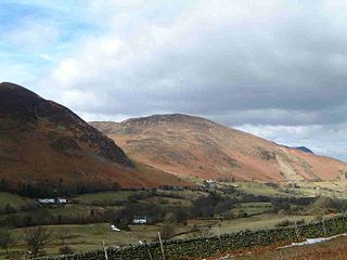
Hindscarth is a mountain between the valleys of Buttermere and Newlands, in the north-western part of the English Lake District. The fell's name is derived from two words from the Old Norse language, Hind and Skarth, and means the pass used by the red deer.
Barrow is a small fell in the English Lake District in the county of Cumbria which reaches a height of 455 metres (1,494 feet). It is in the Newlands Valley 2.5 miles (4 km) south-west of Keswick. Although comparatively small in height, Barrow commands an all-round view, with the vales of Keswick and Newlands being visible. The name of the fell originates from the Anglo Saxon language meaning a hill or long ridge.

The Newlands Valley is in the Lake District National Park in Cumbria, England. It is regarded as one of the most picturesque and quiet valleys in the national park, even though it is situated very close to the popular tourist town of Keswick and the busy A66 road.

Glaramara is a fell in the English Lake District in Cumbria. It is a substantial fell that is part of a long ridge that stretches for over six kilometres from Stonethwaite in Borrowdale up to the important mountain pass of Esk Hause. The summit of Glaramara at 783 metres (2,569 ft) is the central point of this ridge, which separates the valleys of Langstrath and Grains Gill. However, the ridge has two additional fells, numerous subsidiary tops and several small tarns making its traverse an appealing and challenging walk.
Green Gable is a fell in the English Lake District often traversed by walkers en route to its more famous neighbour Great Gable. It can be ascended from Honister Pass, Seathwaite in Borrowdale, or Ennerdale. There are good views of Gable Crag, Scafell Pike and the Buttermere valley from the summit.

High Spy is a fell in the English Lake District it is situated on the ridge that separates the Newlands Valley from Borrowdale, eight kilometres south of Keswick.

Sail is a hill in the English Lake District, lying between Derwentwater and Crummock Water.
Rosthwaite Fell is a fell in the English Lake District. It is situated some 12 kilometres due south of Keswick and 2 kilometres south of the village of Rosthwaite in Borrowdale.

Birkhouse Moor is a fell in the English Lake District, an outlier of the Helvellyn range in the Eastern Fells. It is properly an eastern ridge of Helvellyn, but was treated as a separate fell by Alfred Wainwright in his Pictorial Guide to the Lakeland Fells. That convention is followed here.

Rossett Pike is a fell in the English Lake District. It is located at the head of Mickleden, one of two tributary valleys of Great Langdale.

Green Crag is a fell in the English Lake District. It stands between Eskdale and the Duddon valley in the Southern Fells.

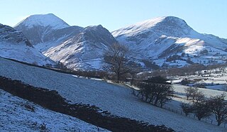
The North Western Fells are a part of the Cumbrian Mountains in the Lake District of England. Including such favourites as Catbells and Grisedale Pike, they occupy an oval area beneath the Buttermere and Borrowdale valley systems. The North Western Fells are characterised by soaring east-west ridges and an absence of mountain tarns.


