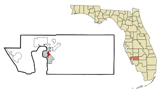
Manatee Road, Florida

Last updated

Manatee Road, Florida
Levy County Florida Incorporated and Unincorporated areas Manattee Road Highlighted.svg
Location in Levy County and the state of Florida
Coordinates: 29°30′27″N82°55′14″W / 29.50750°N 82.92056°W / 29.50750; -82.92056
Country Flag of the United States.svg  United States
State Flag of Florida.svg  Florida
County   Levy
Area
[1]
  Total13.00 sq mi (33.68 km2)
  Land13.00 sq mi (33.68 km2)
  Water0.00 sq mi (0.00 km2)
Elevation
30 ft (9 m)
Population
 (2020)
  Total2,484
  Density191.03/sq mi (73.76/km2)
Time zone UTC-5 (Eastern (EST))
  Summer (DST) UTC-4 (EDT)
FIPS code 12-42787 [2]
GNIS feature ID1853268 [3]

Manatee Road is a census-designated place (CDP) in Levy County, Florida, United States. The population was 2,484 at the 2020 census, up from 2,244 at the 2010 census. [4] At the 2000 census, the CDP was misspelled as "Manattee Road". [5] It is part of the Gainesville, Florida Metropolitan Statistical Area.

Contents

Geography

Manatee Road is located in northwestern Levy County at 29°30′27″N82°55′14″W / 29.50750°N 82.92056°W / 29.50750; -82.92056 (29.507549, -82.920612). [6] It is bordered to the east by the city of Chiefland and to the northeast by unincorporated Andrews. Florida State Road 320 (Manatee Springs Road) runs through the southern part of the CDP, leading east to Chiefland and west to its end at Manatee Springs State Park.

According to the United States Census Bureau, the Manatee Road CDP has a total area of 13.0 square miles (33.7 km2), all land. [7]

Demographics

Historical population
CensusPop.Note
2000 1,937
2010 2,24415.8%
2020 2,48410.7%
U.S. Decennial Census [8]

As of the census [2] of 2000, there were 1,937 people, 852 households, and 593 families residing in the CDP. The population density was 135.4 inhabitants per square mile (52.3/km2). There were 1,009 housing units at an average density of 70.5 per square mile (27.2/km2). The racial makeup of the CDP was 96.75% White, 1.55% African American, 0.10% Native American, 0.05% Asian, 0.46% from other races, and 1.08% from two or more races. Hispanic or Latino of any race were 1.70% of the population.

There were 852 households, out of which 21.6% had children under the age of 18 living with them, 57.6% were married couples living together, 8.8% had a female householder with no husband present, and 30.3% were non-families. 25.9% of all households were made up of individuals, and 13.4% had someone living alone who was 65 years of age or older. The average household size was 2.27 and the average family size was 2.71.

In the CDP, the population was spread out, with 19.4% under the age of 18, 5.8% from 18 to 24, 19.9% from 25 to 44, 28.1% from 45 to 64, and 26.8% who were 65 years of age or older. The median age was 49 years. For every 100 females, there were 94.5 males. For every 100 females age 18 and over, there were 93.8 males.

The median income for a household in the CDP was $22,306, and the median income for a family was $25,174. Males had a median income of $22,417 versus $14,200 for females. The per capita income for the CDP was $13,534. About 17.3% of families and 21.1% of the population were below the poverty line, including 38.3% of those under age 18 and 6.6% of those age 65 or over.

Related Research Articles

<span class="mw-page-title-main">Charlotte Park, Florida</span> Census-designated place in Florida, United States

Charlotte Park is a census-designated place (CDP) in Charlotte County, Florida, United States. The population was 2,667 at the 2020 census, up from 2,325 at the 2010 census. It is part of the Punta Gorda, Florida Metropolitan Statistical Area, included in the North Port-Bradenton, Florida Combined Statistical Area.
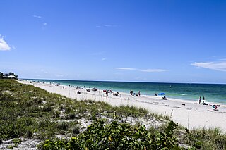
<span class="mw-page-title-main">Manasota Key, Florida</span> Census-designated place in Florida, United States

Manasota Key is a census-designated place (CDP) consisting mainly of the community of Englewood Beach in Charlotte County, Florida, United States. The population of the CDP was 1,326 at the 2020 census, up from 1,229 at the 2010 census. It is part of the Punta Gorda, Florida Metropolitan Statistical Area, included in the North Port-Bradenton, Florida Combined Statistical Area.

<span class="mw-page-title-main">Solana, Florida</span> Census-designated place in Florida, United States

Solana is an unincorporated community and census-designated place (CDP) in Charlotte County, Florida, United States. The population was 671 at the 2020 census, down from 742 at the 2010 census. It is part of the Punta Gorda, Florida Metropolitan Statistical Area, included in the North Port-Bradenton, Florida Combined Statistical Area.

<span class="mw-page-title-main">Lake Lindsey, Florida</span> Census-designated place in Florida, United States

Lake Lindsey is an unincorporated community and census-designated place (CDP) in Hernando County, Florida, United States. The population was 71 at the 2010 census.

<span class="mw-page-title-main">University, Hillsborough County, Florida</span> Census-designated place in Florida, United States

University is an unincorporated census-designated place in Hillsborough County, Florida, United States. The population was 41,163 at the 2010 census, up from 30,736 at the 2000 census. The University of South Florida is located just southeast of the community, within the Tampa city limits. The community is also known as "University West", mainly due to its location in relation to the university. The community is often notoriously referred to by locals as "Suitcase City" due to the high rate of transients.

<span class="mw-page-title-main">Bokeelia, Florida</span> Census-designated place in Florida, United States

Bokeelia is an unincorporated community and census-designated place (CDP) located on Pine Island in Lee County, Florida, United States. As of the 2020 census, the CDP had a population of 1,855, up from 1,780 at the 2010 census. It is part of the Cape Coral-Fort Myers, Florida Metropolitan Statistical Area. Bokeelia is still home to one of Lee County's first pioneer families, the Padillas, who came by way of Cayo Costa.

<span class="mw-page-title-main">Matlacha Isles-Matlacha Shores, Florida</span> Census-designated place in Florida, United States

Matlacha Isles-Matlacha Shores is an unincorporated community and census-designated place (CDP) in Lee County, Florida, United States. The population was 227 at the 2020 census, down from 229 at the 2010 census. It is part of the Cape Coral-Fort Myers, Florida Metropolitan Statistical Area.

<span class="mw-page-title-main">Andrews, Levy County, Florida</span> Census-designated place in Florida, United States

Andrews is a census-designated place (CDP) in Levy County, Florida, United States. The population was 837 at the 2020 census, up from 798 at the 2010 census. It is part of the Gainesville, Florida Metropolitan Statistical Area.

<span class="mw-page-title-main">Chiefland, Florida</span> City in Florida, United States

Chiefland is a city in Levy County, Florida, United States. The population was 2,316 at the 2020 census, up from 2,245 at the 2010 census. It is part of the Gainesville, Florida Metropolitan Statistical Area. Chiefland calls itself "The Gem of the Suwannee Valley" and was incorporated in 1913.

<span class="mw-page-title-main">Memphis, Florida</span> Census-designated place in Florida, United States

Memphis is an unincorporated community and census-designated place (CDP) in Manatee County, Florida, United States. The population was 9,024 as of the 2020 census, up from 7,848 in 2010. It is part of the North Port–Bradenton–Sarasota, Florida Metropolitan Statistical Area.

<span class="mw-page-title-main">Samoset, Florida</span> Census-designated place in Florida, United States

Samoset is an unincorporated community and census-designated place (CDP) in Manatee County, Florida, United States. The population was 4,146 at the 2020 census, up from 3,854 in 2010. It is part of the North Port–Bradenton–Sarasota, Florida Metropolitan Statistical Area.
<span class="mw-page-title-main">South Bradenton, Florida</span> Census-designated place in Florida, United States

South Bradenton is an unincorporated community and census-designated place (CDP) in Manatee County, Florida, United States. The population was 26,858 at the 2020 census, up from 22,178 in 2010. It is part of the North Port–Bradenton–Sarasota, Florida Metropolitan Statistical Area.

<span class="mw-page-title-main">West Bradenton, Florida</span> Census-designated place in Florida, United States

West Bradenton is an unincorporated area and census-designated place (CDP) in Manatee County, Florida, United States. The population was 4,247 at the 2020 census, up from 4,192 at the 2010 census. It is part of the North Port–Bradenton–Sarasota, Florida Metropolitan Statistical Area.

<span class="mw-page-title-main">West Samoset, Florida</span> Census-designated place in Florida, United States

West Samoset is an unincorporated area and census-designated place (CDP) in Manatee County, Florida, United States. The population was 6,482 at the 2020 census, up from 5,583 in 2010. It is part of the North Port–Bradenton–Sarasota, Florida Metropolitan Statistical Area.
<span class="mw-page-title-main">Port Salerno, Florida</span> Census-designated place in Florida, United States

Port Salerno is an unincorporated community and census-designated place (CDP) in Martin County, Florida, United States. The population was 10,401 at the 2020 census. It is part of the Port St. Lucie Metropolitan Statistical Area.

<span class="mw-page-title-main">Lawai, Hawaii</span> Census-designated place in Hawaii, United States

Lāwaʻi is a census-designated place (CDP) in Kauaʻi County in the U.S. state of Hawaiʻi. The population was 2,578 at the 2020 census, up from 1,984 at the 2000 census.

<span class="mw-page-title-main">Haiku-Pauwela, Hawaii</span> Census-designated place in Hawaii, United States

Haiku-Pauwela is a census-designated place (CDP) in Maui County, Hawaii, United States, consisting of the village of Haiku, Hawaii and the hamlet of Pauwela. Haiku itself is an unincorporated community. The population was 8,595 at the 2020 census.
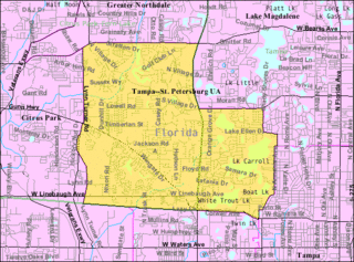
<span class="mw-page-title-main">Carrollwood (CDP), Florida</span> Census-designated place in Florida, United States

Carrollwood is a census-designated place (CDP) in northwestern Hillsborough County, Florida, United States. The census area includes the unincorporated communities of Carrollwood and Carrollwood Village. For the 2000 census the area was enumerated under the name "Greater Carrollwood". A similar area was listed as "Lake Carroll" in 1970 and 1980; for the 1990 census it was split into the smaller Carrollwood and Carrollwood Village CDPs. The population was 34,352 at the 2020 census.

<span class="mw-page-title-main">Homeacre-Lyndora, Pennsylvania</span> Census-designated place in Pennsylvania, United States

Homeacre-Lyndora is a census-designated place (CDP) in Butler County, Pennsylvania, United States. The population was 6,906 at the 2010 census.

<span class="mw-page-title-main">Sun City Center, Florida</span> Census-designated place in Florida, United States

Sun City Center is an unincorporated census-designated place (CDP) in southern Hillsborough County, Florida, United States. It is located south of Tampa and north of Sarasota on I-75. As of the 2020 census, the population was 30,952. The ZIP Code serving the community is 33573.

References

  1. "2020 U.S. Gazetteer Files". United States Census Bureau. Retrieved October 31, 2021.
  2. 1 2 "U.S. Census website". United States Census Bureau . Retrieved January 31, 2008.
  3. "US Board on Geographic Names". United States Geological Survey. October 25, 2007. Retrieved January 31, 2008.
  4. "Geographic Identifiers: 2010 Demographic Profile Data (G001): Manatee Road CDP, Florida". U.S. Census Bureau, American Factfinder. Archived from the original on February 12, 2020. Retrieved December 5, 2012.
  5. 2000 U.S. Census errata
  6. "US Gazetteer files: 2010, 2000, and 1990". United States Census Bureau. February 12, 2011. Retrieved April 23, 2011.
  7. "U.S. Gazetteer Files: 2019: Places: Florida". U.S. Census Bureau Geography Division. Retrieved December 5, 2019.
  8. "Census of Population and Housing". Census.gov. Retrieved June 4, 2016.