Otter Creek, Florida

Last updated

Otter Creek, Florida
Otter Creek, Florida.jpg
Eastbound SR 24 entering Otter Creek.
Levy County Florida Incorporated and Unincorporated areas Otter Creek Highlighted.svg
Location in Levy County and the state of Florida
Coordinates: 29°19′24″N82°46′22″W / 29.32333°N 82.77278°W / 29.32333; -82.77278
Country Flag of the United States.svg  United States
State Flag of Florida.svg  Florida
County   Levy
Incorporated 1969 [1]
Government
  Type Mayor-Council
   Mayor [2] Therese Granger
   Vice Mayor Zim Padgett
   Councilmembers Don Severino,
Sonya Lamb, and
Russell Meeks Sr.
   Town Attorney Steven Warm
Area
[3]
  Total1.38 sq mi (3.57 km2)
  Land1.36 sq mi (3.52 km2)
  Water0.02 sq mi (0.05 km2)
Elevation
26 ft (8 m)
Population
 (2020)
  Total108
  Density79.35/sq mi (30.64/km2)
Time zone UTC-5 (Eastern (EST))
  Summer (DST) UTC-4 (EDT)
ZIP code
32683
Area code 352
FIPS code 12-53500 [4]
GNIS feature ID0288275 [5]

Otter Creek is a town in Levy County, Florida, United States. The town is located in North Florida. The population was 108 at the 2020 census.

Contents

History

Hernando de Soto crossed Otter Creek during his explorations of Florida in 1539.

In the 1930s and 1940s, Otter Creek was the second largest community in Levy County, with a population approaching 1,000.

The loss of a lumber mill that made cypress "flitches" for citrus crates and the discontinuation of two railroads which bisected the town led to a steady population decline.

The town was officially incorporated as a municipality in 1969. [1]

In 2007, the town council created a local historic district consisting of neighborhoods with "company town" residences that date from the 19th and early 20th century

After the closure of the lumber mill, there has been very little business or commercial activity within Otter Creek. By 2019, only two small businesses remained, an independently-owned convenience store (no gasoline) located at the intersection of Highways 19 and 24, and the Creekside Christian School, a private, primary school operating on the grounds of Otter Creek Baptist Church.

To the extent that other businesses existed, they have closed due to the deaths of their owners or otherwise failed. Some notable examples were the Smith Store and the Country Store, both community-centric and vibrant in their days. The Smith Store was operated by Ella Graham (deceased 1996), whose grandson once delivered groceries and dry goods to the town residents on a Shetland pony. The Country Store, originally built and operated by Junior and Philene Williams, changed hands after their deaths, but permanently closed about 2000. There was an animal hide tannery until about 1980, and a few bait shops and convenience stores. The remnants of nearly all are now decrepit.

Geography

The approximate coordinates for the Town of Otter Creek is located at 29°19′24″N82°46′22″W / 29.323435°N 82.772708°W / 29.323435; -82.772708 . [6]

According to the United States Census Bureau, the town has a total area of 1.5 square miles (3.8 km2), of which 1.4 square miles (3.7 km2) is land and 0.019 square miles (0.05 km2) (1.28%) is water.

Climate

The climate in this area is characterized by hot, humid summers and generally mild winters. According to the Köppen climate classification, the Town of Otter Creek has a humid subtropical climate zone (Cfa).

Demographics

Historical population
CensusPop.Note
1970 230
1980 167−27.4%
1990 136−18.6%
2000 121−11.0%
2010 13410.7%
2020 108−19.4%
U.S. Decennial Census [7]

2010 and 2020 census

Otter Creek racial composition
(Hispanics excluded from racial categories)
(NH = Non-Hispanic)
RacePop 2010 [8] Pop 2020 [9] % 2010% 2020
White (NH)1269394.03%86.11%
Black or African American (NH)422.99%1.85%
Native American or Alaska Native (NH)030.00%2.78%
Asian (NH)000.00%0.00%
Pacific Islander or Native Hawaiian (NH)000.00%0.00%
Some other race (NH)020.00%1.85%
Two or more races/Multiracial (NH)110.75%0.93%
Hispanic or Latino (any race)372.24%6.48%
Total134108

As of the 2020 United States census, there were 108 people, 44 households, and 33 families residing in the town. [10]

As of the 2010 United States census, there were 134 people, 65 households, and 49 families residing in the town. [11]

2000 census

As of the census [4] of 2000, there were 121 people, 54 households, and 32 families residing in the town. The population density was 84.7 inhabitants per square mile (32.7/km2). There were 70 housing units at an average density of 49.0 per square mile (18.9/km2). The racial makeup of the town was 93.39% White, 3.31% African American, 2.48% from other races, and 0.83% from two or more races. Hispanic or Latino of any race were 4.96% of the population.

In 2000, there were 54 households, out of which 22.2% had children under the age of 18 living with them, 51.9% were married couples living together, 3.7% had a female householder with no husband present, and 40.7% were non-families. 31.5% of all households were made up of individuals, and 14.8% had someone living alone who was 65 years of age or older. The average household size was 2.24 and the average family size was 2.91.

In 2000, in the town, the population was spread out, with 17.4% under the age of 18, 7.4% from 18 to 24, 20.7% from 25 to 44, 37.2% from 45 to 64, and 17.4% who were 65 years of age or older. The median age was 46 years. For every 100 females, there were 108.6 males. For every 100 females age 18 and over, there were 100.0 males.

In 2000, the median income for a household in the town was $18,036, and the median income for a family was $19,821. Males had a median income of $30,000 versus $22,500 for females. The per capita income for the town was $13,101. There were 12.1% of families and 20.2% of the population living below the poverty line, including no under eighteens and 17.2% of those over 64.

Related Research Articles

<span class="mw-page-title-main">Callaway, Florida</span> City in Florida, United States

Callaway is a city in Bay County, Florida, United States, and is a suburb of Panama City. The population was 13,045 at the 2020 census, down from 14,405 at the 2010 census. It is part of the Panama City–Panama City Beach, Florida Metropolitan Statistical Area.

<span class="mw-page-title-main">Penney Farms, Florida</span> Town in the state of Florida, United States

Penney Farms is a town in Clay County, Florida, United States. It is part of the Jacksonville metropolitan area. The population was 821 at the 2020 census.

<span class="mw-page-title-main">Horseshoe Beach, Florida</span> Town in the state of Florida, United States

Horseshoe Beach is a town in southern Dixie County, Florida, United States. The town is part of Big Bend and the Nature Coast in North Florida, along the Gulf of Mexico. The population was 165 at the 2020 census.

<span class="mw-page-title-main">Beverly Beach, Florida</span> Town in Florida, United States

Beverly Beach is a town in Flagler County, Florida, United States. The Town of Beverly Beach is part of the Deltona–Daytona Beach–Ormond Beach, FL metropolitan statistical area. The population was 474 at the 2020 census, up from 338 in the 2010 census.

<span class="mw-page-title-main">Fanning Springs, Florida</span> City in Florida, United States

Fanning Springs is a city in Gilchrist and Levy counties in the U.S. state of Florida. It is part of the Gainesville, Florida Metropolitan Statistical Area. The population was 1,182 at the 2020 census, up from 764 at the 2010 census.

<span class="mw-page-title-main">Town 'n' Country, Florida</span> Census-designated place in Florida, United States

Town 'n' Country is a census-designated place (CDP) in Hillsborough County, Florida, United States. The population was 85,951 at the 2020 census.

<span class="mw-page-title-main">Ponce de Leon, Florida</span> Town in the state of Florida, United States

Ponce de Leon is a town in Holmes County, Florida, United States. The Town of Ponce de Leon was named after Spanish explorer, Juan Ponce de León. It is part of the Florida Panhandle in North Florida. The population was 504 at the 2020 census, down from 598 at the 2010 census.

<span class="mw-page-title-main">Campbellton, Florida</span> Town in Florida, United States

Campbellton is a town in Jackson County, Florida, United States. The town is part of the Florida Panhandle in North Florida, and has a predominately African American majority. The population was 191 at the 2020 census.

<span class="mw-page-title-main">Greenwood, Florida</span> Town in Florida, United States

Greenwood is a town in Jackson County, Florida, United States. It is part of the Florida Panhandle and located in North Florida, specifically Northwest Florida. The population was 539 at the 2020 census.

<span class="mw-page-title-main">Astatula, Florida</span> Town in the state of Florida, United States

Astatula is a town in Lake County, Florida, United States. The population was 1,889 at the 2020 census. It is part of the Orlando–Kissimmee–Sanford Metropolitan Statistical Area.

<span class="mw-page-title-main">Howey-in-the-Hills, Florida</span> Town in the state of Florida, United States

Howey-In-The-Hills is a town in Lake County, Florida, United States. The population was 1,643 at the 2020 census. It is part of the Orlando–Kissimmee–Sanford Metropolitan Statistical Area.

<span class="mw-page-title-main">Montverde, Florida</span> Town in Florida, United States

Montverde is a town in Lake County, Florida, United States. The population was 1,655 at the 2020 census. It is part of the Orlando–Kissimmee–Sanford Metropolitan Statistical Area.

<span class="mw-page-title-main">Bronson, Florida</span> Town in Florida, United States

Bronson is a town and the county seat of Levy County, Florida, United States. The population was 1,140 at the 2020 census, up from 1,113 at the 2010 census. It is part of the Gainesville, Florida Metropolitan Statistical Area.

<span class="mw-page-title-main">Inglis, Florida</span> Town in Florida, United States

Inglis is a town in Levy County, Florida, United States. It is on U.S. Highway 19 near the Cross Florida Greenway. As of the 2020 census, the town had a population of 1,476, up from 1,325 at the 2010 census. It is part of the Gainesville, Florida Metropolitan Statistical Area.

<span class="mw-page-title-main">Sunset, Florida</span> Census-designated place in Florida

Sunset is a census-designated place (CDP) in Miami-Dade County, Florida, United States. It is part of the Miami metropolitan area of South Florida. The population was 15,912 at the 2020 census. The U.S. Postal Service uses the ZIP Codes of 33173 and 33183 for Sunset.

<span class="mw-page-title-main">North Redington Beach, Florida</span> Town in the state of Florida, United States

North Redington Beach is a town in Pinellas County, Florida, United States. It is part of the Tampa–St. Petersburg–Clearwater Metropolitan Statistical Area, more commonly known as the Tampa Bay Area. The population was 1,495 at the 2020 census.

<span class="mw-page-title-main">Pomona Park, Florida</span> Town in the state of Florida, United States

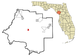
Pomona Park is a town in Putnam County, Florida, United States. The Town of Pomona Park is part of the Palatka Micropolitan Statistical Area. The population was 784 at the 2020 census.

<span class="mw-page-title-main">St. Lucie Village, Florida</span> Town in the state of Florida, United States

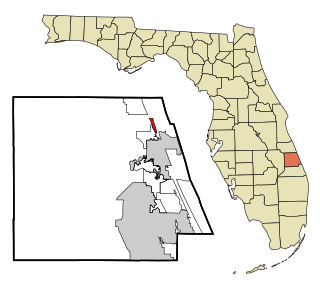
St. Lucie Village is a town in St. Lucie County, Florida, United States. It is part of the Port St. Lucie Metropolitan Statistical Area. The population was 613 at the 2020 census.

<span class="mw-page-title-main">Freeport, Florida</span> City in Florida, United States of America

Freeport is a city in Walton County, Florida, United States. It is part of the Crestview–Fort Walton Beach–Destin, Florida Metropolitan Statistical Area. As of the 2020, the population recorded by the U.S. Census Bureau was 5,861, up from 1,787 at the 2010 census. Freeport is one of the fastest growing cities in Florida. After the construction of the massive group of neighborhoods, Hammock Bay, the population exploded.

<span class="mw-page-title-main">Paxton, Florida</span> Town in the state of Florida, United States

Paxton is a town in Walton County, Florida, United States. Located near Britton Hill on the Alabama–Florida state line, it has the highest elevation of any in Florida. The Town of Paxton is located on the Florida Panhandle, and is part of the Crestview–Fort Walton Beach–Destin, Florida Metropolitan Statistical Area. The population was 556 as of the 2020 census, down from 644 at the 2010 census.

References

  1. 1 2 "FLORIDA CITIES BY INCORPORATION YEAR WITH INCORPORATION & DISSOLUTION INFO" (PDF). www.flcities.com.
  2. "MUNICIPAL DIRECTORY: Town of Otter Creek". Florida League of Cities.
  3. "2020 U.S. Gazetteer Files". United States Census Bureau. Retrieved October 31, 2021.
  4. 1 2 "U.S. Census website". United States Census Bureau . Retrieved January 31, 2008.
  5. "US Board on Geographic Names". United States Geological Survey. October 25, 2007. Retrieved January 31, 2008.
  6. "US Gazetteer files: 2010, 2000, and 1990". United States Census Bureau. February 12, 2011. Retrieved April 23, 2011.
  7. "Census of Population and Housing". Census.gov. Retrieved June 4, 2015.
  8. "P2 HISPANIC OR LATINO, AND NOT HISPANIC OR LATINO BY RACE - 2010: DEC Redistricting Data (PL 94-171) - Otter Creek town, Florida". United States Census Bureau .
  9. "P2 HISPANIC OR LATINO, AND NOT HISPANIC OR LATINO BY RACE - 2020: DEC Redistricting Data (PL 94-171) - Otter Creek town, Florida". United States Census Bureau .
  10. "S1101 HOUSEHOLDS AND FAMILIES - 2020: Otter Creek town, Florida". United States Census Bureau .
  11. "S1101 HOUSEHOLDS AND FAMILIES - 2010: Otter Creek town, Florida". United States Census Bureau .