Marvin, North Carolina

Last updated

Marvin, North Carolina
NCMap-doton-Marvin.PNG
Location of Marvin, North Carolina
Coordinates: 34°00′06″N80°49′07″W / 34.00167°N 80.81861°W / 34.00167; -80.81861
Country Flag of the United States (23px).png  United States
State Flag of North Carolina.svg  North Carolina
County Union
IncorporatedJuly 1, 1994 [1]
Area
[2]
  Total6.03 sq mi (15.63 km2)
  Land5.99 sq mi (15.50 km2)
  Water0.05 sq mi (0.12 km2)
Elevation
[3]
646 ft (197 m)
Population
 (2020)
  Total6,358
  Density1,062.15/sq mi (410.09/km2)
Time zone UTC-5 (Eastern (EST))
  Summer (DST) UTC-4 (EDT)
ZIP code
28173
Area code 704
FIPS code 37-41720 [4]
GNIS feature ID2407497 [3]

Marvin is a village in Union County, North Carolina, United States. The population was 5,579 at the 2010 census. It is a more rural suburb of Charlotte. [5]

Contents

Geography

According to the United States Census Bureau, the village has a total area of 3.9 square miles (10 km2), of which 3.9 square miles (10 km2) is land and 0.04 square miles (0.10 km2) (0.51%) is water. Marvin is a border territory, which lies in the state of North Carolina but borders South Carolina to the southwest.

Demographics

Historical population
CensusPop.Note
2000 1,039
2010 5,579437.0%
2020 6,35814.0%
U.S. Decennial Census [6]

As of the census [4] of 2010, there were 5,579 people, 1,553 households, and 1,463 families residing in the village. The population density was 1,429 inhabitants per square mile (552/km2). There were 1506 housing units at an average density of 386 per square mile (149/km2). The racial makeup of the village was 86.2% White, 5.7% African American, 5.4% Asian, and 1.6% from two or more races. Hispanic or Latino of any race were 3.3% of the population.

There were 1553 households, out of which 67.7% had children under the age of 18 living with them, 89.4% were married couples living together, 2.3% had a female householder with no husband present, and 5.8% were non-families. 4.8% of all households were made up of individuals, and 1.7% had someone living alone who was 65 years of age or older. The average household size was 3.59 and the average family size was 3.73.

In the village, the population was spread out, with 33.6% under the age of 18, 3.4% from 18 to 24, 33.8% from 25 to 44, 24.2% from 45 to 64, and 5.1% who were 65 years of age or older. The median age was 37 years. For every 100 females, there were 102.5 males. For every 100 females age 18 and over, there were 97.1 males.

The median income for a household in the village was $157,297, and the median income for a family was $158,537. Males had a median income of $127,159 versus $51,053 for females. The per capita income for the village was $57,822. About 1.6% of families and 1.6% of the population were below the poverty line, including 2.2% of those under age 18 and 0% of those age 65 or over.

The Village enacted a new land use plan in 2004, to establish its desire to preserve its open spaces firmly, and low-density character. Marvin is located near Ballantyne, South Charlotte.

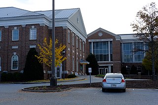
In April 2022, the village opened a village hall near Marvin Elementary School.

History

The area known as Marvin today was settled and inhabited by elements of the Waxhaw Indian tribe, who lived near the present day border between North Carolina and South Carolina. The Waxhaw gained their name from the type of waxy reed which grew near the swamps of the Waxhaw forests. [7]

On October 30, 1629, King Charles I of England granted the establishment of the Colony of Carolina under the governance of Sir Robert Heath. [8] This sparked the development of the Carolina colonies which resulted in several explorations down the Great Trading Path which ran from Augusta through Charlotte and towards Petersburg, Virginia. [9]

In 1700, John Lawson, Surveyor-General of the Colony of North Carolina made first contact with the Waxhaw Indians, and the native land of Marvin. [7] He noted that "the land was being so fertile that no labor of man in one or two ages could make it poor." [7] Lawsons thoughts about the land were confirmed 300 years later with numerous farms scattered around the Marvin area, giving its semi-rural suburban atmosphere. In 1741, an epidemic of smallpox was introduced into the community, and many of the Indians were killed or were forced to abandon the area. [7] Settlers began to exploit the fertile land to grow craps such as soy and tobacco.

German, English, Welch, and Scottish families, some of whom were escaping turmoil in Europe such as the 7 years war and the Jacobite rising of 1745.

Until 1842, Marvin was an unincorporated section of Anson county, until the schism between Mecklenburg - Union counties, which resulted in the creation of Union county, and thus the incorporation of Marvin. Most settlers of Marvin owned slaves and would pass inheritance to their children. It would not be until the end of the Civil War that slavery was ended in Marvin. Most local slaves were purchased in Charleston, SC. Old Steel Creek road was used as a transport of slaved cotton, which was destroyed by General Cornwallis during the American Revolutionary war, and currently is the site of Highway 521.

Although sources are scarce, it is believed that Henry Downs was one of the original signatories of the "Mecklenburg Declaration of Independence", which was destroyed in a fire in 1800, [10] and published just one month after the events at Lexington and Concord.

In 1777, North Carolina began issuing land grants to those who served in the American revolution. Around 640 acres of land were distributed through this land grant system. It is believed that the Crane road was where Francis Carter, one of the first settlers of the Marvin area, lived and managed the distribution of crown grants. [7] A few of the oldest families in the Carolinas held kings’ grants from those distributed by Francis Carter, but most had come down the Great Trading Path from the North, such as the Polk family, and President James K. Polk, along with the Jackson family, and President Andrew Jackson, born near Marvin. [11]

Maggie Ross, one of the richest women in Union County had a scandal regarding the distribution between her will and her family members. After her sister, Sallie Ross, died in 1909, her estate was bequeathed to Bob Ross, who were African American. This sparked one of the largest civil rights feuds in the county due to racial prejudice in the local Union county municipal courts. [12] Later, this racial tension would culminate in the Kissing Case, taking place in Monroe.

Marvin was founded on July 1, 1994. [7] According to Ruth B. Ezzell, the major Marvin principles for foundation were "the hardships, the sacrifices made by our forefathers, their determination to lay principles as foundations for future generations, how they fought in wars for freedom and liberty, we may be inspired to a greater loyalty and appreciation of our community".

Marvin has experienced numerous demographic changes, such as an increase of Asian-Americans who have migrated to the town during the early 2000's. Marvin is geographically located near Charlotte, and is incorporated as an official suburb of Charlotte, and the major shift in population can be attributed towards the large banking Industry of Charlotte, NC, which has grown due to the introduction of Bank of America which was finalized around 1992. [13]

Related Research Articles

<span class="mw-page-title-main">Mecklenburg County, Virginia</span> County in Virginia, United States

Mecklenburg County is a county in the Commonwealth of Virginia. As of the 2020 census, the population was 30,319. Its county seat is Boydton.

<span class="mw-page-title-main">Lancaster County, South Carolina</span> County in South Carolina, United States

Lancaster County is a county located in the U.S. state of South Carolina. As of the 2020 census, its population was 96,016, Its county seat is Lancaster, which has an urban population of 23,979. The county was created in 1785.

<span class="mw-page-title-main">Union County, North Carolina</span> County in North Carolina, United States

Union County is a county located in the U.S. state of North Carolina. As of the 2020 census, the population was 238,267. Its county seat is Monroe. Union County is included in the Charlotte-Concord-Gastonia, NC-SC Metropolitan Statistical Area.

<span class="mw-page-title-main">Nash County, North Carolina</span> County in North Carolina, United States

Nash County is a county located in the U.S. state of North Carolina. As of the 2020 census, the population was 94,970. Its county seat is Nashville.

<span class="mw-page-title-main">Mecklenburg County, North Carolina</span> County in North Carolina, United States

Mecklenburg County is a county located in the southwestern region of the U.S. state of North Carolina, in the United States. As of the 2020 census, the population was 1,115,482, making it the second-most populous county in North Carolina, and the first county in the Carolinas to surpass one million in population. Its county seat is Charlotte, the state's largest municipality.

<span class="mw-page-title-main">Lincoln County, North Carolina</span> County in North Carolina, United States

Lincoln County is a county located in the U.S. state of North Carolina. As of the 2020 census, the population was 86,810, making it the most populous "Lincoln County" in the United States. Its county seat is Lincolnton.

<span class="mw-page-title-main">Cabarrus County, North Carolina</span> County in North Carolina, United States

Cabarrus County is a county located in the south-central part of the U.S. state of North Carolina. As of the 2020 census, the population was 225,804, making it the 9th-most populous county in North Carolina. The county seat is Concord, which was incorporated in 1803. Cabarrus County is included in the Charlotte-Concord-Gastonia, NC-SC Metropolitan Statistical Area.

<span class="mw-page-title-main">Anson County, North Carolina</span> County in North Carolina, United States

Anson County is a county located in the U.S. state of North Carolina. As of the 2020 census, the population was 22,055. Its county seat is Wadesboro.

<span class="mw-page-title-main">Pineville, North Carolina</span> Town in North Carolina, United States

Pineville is a suburban town in the southernmost portion of Mecklenburg County, North Carolina, United States. Part of the Charlotte metropolitan area, it is situated in the Waxhaws district between Charlotte and Fort Mill.

<span class="mw-page-title-main">Harrisburg, North Carolina</span> Town in North Carolina, United States

Harrisburg is a town in Cabarrus County, North Carolina, United States. It is a northeastern suburb of Charlotte. In the 2020 census, the population was 18,967.

<span class="mw-page-title-main">Mount Holly, North Carolina</span> City in North Carolina, United States

Mount Holly is a small suburban city in northeastern Gaston County, North Carolina, United States. The city is situated just west of the Catawba River, north of Interstate 85, south of North Carolina State Highway 16. The population was 17,703 at the 2020 census, up from 13,656 in 2010.

<span class="mw-page-title-main">Cornelius, North Carolina</span> Town in North Carolina, United States

Cornelius is a suburban town located along Lake Norman in northern Mecklenburg County, North Carolina, United States. It is a major suburb in the Charlotte metropolitan area. The population was 24,866 at the 2010 census.

<span class="mw-page-title-main">Huntersville, North Carolina</span> Town in North Carolina, United States

Huntersville is a large suburban town in northern Mecklenburg County, North Carolina, United States. At the 2020 census, its population was 61,376, making Huntersville the 15th-most populous municipality in North Carolina. It is located in the Charlotte metropolitan area and 14 mi (23 km) north of Charlotte.

<span class="mw-page-title-main">Matthews, North Carolina</span> Town in North Carolina, United States

Matthews is a town in southeastern Mecklenburg County, North Carolina, United States. It is a suburb of Charlotte. The population was 27,198 according to the 2010 census.

<span class="mw-page-title-main">Mint Hill, North Carolina</span> Town in North Carolina, United States

Mint Hill is a suburban town in southeastern Mecklenburg and northwestern Union counties in the U.S. state of North Carolina, it is a major suburb on the outskirts of Charlotte and near the Cabarrus County line. The population was 22,722 at the 2010 census.

<span class="mw-page-title-main">Indian Trail, North Carolina</span> Town in North Carolina, United States

Indian Trail is a suburban town in Union County, North Carolina, United States. A part of the Charlotte metropolitan area, Indian Trail has grown rapidly in the 21st century, going from 1,942 residents in 1990 to 39,997 in 2020.

<span class="mw-page-title-main">Waxhaw, North Carolina</span> Town in North Carolina, United States

Waxhaw is a town in Union County, North Carolina, United States. The population was 20,534 according to the 2020 Census. The population grew 108.28% from 2010. The name is derived from the indigenous people who lived in the area, who were known as the Waxhaw people.

<span class="mw-page-title-main">Wesley Chapel, North Carolina</span> Village in North Carolina, United States

Wesley Chapel is a village in Union County, North Carolina, United States. The population was 8,681 at the 2020 census and was estimated to be 8,883 in 2021.

<span class="mw-page-title-main">Lancaster, South Carolina</span> City in South Carolina, United States

The city of Lancaster is the county seat of Lancaster County, South Carolina, United States, located in the Charlotte Metropolitan Area. As of the United States Census of 2010, the city population was 8,526. The city was named after the famous House of Lancaster.

<span class="mw-page-title-main">Davidson, North Carolina</span> Town in North Carolina, United States

Davidson is a suburban town located in Iredell and Mecklenburg counties, North Carolina, United States, on the banks of Lake Norman. It is a suburb in the Charlotte metropolitan area. The population was 10,944 at the 2010 census, and in 2019 the estimated population was 13,054. The town was founded in 1837 with the establishment of the Presbyterian Davidson College, named for Brigadier General William Lee Davidson, a local Revolutionary War hero. The land for Davidson College came from Davidson's estate, a large portion of which was donated by his son.

References

  1. "Who We Are". Village of Marvin. Retrieved November 25, 2023.
  2. "ArcGIS REST Services Directory". United States Census Bureau. Retrieved September 20, 2022.
  3. 1 2 U.S. Geological Survey Geographic Names Information System: Marvin, North Carolina
  4. 1 2 "U.S. Census website". United States Census Bureau . Retrieved January 31, 2008.
  5. Drillinger, Meagan. "Richest Towns in Each State". Stacker. Retrieved October 19, 2021.
  6. "Census of Population and Housing". Census.gov. Retrieved June 4, 2015.
  7. 1 2 3 4 5 6 Ezzell, Ruth (2022). "The History of Marvin" (PDF). Village of Marvin. Retrieved March 21, 2023.
  8. "Originally Carolana, for King Charles I | NC DNCR". www.dncr.nc.gov. October 30, 2016. Retrieved August 10, 2023.
  9. mjatkowski@classicalamericanhomes.org, mjatkowski@classicalamericanhomes org (October 25, 2021). "The Great Trading Path". Classical American Homes Preservation Trust. Retrieved August 10, 2023.
  10. "Mecklenburg Declaration of Independence". American Battlefield Trust. Retrieved March 22, 2023.
  11. Stowe, Gene (2006). Inherit the Land: Jim Crow Meets Miss Maggie's Will (1st ed.). Marvin Ridge, NC: University Press of Mississippi. pp. 9–15. ISBN   1934110604.
  12. Inherit the Land.
  13. https://www.britannica.com/topic/Bank-of-America-Corporation