Mineral Springs, North Carolina

Last updated

Mineral Springs, North Carolina
NCMap-doton-MineralSprings.PNG
Location of MineralSprings, North Carolina
Coordinates: 34°56′28″N80°41′05″W / 34.94111°N 80.68472°W / 34.94111; -80.68472
Country United States
State North Carolina
County Union
Incorporated1905, 1999 [1]
Area
[2]
  Total8.28 sq mi (21.44 km2)
  Land8.21 sq mi (21.26 km2)
  Water0.07 sq mi (0.18 km2)
Elevation
[3]
650 ft (200 m)
Population
 (2020)
  Total3,159
  Density384.77/sq mi (148.56/km2)
Time zone UTC-5 (Eastern (EST))
  Summer (DST) UTC-4 (EDT)
ZIP code
28108
Area code 704
FIPS code 37-43360 [4]
GNIS feature ID2406168 [3]
Website www.mineralspringsnc.com

Mineral Springs is a town in Union County, North Carolina, United States. The population was 2,639 at the 2010 census.

Contents

Geography

According to the United States Census Bureau, the town has a total area of 7.6 square miles (20 km2), of which 7.6 square miles (20 km2) is land and 0.13% is water.

Demographics

Historical population
CensusPop.Note
1920 84
1930 11435.7%
2000 1,370
2010 2,63992.6%
2020 3,15919.7%
U.S. Decennial Census [5]

As of the census [4] of 2000, there were 1,370 people, 475 households, and 387 families residing in the town. The population density was 181.2 inhabitants per square mile (70.0/km2). There were 491 housing units at an average density of 64.9 per square mile (25.1/km2). The racial makeup of the town was 79.93% White, 17.88% African American, 0.15% Native American, 0.22% Asian, 0.88% from other races, and 0.95% from two or more races. Hispanic or Latino of any race were 1.90% of the population.

There were 475 households, out of which 40.2% had children under the age of 18 living with them, 69.9% were married couples living together, 8.6% had a female householder with no husband present, and 18.5% were non-families. 14.9% of all households were made up of individuals, and 5.1% had someone living alone who was 65 years of age or older. The average household size was 2.88 and the average family size was 3.20.

In the town, the population was spread out, with 28.3% under the age of 18, 7.2% from 18 to 24, 32.2% from 25 to 44, 23.6% from 45 to 64, and 8.7% who were 65 years of age or older. The median age was 36 years. For every 100 females, there were 98.6 males. For every 100 females age 18 and over, there were 96.0 males.

The median income for a household in the town was $41,932, and the median income for a family was $44,531. Males had a median income of $31,581 versus $24,926 for females. The per capita income for the town was $17,896. About 3.9% of families and 4.4% of the population were below the poverty line, including 4.3% of those under age 18 and 11.1% of those age 65 or over.

Queens Cup Steeplechase Races

Related Research Articles

<span class="mw-page-title-main">Mineral Springs, Arkansas</span> City in Arkansas, United States

Mineral Springs is a city in Howard County, Arkansas, United States. The population was 1,208 at the 2010 census.

<span class="mw-page-title-main">Pottsville, Arkansas</span> City in Arkansas, United States

Pottsville is a city in Pope County, Arkansas, United States. As of the 2020 census the population was 3,140. It is part of the Russellville Micropolitan Statistical Area.

<span class="mw-page-title-main">Dillard, Georgia</span> City in Georgia, United States

Dillard is a town in Rabun County, Georgia, United States. As of the 2020 census, the city population was 337.

<span class="mw-page-title-main">Rossville, Indiana</span> Town in Indiana, United States

Rossville is a town in Ross Township, Clinton County, Indiana, United States. The population was 1,653 at the 2010 census.

<span class="mw-page-title-main">West Baden Springs, Indiana</span> Town in Indiana, United States

West Baden Springs is a town in French Lick Township, Orange County, in the U.S. state of Indiana. The population was 574 at the 2010 census.

Greenwood is a town in Oxford County, Maine, United States. The population was 774 at the 2020 census. The town was named for surveyor Alexander Greenwood. The village of Locke Mills, on State Route 26 in the northern part of Greenwood, is the town's urban center and largest settlement.

<span class="mw-page-title-main">Brooks, Maine</span> Town in the state of Maine, United States

Brooks is a town in Waldo County, Maine, United States. The population was 1,010 at the 2020 census.

<span class="mw-page-title-main">Berrien Springs, Michigan</span> Village in Michigan, United States

Berrien Springs is a village in Berrien County in the U.S. state of Michigan. The population was 1,910 at the time of the 2020 census. The village is located within Oronoko Charter Township.

<span class="mw-page-title-main">Lewis, Essex County, New York</span> Town in Essex County, New York, US

Lewis is a town in Essex County, New York, United States. The population was 1,382 at the 2010 census. The town is named after Morgan Lewis, the governor of New York at the time the town was established.

<span class="mw-page-title-main">Connelly Springs, North Carolina</span> Town in North Carolina, United States

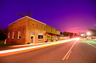
Connelly Springs is a town in Burke County, North Carolina, United States. The population was 1,669 at the 2010 census. It is part of the Hickory–Lenoir–Morganton Metropolitan Statistical Area.

<span class="mw-page-title-main">Rural Hall, North Carolina</span> Town in North Carolina, United States

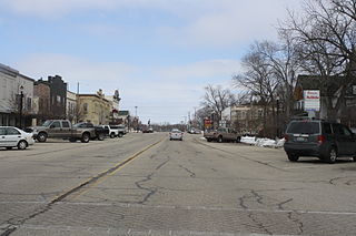
Rural Hall is a town in Forsyth County, North Carolina, United States. It is a part of the Piedmont Triad. The population was 3,360 at the 2020 census. The town has one public park: Covington Memorial Park.

<span class="mw-page-title-main">Mineral City, Ohio</span> Village in Ohio, United States

Mineral City is a village in Tuscarawas County, Ohio, United States. The population was 652 at the 2020 census.

<span class="mw-page-title-main">Spring Brook Township, Pennsylvania</span> Place in Pennsylvania, United States

Spring Brook Township is a township in Lackawanna County, Pennsylvania, United States. The population was 2,753 at the 2020 census.

<span class="mw-page-title-main">Burnettown, South Carolina</span> Town in South Carolina, United States of America

Burnettown is a town in Aiken County, South Carolina, United States. The population was 3,105 at the 2020 census. It is part of the Augusta, Georgia metropolitan area. Burnettown is located in historic Horse Creek Valley.

<span class="mw-page-title-main">Blackville, South Carolina</span> Town in South Carolina, United States

Blackville is a small town in Barnwell County, South Carolina, United States. The population was 2,406 at the 2010 census.

<span class="mw-page-title-main">South Congaree, South Carolina</span> Town in South Carolina, United States

South Congaree is a town in Lexington County, South Carolina, United States. The population was 2,306 at the 2010 census. It is part of the Columbia, South Carolina Metropolitan Statistical Area.

<span class="mw-page-title-main">Mason, West Virginia</span> Town in West Virginia, United States

Mason, also known as Mason City, is a town in Mason County, West Virginia, United States. The population was 865 at the 2020 census. It is part of the Point Pleasant, WV–OH Micropolitan Statistical Area.

<span class="mw-page-title-main">Green Springs, Ohio</span> Village in Ohio, United States

Green Springs is a village in Sandusky and Seneca counties in the U.S. state of Ohio. The population was 1,233 at the 2020 census.

<span class="mw-page-title-main">Albany, Green County, Wisconsin</span> Town in Wisconsin, United States

The Town of Albany is a town located in Green County, Wisconsin, United States. The population was 1,189 at the 2020 Census. The Village of Albany is located within the town. The unincorporated community of Mineral Point is also located in the town.

<span class="mw-page-title-main">Palmyra, Wisconsin</span> Village in Wisconsin, United States

Palmyra is a village in Jefferson County, Wisconsin, United States, along the Scuppernong River. It was named after the desert oasis city of Palmyra, Syria, due to its dry, sandy soil. The population was 1,719 at the 2020 census. The village is adjacent to the Town of Palmyra.

References

  1. "North Carolina Gazetteer" . Retrieved November 25, 2023.
  2. "ArcGIS REST Services Directory". United States Census Bureau. Retrieved September 20, 2022.
  3. 1 2 U.S. Geological Survey Geographic Names Information System: Mineral Springs, North Carolina
  4. 1 2 "U.S. Census website". United States Census Bureau . Retrieved January 31, 2008.
  5. "Census of Population and Housing". Census.gov. Retrieved June 4, 2015.