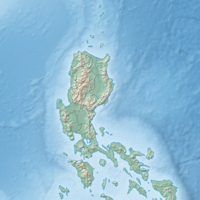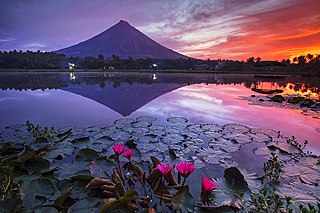
Albay, officially the Province of Albay, is a province in the Bicol Region of the Philippines, mostly on the southeastern part of the island of Luzon. Its capital is the city of Legazpi, the regional center of the whole Bicol Region, which is located in the southern foothill of Mayon Volcano.
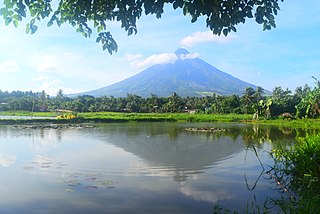
Bicol, known formally as the Bicol Region or colloquially as Bicolandia, is an administrative region of the Philippines, designated as Region V. Bicol comprises six provinces, four on the Bicol Peninsula mainland – Albay, Camarines Norte, Camarines Sur, and Sorsogon – and the offshore island provinces of Catanduanes and Masbate.

Mayon, also known as Mount Mayon and Mayon Volcano, is an active stratovolcano in the province of Albay in Bicol Region, on the island of Luzon in the Philippines. A popular tourist spot, it is renowned for its "perfect cone" because of its symmetric conical shape, and is regarded as very sacred in Philippine mythology.
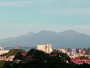
Mount Apo, also known locally as Apo Sandawa, is a large solfataric, dormant stratovolcano on the island of Mindanao, Philippines. With an elevation of 2,954 meters (9,692 ft) above sea level, it is the highest-mountain in the Philippine Archipelago, Mindanao and 24th-highest peak of an island on Earth. Located between Davao City and Davao del Sur in the Davao Region, and Cotabato in Soccsksargen, Mount Apo is the most-prominent mountain in the Philippines. The peak overlooks from Davao City 45 kilometers (28 mi) to the northeast, Digos 25 kilometers (16 mi) to the southeast, and Kidapawan 20 kilometers (12 mi) to the west. It is a protected area and a Natural Park of the Philippines.
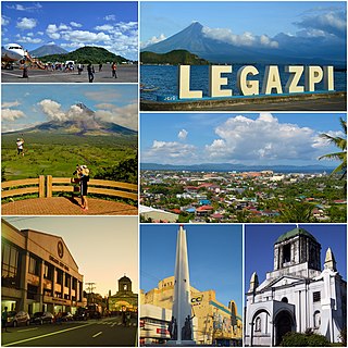
Legazpi, officially known as the City of Legazpi, is a 1st class component city and capital of the province of Albay, Philippines. According to the 2020 census, it has a population of 209,533. Legazpi is the regional center and largest city of the Bicol Region, in terms of population. It is the region's center of tourism, education, health services, commerce and transportation in the Bicol Region.
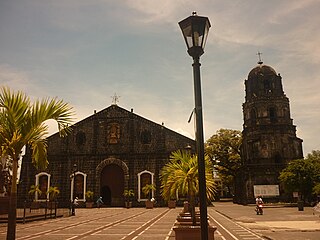
Tabaco, officially known as the City of Tabaco, is a 4th class component city in the province of Albay, Philippines. According to the 2020 census, it has a population of 140,961 people.

Daraga, officially the Municipality of Daraga, is a 1st class municipality in the province of Albay, Philippines. According to the 2020 census, it has a population of 133,893.
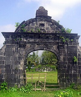
Malinao, officially the Municipality of Malinao, is a 3rd class municipality in the province of Albay, Philippines. According to the 2020 census, it has a population of 47,395 people.

Mount Isarog is an active stratovolcano located in the province of Camarines Sur, Philippines, on the island of Luzon. The mountain has active fumaroles and hot springs. It has an elevation of 2,011 m (6,598 ft) above mean sea level.

Mount Malindang is a complex volcano located in the province of Misamis Occidental in the southern island of Mindanao, Philippines. It is the highest point in the province. The least studied mountain range was formed through several volcanic activities some of which could be historical, evident by the presence of two calderas, surrounded by high rock walls, cinder cones, dome volcano plugs, two sulfurous hot springs, and a crater lake named Lake Duminagat. The amphitheater structures have extensive distribution of volcanic rocks, carbonized wood that are found in pyroclastic deposits. The mountain range is dissected by several canyons and ravines.
Mahagnao Volcano also known as part of is a dormant stratovolcano located in the Barangay Mahagnao part of the municipality of Burauen province of Leyte, Philippines. It is also bounded by the municipalities of La Paz and MacArthur. The area is mostly composed of wetland forests and also the birth of many rivers and streams flowing on many part of Burauen and on its neighboring towns.

Lake Danao is a guitar-shaped lake on the island of Leyte in the Philippines.

Lake Balinsasayao is one of three crater lakes rising 1,000 feet (300 m) above sea level located within the Balinsasayao Twin Lakes Natural Park, an 8,016.05-hectare (19,808.1-acre) protected area covering the municipalities of Valencia, Sibulan, and San Jose in the province of Negros Oriental, Philippines.
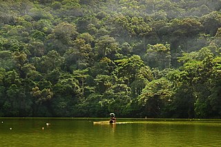
The Bulusan Volcano Natural Park is a 3,673-hectare (9,080-acre) protected area of rainforest surrounding Mount Bulusan in the Philippines. It was first designated as a National Park by Proclamation no. 811 on June 7, 1935. Under the National Integrated Protected Areas System (NIPAS) of 1992 managed by the Department of the Environment and Natural Resources, the park was reclassified as a Natural Park by Proc. 421 on November 27, 2000. The area features the volcano itself, Bulusan Lake, the two other mountains known as the 'Sharp Peak' and 'Hormahan' and Lake Aguingay. The park is in the south central part of Sorsogon Province, southern Luzon, Bicol Region, Philippines, bounded by five municipalities: Bulusan, Barcelona, Irosin, Juban and Casiguran.

The Cagsawa Ruins are the remnants of a 16th-century Franciscan church, the Cagsawa church. It was originally built in the town of Cagsawa in 1587 but was burned down and destroyed by Dutch pirates in 1636. It was rebuilt in 1724 by Fr. Francisco Blanco, but was destroyed again, along with the town of Cagsawa, on February 1, 1814, during the eruption of the Mayon Volcano.

The Bicol Natural Park is a protected area of the Philippines located in the Bicol Region of southern Luzon. It straddles the mountainous border between the provinces of Camarines Norte and Camarines Sur in the northern interior of the Bicol Peninsula. First declared as a national park covering 4,225 hectares on 13 February 1934 through Proclamation No. 657 of Governor General Frank Murphy, the Bicol National Park was later extended to its present area of 5,201 hectares through amendments made in Proclamation No. 655 signed by President Manuel Luis Quezon on 23 December 1940. The area was reclassified as a natural park on 29 December 2000 by virtue of Proclamation No. 43 by President Joseph Estrada.
Bongsanglay Natural Park is a protected area of mangrove forests and swamps on Ticao Island in the Bicol Region of the Philippines. It is located in the municipality of Batuan in the island province of Masbate covering an area of 244.72 hectares. The protected area was established on 29 December 1981 when the area "from Panciscan Point in Bitos Bay up to Bano Sanlay" in Batuan was declared a Mangrove Swamp Forest Reserve under Proclamation No. 2152 signed by President Ferdinand Marcos. In 2000, when President Joseph Estrada signed Proclamation No. 319, Bongsanglay was reclassified as a natural park pursuant to the National Integrated Protected Areas System (NIPAS) Act.

The Quezon Protected Landscape is a protected area in the Republic of the Philippines, spanning the municipalities of Pagbilao, Padre Burgos and Atimonan in Quezon province. The park is situated north of the narrowest section of Luzon in Quezon province, located about 164 km (102 mi) southeast of Metro Manila.
The Old Nayong Pilipino, officially the Nayong Pilipino Cultural Park, was a cultural theme park near the Ninoy Aquino International Airport in Pasay, Metro Manila.


